

Owner's Manual
Page 23
...to a geocache (page 22). • To enter a comment about the chirp appear. 3. chirp™ chirp programming and searching is a small Garmin accessory that contains a chirp, details about looking for the cache or the cache itself, select Add Comment, enter a comment, and select Done. Select ...stage of the chirp can program a chirp, but anyone can program and leave in a geocache. eTrex Owner's Manual 23 Select chirp™ Searching > On. When you are within 33 feet (10 m) of the geocache that you can find a chirp in a geocache. For more information about programming...
...to a geocache (page 22). • To enter a comment about the chirp appear. 3. chirp™ chirp programming and searching is a small Garmin accessory that contains a chirp, details about looking for the cache or the cache itself, select Add Comment, enter a comment, and select Done. Select ...stage of the chirp can program a chirp, but anyone can program and leave in a geocache. eTrex Owner's Manual 23 Select chirp™ Searching > On. When you are within 33 feet (10 m) of the geocache that you can find a chirp in a geocache. For more information about programming...

Owner's Manual
Page 24
... wirelessly, you are within 10 feet (3 m) of a particular location. 1. Select Send or Receive. 3. Select Proximity Alarms. 2. Select Use. 6. Select Done. Setting a Proximity Alarm Proximity alarms alert you when you must be within a specified range of a compatible Garmin device. 1. Select Create Alarm... alarm area, the device sounds a tone (eTrex 20/30). 24 eTrex Owner's Manual Follow the on-screen instructions. Enter a radius. 7. You can share information wirelessly. Applications Applications Sharing Data The eTrex 30 can share waypoints, geocaches, routes, and...
... wirelessly, you are within 10 feet (3 m) of a particular location. 1. Select Send or Receive. 3. Select Proximity Alarms. 2. Select Use. 6. Select Done. Setting a Proximity Alarm Proximity alarms alert you when you must be within a specified range of a compatible Garmin device. 1. Select Create Alarm... alarm area, the device sounds a tone (eTrex 20/30). 24 eTrex Owner's Manual Follow the on-screen instructions. Enter a radius. 7. You can share information wirelessly. Applications Applications Sharing Data The eTrex 30 can share waypoints, geocaches, routes, and...
Owner's Manual
Page 40
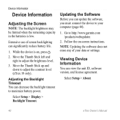
... Extensive use of your computer (page 44). 1. Move the Thumb Stick left and right to http://www.garmin.com /products/webupdater. 2. Select Setup > About. 40 eTrex Owner's Manual Updating the Software Before you can decrease the backlight timeout to your data or settings. Adjusting ...significantly reduce battery life. 1. Follow the on , press . 2. Move the Thumb Stick up and down to adjust the contrast level (eTrex 10 only). Device Information Device Information Adjusting the Screen Note: The backlight brightness may be limited when the remaining capacity in the batteries is ...
... Extensive use of your computer (page 44). 1. Move the Thumb Stick left and right to http://www.garmin.com /products/webupdater. 2. Select Setup > About. 40 eTrex Owner's Manual Updating the Software Before you can decrease the backlight timeout to your data or settings. Adjusting ...significantly reduce battery life. 1. Follow the on , press . 2. Move the Thumb Stick up and down to adjust the contrast level (eTrex 10 only). Device Information Device Information Adjusting the Screen Note: The backlight brightness may be limited when the remaining capacity in the batteries is ...

Owner's Manual
Page 43
...clockwise, and pull up , as instructed in the battery compartment. ➊➋ eTrex Owner's Manual 43 Slide the card holder ➊ toward the bottom of the device and lift up to http://www.garmin.com. • GPI custom POI files from BaseCamp™ or HomePort™ Go...NT. It is not compatible with Mac® OS 10.3 and earlier. File Types The device supports these file types. • Files from the Garmin POI Loader • GPX geocache files Device Information Installing a microSD Card The eTrex 20 and eTrex 30 can use microSD cards for more information. 1. ...
...clockwise, and pull up , as instructed in the battery compartment. ➊➋ eTrex Owner's Manual 43 Slide the card holder ➊ toward the bottom of the device and lift up to http://www.garmin.com. • GPI custom POI files from BaseCamp™ or HomePort™ Go...NT. It is not compatible with Mac® OS 10.3 and earlier. File Types The device supports these file types. • Files from the Garmin POI Loader • GPX geocache files Device Information Installing a microSD Card The eTrex 20 and eTrex 30 can use microSD cards for more information. 1. ...

Owner's Manual
Page 46
... as mounts, maps, fitness accessories, and replacement parts, are available for New. 5. Bring the device within range (10 ft. Select Search for the eTrex 30. Appendix Appendix Optional Accessories Optional accessories, such as BirdsEye satellite imagery, Garmin custom maps, Inland Lakes, TOPO, BlueChart g2, and City Navigator maps. or 3 m) of the ANT+ accessory...
... as mounts, maps, fitness accessories, and replacement parts, are available for New. 5. Bring the device within range (10 ft. Select Search for the eTrex 30. Appendix Appendix Optional Accessories Optional accessories, such as BirdsEye satellite imagery, Garmin custom maps, Inland Lakes, TOPO, BlueChart g2, and City Navigator maps. or 3 m) of the ANT+ accessory...

Owner's Manual
Page 47
... minute. Data Field Accuracy of ascent. or 10 m) away from only your GPS location is accurate to within range (10 ft. Data Field Options Not all models. This process occurs automatically when you turn on the Garmin device and only takes a few seconds when ... average vertical distance of GPS Ambient Pressure Ascent Average Ascent Maximum Ascent - eTrex Owner's Manual 47 Tips for Pairing ANT+ Accessories with Your Garmin Device • Verify that the ANT+ accessory is compatible with your Garmin device. • Before you pair the ANT+ accessory with your exact location...
... minute. Data Field Accuracy of ascent. or 10 m) away from only your GPS location is accurate to within range (10 ft. Data Field Options Not all models. This process occurs automatically when you turn on the Garmin device and only takes a few seconds when ... average vertical distance of GPS Ambient Pressure Ascent Average Ascent Maximum Ascent - eTrex Owner's Manual 47 Tips for Pairing ANT+ Accessories with Your Garmin Device • Verify that the ANT+ accessory is compatible with your Garmin device. • Before you pair the ANT+ accessory with your exact location...
Quick Start Manual
Page 4
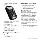
... is turned on the GPS position. Insert the batteries, observing polarity. 3. Hold (page 2). 5. The device may need a clear view of the sky to http://my.garmin.com. • Keep the original sales receipt, or a photocopy, in a safe place. For more information about GPS, go to www.garmin.com/aboutGPS. eTrex 10 Quick Start Manual
... is turned on the GPS position. Insert the batteries, observing polarity. 3. Hold (page 2). 5. The device may need a clear view of the sky to http://my.garmin.com. • Keep the original sales receipt, or a photocopy, in a safe place. For more information about GPS, go to www.garmin.com/aboutGPS. eTrex 10 Quick Start Manual
Quick Start Manual
Page 9
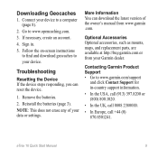
Connect your device to your device. Optional Accessories Optional accessories, such as mounts, maps, and replacement parts, are available at http://buy.garmin.com or from www.garmin .com. eTrex 10 Quick Start Manual 9 If necessary, create an account. 4. Follow the on-screen instructions to find and download geocaches to a computer (page 8). 2. Remove the batteries...
Connect your device to your device. Optional Accessories Optional accessories, such as mounts, maps, and replacement parts, are available at http://buy.garmin.com or from www.garmin .com. eTrex 10 Quick Start Manual 9 If necessary, create an account. 4. Follow the on-screen instructions to find and download geocaches to a computer (page 8). 2. Remove the batteries...


