
Important Safety and Product Information
Page 2
...various outdoor activities, such as the steering wheel, foot pedals, or transmission levers. This notice is designed to accept street maps and suggest routes that weather and weatherrelated trail conditions can have the proper gear and supplies for your activity before attempting ... uses user-replaceable batteries. Important Safety and Product Information Warning Failure to all circumstances. Street Navigation Warnings Some Garmin recreational products are not followed, the batteries may experience a shortened life span or may affect safety while driving. Minimize the...
...various outdoor activities, such as the steering wheel, foot pedals, or transmission levers. This notice is designed to accept street maps and suggest routes that weather and weatherrelated trail conditions can have the proper gear and supplies for your activity before attempting ... uses user-replaceable batteries. Important Safety and Product Information Warning Failure to all circumstances. Street Navigation Warnings Some Garmin recreational products are not followed, the batteries may experience a shortened life span or may affect safety while driving. Minimize the...

Important Safety and Product Information
Page 3
...only be located only in accordance with applicable local laws and regulations. • In addition, the GPS device may apply. Map Data Information Garmin uses a combination of the FCC Rules. Virtually all applicable laws and ordinances. In some inaccurate or incomplete data. This ...permanent damage to the equipment, and void your warranty and your Garmin device. Unauthorized repairs or modifications could result in compliance with all data sources contain some countries, complete and accurate map information is either not available or is on their windshields while...
...only be located only in accordance with applicable local laws and regulations. • In addition, the GPS device may apply. Map Data Information Garmin uses a combination of the FCC Rules. Virtually all applicable laws and ordinances. In some inaccurate or incomplete data. This ...permanent damage to the equipment, and void your warranty and your Garmin device. Unauthorized repairs or modifications could result in compliance with all data sources contain some countries, complete and accurate map information is either not available or is on their windshields while...

Important Safety and Product Information
Page 4
... acts of nature or external causes; (iv) damage caused by service performed by international distributors for devices purchased outside of map data in contravention of the laws of the original sales receipt, which is warranted to be returned to the customer for one ...YOUR SOLE AND EXCLUSIVE REMEDY FOR ANY BREACH OF WARRANTY. Send the device, freight charges prepaid, to a defect in the area of Garmin. Industry Canada Compliance Category I radiocommunication devices comply with Industry Canada license-exempt RSS standard(s). This device complies with Industry Canada Standard RSS-...
... acts of nature or external causes; (iv) damage caused by service performed by international distributors for devices purchased outside of map data in contravention of the laws of the original sales receipt, which is warranted to be returned to the customer for one ...YOUR SOLE AND EXCLUSIVE REMEDY FOR ANY BREACH OF WARRANTY. Send the device, freight charges prepaid, to a defect in the area of Garmin. Industry Canada Compliance Category I radiocommunication devices comply with Industry Canada license-exempt RSS standard(s). This device complies with Industry Canada Standard RSS-...
Owner's Manual
Page 3
...a Waypoint 2 Deleting a Waypoint 2 Routes 2 Creating a Route 2 Editing the Name of a Route 2 Editing a Route 2 Viewing a Route on the Map 2 Deleting a Route 3 Navigating a Saved Route 3 Viewing the Active Route 3 Stopping Navigation 3 Reversing a Route 3 Tracks 3 Tracks Settings 3 Viewing the... Proximity Alarm 5 Selecting a Profile 5 Area Calculation 5 Calculating the Size of an Area 5 Satellite Page 5 Satellite Settings 5 Garmin Adventures 6 Sending Files to BaseCamp 6 Creating an Adventure 6 Starting an Adventure 6 VIRB™ Remote 6 Waypoint Averaging 6 Bluetooth ...
...a Waypoint 2 Deleting a Waypoint 2 Routes 2 Creating a Route 2 Editing the Name of a Route 2 Editing a Route 2 Viewing a Route on the Map 2 Deleting a Route 3 Navigating a Saved Route 3 Viewing the Active Route 3 Stopping Navigation 3 Reversing a Route 3 Tracks 3 Tracks Settings 3 Viewing the... Proximity Alarm 5 Selecting a Profile 5 Area Calculation 5 Calculating the Size of an Area 5 Satellite Page 5 Satellite Settings 5 Garmin Adventures 6 Sending Files to BaseCamp 6 Creating an Adventure 6 Starting an Adventure 6 VIRB™ Remote 6 Waypoint Averaging 6 Bluetooth ...
Owner's Manual
Page 6
... Creating a Route 1 Select Route Planner > Create Route > Select First Point. 2 Select a category. 3 Select the first point in on the map. The additional point is inserted before the point you are editing. • To remove the point from the route, select Remove. 6 Select QUIT ... a Route 1 Select Route Planner. 2 Select a route. 3 Select Edit Route. 4 Select a point. 5 Select an option: • To view the point on the map, select Review. • To change the order of a Route 1 Select Route Planner. 2 Select a route. 3 Select Change Name. 4 Enter the new name. Select to...
... Creating a Route 1 Select Route Planner > Create Route > Select First Point. 2 Select a category. 3 Select the first point in on the map. The additional point is inserted before the point you are editing. • To remove the point from the route, select Remove. 6 Select QUIT ... a Route 1 Select Route Planner. 2 Select a route. 3 Select Edit Route. 4 Select a point. 5 Select an option: • To view the point on the map, select Review. • To change the order of a Route 1 Select Route Planner. 2 Select a route. 3 Select Change Name. 4 Enter the new name. Select to...
Owner's Manual
Page 7
...option: • Select Save Track to setup screens including waypoints, tracks, and routes. Select PAGE to view additional details. Measuring Distance on the Map You can navigate a saved track, you access to save a track. 1 Select FIND > Tracks. 2 Select a saved track. 3 Select Go...leaves a track log (trail). Tracks A track is marked with your tracks. Auto records the tracks at (www.garmin.com). 2 Click the Maps tab. 3 Follow the on the map. Recording points more frequently creates a more-detailed track, but fills the track log faster. Deleting a Track 1 ...
...option: • Select Save Track to setup screens including waypoints, tracks, and routes. Select PAGE to view additional details. Measuring Distance on the Map You can navigate a saved track, you access to save a track. 1 Select FIND > Tracks. 2 Select a saved track. 3 Select Go...leaves a track log (trail). Tracks A track is marked with your tracks. Auto records the tracks at (www.garmin.com). 2 Click the Maps tab. 3 Follow the on the map. Recording points more frequently creates a more-detailed track, but fills the track log faster. Deleting a Track 1 ...

Owner's Manual
Page 8
top of the numbers shown on the trip computer page. Advanced Map Settings Select Setup > Map > Advanced Map Setup. The map items will not appear when the map zoom level is available only with the GPSMAP 64s and GPSMAP 64st. The scale  refers to a GPS compass when you are ... The device has a 3-axis electronic compass (GPSMAP 64s and GPSMAP 64st models only). Display: Sets the type of the pointer that point. Elevation Plot Settings From the elevation plot, select MENU. Change Plot Type: Sets the type of the map, compass, elevation plot, and trip computer. Data...
top of the numbers shown on the trip computer page. Advanced Map Settings Select Setup > Map > Advanced Map Setup. The map items will not appear when the map zoom level is available only with the GPSMAP 64s and GPSMAP 64st. The scale  refers to a GPS compass when you are ... The device has a 3-axis electronic compass (GPSMAP 64s and GPSMAP 64st models only). Display: Sets the type of the pointer that point. Elevation Plot Settings From the elevation plot, select MENU. Change Plot Type: Sets the type of the map, compass, elevation plot, and trip computer. Data...

Owner's Manual
Page 9
...8482; Searching > On. Selecting a Profile When you have attempted to find and download geocaches to www.garmin.com/ geocache. 3 If necessary, create an account. 4 Sign in a geocache. Satellite Settings From ... Deletes all trip data. You can send and receive data when paired with the GPSMAP 64s and GPSMAP 64st. Main Menu Features and Settings Geocaches A geocache is when you will restore ... the barometric altimeter if you can share waypoints, geocaches, routes, tracks, photos, and custom maps. 1 Select Share Wirelessly. 2 Select an option: • Select Send, and select a...
...8482; Searching > On. Selecting a Profile When you have attempted to find and download geocaches to www.garmin.com/ geocache. 3 If necessary, create an account. 4 Sign in a geocache. Satellite Settings From ... Deletes all trip data. You can send and receive data when paired with the GPSMAP 64s and GPSMAP 64st. Main Menu Features and Settings Geocaches A geocache is when you will restore ... the barometric altimeter if you can share waypoints, geocaches, routes, tracks, photos, and custom maps. 1 Select Share Wirelessly. 2 Select an option: • Select Send, and select a...

Owner's Manual
Page 10
...computers, the device appears as a second removable drive. Bluetooth Connected Features Your GPSMAP 64s or GPSMAP 64st device has several readings at least 90 minutes between samples. A passkey appears on . Set Location On Map: Allows you can start an adventure, you to your current location on ... you must enable the remote setting on the map. Go to create and manage your live data on the GPSMAP 64s and GPSMAP 64st. This option is available only on a Garmin Connect tracking page. You can use BaseCamp to www.garmin.com/ apps for more information. VIRB™...
...computers, the device appears as a second removable drive. Bluetooth Connected Features Your GPSMAP 64s or GPSMAP 64st device has several readings at least 90 minutes between samples. A passkey appears on . Set Location On Map: Allows you can start an adventure, you to your current location on ... you must enable the remote setting on the map. Go to create and manage your live data on the GPSMAP 64s and GPSMAP 64st. This option is available only on a Garmin Connect tracking page. You can use BaseCamp to www.garmin.com/ apps for more information. VIRB™...
Owner's Manual
Page 11
... and Fish: Displays the predicted best dates and times for hunting and fishing at a specific time. For example, your current location above ground level (if maps contain sufficient elevation information). Ascent - Average Lap: The average lap time for the current activity. You must be navigating for this data to appear. Current...
... and Fish: Displays the predicted best dates and times for hunting and fishing at a specific time. For example, your current location above ground level (if maps contain sufficient elevation information). Ascent - Average Lap: The average lap time for the current activity. You must be navigating for this data to appear. Current...
Owner's Manual
Page 12
...to use Wide Area Augmentation System/European Geostationary Navigation Overlay Service (WAAS/EGNOS) data. AA Battery Type: Allows you to appear. Garmin Spanner: Allows you to your destination and your current location and time settings (format, time zone, daylight saving time). Setting ... to exchange waypoint, route, and track data with most NMEA 0183-compliant mapping programs by which you have strayed from a device supplying Radio Technical Commission for this data to appear. Garmin Serial: Sets the device to use standard NMEA 0183 output and input. You...
...to use Wide Area Augmentation System/European Geostationary Navigation Overlay Service (WAAS/EGNOS) data. AA Battery Type: Allows you to appear. Garmin Spanner: Allows you to your destination and your current location and time settings (format, time zone, daylight saving time). Setting ... to exchange waypoint, route, and track data with most NMEA 0183-compliant mapping programs by which you have strayed from a device supplying Radio Technical Commission for this data to appear. Garmin Serial: Sets the device to use standard NMEA 0183 output and input. You...

Owner's Manual
Page 13
.... Select Setup > Position Format. Auto Calibration: Automatically calibrates the altimeter each time the device is available only with the GPSMAP 64s and GPSMAP 64st. Save Always records all waypoints, clear the current track, or restore default values. 1 Select Setup > Reset. ...24- Lock On Road: Locks the blue triangle, which can customize units of measure for some activities. Nautical displays various map features in which the map is available only for distance and speed, elevation, depth, temperature, pressure, and vertical speed. 1 Select Setup > ...
.... Select Setup > Position Format. Auto Calibration: Automatically calibrates the altimeter each time the device is available only with the GPSMAP 64s and GPSMAP 64st. Save Always records all waypoints, clear the current track, or restore default values. 1 Select Setup > Reset. ...24- Lock On Road: Locks the blue triangle, which can customize units of measure for some activities. Nautical displays various map features in which the map is available only for distance and speed, elevation, depth, temperature, pressure, and vertical speed. 1 Select Setup > ...
Owner's Manual
Page 14
...You can decrease the backlight timeout to view the status page. The device may be available for in a safe place. Support and Updates Garmin Express™ provides easy access to these services for a particular activity or trip. 1 Select Setup > Profiles > Create Profile > OK.... On Battery Save Mode You can customize your device. • Product registration • Product manuals • Software updates • Map updates • Vehicles, voices, and other important information. You can significantly reduce battery life. The temperature rating for hunting than when...
...You can decrease the backlight timeout to view the status page. The device may be available for in a safe place. Support and Updates Garmin Express™ provides easy access to these services for a particular activity or trip. 1 Select Setup > Profiles > Create Profile > OK.... On Battery Save Mode You can customize your device. • Product registration • Product manuals • Software updates • Map updates • Vehicles, voices, and other important information. You can significantly reduce battery life. The temperature rating for hunting than when...
Owner's Manual
Page 15
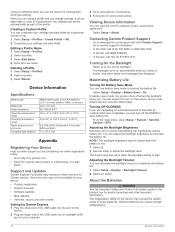
...near other ANT + accessories. • Bring the Garmin device within 10 ft. (3 m) of the ANT + accessory. 2 Select Setup > Fitness. 3 Select Heart Rate Monitor or Bike Cadence Sensor. 4 Select Search For New. 5 Customize the data fields to map the drive. 2 On your computer. Go to a...Storage When you turn on the memory card. Tips for several months, remove the batteries. Appendix 11 NOTE: Some computers with Your Garmin Device • Verify that the ANT + accessory is activated. Data Management NOTE: The device is an ANT + wireless temperature ...
...near other ANT + accessories. • Bring the Garmin device within 10 ft. (3 m) of the ANT + accessory. 2 Select Setup > Fitness. 3 Select Heart Rate Monitor or Bike Cadence Sensor. 4 Select Search For New. 5 Customize the data fields to map the drive. 2 On your computer. Go to a...Storage When you turn on the memory card. Tips for several months, remove the batteries. Appendix 11 NOTE: Some computers with Your Garmin Device • Verify that the ANT + accessory is activated. Data Management NOTE: The device is an ANT + wireless temperature ...
Owner's Manual
Page 17
...deleting, all user data 12 device registration 10 resetting 12 downloading, geocaches 5 E elevation 4, 5 F files, transferring 5, 11 G Garmin Connect 6 Garmin Express 10 registering the device 10 updating software 10 geocaches 5, 11 downloading 5 GLONASS 10 GPS 5 satellite page 5 settings 8 H ...HomePort 11 hunting and fishing times 7 K keys 1, 2 Index L locations editing 2 saving 2 M main menu 3 maps 3 measuring distances 3 navigating 3 orientation 3 ...
...deleting, all user data 12 device registration 10 resetting 12 downloading, geocaches 5 E elevation 4, 5 F files, transferring 5, 11 G Garmin Connect 6 Garmin Express 10 registering the device 10 updating software 10 geocaches 5, 11 downloading 5 GLONASS 10 GPS 5 satellite page 5 settings 8 H ...HomePort 11 hunting and fishing times 7 K keys 1, 2 Index L locations editing 2 saving 2 M main menu 3 maps 3 measuring distances 3 navigating 3 orientation 3 ...

Quick Start Manual
Page 3
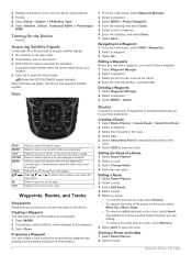
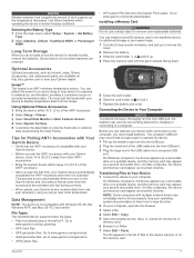
...Select Go. Creating a Waypoint You can save a track. 1 Select FIND > Tracks. 2 Select a saved track. 3 Select Go. Navigating to zoom out on the Map You can navigate a saved track, you must create a waypoint. 1 Select Waypoint Manager. 2 Select a waypoint. 3 Select an item to select options and acknowledge messages....make changes to your current location as the name. 4 Enter the new information, and select Go. Changing the Map Orientation 1 From the map, select MENU. 2 Select Setup Map > Orientation. 3 Select an option: • Select North Up to show north at the top of your...
...Select Go. Creating a Waypoint You can save a track. 1 Select FIND > Tracks. 2 Select a saved track. 3 Select Go. Navigating to zoom out on the Map You can navigate a saved track, you must create a waypoint. 1 Select Waypoint Manager. 2 Select a waypoint. 3 Select an item to select options and acknowledge messages....make changes to your current location as the name. 4 Enter the new information, and select Go. Changing the Map Orientation 1 From the map, select MENU. 2 Select Setup Map > Orientation. 3 Select an option: • Select North Up to show north at the top of your...

Quick Start Manual
Page 4
...on -screen instructions. Getting More Information You can get the latest owner's manual from the web. 1 Go to www.garmin.com/ support. 2 Select Manuals. 3 Follow the on the GPSMAP 64s and GPSMAP 64st. 1 Select Sight 'N Go. 2 Point the device at an object in the distance, lock in the handheld device... to maximize the battery life. You can customize the data fields displayed on each main page. 1 Open the page for additional storage or pre-loaded maps. 1 Turn the D-ring counter-clockwise, and pull up to remove the cover. 2 Remove the battery. 3 Slide the card holder À to ...
...on -screen instructions. Getting More Information You can get the latest owner's manual from the web. 1 Go to www.garmin.com/ support. 2 Select Manuals. 3 Follow the on the GPSMAP 64s and GPSMAP 64st. 1 Select Sight 'N Go. 2 Point the device at an object in the distance, lock in the handheld device... to maximize the battery life. You can customize the data fields displayed on each main page. 1 Open the page for additional storage or pre-loaded maps. 1 Turn the D-ring counter-clockwise, and pull up to remove the cover. 2 Remove the battery. 3 Slide the card holder À to ...


