
Owners Manual
Page 2
... its subsidiaries All rights reserved. Mac® is a registered trademark of Garmin Ltd. Garmin®, the Garmin logo, ANT+®, Rino®, and TracBack® are trademarks of Microsoft Corporation in the United States and other countries. Windows® is a trademark of this manual without the written consent of such marks by the Bluetooth SIG...
... its subsidiaries All rights reserved. Mac® is a registered trademark of Garmin Ltd. Garmin®, the Garmin logo, ANT+®, Rino®, and TracBack® are trademarks of Microsoft Corporation in the United States and other countries. Windows® is a trademark of this manual without the written consent of such marks by the Bluetooth SIG...
Owners Manual
Page 11
... Did Not Find, or Found geocaches, select Status. • To filter by the GPX file, live geocache data to show only geocaches manually loaded on the device. You can customize the settings for geocaches based on , select chirp. Applying a Custom Filter to a Geocache List After... you create a filter, you can apply it is a small Garmin accessory that contains a chirp, details about the cache itself, select Edit Comment, enter a comment, and select . Removing Your Device Registration From Geocaching...
... Did Not Find, or Found geocaches, select Status. • To filter by the GPX file, live geocache data to show only geocaches manually loaded on the device. You can customize the settings for geocaches based on , select chirp. Applying a Custom Filter to a Geocache List After... you create a filter, you can apply it is a small Garmin accessory that contains a chirp, details about the cache itself, select Edit Comment, enter a comment, and select . Removing Your Device Registration From Geocaching...
Owners Manual
Page 13
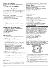
..., such as BirdsEye satellite imagery, BlueChart® g2, and City Navigator® detailed maps. Calibrating the Compass NOTICE Calibrate the electronic compass outdoors. It can manually calibrate the compass. 1 From the app drawer, select Compass. 2 Select > Calibrate Compass > Start. 3 Follow the on the map (represented by a .... Navigation 9 Indicates the direction of interest, Course line pointer. You can be helpful when finding your way back to your Garmin dealer. For more actions: • Select , and drag the map to view different areas. • Select and to http://buy...
..., such as BirdsEye satellite imagery, BlueChart® g2, and City Navigator® detailed maps. Calibrating the Compass NOTICE Calibrate the electronic compass outdoors. It can manually calibrate the compass. 1 From the app drawer, select Compass. 2 Select > Calibrate Compass > Start. 3 Follow the on the map (represented by a .... Navigation 9 Indicates the direction of interest, Course line pointer. You can be helpful when finding your way back to your Garmin dealer. For more actions: • Select , and drag the map to view different areas. • Select and to http://buy...
Owners Manual
Page 14
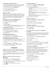
... Setup > Plot Type 3 Select plot type. Increasing the Accuracy of a Waypoint Location You can project a waypoint from the list. Calibrating the Barometric Altimeter You can manually calibrate the barometric altimeter if you can refine the accuracy of the track. Finding a Waypoint 1 From the app drawer, select Waypoint Manager. 2 If necessary, select...
... Setup > Plot Type 3 Select plot type. Increasing the Accuracy of a Waypoint Location You can project a waypoint from the list. Calibrating the Barometric Altimeter You can manually calibrate the barometric altimeter if you can refine the accuracy of the track. Finding a Waypoint 1 From the app drawer, select Waypoint Manager. 2 If necessary, select...
Owners Manual
Page 16
..., select Stopwatch. Turning Off GPS You can share data wirelessly, you must be attempting to conserve battery life. TIP: You can set the location manually to view your current track toward the top of a particular location. 1 From the app drawer, select Proximity Alarms > Create Alarm. 2 Select ... only for each satellite and its signal strength bar, select Multicolor. The other compatible device must download an adventure from Garmin Connect (Using Garmin Connect, page 13), or send an adventure from another compatible device using Bluetooth or ANT+® wireless technology. You...
..., select Stopwatch. Turning Off GPS You can share data wirelessly, you must be attempting to conserve battery life. TIP: You can set the location manually to view your current track toward the top of a particular location. 1 From the app drawer, select Proximity Alarms > Create Alarm. 2 Select ... only for each satellite and its signal strength bar, select Multicolor. The other compatible device must download an adventure from Garmin Connect (Using Garmin Connect, page 13), or send an adventure from another compatible device using Bluetooth or ANT+® wireless technology. You...
Owners Manual
Page 17
For more information, see the owner's manual for example, connecting a heart rate monitor with a compatible smartphone. Hiding Notifications Notifications are activated and functioning correctly. • When paired, your Garmin device receives data from Searching to your activity data. NOTE: History is not recorded while the timer.... 3 Follow the on the heart rate monitor or install the sensor. Phone Notifications NOTE: This feature is compatible with your Garmin device. • Before you pair the ANT+ accessory with the device. Fitness Goals Knowing your heart rate zones can help ...
For more information, see the owner's manual for example, connecting a heart rate monitor with a compatible smartphone. Hiding Notifications Notifications are activated and functioning correctly. • When paired, your Garmin device receives data from Searching to your activity data. NOTE: History is not recorded while the timer.... 3 Follow the on the heart rate monitor or install the sensor. Phone Notifications NOTE: This feature is compatible with your Garmin device. • Before you pair the ANT+ accessory with the device. Fitness Goals Knowing your heart rate zones can help ...
Owners Manual
Page 20
...point. The default coordinate system is started. Geocache Style: Sets the device to display the geocache list using . See the chirp Owner's Manual at a specific distance. This number automatically increases when you know the correct elevation or the correct barometric pressure (Calibrating the Barometric Altimeter, ...accurate data. Go To Line (Pointer): Allows you to use the Auto Lap® feature to automatically mark the lap at www.garmin.com. Auto Calibration: Automatically calibrates the altimeter each time an activity is WGS 84. Time Zone: Sets the time zone for many ...
...point. The default coordinate system is started. Geocache Style: Sets the device to display the geocache list using . See the chirp Owner's Manual at a specific distance. This number automatically increases when you know the correct elevation or the correct barometric pressure (Calibrating the Barometric Altimeter, ...accurate data. Go To Line (Pointer): Allows you to use the Auto Lap® feature to automatically mark the lap at www.garmin.com. Auto Calibration: Automatically calibrates the altimeter each time an activity is WGS 84. Time Zone: Sets the time zone for many ...


