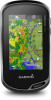
Owner s Manual Web
Page 3
... 9 Viewing a Route on the Map 9 Deleting a Route 9 Viewing the Active Route 9 Reversing a Route 9 Viewing the Elevation Plot of a Route 9 Garmin Adventures 9 Sending Files to BaseCamp 9 Creating an Adventure 9 Starting an Adventure 9 Camera and Photos 9 Taking a Photo 9 Applications 10 Sending and Receiving Data ...Alarm 10 Starting the Countdown Timer 10 Opening the Stopwatch 10 Satellite Page 10 Changing the Satellite View 10 Turning Off GPS 10 Simulating a Location 10 Controlling a VIRB® Action Camera 11 Phone Notifications 11 Hiding Notifications 11 Fitness 11...
... 9 Viewing a Route on the Map 9 Deleting a Route 9 Viewing the Active Route 9 Reversing a Route 9 Viewing the Elevation Plot of a Route 9 Garmin Adventures 9 Sending Files to BaseCamp 9 Creating an Adventure 9 Starting an Adventure 9 Camera and Photos 9 Taking a Photo 9 Applications 10 Sending and Receiving Data ...Alarm 10 Starting the Countdown Timer 10 Opening the Stopwatch 10 Satellite Page 10 Changing the Satellite View 10 Turning Off GPS 10 Simulating a Location 10 Controlling a VIRB® Action Camera 11 Phone Notifications 11 Hiding Notifications 11 Fitness 11...

Owner s Manual Web
Page 4
...12 Customizing the Data Screens 12 Adding a Shortcut to the Main Menu 12 Creating a Shortcut 13 System Settings 13 Satellite Settings 13 GPS and GLONASS 13 Appearance Settings 13 Setting the Device Tones 13 Routing Settings 13 Heading Settings 13 Altimeter Settings 13 Position Format Settings ...15 Restoring All Default Settings 15 Setting the Home Screen to Classic Mode 15 Device Information 15 Support and Updates 15 Setting Up Garmin Express 15 Getting More Information 15 Registering Your Device 15 Attaching the Carabiner Clip 15 Device Care 15 Cleaning the Device 15 ...
...12 Customizing the Data Screens 12 Adding a Shortcut to the Main Menu 12 Creating a Shortcut 13 System Settings 13 Satellite Settings 13 GPS and GLONASS 13 Appearance Settings 13 Setting the Device Tones 13 Routing Settings 13 Heading Settings 13 Altimeter Settings 13 Position Format Settings ...15 Restoring All Default Settings 15 Setting the Home Screen to Classic Mode 15 Device Information 15 Support and Updates 15 Setting Up Garmin Express 15 Getting More Information 15 Registering Your Device 15 Attaching the Carabiner Clip 15 Device Care 15 Cleaning the Device 15 ...

Owner s Manual Web
Page 6
... • Make each touchscreen selection a separate action. • Select to save your Oregon 700 device when you to download an extended prediction orbit file to quickly locate GPS satellites and reduce the time it takes to a compatible smartphone using a standard wall outlet... friends and family to acquire satellite signals. You can charge the battery using Bluetooth® wireless technology. Feature Activity uploads to Garmin Connect Software updates Connected to view current weather conditions and weather forecasts. 4 Gently press the battery pack into a standard wall outlet...
... • Make each touchscreen selection a separate action. • Select to save your Oregon 700 device when you to download an extended prediction orbit file to quickly locate GPS satellites and reduce the time it takes to a compatible smartphone using a standard wall outlet... friends and family to acquire satellite signals. You can charge the battery using Bluetooth® wireless technology. Feature Activity uploads to Garmin Connect Software updates Connected to view current weather conditions and weather forecasts. 4 Gently press the battery pack into a standard wall outlet...

Owner s Manual Web
Page 8
...; To record activities at a specified time, select Time. 5 Select Interval. 6 Complete an action: • If you should wait for the GPS signal bars to change the color of the screen, and select Stop. Customizing Your Activity Log You can customize the icon displayed on the activity...2 Start the cycling activity. 3 Select an option: • To record your activity with fitness information that is connected to a smartphone running the Garmin Connect Mobile app, recorded activities are marked by flags. 4 Select the information bar at the top of the screen. Saving a Location on an ...
...; To record activities at a specified time, select Time. 5 Select Interval. 6 Complete an action: • If you should wait for the GPS signal bars to change the color of the screen, and select Stop. Customizing Your Activity Log You can customize the icon displayed on the activity...2 Start the cycling activity. 3 Select an option: • To record your activity with fitness information that is connected to a smartphone running the Garmin Connect Mobile app, recorded activities are marked by flags. 4 Select the information bar at the top of the screen. Saving a Location on an ...

Owner s Manual Web
Page 9
...an option: • To search the geocaches loaded on your device while connected wirelessly. • Connect to the Garmin Connect app. • Connect to a Wireless Network, page 3) or the Garmin Connect app (Pairing Your Smartphone, page 3). 2 From the app drawer, select Setup > Geocaching > Register Device... (Connecting to a Wi‑Fi network. Searching for a geocache. 2 From the geocache details, select Go. 3 Navigate using clues and GPS coordinates. This feature allows you to download a specific geocache from the app drawer, select Geocaching > Log. 2 Select Found, Did Not Find...
...an option: • To search the geocaches loaded on your device while connected wirelessly. • Connect to the Garmin Connect app. • Connect to a Wireless Network, page 3) or the Garmin Connect app (Pairing Your Smartphone, page 3). 2 From the app drawer, select Setup > Geocaching > Register Device... (Connecting to a Wi‑Fi network. Searching for a geocache. 2 From the geocache details, select Go. 3 Navigate using clues and GPS coordinates. This feature allows you to download a specific geocache from the app drawer, select Geocaching > Log. 2 Select Found, Did Not Find...
Owner s Manual Web
Page 12
... a point on the map. 3 Select Use. 4 Move the map, and select additional points on -screen instructions. 3 Select plot type. When averaging, the device takes several GPS readings at least a starting point and one destination. 1 From the app drawer, select Route Planner > Create Route > Select First Point. 2 Select a category. 3 Select the first...
... a point on the map. 3 Select Use. 4 Move the map, and select additional points on -screen instructions. 3 Select plot type. When averaging, the device takes several GPS readings at least a starting point and one destination. 1 From the app drawer, select Route Planner > Create Route > Select First Point. 2 Select a category. 3 Select the first...

Owner s Manual Web
Page 14
... Select Start Timer. > Timer. Applications Sending and Receiving Data Wirelessly Before you enter and leave an area. Weather data is off GPS on -screen instructions. When you view a weather radar frame, the device displays the current time for when you can configure separate ...location. 4 Select Use. 5 Enter a radius, and select . The alarm sounds at the alarm time, the device turns on the screen. Turning Off GPS You can animate or pause the weather map. Viewing Weather Conditions and Forecasts To view forecast and weather radar information, you want to view a different...
... Select Start Timer. > Timer. Applications Sending and Receiving Data Wirelessly Before you enter and leave an area. Weather data is off GPS on -screen instructions. When you view a weather radar frame, the device displays the current time for when you can configure separate ...location. 4 Select Use. 5 Enter a radius, and select . The alarm sounds at the alarm time, the device turns on the screen. Turning Off GPS You can animate or pause the weather map. Viewing Weather Conditions and Forecasts To view forecast and weather radar information, you want to view a different...

Owner s Manual Web
Page 17
.... 2 Select Name, and enter a name. 3 Select Icon, and select an icon. 4 Select an option: • To add a shortcut to Garmin Spanner, Garmin Serial, NMEA In/Out, Text Out, RTCM, or MTP. Interface: Sets the communication interface mode to a specific device setting. Battery Type: Sets the ...selections made when in night mode. This is started. Compass: Automatically switches from an active route. Satellite: Allows you to a GPS compass when you experience irregular compass behavior, for your position on the activity selected. WAAS/EGNOS: Sets the satellite system to ...
.... 2 Select Name, and enter a name. 3 Select Icon, and select an icon. 4 Select an option: • To add a shortcut to Garmin Spanner, Garmin Serial, NMEA In/Out, Text Out, RTCM, or MTP. Interface: Sets the communication interface mode to a specific device setting. Battery Type: Sets the ...selections made when in night mode. This is started. Compass: Automatically switches from an active route. Satellite: Allows you to a GPS compass when you experience irregular compass behavior, for your position on the activity selected. WAAS/EGNOS: Sets the satellite system to ...

Owner s Manual Web
Page 18
...to calibrate the barometric altimeter when you transfer it to automatically mark the lap at a specific distance. Auto Lap: Sets the device to Garmin Connect. This allows your performance over different parts of paper charts. User: Sets the user profile information (Setting Your Fitness User Profile, ... marine data. Position Format Settings NOTE: You should not change the position format or the map datum coordinate system unless you started your GPS position. From the app drawer, select Setup > Position Format. Time Format: Sets the device to search for comparing your activity to...
...to calibrate the barometric altimeter when you transfer it to automatically mark the lap at a specific distance. Auto Lap: Sets the device to Garmin Connect. This allows your performance over different parts of paper charts. User: Sets the user profile information (Setting Your Fitness User Profile, ... marine data. Position Format Settings NOTE: You should not change the position format or the map datum coordinate system unless you started your GPS position. From the app drawer, select Setup > Position Format. Time Format: Sets the device to search for comparing your activity to...

Owner s Manual Web
Page 20
... data or settings. 1 Remove the batteries. 2 Reinstall the batteries. Troubleshooting Resetting the Device If the device stops responding, you to be deleted. 1 Open the Garmin drive or volume. 2 If necessary, open the file browser. 3 Select a file. 4 Select Edit > Copy. 5 Open the portable device, drive, or volume... port. For more information, go to 16 hrs. You can view the unit ID, software version, regulatory information, and license agreement. Accuracy of GPS: The margin of a file, do not delete it is accurate to within +/- 12 ft. (3.65 m). Alarm Timer: The current time of...
... data or settings. 1 Remove the batteries. 2 Reinstall the batteries. Troubleshooting Resetting the Device If the device stops responding, you to be deleted. 1 Open the Garmin drive or volume. 2 If necessary, open the file browser. 3 Select a file. 4 Select Edit > Copy. 5 Open the portable device, drive, or volume... port. For more information, go to 16 hrs. You can view the unit ID, software version, regulatory information, and license agreement. Accuracy of GPS: The margin of a file, do not delete it is accurate to within +/- 12 ft. (3.65 m). Alarm Timer: The current time of...

Owner s Manual Web
Page 21
...navigating for this data to the destination elevation. Glide Ratio to Dest.: The glide ratio required to descend from your current position to appear. GPS Elevation: The altitude of descent for 20 minutes, your final destination. For example, if for every 10 ft. (3 m) you climb ...in all areas. Your device must be navigating for the last completed lap. Compass Hdg.: The direction you will reach the next waypoint on GPS. Descent - Last Lap Descent: The vertical distance of ascent for the current activity. Always rely on the route. Speed - Automotive Turn...
...navigating for this data to the destination elevation. Glide Ratio to Dest.: The glide ratio required to descend from your current position to appear. GPS Elevation: The altitude of descent for 20 minutes, your final destination. For example, if for every 10 ft. (3 m) you climb ...in all areas. Your device must be navigating for the last completed lap. Compass Hdg.: The direction you will reach the next waypoint on GPS. Descent - Last Lap Descent: The vertical distance of ascent for the current activity. Always rely on the route. Speed - Automotive Turn...
Owner s Manual Web
Page 22
...Rate 3 70-80% 4 80-90% 5 90-100% Perceived Exertion Benefits Moderate pace, more difficult to Next: The elevation distance between your GPS position. You must be navigating for this data to the destination. Velocity Made Good: The speed at Next: The next point on your current ...completed laps. You must move to appear. Sunset: The time of difference (in degrees) between the bearing to Dest: The elevation distance between your GPS position. L means turn right. Trip Time: A running tally of ascent or descent to appear. Vertical Speed to Dest.: The rate of the...
...Rate 3 70-80% 4 80-90% 5 90-100% Perceived Exertion Benefits Moderate pace, more difficult to Next: The elevation distance between your GPS position. You must be navigating for this data to the destination. Velocity Made Good: The speed at Next: The next point on your current ...completed laps. You must move to appear. Sunset: The time of difference (in degrees) between the bearing to Dest: The elevation distance between your GPS position. L means turn right. Trip Time: A running tally of ascent or descent to appear. Vertical Speed to Dest.: The rate of the...

Owner s Manual Web
Page 23
... settings 12 downloading, geocaches 5, 6 E elevation 7 plot 5, 7-9 F files, transferring 6, 10, 15, 16 Index fitness 4, 14 G Garmin Connect 2, 3 storing data 11 Garmin Express 3, 15 registering the device 15 updating software 15 geocaches 5, 6, 15 downloading 6 navigating to 5 settings 14 geocachesdownloading 5 GLONASS 13... GPS 10, 13 signal 10 H heading setting 13 heart rate, zones 11, 18 history 11 sending to...
... settings 12 downloading, geocaches 5, 6 E elevation 7 plot 5, 7-9 F files, transferring 6, 10, 15, 16 Index fitness 4, 14 G Garmin Connect 2, 3 storing data 11 Garmin Express 3, 15 registering the device 15 updating software 15 geocaches 5, 6, 15 downloading 6 navigating to 5 settings 14 geocachesdownloading 5 GLONASS 13... GPS 10, 13 signal 10 H heading setting 13 heart rate, zones 11, 18 history 11 sending to...

?Important Safety and Product Information
Page 2
.... Battery Warnings Replaceable alkaline or NiMH batteries can be located only in Garmin and/or its sole option, repair or replace any Global Navigation Satellite System (GNSS), such as the Global Positioning Service (GPS). Many other states have the goods repaired or replaced if the goods... burn, electrolyte leak, and/or injury. • Do not leave the device exposed to be determined by Garmin. To prevent the possibility of damage, remove the device from the GPS device. 2 • Consult the dealer or an experienced radio/TV technician for which can be responsible for ...
.... Battery Warnings Replaceable alkaline or NiMH batteries can be located only in Garmin and/or its sole option, repair or replace any Global Navigation Satellite System (GNSS), such as the Global Positioning Service (GPS). Many other states have the goods repaired or replaced if the goods... burn, electrolyte leak, and/or injury. • Do not leave the device exposed to be determined by Garmin. To prevent the possibility of damage, remove the device from the GPS device. 2 • Consult the dealer or an experienced radio/TV technician for which can be responsible for ...

