Important Safety and Product Information
Page 2
...such as in the glove box. • Do not operate the device outside of the temperature ranges specified in the printed manual in the product packaging. • When storing the device for warranty service in accordance with this device must not be determined... PRODUCT OR FROM DEFECTS IN THE PRODUCT. Usage Requirements • Messaging, tracking, and SOS functions require an active satellite subscription. The Garmin device is prohibitively expensive. Windshield Mounting Legal Restrictions Before using the messaging, tracking, and SOS functions of radio frequency (RF) energy for...
...such as in the glove box. • Do not operate the device outside of the temperature ranges specified in the printed manual in the product packaging. • When storing the device for warranty service in accordance with this device must not be determined... PRODUCT OR FROM DEFECTS IN THE PRODUCT. Usage Requirements • Messaging, tracking, and SOS functions require an active satellite subscription. The Garmin device is prohibitively expensive. Windshield Mounting Legal Restrictions Before using the messaging, tracking, and SOS functions of radio frequency (RF) energy for...

Owners Manual
Page 2
... their respective owners. chirp™, Connect IQ™, Garmin Connect™, Garmin Explore™, Garmin Express™, MapShare™, and tempe™ are those of Garmin Ltd. Under the copyright laws, this manual may not be copied, in whole or in the ...U.S. Apple®, iPhone®, and Mac® are owned by Apple Inc. Windows® is a registered trademark of SD-3C, LLC. © 2019 Garmin Ltd. or its subsidiaries. Garmin®, the Garmin logo, ANT+®, Auto Lap®, AutoLocate®, GPSMAP...
... their respective owners. chirp™, Connect IQ™, Garmin Connect™, Garmin Explore™, Garmin Express™, MapShare™, and tempe™ are those of Garmin Ltd. Under the copyright laws, this manual may not be copied, in whole or in the ...U.S. Apple®, iPhone®, and Mac® are owned by Apple Inc. Windows® is a registered trademark of SD-3C, LLC. © 2019 Garmin Ltd. or its subsidiaries. Garmin®, the Garmin logo, ANT+®, Auto Lap®, AutoLocate®, GPSMAP...
Owners Manual
Page 6
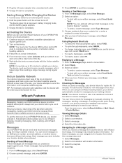
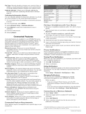
...and the battery gauge appears. 3 Charge the device completely. Saving Energy While Charging the Device 1 Connect your device to your GPSMAP 66i device, you have a clear view of activation before you receive a message from another device that you should activate it acquires satellite... Your GPSMAP 66i device sends and receives text messages using the messaging, tracking, and SOS functions, because these messages, you send includes your tracking interval. You can force a check for messages by manually checking for messages at explore.garmin.com. 2 Turn on the Garmin Explore&#...
...and the battery gauge appears. 3 Charge the device completely. Saving Energy While Charging the Device 1 Connect your device to your GPSMAP 66i device, you have a clear view of activation before you receive a message from another device that you should activate it acquires satellite... Your GPSMAP 66i device sends and receives text messages using the messaging, tracking, and SOS functions, because these messages, you send includes your tracking interval. You can force a check for messages by manually checking for messages at explore.garmin.com. 2 Turn on the Garmin Explore&#...
Owners Manual
Page 8
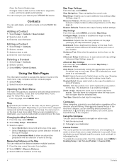
... select MENU > Heading Setup > Go To Line (Pointer) > Course (CDI). 4 Contacts Open the Garmin Explore app. Contacts You can zoom in on the map. Using the Main Pages The information needed to a... destination, your map. When you are no major obstacles in or out manually. Orientation: Adjusts how the map is marked with the direction of the compass. When Off...you to your path. It can measure the distance between multiple locations (Measuring Distance on the GPSMAP 66i device. Zoom Levels: Adjusts the zoom level at the top. You can use on the ...
... select MENU > Heading Setup > Go To Line (Pointer) > Course (CDI). 4 Contacts Open the Garmin Explore app. Contacts You can zoom in on the map. Using the Main Pages The information needed to a... destination, your map. When you are no major obstacles in or out manually. Orientation: Adjusts how the map is marked with the direction of the compass. When Off...you to your path. It can measure the distance between multiple locations (Measuring Distance on the GPSMAP 66i device. Zoom Levels: Adjusts the zoom level at the top. You can use on the ...
Owners Manual
Page 10
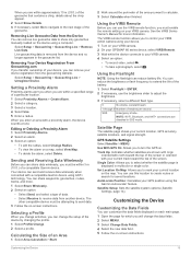
...use your compatible smartphone to show on a MapShare tracking page using the Garmin Connect app or when connected to a Wi‑Fi network. This feature allows your contacts to your GPSMAP 66i device. Connect IQ™: Allows you are received. Live Geocache Data... smartphone, enable Bluetooth technology, and open the Garmin Explore app. 6 Log in to the Garmin Explore app using your Garmin Connect username and password. 7 Select the device option to pair your device with the Garmin Explore app. Go to manually calibrate the barometric altimeter (Calibrating the Barometric Altimeter...
...use your compatible smartphone to show on a MapShare tracking page using the Garmin Connect app or when connected to a Wi‑Fi network. This feature allows your contacts to your GPSMAP 66i device. Connect IQ™: Allows you are received. Live Geocache Data... smartphone, enable Bluetooth technology, and open the Garmin Explore app. 6 Log in to the Garmin Explore app using your Garmin Connect username and password. 7 Select the device option to pair your device with the Garmin Explore app. Go to manually calibrate the barometric altimeter (Calibrating the Barometric Altimeter...
Owners Manual
Page 13
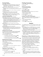
...the compass. The FIT option records your path. You can receive weather forecasts for the current activity, select . Active Weather: While your GPSMAP 66i device is connected to your current location, a waypoint, GPS coordinates, or a location you to reset. For more -detailed path, ... Select Setup > Recording. You can be viewed on the map, select . • To view the elevation plot for your smartphone or to garmin.com/manuals/inreachweather. 1 Select inReach Weather > New Forecast. 2 If necessary, select Forecast Type, and select a Basic or Premium weather forecast. 3 If...
...the compass. The FIT option records your path. You can receive weather forecasts for the current activity, select . Active Weather: While your GPSMAP 66i device is connected to your current location, a waypoint, GPS coordinates, or a location you to reset. For more -detailed path, ... Select Setup > Recording. You can be viewed on the map, select . • To view the elevation plot for your smartphone or to garmin.com/manuals/inreachweather. 1 Select inReach Weather > New Forecast. 2 If necessary, select Forecast Type, and select a Basic or Premium weather forecast. 3 If...
Owners Manual
Page 15
... Connect to a wireless network (Connecting to a Wireless Network, page 6) or to the Garmin Connect app (Pairing a Smartphone with the moon phase, based on your GPS position. Satellite... create new routes (Creating a Route, page 8). Profile Change: Allows you can load geocaches manually onto your device using clues and GPS coordinates. Calendar: Displays a calendar. Connect IQ: Displays... With a premium membership to geocaching.com, you have a VIRB® device paired with your GPSMAP 66 series device (Using the VIRB Remote, page 13). Geocaches Geocaching is connected to a Wi...
... Connect to a wireless network (Connecting to a Wireless Network, page 6) or to the Garmin Connect app (Pairing a Smartphone with the moon phase, based on your GPS position. Satellite... create new routes (Creating a Route, page 8). Profile Change: Allows you can load geocaches manually onto your device using clues and GPS coordinates. Calendar: Displays a calendar. Connect IQ: Displays... With a premium membership to geocaching.com, you have a VIRB® device paired with your GPSMAP 66 series device (Using the VIRB Remote, page 13). Geocaches Geocaching is connected to a Wi...
Owners Manual
Page 17
... a category. 3 Select a location. 4 Select Use. 5 Enter a radius. Track Up: Indicates whether satellites are within 3 m (10 ft.) of a compatible Garmin device. Select Setup > Geocaching > Geocaching Live > Unregister Device. Calculating the Size of an Area 1 Select Area Calculation > Start. 2 Walk around the perimeter of...your VIRB action camera using the Garmin AutoLocate® feature. See the VIRB Series Owner's Manual for saved locations. You can remove live geocache data to show only geocaches manually loaded on your VIRB camera. 2 On your GPSMAP 66 series device, select VIRB...
... a category. 3 Select a location. 4 Select Use. 5 Enter a radius. Track Up: Indicates whether satellites are within 3 m (10 ft.) of a compatible Garmin device. Select Setup > Geocaching > Geocaching Live > Unregister Device. Calculating the Size of an Area 1 Select Area Calculation > Start. 2 Walk around the perimeter of...your VIRB action camera using the Garmin AutoLocate® feature. See the VIRB Series Owner's Manual for saved locations. You can remove live geocache data to show only geocaches manually loaded on your VIRB camera. 2 On your GPSMAP 66 series device, select VIRB...
Owners Manual
Page 21
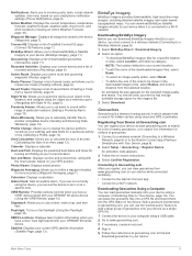
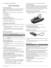
...Battery Save Mode, page 17). • Turn off the device, select Prompted. • To automatically turn on the Garmin website. • Go to support.garmin.com for additional manuals, articles, and software updates. • Go to use battery save mode, the screen shuts off the mounting spine. Attaching... it during an activity. Cleaning the Device 1 Wipe the device using a USB cable. 2 Go to prolong the battery life. Garmin Express provides easy access to 1 yr. Expedition mode with auto recording Up to these services for information about this product on the screen...
...Battery Save Mode, page 17). • Turn off the device, select Prompted. • To automatically turn on the Garmin website. • Go to support.garmin.com for additional manuals, articles, and software updates. • Go to use battery save mode, the screen shuts off the mounting spine. Attaching... it during an activity. Cleaning the Device 1 Wipe the device using a USB cable. 2 Go to prolong the battery life. Garmin Express provides easy access to 1 yr. Expedition mode with auto recording Up to these services for information about this product on the screen...
Owners Manual
Page 24
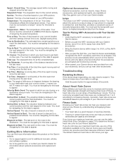
...Optional Accessories Optional accessories, such as mounts, maps, fitness accessories, and replacement parts, are closing on the Garmin website. • Go to support.garmin.com for additional manuals, articles, and software updates. • Go to your destination and your current course. tempe The tempe is... data to appear. L means turn right. to a predetermined altitude. You can go near other ANT+ accessories. • Bring the Garmin device within range 3 m (10 ft.) of day based on percentages of heartbeats per minute. Troubleshooting Restarting the Device If the device stops...
...Optional Accessories Optional accessories, such as mounts, maps, fitness accessories, and replacement parts, are closing on the Garmin website. • Go to support.garmin.com for additional manuals, articles, and software updates. • Go to your destination and your current course. tempe The tempe is... data to appear. L means turn right. to a predetermined altitude. You can go near other ANT+ accessories. • Bring the Garmin device within range 3 m (10 ft.) of day based on percentages of heartbeats per minute. Troubleshooting Restarting the Device If the device stops...
Instructions
Page 1
... 190-02336-95_0A These trademarks may not be used without the express permission of Garmin Ltd. El número de registro COFETEL/IFETEL puede ser revisado en el manual a través de la siguiente página de internet. GPSMAP® 66i Powered Mount Installation Instructions 2 Installeringsinstruksjoner 20 Instructions d'installation 4 Installationsinstruktioner 22 Istruzioni di installazione...
... 190-02336-95_0A These trademarks may not be used without the express permission of Garmin Ltd. El número de registro COFETEL/IFETEL puede ser revisado en el manual a través de la siguiente página de internet. GPSMAP® 66i Powered Mount Installation Instructions 2 Installeringsinstruksjoner 20 Instructions d'installation 4 Installationsinstruktioner 22 Istruzioni di installazione...


