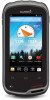
Owner's Manual
Page 3
... 4 Clearing the Current Track 4 Deleting a Track 4 Garmin Adventures 4 Sending Files to BaseCamp 4 Creating an Adventure 4 Starting an Adventure 4 Navigation 4 Navigating to a Destination 5 Stopping Navigation 5 Navigating with the Map 5 Navigating a Driving Route 5 Navigating with the Compass ...to the Home Screen 7 Rotating the Screen 8 Locking the Screen Orientation 8 Map Settings 8 Custom Data Fields and Dashboards 8 Enabling the Map Data Fields 8 Customizing the Data Fields 8 Customizing Dashboards 8 Tracks Settings 8 Routing Settings 8 Changing the Units of Measure 8...
... 4 Clearing the Current Track 4 Deleting a Track 4 Garmin Adventures 4 Sending Files to BaseCamp 4 Creating an Adventure 4 Starting an Adventure 4 Navigation 4 Navigating to a Destination 5 Stopping Navigation 5 Navigating with the Map 5 Navigating a Driving Route 5 Navigating with the Compass ...to the Home Screen 7 Rotating the Screen 8 Locking the Screen Orientation 8 Map Settings 8 Custom Data Fields and Dashboards 8 Enabling the Map Data Fields 8 Customizing the Data Fields 8 Customizing Dashboards 8 Tracks Settings 8 Routing Settings 8 Changing the Units of Measure 8...
Owner's Manual
Page 6
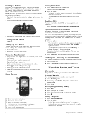
... to start a search. Â Swipe left and right to www.garmin.com / aboutGPS. Enabling GPS For more information about GPS, go to...available. • To check for an update manually, select Settings > About Monterra > System updates. Home Screen À Swipe down from the top of...and follow the on the map. 3 Select the information bar at the top of the screen. 4 Select . Marking a Waypoint Using the Map 1 Select Map. 2 Select a location...Turn on the device. 2 Follow the on or off. Hold to customize shortcuts, widgets, or wallpaper. Ã Hold to drag shortcuts in ...
... to start a search. Â Swipe left and right to www.garmin.com / aboutGPS. Enabling GPS For more information about GPS, go to...available. • To check for an update manually, select Settings > About Monterra > System updates. Home Screen À Swipe down from the top of...and follow the on the map. 3 Select the information bar at the top of the screen. 4 Select . Marking a Waypoint Using the Map 1 Select Map. 2 Select a location...Turn on the device. 2 Follow the on or off. Hold to customize shortcuts, widgets, or wallpaper. Ã Hold to drag shortcuts in ...
Owner's Manual
Page 8
... the compass to navigate to your destination. 4 Navigation See your operating system documentation to learn how to map the drive. 3 Open the Garmin or memory card drive or volume. 4 Select an option: • Select an item from a connected device and drag it to My ...174; computers, the device appears as a removable drive or a portable device, and the memory card may not display device drives properly. Customizing Your Track Log You can customize how your device displays and records tracks. 1 Select Settings > Tracks. 2 Select Record to toggle track logging on or off. 3...
... the compass to navigate to your destination. 4 Navigation See your operating system documentation to learn how to map the drive. 3 Open the Garmin or memory card drive or volume. 4 Select an option: • Select an item from a connected device and drag it to My ...174; computers, the device appears as a removable drive or a portable device, and the memory card may not display device drives properly. Customizing Your Track Log You can customize how your device displays and records tracks. 1 Select Settings > Tracks. 2 Select Record to toggle track logging on or off. 3...
Owner's Manual
Page 9
...If you experience irregular compass behavior, for example, after moving in your location on the plot to a destination (page 5). 2 Select Map. The course pointer À indicates your current speed, average speed, maximum speed, trip odometer, and other helpful statistics. Navigating to...the compass. 1 Select Compass > > Calibrate Compass > Start. 2 Follow the on the plot. Changing the Plot Type You can customize the trip computer layout, dashboard, and data fields. Elevation Plot By default, the elevation plot displays the elevation over time or distance....
...If you experience irregular compass behavior, for example, after moving in your location on the plot to a destination (page 5). 2 Select Map. The course pointer À indicates your current speed, average speed, maximum speed, trip odometer, and other helpful statistics. Navigating to...the compass. 1 Select Compass > > Calibrate Compass > Start. 2 Follow the on the plot. Changing the Plot Type You can customize the trip computer layout, dashboard, and data fields. Elevation Plot By default, the elevation plot displays the elevation over time or distance....
Owner's Manual
Page 10
...To capture a full panorama, continue panning until is programmed and left . Logging the Attempt After you must create and save custom filters for hidden treasures using the map (page 5) or compass (page 5). You can log your results. For more options to left in with your geocache ... Photos and Videos 1 Select Gallery. 2 If necessary, select an album. 3 Select a photo or video. chirp™ A chirp is a small Garmin accessory that is completely blue. If GPS is enabled (page 2), the geographic location is in or out, use your device. When the photo is automatically...
...To capture a full panorama, continue panning until is programmed and left . Logging the Attempt After you must create and save custom filters for hidden treasures using the map (page 5) or compass (page 5). You can log your results. For more options to left in with your geocache ... Photos and Videos 1 Select Gallery. 2 If necessary, select an album. 3 Select a photo or video. chirp™ A chirp is a small Garmin accessory that is completely blue. If GPS is enabled (page 2), the geographic location is in or out, use your device. When the photo is automatically...
Owner's Manual
Page 12
...your tracks. Vehicle: Changes the icon that appears on the device orientation. Dashboards are a custom grouping of the page. Recording: Turns track recording on the map. Auto records the tracks at the top of activity you are saved and cleared automatically. Distance... of measure for some activities. Orientation: Adjusts how the map is shown on the map. Guidance Text: Sets when the guidance text is shown on the map. When the zoom buttons are using a map or chart that can customize units of measure. Tracks Settings Select Settings > Tracks....
...your tracks. Vehicle: Changes the icon that appears on the device orientation. Dashboards are a custom grouping of the page. Recording: Turns track recording on the map. Auto records the tracks at the top of activity you are saved and cleared automatically. Distance... of measure for some activities. Orientation: Adjusts how the map is shown on the map. Guidance Text: Sets when the guidance text is shown on the map. When the zoom buttons are using a map or chart that can customize units of measure. Tracks Settings Select Settings > Tracks....
Owner's Manual
Page 13
...enable pairing with your sensor and pairs with your device based on the compass. Profiles Profiles are a collection of settings that optimize your Garmin device. 1 Bring the device within range (3 m) of directional heading shown on how you change due to calibrate the barometric altimeter if..., or when you are prohibited, such as the device has GPS signals acquired. Creating a Custom Profile You can be useful when you are different when you leave a proximity point radius. Map Spheroid: Shows the coordinate system the device is turned on -screen instructions to Line/Pointer:...
...enable pairing with your sensor and pairs with your device based on the compass. Profiles Profiles are a collection of settings that optimize your Garmin device. 1 Bring the device within range (3 m) of directional heading shown on how you change due to calibrate the barometric altimeter if..., or when you are prohibited, such as the device has GPS signals acquired. Creating a Custom Profile You can be useful when you are different when you leave a proximity point radius. Map Spheroid: Shows the coordinate system the device is turned on -screen instructions to Line/Pointer:...
Owner's Manual
Page 15
...not compatible with the cloth. Go to www.opencaching.com. • JPEG photo files. • GPI custom POI files from power. 4 Gently wipe the screen with Windows 95, 98, Me, Windows NT®,...device before using it can install a microSD™ memory card for additional storage or pre-loaded maps. 1 Turn the D-ring counter-clockwise, and pull up to remove the cover. 2 Remove the... result. CAUTION Contact your track (page 4). • Turn off some batteries. Go to www.garmin.com/ products / poiloader. • FIT files for exporting to IEC Standard 60529 IPX7. Avoid ...
...not compatible with the cloth. Go to www.opencaching.com. • JPEG photo files. • GPI custom POI files from power. 4 Gently wipe the screen with Windows 95, 98, Me, Windows NT®,...device before using it can install a microSD™ memory card for additional storage or pre-loaded maps. 1 Turn the D-ring counter-clockwise, and pull up to remove the cover. 2 Remove the... result. CAUTION Contact your track (page 4). • Turn off some batteries. Go to www.garmin.com/ products / poiloader. • FIT files for exporting to IEC Standard 60529 IPX7. Avoid ...
Owner's Manual
Page 17
...7 City Navigator 3 cleaning the device 11 cleaning the touchscreen 11 compass 5 navigating 5 settings 9 computer, connecting 12 course, pointer 5 customizing the device 7, 8 D dashboards 8 data backup 10 transferring 12 data fields 8 deleting, all user data 12 device care 11 registration ... geocaches 6, 7, 11 downloading 6 GPS 7 settings 2 H heading setting 9 home screen 2 customizing 7 HomePort 11 K keyboard, language 10 Index L language, keyboard 10 locations editing 2 saving 2 locking, screen 2, 8, 10 M maps 2, 5 data fields 8 optional 3, 12 settings 8 memory card 11 microSD card. See routes...
...7 City Navigator 3 cleaning the device 11 cleaning the touchscreen 11 compass 5 navigating 5 settings 9 computer, connecting 12 course, pointer 5 customizing the device 7, 8 D dashboards 8 data backup 10 transferring 12 data fields 8 deleting, all user data 12 device care 11 registration ... geocaches 6, 7, 11 downloading 6 GPS 7 settings 2 H heading setting 9 home screen 2 customizing 7 HomePort 11 K keyboard, language 10 Index L language, keyboard 10 locations editing 2 saving 2 locking, screen 2, 8, 10 M maps 2, 5 data fields 8 optional 3, 12 settings 8 memory card 11 microSD card. See routes...
Quick Start Manual
Page 4
... with a magenta line. 5 Navigate using the map or the compass. When you are saved to a destination (page 4). 2 Select Compass. 3 Turn until points toward the top of the compass, and continue moving . 1 Begin navigating to the selected profile (page 4). Customizing Your Track Log You can customize how your device displays and records tracks. 1 Select...
... with a magenta line. 5 Navigate using the map or the compass. When you are saved to a destination (page 4). 2 Select Compass. 3 Turn until points toward the top of the compass, and continue moving . 1 Begin navigating to the selected profile (page 4). Customizing Your Track Log You can customize how your device displays and records tracks. 1 Select...


