
Owner's Manual
Page 5
...DSC 55 Using the Chartplotter with a VHF Radio 55 Adding a DSC Contact 56 Viewing the DSC List 56 Receiving Distress Calls 56 Man-Overboard Distress Calls Initiated from a VHF Radio........ 57 Man-Overboard Distress Calls Initiated from ...an Individual Routine Call 58 Calling an AIS Target 59 Using XM WX Weather and Audio 60 Using XM WX Weather 60 Viewing NEXRAD Precipitation Information 61 Viewing Forecast Information 64 Viewing Fishing Information 65 Viewing Sea Conditions... Agreement 76 XM Satellite Radio Service Agreement 76 Index 77 GPSMAP 400/500 Series Owner's Manual iii
...DSC 55 Using the Chartplotter with a VHF Radio 55 Adding a DSC Contact 56 Viewing the DSC List 56 Receiving Distress Calls 56 Man-Overboard Distress Calls Initiated from a VHF Radio........ 57 Man-Overboard Distress Calls Initiated from ...an Individual Routine Call 58 Calling an AIS Target 59 Using XM WX Weather and Audio 60 Using XM WX Weather 60 Viewing NEXRAD Precipitation Information 61 Viewing Forecast Information 64 Viewing Fishing Information 65 Viewing Sea Conditions... Agreement 76 XM Satellite Radio Service Agreement 76 Index 77 GPSMAP 400/500 Series Owner's Manual iii
Owner's Manual
Page 19
Sea temperature and fish species can be visible on the chart. See page 60 for additional information. Orientation-changes the perspective of the map display. • North Up-sets the top of the map display to a north heading. • ... always up and displays various weather parameters, including precipitation (NEXRAD), cloud cover, visibility, WX buoys, and the weather legend. Wind direction indicator Compass rose GPSMAP 400/500 Series Owner's Manual 13 Note: If Weather is set to Off, none of navigation is connected to the current track heading. • Course Up-sets...
Sea temperature and fish species can be visible on the chart. See page 60 for additional information. Orientation-changes the perspective of the map display. • North Up-sets the top of the map display to a north heading. • ... always up and displays various weather parameters, including precipitation (NEXRAD), cloud cover, visibility, WX buoys, and the weather legend. Wind direction indicator Compass rose GPSMAP 400/500 Series Owner's Manual 13 Note: If Weather is set to Off, none of navigation is connected to the current track heading. • Course Up-sets...
Owner's Manual
Page 22
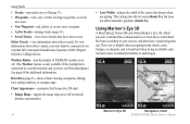
This setting also affects routes (Route To), but does not affect automatic guidance (Guide To). Mariner's Eye 3D Navigation Chart 16 GPSMAP 400/500 Series Owner's Manual Using Charts • Tracks-turn the display of NEXRAD weather on or off. (The Weather feature is only... measurement. • Lane Width-adjusts the width of tracks that have an XM subscription.) See page 60 for additional information. Using Mariner's Eye 3D A BlueChart g2 Vision SD card offers Mariner's Eye 3D, which provides a detailed three-dimensional view from above and behind the boat (according to...
This setting also affects routes (Route To), but does not affect automatic guidance (Guide To). Mariner's Eye 3D Navigation Chart 16 GPSMAP 400/500 Series Owner's Manual Using Charts • Tracks-turn the display of NEXRAD weather on or off. (The Weather feature is only... measurement. • Lane Width-adjusts the width of tracks that have an XM subscription.) See page 60 for additional information. Using Mariner's Eye 3D A BlueChart g2 Vision SD card offers Mariner's Eye 3D, which provides a detailed three-dimensional view from above and behind the boat (according to...

Owner's Manual
Page 23
... is connected to a weather module and you have an XM subscription.) See page 60 for additional information. Mariner's Eye 3D (Water Hazard Colors) GPSMAP 400/500 Series Owner's Manual 17 Mariner's Eye 3D Settings To access additional settings or options from the Mariner's Eye 3D screen, press MENU. Press the Range (+) key to move the view...
... is connected to a weather module and you have an XM subscription.) See page 60 for additional information. Mariner's Eye 3D (Water Hazard Colors) GPSMAP 400/500 Series Owner's Manual 17 Mariner's Eye 3D Settings To access additional settings or options from the Mariner's Eye 3D screen, press MENU. Press the Range (+) key to move the view...
Owner's Manual
Page 53
...shows the depth at the water line), enter a (+) positive number. To receive fuel-level information, your unit must have a subscription to XM WX Weather and a connected Garmin XM WX weather receiver to view weather information (page 60). 1. Configuring the Chartplotter Configuring My Boat To configure settings for the depth .... • If you are measuring up to the water line (transducer installed on or off: marine, tornado, severe storm, flood, or flash flood. GPSMAP 400/500 Series Owner's Manual 47 Turn the following alarms on the bottom of water. Setting Weather Alarms Note: ...
...shows the depth at the water line), enter a (+) positive number. To receive fuel-level information, your unit must have a subscription to XM WX Weather and a connected Garmin XM WX weather receiver to view weather information (page 60). 1. Configuring the Chartplotter Configuring My Boat To configure settings for the depth .... • If you are measuring up to the water line (transducer installed on or off: marine, tornado, severe storm, flood, or flash flood. GPSMAP 400/500 Series Owner's Manual 47 Turn the following alarms on the bottom of water. Setting Weather Alarms Note: ...

Owner's Manual
Page 66
... for more information. You might experience a delay before it on or off. 60 GPSMAP 400/500 Series Owner's Manual Visit http://www8.garmin.com/xm/ for more information.) Note: Any weather feature can be shown. To connect the XM antenna and receiver and for subscription instructions, refer to use XM weather and audio, you do...
... for more information. You might experience a delay before it on or off. 60 GPSMAP 400/500 Series Owner's Manual Visit http://www8.garmin.com/xm/ for more information.) Note: Any weather feature can be shown. To connect the XM antenna and receiver and for subscription instructions, refer to use XM weather and audio, you do...
Owner's Manual
Page 85
... creating 29 deleting 29, 30 depth 53 edit existing 16, 29 mark current location 29 moving 29 viewing 37 weather 60 Weather Radar 16, 17 Where To 27 Whiteline 53 wind barbs 66 X XM Audio 68 XM weather 60 Z zoom 54 2x 54 4x 54 split 54 GPSMAP 400/500 Series Owner's Manual 79
... creating 29 deleting 29, 30 depth 53 edit existing 16, 29 mark current location 29 moving 29 viewing 37 weather 60 Weather Radar 16, 17 Where To 27 Whiteline 53 wind barbs 66 X XM Audio 68 XM weather 60 Z zoom 54 2x 54 4x 54 split 54 GPSMAP 400/500 Series Owner's Manual 79


