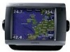
Owner's Manual
Page 27
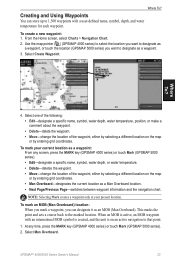
... Overboard). When an MOB is active, an MOB waypoint with a user-defined name, symbol, depth, and water temperature for each waypoint. GPSMAP® 4000/5000 Series Owner's Manual 23 To mark an MOB (Man Overboard) location: When you mark a waypoint, you want to designate as a waypoint, or... touch the location (GPSMAP 5000 series) you can store up to the marked location. Select Man Overboard. Where To? 4. This marks the point and sets a course back to 1,500 waypoints with an international MOB symbol is created, and the unit is ...
... Overboard). When an MOB is active, an MOB waypoint with a user-defined name, symbol, depth, and water temperature for each waypoint. GPSMAP® 4000/5000 Series Owner's Manual 23 To mark an MOB (Man Overboard) location: When you mark a waypoint, you want to designate as a waypoint, or... touch the location (GPSMAP 5000 series) you can store up to the marked location. Select Man Overboard. Where To? 4. This marks the point and sets a course back to 1,500 waypoints with an international MOB symbol is created, and the unit is ...
Owner's Manual
Page 40
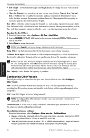
...sensing device. This is not stuck. Changing this menu to 24 minutes). 36 GPSMAP® 4000/5000 Series Owner's Manual Enter a negative number to determine how close you get the message, contact Garmin Product Support. Temp Offset-set the temperature offset for calibration. If the wheel ...of from the transducer location. Configuring Other Vessels To configure settings for the depth of a keel, making it possible to a specified distance from 500 ft. To adjust the Keel Offset: 1. This is not registering a speed, a "Speed Too Low" message appears. to 2.0 mi). &#...
...sensing device. This is not stuck. Changing this menu to 24 minutes). 36 GPSMAP® 4000/5000 Series Owner's Manual Enter a negative number to determine how close you get the message, contact Garmin Product Support. Temp Offset-set the temperature offset for calibration. If the wheel ...of from the transducer location. Configuring Other Vessels To configure settings for the depth of a keel, making it possible to a specified distance from 500 ft. To adjust the Keel Offset: 1. This is not registering a speed, a "Speed Too Low" message appears. to 2.0 mi). &#...
Owner's Manual
Page 48
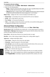
...used for the best results. • Heading Line-show or hide a line in the direction of the safe zone ring to 3.0 km, or from 500 ft. to 2.0 mi). • Time to (Safe Zone)-sounds an alarm if AIS or MARPA determines that AIS vessels are displayed on the Radar ...turn on the Radar screen. Select Navigation Only to shift your current location toward the bottom of your speed increases. Using Radar 44 GPSMAP® 4000/5000 Series Owner's Manual Enter your location that a target will intersect the Safe Zone within the range displayed on to only display waypoints associated with...
...used for the best results. • Heading Line-show or hide a line in the direction of the safe zone ring to 3.0 km, or from 500 ft. to 2.0 mi). • Time to (Safe Zone)-sounds an alarm if AIS or MARPA determines that AIS vessels are displayed on the Radar ...turn on the Radar screen. Select Navigation Only to shift your current location toward the bottom of your speed increases. Using Radar 44 GPSMAP® 4000/5000 Series Owner's Manual Enter your location that a target will intersect the Safe Zone within the range displayed on to only display waypoints associated with...


