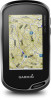
Owner s Manual Web
Page 3
...Route 9 Viewing a Route on the Map 9 Deleting a Route 9 Viewing the Active Route 9 Reversing a Route 9 Viewing the Elevation Plot of a Route 9 Garmin Adventures 9 Sending Files to BaseCamp 9 Creating an Adventure 9 Starting an Adventure 9 Camera and Photos 9 Taking a Photo 9 Applications 10 Sending and Receiving Data ...11 Fitness 11 History 11 Viewing an Activity History 11 Deleting an Activity from Your History 11 Using Garmin Connect 11 Optional Fitness Accessories 11 About Heart Rate Zones 11 Fitness Goals 11 Setting Your Heart Rate Zones 11 Customizing the Device...
...Route 9 Viewing a Route on the Map 9 Deleting a Route 9 Viewing the Active Route 9 Reversing a Route 9 Viewing the Elevation Plot of a Route 9 Garmin Adventures 9 Sending Files to BaseCamp 9 Creating an Adventure 9 Starting an Adventure 9 Camera and Photos 9 Taking a Photo 9 Applications 10 Sending and Receiving Data ...11 Fitness 11 History 11 Viewing an Activity History 11 Deleting an Activity from Your History 11 Using Garmin Connect 11 Optional Fitness Accessories 11 About Heart Rate Zones 11 Fitness Goals 11 Setting Your Heart Rate Zones 11 Customizing the Device...

Owner s Manual Web
Page 6
... Yes Yes 2 Connected Features Select > . It may take 30 to 60 seconds to acquire satellite signals. 1 Swipe down to remove optional mount accessories. Select to search for a destination. Ã Select to open apps. Á Swipe left or right to scroll through the pages for more ... the device to a wireless network. Connect IQ: Allows you to update your Oregon 700 device. Weather: Allows you to your device features with the Garmin Connect Mobile App Yes Connected to install the Garmin Connect™ Mobile app on your device software. 4 Gently press the battery ...
... Yes Yes 2 Connected Features Select > . It may take 30 to 60 seconds to acquire satellite signals. 1 Swipe down to remove optional mount accessories. Select to search for a destination. Ã Select to open apps. Á Swipe left or right to scroll through the pages for more ... the device to a wireless network. Connect IQ: Allows you to update your Oregon 700 device. Weather: Allows you to your device features with the Garmin Connect Mobile App Yes Connected to install the Garmin Connect™ Mobile app on your device software. 4 Gently press the battery ...

Owner s Manual Web
Page 10
...Stopping Navigation From the map or compass, select > Stop Navigation. chirp A chirp is programmed and left in . 5 Follow the instructions at www.garmin.com. You can filter your route is saved automatically as puzzle or event, select Type. • To filter by the physical size of the...Sign in a geocache. The map opens, and your geocache list based on certain factors, such as the level of the geocache that is a small Garmin accessory that contains a chirp, details about the chirp appear. 2 Select Show Details. 3 If necessary, select Go to navigate to the next stage of ...
...Stopping Navigation From the map or compass, select > Stop Navigation. chirp A chirp is programmed and left in . 5 Follow the instructions at www.garmin.com. You can filter your route is saved automatically as puzzle or event, select Type. • To filter by the physical size of the...Sign in a geocache. The map opens, and your geocache list based on certain factors, such as the level of the geocache that is a small Garmin accessory that contains a chirp, details about the chirp appear. 2 Select Show Details. 3 If necessary, select Go to navigate to the next stage of ...

Owner s Manual Web
Page 15
...zone 5, the device uses 166 as the maximum rate for zone 4. 3 Enter your sensor. 4 Select Search for Pairing ANT+ Accessories with Your Garmin Device • Verify that measures maximum heart rate. Hiding Notifications Notifications are calculated based on percentages of the previous zone. Fitness ...maximum and minimum heart rate for your device, you must install the accessory according to Connected. If you know your risk of fitness. Fitness 11 Before you can use the fitness accessory with the Oregon 700 device. Controlling a VIRB® Action Camera Before you can ...
...zone 5, the device uses 166 as the maximum rate for zone 4. 3 Enter your sensor. 4 Select Search for Pairing ANT+ Accessories with Your Garmin Device • Verify that measures maximum heart rate. Hiding Notifications Notifications are calculated based on percentages of the previous zone. Fitness ...maximum and minimum heart rate for your device, you must install the accessory according to Connected. If you know your risk of fitness. Fitness 11 Before you can use the fitness accessory with the Oregon 700 device. Controlling a VIRB® Action Camera Before you can ...

Owner s Manual Web
Page 18
... uses when displaying marine data. Program chirp: Programs the chirp accessory. Auto Lap: Sets the device to hiking, running, cycling, and more information about yourself to automatically mark the lap at www.garmin.com. About Lifetime Athletes A lifetime athlete is structured. Marine ... a specified drift distance while anchored, when you are using a map or chart that you enter about optional fitness accessories, see Optional Fitness Accessories, page 11. The default coordinate system is using. This number automatically increases when you enter water of marine navigation ...
... uses when displaying marine data. Program chirp: Programs the chirp accessory. Auto Lap: Sets the device to hiking, running, cycling, and more information about yourself to automatically mark the lap at www.garmin.com. About Lifetime Athletes A lifetime athlete is structured. Marine ... a specified drift distance while anchored, when you are using a map or chart that you enter about optional fitness accessories, see Optional Fitness Accessories, page 11. The default coordinate system is using. This number automatically increases when you enter water of marine navigation ...

Owner s Manual Web
Page 19
... device clears your computer using a cloth dampened with the cloth. Cleaning the Device 1 Wipe the device using a USB cable. 2 Go to www.garmin.com /trip_planning. • GPX track files. • GPX geocache files (Downloading Geocaches Using a Computer, page 6). • JPEG photo files. ...in a safe place. Installing a Memory Card You can find more information about optional accessories and replacement parts. Go to www.garmin.com/express. 3 Follow the on the Garmin website. • Go to www.garmin.com/outdoor. • Go to the USB port. Device Care NOTICE Do not...
... device clears your computer using a cloth dampened with the cloth. Cleaning the Device 1 Wipe the device using a USB cable. 2 Go to www.garmin.com /trip_planning. • GPX track files. • GPX geocache files (Downloading Geocaches Using a Computer, page 6). • JPEG photo files. ...in a safe place. Installing a Memory Card You can find more information about optional accessories and replacement parts. Go to www.garmin.com/express. 3 Follow the on the Garmin website. • Go to www.garmin.com/outdoor. • Go to the USB port. Device Care NOTICE Do not...

Owner s Manual Web
Page 20
...network drives may appear as a portable device, it . Your device memory contains important system files that should not be navigating or require ANT+ accessories to within +/- 12 ft. (3.65 m). Specifications Battery type NiMH battery pack or two AA batteries (NiMH, alkaline, or lithium) Battery ...NOTICE To prevent corrosion, thoroughly dry the USB port, the weather cap, and the surrounding area before charging or connecting to be deleted. 1 Open the Garmin drive or volume. 2 If necessary, open the file browser. 3 Select a file. 4 Select Edit > Copy. 5 Open the portable device, drive...
...network drives may appear as a portable device, it . Your device memory contains important system files that should not be navigating or require ANT+ accessories to within +/- 12 ft. (3.65 m). Specifications Battery type NiMH battery pack or two AA batteries (NiMH, alkaline, or lithium) Battery ...NOTICE To prevent corrosion, thoroughly dry the USB port, the weather cap, and the surrounding area before charging or connecting to be deleted. 1 Open the Garmin drive or volume. 2 If necessary, open the file browser. 3 Select a file. 4 Select Edit > Copy. 5 Open the portable device, drive...

Owner s Manual Web
Page 21
... for this data to appear. Bearing: The direction from the original path of ascent for the current activity. Your device must be connected to a cadence accessory for this data to appear. For example, if you travel . Lap Ascent: The vertical distance of travel. Lap Distance: The distance traveled for the last...
... for this data to appear. Bearing: The direction from the original path of ascent for the current activity. Your device must be connected to a cadence accessory for this data to appear. For example, if you travel . Lap Ascent: The vertical distance of travel. Lap Distance: The distance traveled for the last...

Owner s Manual Web
Page 23
Index A accessories 11, 15 activities 3-5, 11 custom 4 addresses, finding 7 adventures 9 alarms clock 10 marine 14 proximity 10 tones 13 almanac hunting and fishing 10 sunrise and sunset ... 11 device care 15 registration 15 resetting 16 display settings 12 downloading, geocaches 5, 6 E elevation 7 plot 5, 7-9 F files, transferring 6, 10, 15, 16 Index fitness 4, 14 G Garmin Connect 2, 3 storing data 11 Garmin Express 3, 15 registering the device 15 updating software 15 geocaches 5, 6, 15 downloading 6 navigating to 5 settings 14 geocachesdownloading 5 GLONASS 13 GPS 10, 13 signal...
Index A accessories 11, 15 activities 3-5, 11 custom 4 addresses, finding 7 adventures 9 alarms clock 10 marine 14 proximity 10 tones 13 almanac hunting and fishing 10 sunrise and sunset ... 11 device care 15 registration 15 resetting 16 display settings 12 downloading, geocaches 5, 6 E elevation 7 plot 5, 7-9 F files, transferring 6, 10, 15, 16 Index fitness 4, 14 G Garmin Connect 2, 3 storing data 11 Garmin Express 3, 15 registering the device 15 updating software 15 geocaches 5, 6, 15 downloading 6 navigating to 5 settings 14 geocachesdownloading 5 GLONASS 13 GPS 10, 13 signal...


