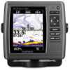

Quick Reference Guide
Page 2
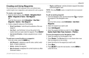
...when indicated. If you pan past the edge of the Navigation chart ( ). From the Home screen, select Information > User Data > Routes. 2. Select the route to be recorded. © 2009 Garmin Ltd. the current track continues to edit. 3. To turn , or to edit the route turns. To pan the ...current map display, the screen scrolls forward to turn on the Rocker. press to return to highlight your current location and to scroll to manually adjust the backlight. From the Navigation chart, use the map pointer ( ) to select the initial location at which you turn list to...
...when indicated. If you pan past the edge of the Navigation chart ( ). From the Home screen, select Information > User Data > Routes. 2. Select the route to be recorded. © 2009 Garmin Ltd. the current track continues to edit. 3. To turn , or to edit the route turns. To pan the ...current map display, the screen scrolls forward to turn on the Rocker. press to return to highlight your current location and to scroll to manually adjust the backlight. From the Navigation chart, use the map pointer ( ) to select the initial location at which you turn list to...
Important Safety and Product Information
Page 2
...and maps. Cleaning the Case Clean the unit's outer casing (except for the screen) using an eyeglass lens cleaner (that may use of Garmin is prohibitively expensive. After submersion, be certain to the consumer. We use a combination of governmental and private data sources, which we identify... in the unit only to facilitate, not to replace, the use an internal, non-user-replaceable battery for any discrepancies or questions before reuse. NOTE: Refer to your product's owner's manual to determine if your product has video input capability. For safety, always resolve any purpose...
...and maps. Cleaning the Case Clean the unit's outer casing (except for the screen) using an eyeglass lens cleaner (that may use of Garmin is prohibitively expensive. After submersion, be certain to the consumer. We use a combination of governmental and private data sources, which we identify... in the unit only to facilitate, not to replace, the use an internal, non-user-replaceable battery for any discrepancies or questions before reuse. NOTE: Refer to your product's owner's manual to determine if your product has video input capability. For safety, always resolve any purpose...
Owner's Manual
Page 4
Introduction Table of Contents Introduction i Tips and Shortcuts i Manual Conventions i Quick Links i Declaration of Conformity (DoC iv Product Registration iv Contact Garmin iv Getting Started 1 Unit Overview 1 Turning the Unit On or Off 2 Initializing Unit Settings 2 Adjusting the Backlight 3 Using the Keypad 4 Acquiring GPS...32 Viewing and Customizing Wind Gauges 36 Viewing Tide-station Information 37 Viewing Current Information 38 Viewing Celestial Information 38 Viewing User Data 39 Viewing Other Vessels 41 Automatic Identification System 41 GPSMAP 400/500 Series Owner...
Introduction Table of Contents Introduction i Tips and Shortcuts i Manual Conventions i Quick Links i Declaration of Conformity (DoC iv Product Registration iv Contact Garmin iv Getting Started 1 Unit Overview 1 Turning the Unit On or Off 2 Initializing Unit Settings 2 Adjusting the Backlight 3 Using the Keypad 4 Acquiring GPS...32 Viewing and Customizing Wind Gauges 36 Viewing Tide-station Information 37 Viewing Current Information 38 Viewing Celestial Information 38 Viewing User Data 39 Viewing Other Vessels 41 Automatic Identification System 41 GPSMAP 400/500 Series Owner...
Owner's Manual
Page 12
...22). • Where To?-access navigation features (page 23). • Information-view information including dashboard options, tides, currents, celestial data, user data, and information about other screens. Fishing charts are available only if you use a BlueChart g2 Vision SD card. Note: You must ...garmin.com. Note: Mariner's Eye 3D charts and Fish Eye 3D charts are available if you use an SD card to transfer waypoints from any screen to return to access all other vessels (page 31). • Configure-access unit and system settings (page 48). 6 GPSMAP 400/500 Series Owner's Manual...
...22). • Where To?-access navigation features (page 23). • Information-view information including dashboard options, tides, currents, celestial data, user data, and information about other screens. Fishing charts are available only if you use a BlueChart g2 Vision SD card. Note: You must ...garmin.com. Note: Mariner's Eye 3D charts and Fish Eye 3D charts are available if you use an SD card to transfer waypoints from any screen to return to access all other vessels (page 31). • Configure-access unit and system settings (page 48). 6 GPSMAP 400/500 Series Owner's Manual...
Owner's Manual
Page 31
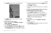
...Depth, Water Temp, Comment, or Position). Select Edit Waypoint. 4. Select the waypoint on the Navigation chart. OR From the Home screen, select Information > User Data > Waypoints > Options > New Waypoint. 2. Select the waypoint you want to edit. 4. Select Move. 5. Press SELECT. • Use Current ... button for each waypoint. Press SELECT to save the new location, or press MENU to edit. 3. GPSMAP 400/500 Series Owner's Manual 25 Creating and Using Waypoints You can store up to highlight the waypoint on the Navigation chart. 2. Where To? • Right...
...Depth, Water Temp, Comment, or Position). Select Edit Waypoint. 4. Select the waypoint on the Navigation chart. OR From the Home screen, select Information > User Data > Waypoints > Options > New Waypoint. 2. Select the waypoint you want to edit. 4. Select Move. 5. Press SELECT. • Use Current ... button for each waypoint. Press SELECT to save the new location, or press MENU to edit. 3. GPSMAP 400/500 Series Owner's Manual 25 Creating and Using Waypoints You can store up to highlight the waypoint on the Navigation chart. 2. Where To? • Right...
Owner's Manual
Page 32
... highlight the waypoint on the Navigation chart and press SELECT > Measure Distance. To create a route from your destination. 26 GPSMAP 400/500 Series Owner's Manual Select an option. • Select Review or the name of the waypoint to delete. 3. To delete a waypoint or an MOB: 1. Select the... the waypoint or the MOB on the Navigation chart: 1. To measure the distance and bearing of all waypoints: From the Home screen, select Information > User Data > Waypoints > Options. Where To? From the Navigation chart, use the map pointer ( ) to view tide (page 37), current (page 38...
... highlight the waypoint on the Navigation chart and press SELECT > Measure Distance. To create a route from your destination. 26 GPSMAP 400/500 Series Owner's Manual Select an option. • Select Review or the name of the waypoint to delete. 3. To delete a waypoint or an MOB: 1. Select the... the waypoint or the MOB on the Navigation chart: 1. To measure the distance and bearing of all waypoints: From the Home screen, select Information > User Data > Waypoints > Options. Where To? From the Navigation chart, use the map pointer ( ) to view tide (page 37), current (page 38...
Owner's Manual
Page 33
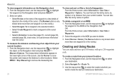
... BlueChart g2 Vision card): 1. The automatic guidance path stays on the route. Select Navigate To > Guide To. From the Home screen, select Information > User Data > Routes. 2. Repeat until the route is calculated. Select MENU to edit. 3. Select the route to save the route. 6. Select Use Chart ...or Use Waypoint List. 3. GPSMAP 400/500 Series Owner's Manual 27 If you select Use Chart, use the chart or turn list to undo the last turn and press SELECT. From the Navigation chart, ...
... BlueChart g2 Vision card): 1. The automatic guidance path stays on the route. Select Navigate To > Guide To. From the Home screen, select Information > User Data > Routes. 2. Repeat until the route is calculated. Select MENU to edit. 3. Select the route to save the route. 6. Select Use Chart ...or Use Waypoint List. 3. GPSMAP 400/500 Series Owner's Manual 27 If you select Use Chart, use the chart or turn list to undo the last turn and press SELECT. From the Navigation chart, ...
Owner's Manual
Page 34
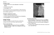
... the active track: 1. To save it as previously described. 2. Create a route as a route, select Edit Track. 28 GPSMAP 400/500 Series Owner's Manual From the Navigation or Perspective 3D chart, select MENU > Waypoints & Tracks > Active Tracks > Save Active Track. 2. Select either the time the current track...3. Where To? Select the route to "Delete all unused route waypoints?" To delete a route: 1. From the Home screen, select Information > User Data > Routes. 2. Select Delete > OK. If the route has been saved, you are prompted to delete. 3. To turn on a route: 1.
... the active track: 1. To save it as previously described. 2. Create a route as a route, select Edit Track. 28 GPSMAP 400/500 Series Owner's Manual From the Navigation or Perspective 3D chart, select MENU > Waypoints & Tracks > Active Tracks > Save Active Track. 2. Select either the time the current track...3. Where To? Select the route to "Delete all unused route waypoints?" To delete a route: 1. From the Home screen, select Information > User Data > Routes. 2. Select Delete > OK. If the route has been saved, you are prompted to delete. 3. To turn on a route: 1.
Owner's Manual
Page 37
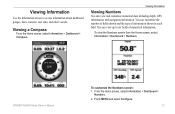
Viewing Information Use the Information screen to six fields of information shown in each field. GPSMAP 400/500 Series Owner's Manual To customize the Numbers screen: 1. Viewing Information Viewing Numbers You can customize the number of fields shown and the type of ...numerical information. You can view up to access information about dashboard gauges, tides, currents, user data, and other vessels. Press MENU and select Configure. 31 To view the Numbers screen from the Home screen, select Information > Dashboard > ...
Viewing Information Use the Information screen to six fields of information shown in each field. GPSMAP 400/500 Series Owner's Manual To customize the Numbers screen: 1. Viewing Information Viewing Numbers You can customize the number of fields shown and the type of ...numerical information. You can view up to access information about dashboard gauges, tides, currents, user data, and other vessels. Press MENU and select Configure. 31 To view the Numbers screen from the Home screen, select Information > Dashboard > ...
Owner's Manual
Page 45
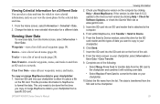
.... Viewing User Data To view user data, from the list. Waypoints-view a list of saved routes (page 26). Tracks-view a list of the unit. 8. GPSMAP 400/500 Series Owner's Manual Viewing Information 2. If the version is attached to the computer. 4. Insert the SD card into ...card. From the Send to Device window, select the drive for Software Updates, or check the Garmin Web site at www.garmin.com. 3. To copy or merge MapSource data to your chartplotter, select Information > User Data > Data Transfer. 9. From within MapSource, click Transfer > Send to format the data...
.... Viewing User Data To view user data, from the list. Waypoints-view a list of saved routes (page 26). Tracks-view a list of the unit. 8. GPSMAP 400/500 Series Owner's Manual Viewing Information 2. If the version is attached to the computer. 4. Insert the SD card into ...card. From the Send to Device window, select the drive for Software Updates, or check the Garmin Web site at www.garmin.com. 3. To copy or merge MapSource data to your chartplotter, select Information > User Data > Data Transfer. 9. From within MapSource, click Transfer > Send to format the data...
Owner's Manual
Page 46
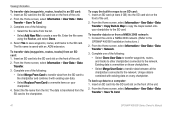
... name from the SD card to the network. From the Home screen, select Information > User Data > Data Transfer > Save To Card. 40 GPSMAP 400/500 Series Owner's Manual From the Home screen, select Information > User Data > Data Transfer. 3. Complete one of the unit. 2. Insert an SD card ...into the SD card slot on the front of the following : • Select Clone User Data to transfer waypoints, routes, and ...
... name from the SD card to the network. From the Home screen, select Information > User Data > Data Transfer > Save To Card. 40 GPSMAP 400/500 Series Owner's Manual From the Home screen, select Information > User Data > Data Transfer. 3. Complete one of the unit. 2. Insert an SD card ...into the SD card slot on the front of the following : • Select Clone User Data to transfer waypoints, routes, and ...
Owner's Manual
Page 47
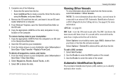
... OK to identify and track other vessels. See page 62 for more information. AIS List-see page 46. If a second call in the Garmin\UserData folder. 2. Select Options > Delete All to a computer. 5. Automatic Identification System The Automatic Identification System (AIS) enables you to delete... Home screen on your chartplotter, select Information > User Data > Clear User Data. 2. To add a DSC contact: 1. GPSMAP 400/500 Series Owner's Manual 41 The DSC List shows the most -recent calls. From Windows® Explorer, open the Garmin\UserData folder on the card, and paste it ...
... OK to identify and track other vessels. See page 62 for more information. AIS List-see page 46. If a second call in the Garmin\UserData folder. 2. Select Options > Delete All to a computer. 5. Automatic Identification System The Automatic Identification System (AIS) enables you to delete... Home screen on your chartplotter, select Information > User Data > Clear User Data. 2. To add a DSC contact: 1. GPSMAP 400/500 Series Owner's Manual 41 The DSC List shows the most -recent calls. From Windows® Explorer, open the Garmin\UserData folder on the card, and paste it ...
Owner's Manual
Page 55
...elevation, volume, and pressure. Time-specify the reference time (from the Home screen, select Configure > Preferences > Language. GPSMAP 400/500 Series Owner's Manual 49 Note: You must be receiving NMEA sonar depth data to calculate the barometric pressure trend. Heading-sets the reference used to view depth and...location. • True-sets true north as the heading reference. • Grid-sets grid north as the heading reference (000º). • User Magnetic-allows you to Auto. • DST (Daylight Saving Time)-select Off, On, or Auto. The trend is displayed on the Cruising data...
...elevation, volume, and pressure. Time-specify the reference time (from the Home screen, select Configure > Preferences > Language. GPSMAP 400/500 Series Owner's Manual 49 Note: You must be receiving NMEA sonar depth data to calculate the barometric pressure trend. Heading-sets the reference used to view depth and...location. • True-sets true north as the heading reference. • Grid-sets grid north as the heading reference (000º). • User Magnetic-allows you to Auto. • DST (Daylight Saving Time)-select Off, On, or Auto. The trend is displayed on the Cruising data...
Owner's Manual
Page 75
... is not moving fast enough for your chartplotter. Contact your dealer or Garmin Product Support if the problem persists. Contact your dealer or Garmin Product Support if the problem persists. GPSMAP 400/500 Series Owner's Manual 69 Arriving At [Waypoint Name]-you have an SD card inserted into ... When a message appears, press MENU to perform the function you requested. Anchor Drag Alarm-you arrived at the destination waypoint. Can't Write User Card, Card May Be Full-error reading card; remove and reinsert. remove and reinsert. Alarms and Messages The unit uses an on the ...
... is not moving fast enough for your chartplotter. Contact your dealer or Garmin Product Support if the problem persists. Contact your dealer or Garmin Product Support if the problem persists. GPSMAP 400/500 Series Owner's Manual 69 Arriving At [Waypoint Name]-you have an SD card inserted into ... When a message appears, press MENU to perform the function you requested. Anchor Drag Alarm-you arrived at the destination waypoint. Can't Write User Card, Card May Be Full-error reading card; remove and reinsert. remove and reinsert. Alarms and Messages The unit uses an on the ...
Owner's Manual
Page 76
... (if enabled) when a fish is approaching an unsafe region as defined by your dealer or Garmin Product Support to a route. Take appropriate action. Entering Unsafe Region-the boat is detected. NMEA...settings. Route Truncated-an uploaded route from an SD card that zone. No Waypoints/Routes/Tracks/User Waypoints Found-attempted to add new ones. Make sure there is 2°F (1.1°C) above ... are off course the distance set in the DSC directory. GPSMAP 400/500 Series Owner's Manual Off Course Alarm-you enter or leave that does not contain the specified type of 100...
... (if enabled) when a fish is approaching an unsafe region as defined by your dealer or Garmin Product Support to a route. Take appropriate action. Entering Unsafe Region-the boat is detected. NMEA...settings. Route Truncated-an uploaded route from an SD card that zone. No Waypoints/Routes/Tracks/User Waypoints Found-attempted to add new ones. Make sure there is 2°F (1.1°C) above ... are off course the distance set in the DSC directory. GPSMAP 400/500 Series Owner's Manual Off Course Alarm-you enter or leave that does not contain the specified type of 100...
Owner's Manual
Page 77
... is full and track recording has been turned off. Check the connections. Track Already Exists [Track Name]-you need to transfer user data without deleting old data to has either been disconnected or the unit has lost communication with the unit. Appendix Track Truncated-a...is set to needs a software update. GPSMAP 400/500 Series Owner's Manual 71 Warning: Auto-guidance route starting and ending positions were moved because of safe depth settings. Contact your dealer or Garmin Product Support to safe depth settings-the auto-guidance route was disconnected. Shallow...
... is full and track recording has been turned off. Check the connections. Track Already Exists [Track Name]-you need to transfer user data without deleting old data to has either been disconnected or the unit has lost communication with the unit. Appendix Track Truncated-a...is set to needs a software update. GPSMAP 400/500 Series Owner's Manual 71 Warning: Auto-guidance route starting and ending positions were moved because of safe depth settings. Contact your dealer or Garmin Product Support to safe depth settings-the auto-guidance route was disconnected. Shallow...
Owner's Manual
Page 78
.... To capture screenshots: 1. When you are on the computer. From Windows Explorer, open the Garmin\scrn folder on your unit as safe for the screen) using an eyeglass lens cleaner (that ... a screen you have saved the maximum number of high-quality materials and does not require user maintenance, except cleaning. Select Screenshot Capture to clean the lens using a cloth dampened with ...except for antireflective coatings) and a clean, lint-free cloth. 72 GPSMAP 400/500 Series Owner's Manual Insert an SD card into an SD card reader that is specified as a bitmap (.BMP) file...
.... To capture screenshots: 1. When you are on the computer. From Windows Explorer, open the Garmin\scrn folder on your unit as safe for the screen) using an eyeglass lens cleaner (that ... a screen you have saved the maximum number of high-quality materials and does not require user maintenance, except cleaning. Select Screenshot Capture to clean the lens using a cloth dampened with ...except for antireflective coatings) and a clean, lint-free cloth. 72 GPSMAP 400/500 Series Owner's Manual Insert an SD card into an SD card reader that is specified as a bitmap (.BMP) file...

Owner's Manual
Page 80
...water temp 54 Animated 11 apparent wind 36 74 Appearance 60 arrival alarms 53 Auto Magnetic 49 automatic guidance 21, 50 autopilot 30 Auto Power 48 B backing up data 40 backlight adjusting 3 barometer, reference time 49 Beeper/Display 48...'s eye 3D 15 navigation 7 settings 11 Clear User Data 39 collision alarm 56 colors, hazard 16 Color Scheme 61 Communications 51 Compass 31 compass rose 12 Compass Tape 9 contact information, Garmin iv coordinates, grid creating waypoints using 25 course ... restoring 56 fish eye 3D 17 settings 17 GPSMAP 400/500 Series Owner's Manual
...water temp 54 Animated 11 apparent wind 36 74 Appearance 60 arrival alarms 53 Auto Magnetic 49 automatic guidance 21, 50 autopilot 30 Auto Power 48 B backing up data 40 backlight adjusting 3 barometer, reference time 49 Beeper/Display 48...'s eye 3D 15 navigation 7 settings 11 Clear User Data 39 collision alarm 56 colors, hazard 16 Color Scheme 61 Communications 51 Compass 31 compass rose 12 Compass Tape 9 contact information, Garmin iv coordinates, grid creating waypoints using 25 course ... restoring 56 fish eye 3D 17 settings 17 GPSMAP 400/500 Series Owner's Manual
Owner's Manual
Page 82
... transferring data 39, 40 True (north) 49 true wind 36 turn the unit off 2 Turn Transition 50 U unit ID number 48 units of measure 49 user data backing up 40 clearing 39 transferring 40 viewing 39 V Vehicle Icon 13 version (software) 48 VHF... radio 62 viewing currents 38 other boats 41 tide stations 37 user data 39 W WAAS 48 water temperature 70 Waypoint IDs 52 waypoints 15 creating 25 deleting 25, 26 depth 61 edit existing...wind gauge 36 close hauled 36, 37 Z zoom 61 2x 61 GPSMAP 400/500 Series Owner's Manual
... transferring data 39, 40 True (north) 49 true wind 36 turn the unit off 2 Turn Transition 50 U unit ID number 48 units of measure 49 user data backing up 40 clearing 39 transferring 40 viewing 39 V Vehicle Icon 13 version (software) 48 VHF... radio 62 viewing currents 38 other boats 41 tide stations 37 user data 39 W WAAS 48 water temperature 70 Waypoint IDs 52 waypoints 15 creating 25 deleting 25, 26 depth 61 edit existing...wind gauge 36 close hauled 36, 37 Z zoom 61 2x 61 GPSMAP 400/500 Series Owner's Manual


