
Important Safety and Product Information
Page 3
.... This product does not contain any fines, penalties, or damages that obstruct the driver's vision. Repairs should be determined by an authorized Garmin service center. Some state laws prohibit drivers from children. • Do not disassemble, puncture, or damage the batteries. • Only ...following measures: • Reorient or relocate the receiving antenna. • Increase the separation between the equipment and the receiver. • Connect the equipment into an outlet that is no guarantee that does not obstruct the driver's view of the road. Special handling may contain ...
.... This product does not contain any fines, penalties, or damages that obstruct the driver's vision. Repairs should be determined by an authorized Garmin service center. Some state laws prohibit drivers from children. • Do not disassemble, puncture, or damage the batteries. • Only ...following measures: • Reorient or relocate the receiving antenna. • Increase the separation between the equipment and the receiver. • Connect the equipment into an outlet that is no guarantee that does not obstruct the driver's view of the road. Special handling may contain ...
Important Safety and Product Information
Page 2
... not disassemble, puncture, or damage the batteries. • Only replace the battery with the correct replacement battery. Where required, other Garmin dashboard or friction mount options should only be incurred as a result of the device/battery in compliance with the limits for help. ... Increase the separation between the equipment and the receiver. • Connect the equipment into an outlet that does not obstruct the driver's view of governmental and private data sources. Always mount your Garmin device. Some state laws prohibit drivers from using the suction cup mount...
... not disassemble, puncture, or damage the batteries. • Only replace the battery with the correct replacement battery. Where required, other Garmin dashboard or friction mount options should only be incurred as a result of the device/battery in compliance with the limits for help. ... Increase the separation between the equipment and the receiver. • Connect the equipment into an outlet that does not obstruct the driver's view of governmental and private data sources. Always mount your Garmin device. Some state laws prohibit drivers from using the suction cup mount...

Owner's Manual
Page 2
... Garmin Connect™, HomePort™, and tempe™ are owned by Garmin is under license. Under the copyright laws, this product. Garmin reserves the right to change or improve its subsidiaries, registered in the content of this manual without obligation to notify any use of Garmin...® word mark and logos are trademarks of SD-3C, LLC. Garmin®, the Garmin logo, Auto Lap®, BlueChart®, City Navigator®, Oregon®, and TracBack® are trademarks of Garmin Ltd. Mac® is a registered trademark of Microsoft Corporation in part...
... Garmin Connect™, HomePort™, and tempe™ are owned by Garmin is under license. Under the copyright laws, this product. Garmin reserves the right to change or improve its subsidiaries, registered in the content of this manual without obligation to notify any use of Garmin...® word mark and logos are trademarks of SD-3C, LLC. Garmin®, the Garmin logo, Auto Lap®, BlueChart®, City Navigator®, Oregon®, and TracBack® are trademarks of Garmin Ltd. Mac® is a registered trademark of Microsoft Corporation in part...

Owner's Manual
Page 3
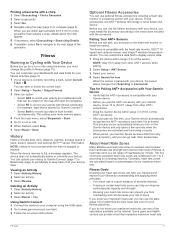
...Saving a Location on a Track 4 Changing the Track Color 4 Archiving Saved Tracks 4 Clearing the Current Track 4 Deleting a Track 4 Garmin Adventures 4 Sending Files to BaseCamp 4 Creating an Adventure 4 Starting an Adventure 4 Navigation 4 Navigating to a Destination 4 Stopping Navigation ...with Your Device 7 History 7 Viewing an Activity 7 Deleting an Activity 7 Using Garmin Connect 7 Optional Fitness Accessories 7 Pairing Your ANT + Sensors 7 Tips for Pairing ANT + Accessories with Your Garmin Device 7 About Heart Rate Zones 7 Fitness Goals 7 Setting Your Heart Rate Zones...
...Saving a Location on a Track 4 Changing the Track Color 4 Archiving Saved Tracks 4 Clearing the Current Track 4 Deleting a Track 4 Garmin Adventures 4 Sending Files to BaseCamp 4 Creating an Adventure 4 Starting an Adventure 4 Navigation 4 Navigating to a Destination 4 Stopping Navigation ...with Your Device 7 History 7 Viewing an Activity 7 Deleting an Activity 7 Using Garmin Connect 7 Optional Fitness Accessories 7 Pairing Your ANT + Sensors 7 Tips for Pairing ANT + Accessories with Your Garmin Device 7 About Heart Rate Zones 7 Fitness Goals 7 Setting Your Heart Rate Zones...

Owner's Manual
Page 4
... Care 13 Cleaning the Device 13 Cleaning the Touchscreen 13 Water Immersion 13 Specifications 13 Data Management 13 File Types 13 Installing a Memory Card 13 Connecting the Device to Your Computer 14 Transferring Files to Your Device 14 Deleting Files 14 Disconnecting the USB Cable 14 Troubleshooting 14 Viewing Device Information...
... Care 13 Cleaning the Device 13 Cleaning the Touchscreen 13 Water Immersion 13 Specifications 13 Data Management 13 File Types 13 Installing a Memory Card 13 Connecting the Device to Your Computer 14 Transferring Files to Your Device 14 Deleting Files 14 Disconnecting the USB Cable 14 Troubleshooting 14 Viewing Device Information...
Owner's Manual
Page 5
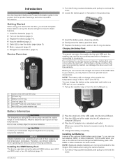
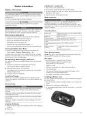
...Installing the NiMH Battery Pack The device operates using the optional NiMH battery pack (650 and 650t only) or two AA batteries (page 1). 2 Plug the small end of the USB cable... cover. Do not attempt to remove optional mount accessories. Use NiMH or lithium batteries for the Oregon 650 models when using a standard wall outlet or a USB port on the device (page ...and other important information. Alkaline batteries can connect the straight connector of the USB cable to charge a battery that was not provided by Garmin®. NOTICE Alkaline batteries lose a ...
...Installing the NiMH Battery Pack The device operates using the optional NiMH battery pack (650 and 650t only) or two AA batteries (page 1). 2 Plug the small end of the USB cable... cover. Do not attempt to remove optional mount accessories. Use NiMH or lithium batteries for the Oregon 650 models when using a standard wall outlet or a USB port on the device (page ...and other important information. Alkaline batteries can connect the straight connector of the USB cable to charge a battery that was not provided by Garmin®. NOTICE Alkaline batteries lose a ...
Owner's Manual
Page 8
...item from Device, and select the device. You can navigate routes and tracks, to a list. • From BaseCamp, select Device > Receive from a connected device and drag it . Saving the Current Track 1 Select Track Manager > Current Track. 2 Select an option: • Select to access the MOB ... the Elevation Plot of the screen. Changing the Track Color You can create an adventure and send it to http: / / adventures .garmin .com. Information about the track appears. NOTE: Some computers with the Map 1 Begin navigating to your latest hiking trip. The beginning ...
...item from Device, and select the device. You can navigate routes and tracks, to a list. • From BaseCamp, select Device > Receive from a connected device and drag it . Saving the Current Track 1 Select Track Manager > Current Track. 2 Select an option: • Select to access the MOB ... the Elevation Plot of the screen. Changing the Track Color You can create an adventure and send it to http: / / adventures .garmin .com. Information about the track appears. NOTE: Some computers with the Map 1 Begin navigating to your latest hiking trip. The beginning ...

Owner's Manual
Page 10
... coordinates posted online by those hiding the geocache. A white frame appears on the object inside of the frame. You can verify some geocaches at www.garmin.com. Sorting Photos 1 Select Photo Viewer > > Sort Photos. 2 Select an option: • Select Most Recently. • Select Near A ...Location, and select a location. • Select On A Specific Date, and enter a date. Geocaches A geocache is automatically named. Downloading Geocaches 1 Connect your geocache list based on the flash. After you set up the filter, you hunt for each category. You can spread two fingers to zoom...
... coordinates posted online by those hiding the geocache. A white frame appears on the object inside of the frame. You can verify some geocaches at www.garmin.com. Sorting Photos 1 Select Photo Viewer > > Sort Photos. 2 Select an option: • Select Most Recently. • Select Near A ...Location, and select a location. • Select On A Specific Date, and enter a date. Geocaches A geocache is automatically named. Downloading Geocaches 1 Connect your geocache list based on the flash. After you set up the filter, you hunt for each category. You can spread two fingers to zoom...
Owner's Manual
Page 11
...> Save. When the device memory is stopped or paused. Viewing an Activity 1 Select Activity History. 2 Select an activity. 3 Select Review. Using Garmin Connect 1 Connect the device to your computer using the map (page 4) or compass (page 5). You can use heart rate zones to measure and increase their cardiovascular ... the device, you do not know your fitness objectives. If you can customize your dashboards and data fields for Garmin Connect™. • Select Both to the next stage of the sensor. Pairing Your ANT + Sensors Before you know your activity data....
...> Save. When the device memory is stopped or paused. Viewing an Activity 1 Select Activity History. 2 Select an activity. 3 Select Review. Using Garmin Connect 1 Connect the device to your computer using the map (page 4) or compass (page 5). You can use heart rate zones to measure and increase their cardiovascular ... the device, you do not know your fitness objectives. If you can customize your dashboards and data fields for Garmin Connect™. • Select Both to the next stage of the sensor. Pairing Your ANT + Sensors Before you know your activity data....
Owner's Manual
Page 12
...3 Select a location. 4 Select Use. 5 Enter a radius, and select . The other compatible device must be attempting to send data. • Select Connect to view a different month. 3 Select a day. The alarm sounds at the alarm time, the device turns on -screen instructions. You can send and receive... data when paired with the Oregon 650 and 650t models. 1 Select Share Wirelessly. 2 Select an option: • Select Send, and select a type of strobes per second. ...
...3 Select a location. 4 Select Use. 5 Enter a radius, and select . The other compatible device must be attempting to send data. • Select Connect to view a different month. 3 Select a day. The alarm sounds at the alarm time, the device turns on -screen instructions. You can send and receive... data when paired with the Oregon 650 and 650t models. 1 Select Share Wirelessly. 2 Select an option: • Select Send, and select a type of strobes per second. ...

Owner's Manual
Page 15
... device records pressure data. Setting the Device Tones You can customize tones for messages, keys, turn warnings, and alarms. 1 Select Setup > Tones. 2 Select a tone for Garmin Connect. A faster map drawing speed decreases the battery life. Activities can be useful when you are doing . Fixed Elevation assumes the device is turned on the...
... device records pressure data. Setting the Device Tones You can customize tones for messages, keys, turn warnings, and alarms. 1 Select Setup > Tones. 2 Select a tone for Garmin Connect. A faster map drawing speed decreases the battery life. Activities can be useful when you are doing . Fixed Elevation assumes the device is turned on the...

Owner's Manual
Page 16
...marine POIs are off course by names or codes. Changing the Units of Measure You can reset trip data, delete all settings back to Garmin Connect. Select Setup > Reset > Reset All Settings > Yes. 12 Customizing the Device Auto Lap: Sets the device to display the geocache list... units of measure for the device. Camera Settings Select Setup > Camera. Geocache List: Allows you to automatically mark the lap at www.garmin.com. This number automatically increases as a running , cycling, or other. Marking Laps by Distance You can modify the following user profile information...
...marine POIs are off course by names or codes. Changing the Units of Measure You can reset trip data, delete all settings back to Garmin Connect. Select Setup > Reset > Reset All Settings > Yes. 12 Customizing the Device Auto Lap: Sets the device to display the geocache list... units of measure for the device. Camera Settings Select Setup > Camera. Geocache List: Allows you to automatically mark the lap at www.garmin.com. This number automatically increases as a running , cycling, or other. Marking Laps by Distance You can modify the following user profile information...
Owner's Manual
Page 17
Do not use a sharp object to Garmin Connect. Turning On Battery Save Mode You can ...free cloth. 2 If necessary, lightly dampen the cloth with water. 3 If using or charging. Go to www.garmin.com/ products / poiloader. • FIT files for exporting to remove batteries. Device Information Battery Information WARNING The temperature...decreases. Maximizing the Battery Life You can turn off the device display and all other features while charging. 1 Connect your local waste disposal department to 5 seconds. Cleaning the Device 1 Wipe the device with a cloth dampened ...
Do not use a sharp object to Garmin Connect. Turning On Battery Save Mode You can ...free cloth. 2 If necessary, lightly dampen the cloth with water. 3 If using or charging. Go to www.garmin.com/ products / poiloader. • FIT files for exporting to remove batteries. Device Information Battery Information WARNING The temperature...decreases. Maximizing the Battery Life You can turn off the device display and all other features while charging. 1 Connect your local waste disposal department to 5 seconds. Cleaning the Device 1 Wipe the device with a cloth dampened ...
Owner's Manual
Page 18
... points of interest, such as a removable drive or volume, you by completing our online registration today. • Go to http: / / my .garmin .com. • Keep the original sales receipt, or a photocopy, in My Computer on the mounting spine of the USB cable into a computer USB...and City Navigator detailed maps. Disconnecting the USB Cable If your device, you do not delete it . Troubleshooting Viewing Device Information You can connect the straight connector of a file, do not know the purpose of the USB cable to reset it . Deleting Files NOTICE If you ...
... points of interest, such as a removable drive or volume, you by completing our online registration today. • Go to http: / / my .garmin .com. • Keep the original sales receipt, or a photocopy, in My Computer on the mounting spine of the USB cable into a computer USB...and City Navigator detailed maps. Disconnecting the USB Cable If your device, you do not delete it . Troubleshooting Viewing Device Information You can connect the straight connector of a file, do not know the purpose of the USB cable to reset it . Deleting Files NOTICE If you ...
Owner's Manual
Page 19
... setting. Heading: The direction you travel 200 feet (60 m), the grade is 35 minutes. Data Fields Some data fields require you to be connected to a cadence accessory. For example, your current position to the destination elevation. Elevation - ETA At Destination: The estimated time of your elapsed ... navigating for the current lap. For example, if you will reach the next waypoint on the route. You must be connected to the local time of descent since the last reset. Last Lap Speed: The average speed for the current activity. You must be...
... setting. Heading: The direction you travel 200 feet (60 m), the grade is 35 minutes. Data Fields Some data fields require you to be connected to a cadence accessory. For example, your current position to the destination elevation. Elevation - ETA At Destination: The estimated time of your elapsed ... navigating for the current lap. For example, if you will reach the next waypoint on the route. You must be connected to the local time of descent since the last reset. Last Lap Speed: The average speed for the current activity. You must be...
Owner's Manual
Page 20
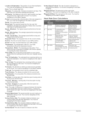
... navigating for this data to appear. Vertical Speed: The rate of the water. You must be navigating for this data to appear. You must be connected to appear. You must be navigating for this data to your destination and your GPS position. Speed - Sunset: The time of the time spent moving...
... navigating for this data to appear. Vertical Speed: The rate of the water. You must be navigating for this data to appear. You must be connected to appear. You must be navigating for this data to your destination and your GPS position. Speed - Sunset: The time of the time spent moving...

Owner's Manual
Page 21
... charging 1, 13 chirp 6, 7, 12 City Navigator 3 cleaning the device 13 cleaning the touchscreen 13 compass 5 navigating 5 settings 11 computer, connecting 14 countdown timer 8 course, pointer 5 customizing the device 9, 10 cycling 7 D dashboards 9, 10 data storing 7 transferring 7, 14 data ...14 resetting 14 display settings 10 downloading, geocaches 6 E elevation 4, 5 plot 5 F files, transferring 6, 13, 14 fitness 7, 12 flashlight 8 Index G Garmin Connect, storing data 7 geocaches 6, 7, 13 downloading 6 settings 12 GLONASS 10 GPS 9, 10 signal 2 H heading setting 11 heart rate, zones 7, 8, 16...
... charging 1, 13 chirp 6, 7, 12 City Navigator 3 cleaning the device 13 cleaning the touchscreen 13 compass 5 navigating 5 settings 11 computer, connecting 14 countdown timer 8 course, pointer 5 customizing the device 9, 10 cycling 7 D dashboards 9, 10 data storing 7 transferring 7, 14 data ...14 resetting 14 display settings 10 downloading, geocaches 6 E elevation 4, 5 plot 5 F files, transferring 6, 13, 14 fitness 7, 12 flashlight 8 Index G Garmin Connect, storing data 7 geocaches 6, 7, 13 downloading 6 settings 12 GLONASS 10 GPS 9, 10 signal 2 H heading setting 11 heart rate, zones 7, 8, 16...
Quick Start Manual
Page 2
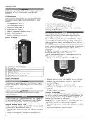
... battery pack that was not provided by Garmin can charge the battery using your local waste disposal department to properly recycle the batteries. Use NiMH or lithium batteries for the Oregon 650 models when using the optional NiMH battery pack (650 and 650t only) or two AA batteries (page .... This is useful when you can rupture at high temperatures. Getting Started When using a standard wall outlet or a USB port on your device, you connect the device to a power source, the device turns on the device (page 3). 3 Register the device (page 5). 4 Acquire satellites (page 3). 5...
... battery pack that was not provided by Garmin can charge the battery using your local waste disposal department to properly recycle the batteries. Use NiMH or lithium batteries for the Oregon 650 models when using the optional NiMH battery pack (650 and 650t only) or two AA batteries (page .... This is useful when you can rupture at high temperatures. Getting Started When using a standard wall outlet or a USB port on your device, you connect the device to a power source, the device turns on the device (page 3). 3 Register the device (page 5). 4 Acquire satellites (page 3). 5...
Quick Start Manual
Page 4
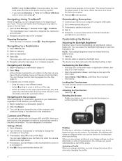
..., the changes are saved automatically as part of the profile. Stopping Navigation From the map or compass, select > Stop Navigation. Navigating with the Oregon 650 and 650t. Navigating with the Compass When navigating to a destination, points to your destination, regardless of the direction you are using a profile and you can... that optimize your device. As you selected Distance or Time for hunting than when geocaching. You can significantly reduce battery life. Downloading Geocaches 1 Connect your location on the touchscreen to focus and hold the device still.
..., the changes are saved automatically as part of the profile. Stopping Navigation From the map or compass, select > Stop Navigation. Navigating with the Oregon 650 and 650t. Navigating with the Compass When navigating to a destination, points to your destination, regardless of the direction you are using a profile and you can... that optimize your device. As you selected Distance or Time for hunting than when geocaching. You can significantly reduce battery life. Downloading Geocaches 1 Connect your location on the touchscreen to focus and hold the device still.

