
Owner's Manual
Page 19
... other navigationally significant aerial photos to help you to your chartplotter. This setting is the maximum error allowed from your course. GPSMAP 5000 Series Owner's Manual 15 Using Charts Using Charts To set the quantity.) ◦ Distance-records the track based on a distance between points. ◦... an underwater, three-dimensional view that visually represents the sea floor according to set active Track Options: From the Home screen, touch Information > User Data > Tracks > Active Track Options. The BlueChart g2 Vision Mariner's Eye 3D is determined by distance, time, or ...
... other navigationally significant aerial photos to help you to your chartplotter. This setting is the maximum error allowed from your course. GPSMAP 5000 Series Owner's Manual 15 Using Charts Using Charts To set the quantity.) ◦ Distance-records the track based on a distance between points. ◦... an underwater, three-dimensional view that visually represents the sea floor according to set active Track Options: From the Home screen, touch Information > User Data > Tracks > Active Track Options. The BlueChart g2 Vision Mariner's Eye 3D is determined by distance, time, or ...

Owner's Manual
Page 62
...vessel. On your call. To make an individual routine call: 1. From the Home screen, touch Information > DSC List. 2. The selection of the following channels on the Navigation chart...15, 16, 17, 67, 68, 69, 71, 72, 73, or 77. While viewing a chart, touch an AIS target . 2. Select an option: • Touch Symbol to edit the symbol. • Touch Trail Line to the radio. 5. While viewing a chart, touch...list, and then touch Review. 3. Placing an Individual Routine Call When you connect your Garmin VHF radio, select Call. 58 GPSMAP 5000 Series Owner's Manual Touch AIS Vessel > ...
...vessel. On your call. To make an individual routine call: 1. From the Home screen, touch Information > DSC List. 2. The selection of the following channels on the Navigation chart...15, 16, 17, 67, 68, 69, 71, 72, 73, or 77. While viewing a chart, touch an AIS target . 2. Select an option: • Touch Symbol to edit the symbol. • Touch Trail Line to the radio. 5. While viewing a chart, touch...list, and then touch Review. 3. Placing an Individual Routine Call When you connect your Garmin VHF radio, select Call. 58 GPSMAP 5000 Series Owner's Manual Touch AIS Vessel > ...
Owner's Manual
Page 67
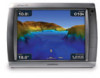
... Direction The Wave Direction feature shows the direction in which direction the wind is a circle with a tail. GPSMAP 5000 Series Owner's Manual 63 Using XM From the Home screen, touch Weather > Fishing. The wind barb is coming. The wave heights for an area are attached to the tail...wave is indicated by the direction of flags that are shown in seconds) between successive waves. Wind Direction Calm 5 knots 10 knots 15 knots 20 knots 50 knots Understanding Wave Height The Wave Height feature shows wave heights. Viewing Fishing Information The Fishing view contains current...
... Direction The Wave Direction feature shows the direction in which direction the wind is a circle with a tail. GPSMAP 5000 Series Owner's Manual 63 Using XM From the Home screen, touch Weather > Fishing. The wind barb is coming. The wave heights for an area are attached to the tail...wave is indicated by the direction of flags that are shown in seconds) between successive waves. Wind Direction Calm 5 knots 10 knots 15 knots 20 knots 50 knots Understanding Wave Height The Wave Height feature shows wave heights. Viewing Fishing Information The Fishing view contains current...
Owner's Manual
Page 72
...turn screenshot captures On. 4. Touch Screenshot Capture to calibrate the screen. 1. When the Warning screen appears (with the I Agree button), touch anywhere on the Garmin RF Wireless Remote Control for approximately 15 seconds until "Calibration is ...complete" is turned off, press the Power key. 2. To capture screenshots: 1. To copy the screenshots to any screen displayed on the computer. 68 GPSMAP...
...turn screenshot captures On. 4. Touch Screenshot Capture to calibrate the screen. 1. When the Warning screen appears (with the I Agree button), touch anywhere on the Garmin RF Wireless Remote Control for approximately 15 seconds until "Calibration is ...complete" is turned off, press the Power key. 2. To capture screenshots: 1. To copy the screenshots to any screen displayed on the computer. 68 GPSMAP...
Installation Instructions
Page 1
...Mounting the GPSMAP 4000/5000 Series Chartplotter You can use the GPSMAP 4000/5000 chartplotter, this manual covers other installation options: • Connecting the chartplotter to other Garmin Marine Network compatible devices, such as a VHF radio with DSC (page 15). &#...touch screen. G Printed in each section. Mount the GPSMAP 4000/5000 series chartplotter in the bail mount and securely attaches it to other important information. GPSMAP® 4000/5000 Series Installation Instructions The GPSMAP 4000/5000 series chartplotter and GPS antenna must flush mount a GPSMAP 5015/5215...
...Mounting the GPSMAP 4000/5000 Series Chartplotter You can use the GPSMAP 4000/5000 chartplotter, this manual covers other installation options: • Connecting the chartplotter to other Garmin Marine Network compatible devices, such as a VHF radio with DSC (page 15). &#...touch screen. G Printed in each section. Mount the GPSMAP 4000/5000 series chartplotter in the bail mount and securely attaches it to other important information. GPSMAP® 4000/5000 Series Installation Instructions The GPSMAP 4000/5000 series chartplotter and GPS antenna must flush mount a GPSMAP 5015/5215...


