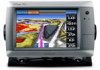
Garmin GPSMAP 740/740s Support Question
Garmin GPSMAP 740/740s Support Question
Find answers below for this question about Garmin GPSMAP 740/740s.Need a Garmin GPSMAP 740/740s manual? We have 7 online manuals for this item!
Question posted by Drode1992 on August 13th, 2013
740s Touch Screen Not Calibrated
The person who posted this question about this Garmin product did not include a detailed explanation. Please use the "Request More Information" button to the right if more details would help you to answer this question.
Current Answers
Related Garmin GPSMAP 740/740s Manual Pages
Technical Reference for Garmin NMEA 2000 Products - Page 28
Using Fuel-Flow Information With a Garmin Chartplotter or Marine Instrument
Caution: The Garmin chartplotter or marine instrument must specify the amount of fuel added: 1.
While viewing the fuel page or fuel instrument screen on to all available fuel-level instruments and sources.
To reset the fuel-level calibration: 1. While viewing the NMEA 2000 device configuration...
Installation Instructions - Page 1
...page 6) • Connecting the chartplotter to a GA 30 remote GPS antenna (page 6). • Connecting the chartplotter to a Garmin marine radar (page 6). • Connecting the chartplotter to other important ...power key and the touch screen. In Europe, go to a sonar transducer ("s" models only) (page 6). The following instructions. The GPSMAP 700 series chartplotter must : ...
Installation Instructions - Page 7
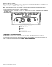
...the version of a GPSMAP 700 series chartplotter: 1. If a software update SD card is not included, visit www.garmin.com to make sure your chartplotter, select or touch Configure > System > ... NMEA 0183, NMEA 2000, or external GPS devices are installed) connect the cables to overtighten the locking ring.
➊
➋
➌
➍
GPSMAP 700 Series Connectors
➊ NMEA 2000 ...
Owner's Manual - Page 3
...; GPSMAP 740/740s • GPSMAP 750/750s
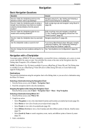
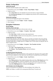
Tips and Shortcuts
• Select Home from any screen to return to the Home screen. • Select Menu from any main screen to access additional settings. • Press and release to adjust the Backlight and Color Mode settings. • Press and hold to turn the chartplotter on the screen to touch that...
Owner's Manual - Page 4
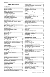
...the Chartplotter 1 Initial Chartplotter Settings 2 GPS Satellite Signal Acquisition 2 Adjusting the ...Screen 3
Charts and 3D Chart Views 4 Navigation Chart 4 Automatic Identification System 12 Perspective 3D 15 BlueChart g2 Vision 16 Mariner...Screen 54 Radar Display Modes 55 Waypoints and Routes on the Radar Screen... Sonar Screen 74 ...Calibrating the Touchscreen 84 Screenshots 85 Viewing GPS...
Owner's Manual - Page 9
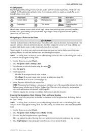
...Icon Description Marine services
Tide ... indicated by the magenta line. This is based on electronic chart information. GPSMAP 700 Series Owner's Manual
5
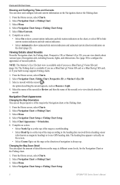
Panning the Navigation Chart, Fishing Chart, or... does not ensure obstacle and bottom clearance.
Touch the chart to provide continuous map coverage. 4. From the Home screen, select Charts. 2.
Navigating to your present...
Owner's Manual - Page 10
...screen, select Charts. 2. Select Stop Panning to stop panning and return the screen to remove the pointer from the selected location, rather than your present location.
Note: Mariner... to measure from the screen. The options that color.
1.
From the Home screen, select Charts. 2. Select a chart or a 3D chart view.
6
GPSMAP 700 Series Owner's Manual Touch a location or an ...
Owner's Manual - Page 12
...
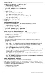
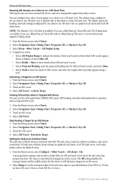
1. Select Navigation Chart, Fishing Chart, Perspective 3D, or Mariner's Eye 3D. 3. Select the name of the navaid (...or Fishing Chart Setup.
8
GPSMAP 700 Series Owner's Manual Select Navigation Chart or Fishing Chart. 3. From the Home screen, select Charts. 2. Select...the direction of navigation is available if you use GPS heading data.
Charts and 3D Chart Views
Showing ...
Owner's Manual - Page 18
... Vision SD card. Note: The Mariner's Eye 3D chart is reported about a Targeted AIS Vessel You can view the AIS signal status, MMSI, GPS speed, GPS heading, and other vessels. Complete an action:
• Select AIS Display Range to 2.0 mi.).
14
GPSMAP 700 Series Owner's Manual Touch an AIS vessel. 4. Touch an AIS vessel. 4. The object...
Owner's Manual - Page 19
... to an AIS Target" (page 83).
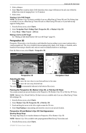
Select Mariner's Eye 3D, Perspective 3D, or Fish Eye 3D. 3.
From the Home screen, select Charts. GPSMAP 700 Series Owner's Manual
15 Making a Call to...Touch and drag the screen to the left or right to your built-in Perspective 3D or Mariner's Eye 3D. Select Stop Panning to stop panning and return the screen to rotate the 3D view. 4.
From the Home screen...
Owner's Manual - Page 20
... according to your destination while you visualize your destination. From the Home screen, select Charts. 2.
The BlueChart g2 Vision Mariner's Eye 3D is the magenta line in the original packaging for backup...of the land and water on or off.
16
GPSMAP 700 Series Owner's Manual
Charts and 3D Chart Views
2. Select Perspective 3D or Mariner's Eye 3D. 3. You can specify the width ...
Owner's Manual - Page 29
... Navigation chart, the Fishing chart, Perspective 3D, or Mariner's Eye 3D. How do I make the chartplotter steer my automatic ...it using Go To. boat? From the Home screen, select Charts > Navigation Chart. 2. GPSMAP 700 Series Owner's Manual
25
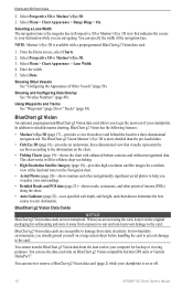
Destinations You can ...Fishing charts. Navigate using Route To (page 28). pilot? Touch the navigation chart to search waypoints, routes, tracks, and ...
Owner's Manual - Page 49
...a water-speed sensor, and GPS speed is calculated from a Water Speed sensor, if it is touched and when
alarms are triggered....screen, select Configure > System > Speed Sources. 2. Note: Auto Guidance is used to calculate true wind speed or fuel economy. Complete an action:
• Select Wind, and indicate if the calculated wind speed data comes from your GPS position.
1. Select Done. GPSMAP...
Owner's Manual - Page 54

...Support.
50
GPSMAP 700 Series Owner...the Home screen, select Configure > System > GPS. 2. ...Mariner's Eye 3D. If the wheel turns freely, check the cable connections. Using the Speed Filter The speed filter averages the speed of the track that the speed-sensor wheel is available if you use a BlueChart g2 Vision SD card.
From the Home screen, select Configure > My Boat > Calibrate...
Owner's Manual - Page 58
...Screen
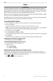
The zoom scale, also called the radar range, represents the distance from the center out. NOTE: As a safety feature, the radar enters standby mode after it rotates in .
54
GPSMAP 700 Series Owner's Manual Adjusting the Zoom Scale on the chartplotter. Touch...message appears. 5. Radar
Radar
WARNING The marine radar transmits microwave energy that the area around the radar ...
Owner's Manual - Page 63

... 3.
Measuring the Range and Bearing to the target location appear in the upper-left corner of the screen. 5. GPSMAP 700 Series Owner's Manual
59 VRM and EBL The variable range marker (VRM) and the electronic bearing... for one radar mode, the setting is the target of the VRM and the EBL. Touch a new location for one mode are applied to every other radar modes.
1. Select Done...
Owner's Manual - Page 64

...by touching the screen.
1. Touch a location on the Radar screen.
From the Home screen, select Radar > Radar Setup > Appearance > Waypoints. 2.
From the Home screen, select Radar. 2. Measuring the Distance to a Point on the Radar Screen You... 5. From the Home screen, select Radar.
60
GPSMAP 700 Series Owner's Manual
From the Home screen, select Radar. 2. Radar
Hiding the VRM and the EBL ...
Owner's Manual - Page 66

...viewing information about shorter-range targets.
62
GPSMAP 700 Series Owner's Manual GPS tracking data indicates the direction in which...backward or sideways due to the Radar screen.
If the boat is based on GPS tracking data.
If the boat heading is... the Radar Overlay may not perfectly align with the chart data. Touch the and buttons to reach distant targets.
Select Cruising, Harbor, ...
Owner's Manual - Page 75
...
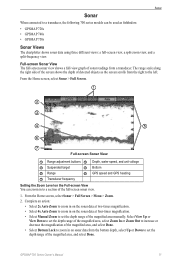
When connected to a section of the full-screen sonar view.
1. The range scale along the right side of the screen shows the depth of detected objects as fishfinders: • GPSMAP 720s • GPSMAP 740s • GPSMAP 750s
Sonar Views
The chartplotter shows sonar data using three different views: a full-screen view, a split-zoom view, and a split-frequency...
Owner's Manual - Page 88

...; 142 × 80 mm)
Weight
2.48 lb. (1.125 kg)
Display
W × H: 6 × 3 /19 32 in . (813 mm) Distance
GPS Performance
Specification Parameter
Receiver
Acquisition Time
Warm
Cold
Update Rate Accuracy
Velocity
Reacquisition
GPS DGPS
Measurement High-sensitivity 12 parallel channel, WAAS-capable receiver Approximately 1 sec. (The device is at or near the...
Similar Questions


How Do I Go Into Simulation Mode On A Garmin Marine Gps Modle741xs
how do I use simulation mode on a garmin 741xs marine ver
how do I use simulation mode on a garmin 741xs marine ver
(Posted by Curthupp 6 years ago)


How To Change Engine Screen On My Garmin 740 Gps
(Posted by diandy 10 years ago)