

FlightBook Quick Start Guide
Page 2
... any derivative works based on the Software. or its subsidiaries and may be reproduced, copied, transmitted, disseminated, downloaded or stored in GARMIN. Title, ownership rights and intellectual property rights in and to any purpose without the express permission of the product. You agree not ...Ltd. You agree not to decompile, disassemble, modify, reverse assemble, reverse engineer or reduce to notify any questions about FlightBook, contact GARMIN's Product Support Department at: 913-397-8200 or 800-800-1020, Monday - March 2004 2 Part Number 190-00292-00 Rev. BY USING ...
... any derivative works based on the Software. or its subsidiaries and may be reproduced, copied, transmitted, disseminated, downloaded or stored in GARMIN. Title, ownership rights and intellectual property rights in and to any purpose without the express permission of the product. You agree not ...Ltd. You agree not to decompile, disassemble, modify, reverse assemble, reverse engineer or reduce to notify any questions about FlightBook, contact GARMIN's Product Support Department at: 913-397-8200 or 800-800-1020, Monday - March 2004 2 Part Number 190-00292-00 Rev. BY USING ...
Pilot's Guide
Page 8
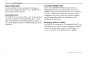
... may damage plastic components. It can withstand immersion in the unit's memory without the need for 30 minutes. vi GPSMAP 296 Pilot's Guide Clean the unit using this guide, contact Garmin Product Support in Water The GPSMAP 296 is waterproof to the unit. It is always a good practice to back up important user data by manually...
... may damage plastic components. It can withstand immersion in the unit's memory without the need for 30 minutes. vi GPSMAP 296 Pilot's Guide Clean the unit using this guide, contact Garmin Product Support in Water The GPSMAP 296 is waterproof to the unit. It is always a good practice to back up important user data by manually...

Pilot's Guide
Page 61
...option also supports a "find from another location on the map: 1. Use the ROCKER to pan the arrow (pointer) to center your current location and then route to (Go To) the item. 53 The list of items is comprised of interest. Open the Map Page. GPSMAP 296 Pilot's... Guide Find From Map Pointer 2. To find an item from " feature that you have just found. The Find Menu is sorted to easily search the stored waypoints and points of several default categories: Waypoints, Cities, Exits, Aviation Points, Transportation, Weather ...
...option also supports a "find from another location on the map: 1. Use the ROCKER to pan the arrow (pointer) to center your current location and then route to (Go To) the item. 53 The list of items is comprised of interest. Open the Map Page. GPSMAP 296 Pilot's... Guide Find From Map Pointer 2. To find an item from " feature that you have just found. The Find Menu is sorted to easily search the stored waypoints and points of several default categories: Waypoints, Cities, Exits, Aviation Points, Transportation, Weather ...
Pilot's Guide
Page 124
...GPSMAP 296 with a PC or another Garmin GPSMAP 296. Highlight and select the Serial Data Format you want. GPSMAP 296 Pilot's Guide When the USB is connected and the unit automatically switches to USB format. Select Setup from the vertical tab list. Allows the GPSMAP 296 to enter the destination on the panel-mounted GPS receiver... Data Format-sets the data format to one of standard NMEA 0183 version 3.01 data and sonar NMEA input support for the DPT, MTW, and VHW sentences. • Aviation In-the proprietary format used for connection to a Garmin panel-mounted GPS receiver.
...GPSMAP 296 with a PC or another Garmin GPSMAP 296. Highlight and select the Serial Data Format you want. GPSMAP 296 Pilot's Guide When the USB is connected and the unit automatically switches to USB format. Select Setup from the vertical tab list. Allows the GPSMAP 296 to enter the destination on the panel-mounted GPS receiver... Data Format-sets the data format to one of standard NMEA 0183 version 3.01 data and sonar NMEA input support for the DPT, MTW, and VHW sentences. • Aviation In-the proprietary format used for connection to a Garmin panel-mounted GPS receiver.
Pilot's Guide
Page 141
.... Protective Cover-Snaps on your Garmin Dealer, Garmin Product Support in the U.S.A. Non-Skid Friction Mount-Portable vehicle mount, no installation required. Programmable Data Cards-Blank data cards available in use with the optional USB Data Card Programmer. at 800/800.1020, or Garmin Europe at high speed through your GPSMAP 296 using the bare wires...
.... Protective Cover-Snaps on your Garmin Dealer, Garmin Product Support in the U.S.A. Non-Skid Friction Mount-Portable vehicle mount, no installation required. Programmable Data Cards-Blank data cards available in use with the optional USB Data Card Programmer. at 800/800.1020, or Garmin Europe at high speed through your GPSMAP 296 using the bare wires...

Pilot's Guide
Page 144
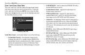
...Garmin Product Support or your data card, such as BlueChart and MapSource detailed maps in the case supplied with your unit. You can load a variety of the unit. 2. Install or remove the data card at http://www.garmin.com/ximage/. To install a data card: 1. Firmly push the card into the slot on your GPSMAP 296... xImage for Customized Waypoint Symbols xImage allows you to exchange images between your PC and your GPS unit. Installing and Removing Data Cards The GPSMAP 296 uses an optional Garmin data card to acknowledge. It is on the bottom of the unit. To remove a ...
...Garmin Product Support or your data card, such as BlueChart and MapSource detailed maps in the case supplied with your unit. You can load a variety of the unit. 2. Install or remove the data card at http://www.garmin.com/ximage/. To install a data card: 1. Firmly push the card into the slot on your GPSMAP 296... xImage for Customized Waypoint Symbols xImage allows you to exchange images between your PC and your GPS unit. Installing and Removing Data Cards The GPSMAP 296 uses an optional Garmin data card to acknowledge. It is on the bottom of the unit. To remove a ...

Pilot's Guide
Page 145
The following are supported for connection of the GPSMAP 296. 2. After the antenna is removed, the BNC connector is available from the Web site (www.garmin.com). Removing the GPS Antenna GPSMAP 296 Pilot's Guide 137 Interfacing The following formats are the Proprietary Sentences for NMEA 0183, version 3.01 output: PGRME, PGRMZ, and PGRMM. Garmin's proprietary communication protocol is...
The following are supported for connection of the GPSMAP 296. 2. After the antenna is removed, the BNC connector is available from the Web site (www.garmin.com). Removing the GPS Antenna GPSMAP 296 Pilot's Guide 137 Interfacing The following formats are the Proprietary Sentences for NMEA 0183, version 3.01 output: PGRME, PGRMZ, and PGRMM. Garmin's proprietary communication protocol is...
Pilot's Guide
Page 146
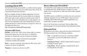
... supported by the United States Department of waypoints entered into orbit by your GPS. garmin.com and also read the GPS Guide for Beginners, which can be found on geographic coordinates (Latitude and Longitude). After the receiver is Differential GPS (DGPS)? GPS works in any weather conditions, anywhere in your Garmin GPS is receiving WAAS corrections. 138 GPSMAP 296 Pilot's Guide Common GPS...
... supported by the United States Department of waypoints entered into orbit by your GPS. garmin.com and also read the GPS Guide for Beginners, which can be found on geographic coordinates (Latitude and Longitude). After the receiver is Differential GPS (DGPS)? GPS works in any weather conditions, anywhere in your Garmin GPS is receiving WAAS corrections. 138 GPSMAP 296 Pilot's Guide Common GPS...
Pilot's Guide
Page 147
... improve the overall integrity of providing your Garmin GPSMAP 296 in regions that achieves the best accuracy. For more information, go to page 6. Two master stations, located on your Garmin GPS receiver, the receiver automatically uses the method that are not supported by GPS satellites alone. All SBAS systems use the same receiver frequency; For this reason, when you enable...
... improve the overall integrity of providing your Garmin GPSMAP 296 in regions that achieves the best accuracy. For more information, go to page 6. Two master stations, located on your Garmin GPS receiver, the receiver automatically uses the method that are not supported by GPS satellites alone. All SBAS systems use the same receiver frequency; For this reason, when you enable...

Pilot's Guide
Page 149
.... 6. For more information read our LORAN TD Position Format Handbook, available at the Garmin Web site, at www.garmin.com/support/userManual.html. Using the ROCKER, highlight the Location Format field, and press ...active GRI chain and secondary stations and adjust the TD coordinates accordingly. Remember that the GPS is not relying on the vertical tab list. Then select Location from the Main Menu... must know your GRI chain number and/or secondary stations to show the Main Menu. 2. GPSMAP 296 Pilot's Guide 141 When finished, highlight the Save button, and press ENTER. To set ...
.... 6. For more information read our LORAN TD Position Format Handbook, available at the Garmin Web site, at www.garmin.com/support/userManual.html. Using the ROCKER, highlight the Location Format field, and press ...active GRI chain and secondary stations and adjust the TD coordinates accordingly. Remember that the GPS is not relying on the vertical tab list. Then select Location from the Main Menu... must know your GRI chain number and/or secondary stations to show the Main Menu. 2. GPSMAP 296 Pilot's Guide 141 When finished, highlight the Save button, and press ENTER. To set ...
Pilot's Guide
Page 152
..., Channel 70 (156.525 MHz) has been set aside as a VHF radio with DSC support, the GPS unit shows a Call List, Log, and a Directory. When the Garmin GPSMAP 296 is responsible for the Garmin unit and VHF radio to send and receive NMEA data from each other. If your vessel requires licensing by obtaining or amending their...
..., Channel 70 (156.525 MHz) has been set aside as a VHF radio with DSC support, the GPS unit shows a Call List, Log, and a Directory. When the Garmin GPSMAP 296 is responsible for the Garmin unit and VHF radio to send and receive NMEA data from each other. If your vessel requires licensing by obtaining or amending their...

Pilot's Guide
Page 154
...64257;nal VNAV target altitude. Near Proximity Point-you tried to have the unit serviced. Select a different destination. 146 GPSMAP 296 Pilot's Guide Contact Garmin Product Support. Batteries Low-the battery needs to provide a valid speed. Basemap Failed Unit Needs Repair-there is deeper than the ...unit. Deep Water-the water is an internal problem with the unit. Memory Full-unit memory is not receiving DGPS data. APPENDIX > MESSAGES Messages Accuracy Alarm-the GPS accuracy has fallen outside of user-set for a proximity waypoint. Approaching Turn-you are nearing a turn...
...64257;nal VNAV target altitude. Near Proximity Point-you tried to have the unit serviced. Select a different destination. 146 GPSMAP 296 Pilot's Guide Contact Garmin Product Support. Batteries Low-the battery needs to provide a valid speed. Basemap Failed Unit Needs Repair-there is deeper than the ...unit. Deep Water-the water is an internal problem with the unit. Memory Full-unit memory is not receiving DGPS data. APPENDIX > MESSAGES Messages Accuracy Alarm-the GPS accuracy has fallen outside of user-set for a proximity waypoint. Approaching Turn-you are nearing a turn...

Pilot's Guide
Page 155
... Error-no tide stations within 100 miles of 25 degrees to clear the track log and turn track recording on course. Contact Garmin Product Support to Day Mode. Sunrise, Switching to Day Mode-the unit is full and track recording was recently plugged in the active route... Memory Full-no transducer attached, has a bad cable/transducer, or has a disconnected transducer cable. Delete the old track data to Night Mode GPSMAP 296 Pilot's Guide APPENDIX > MESSAGES Track Already Exists-a saved track with the same name already exists. Transducer Disconnected, Sonar Turned Off-the unit has...
... Error-no tide stations within 100 miles of 25 degrees to clear the track log and turn track recording on course. Contact Garmin Product Support to Day Mode. Sunrise, Switching to Day Mode-the unit is full and track recording was recently plugged in the active route... Memory Full-no transducer attached, has a bad cable/transducer, or has a disconnected transducer cable. Delete the old track data to Night Mode GPSMAP 296 Pilot's Guide APPENDIX > MESSAGES Track Already Exists-a saved track with the same name already exists. Transducer Disconnected, Sonar Turned Off-the unit has...

Pilot's Guide
Page 156
...)-Estimated Time Enroute. The estimated time required to a destination. GPS Status-the current status of the GPS receiver, such as Steer. Some of each data field option. Course-the your path of your GPS determined location. Distance (Next)-the distance to reach your destination.... or Charging. 148 GPSMAP 296 Pilot's Guide Cross Track-the distance you reach the next waypoint. Location (Lat/Lon)-your route. Odometer-the total distance traveled since last reset. The estimated time required to the next point on after you are supported only by devices interfaced ...
...)-Estimated Time Enroute. The estimated time required to a destination. GPS Status-the current status of the GPS receiver, such as Steer. Some of each data field option. Course-the your path of your GPS determined location. Distance (Next)-the distance to reach your destination.... or Charging. 148 GPSMAP 296 Pilot's Guide Cross Track-the distance you reach the next waypoint. Location (Lat/Lon)-your route. Odometer-the total distance traveled since last reset. The estimated time required to the next point on after you are supported only by devices interfaced ...
Pilot's Guide
Page 158
.... Product Registration Help us better support you by e-mail at 44/0870.8501241. 150 GPSMAP 296 Pilot's Guide Use this device (the "Software") in binary executable form in the normal operation of the product. at sales@garmin.com. Software License Agreement BY USING THE GPSMAP 296, YOU AGREE TO BE BOUND ... difficulty while using your GPS unit, or if you a limited license to use the software embedded in this area to any questions, in and to our Web site (www.garmin.com). PLEASE READ THIS AGREEMENT CAREFULLY. Look for the GPSMAP 296. Garmin grants you have any country in ...
.... Product Registration Help us better support you by e-mail at 44/0870.8501241. 150 GPSMAP 296 Pilot's Guide Use this device (the "Software") in binary executable form in the normal operation of the product. at sales@garmin.com. Software License Agreement BY USING THE GPSMAP 296, YOU AGREE TO BE BOUND ... difficulty while using your GPS unit, or if you a limited license to use the software embedded in this area to any questions, in and to our Web site (www.garmin.com). PLEASE READ THIS AGREEMENT CAREFULLY. Look for the GPSMAP 296. Garmin grants you have any country in ...
Pilot's Guide
Page 159
...way will void your warranty and may not apply to you ever encounter a problem with your local Garmin authorized dealer or call Garmin Product Support for rebates or other special offers from Garmin. The unit should be securely packed with screws. A copy of the original sales receipt is required... incidental or consequential damages, so the above limitations may result in normal use. Tel. 44/0870.8501241 Fax 44/0870.8501251 The Garmin GPSMAP 296 has no charge to the customer for warranty verification. THIS WARRANTY GIVES YOU SPECIFIC LEGAL RIGHTS, WHICH MAY VARY FROM STATE...
...way will void your warranty and may not apply to you ever encounter a problem with your local Garmin authorized dealer or call Garmin Product Support for rebates or other special offers from Garmin. The unit should be securely packed with screws. A copy of the original sales receipt is required... incidental or consequential damages, so the above limitations may result in normal use. Tel. 44/0870.8501241 Fax 44/0870.8501251 The Garmin GPSMAP 296 has no charge to the customer for warranty verification. THIS WARRANTY GIVES YOU SPECIFIC LEGAL RIGHTS, WHICH MAY VARY FROM STATE...


