

Owner's Manual
Page 2
... for current updates and supplemental information concerning the use of Garmin Ltd. ANT™, ANT+™, BaseCamp™, chirp™, HomePort™, and Thumb Stick™ are trademarks of this product. Windows® is a ...the written consent of such changes or improvements. Garmin reserves the right to notify any person or organization of Garmin. Other trademarks and trade names are trademarks of their respective owners. Garmin®, the Garmin logo, eTrex®, BlueChart®, and City Navigator® are those of Garmin Ltd. or its subsidiaries, registered in the ...
... for current updates and supplemental information concerning the use of Garmin Ltd. ANT™, ANT+™, BaseCamp™, chirp™, HomePort™, and Thumb Stick™ are trademarks of this product. Windows® is a ...the written consent of such changes or improvements. Garmin reserves the right to notify any person or organization of Garmin. Other trademarks and trade names are trademarks of their respective owners. Garmin®, the Garmin logo, eTrex®, BlueChart®, and City Navigator® are those of Garmin Ltd. or its subsidiaries, registered in the ...

Owner's Manual
Page 3
...29 System Settings 30 Display Settings 30 3 Menu 11 Routes 12 Tracks 14 Navigation 16 Navigating to a Destination..........16 Map 16 Compass 17 Elevation Plot 19 Trip Computer 20 eTrex Owner's Manual Table of Contents Geocaches 21 Downloading Geocaches 21 Filtering the Geocache ...List..........21 Navigating to a Geocache............22 Logging the Attempt 22 chirp 23 Applications 24 Sharing Data ...
...29 System Settings 30 Display Settings 30 3 Menu 11 Routes 12 Tracks 14 Navigation 16 Navigating to a Destination..........16 Map 16 Compass 17 Elevation Plot 19 Trip Computer 20 eTrex Owner's Manual Table of Contents Geocaches 21 Downloading Geocaches 21 Filtering the Geocache ...List..........21 Navigating to a Geocache............22 Logging the Attempt 22 chirp 23 Applications 24 Sharing Data ...

Owner's Manual
Page 5
... (page 17). ➊ Zoom keys ➋ Back key ➌ Thumb Stick™ ➍ Menu key ➎ /Backlight key eTrex Owner's Manual 5 Register the device (page 8). 5. Mark a waypoint (page 9). 6. Create a route (page 12). 7. Navigate to know the basic features. 1. Turn on the device (page 8). 3. Install the batteries (page 7). 2. Getting Started Getting Started Device...
... (page 17). ➊ Zoom keys ➋ Back key ➌ Thumb Stick™ ➍ Menu key ➎ /Backlight key eTrex Owner's Manual 5 Register the device (page 8). 5. Mark a waypoint (page 9). 6. Create a route (page 12). 7. Navigate to know the basic features. 1. Turn on the device (page 8). 3. Install the batteries (page 7). 2. Getting Started Getting Started Device...

Owner's Manual
Page 10
...samples for the waypoint, waiting at least 90 minutes between samples. Select Waypoint Averaging. 2. Select a waypoint. 3. Using Sight 'N Go Sight 'N Go is available on the eTrex 30. Select Lock Direction > Project Waypoint. 4. Select a unit of a location. 3. For best results, collect four to the location. 4. Point the device at an... samples of the waypoint location. 1. Select Sight 'N Go. 2. You can point the device at an object or in the direction, and then navigate to the object. 1. Select Start. 5. When the Sample Confidence status bar reaches 100%, select Save.
...samples for the waypoint, waiting at least 90 minutes between samples. Select Waypoint Averaging. 2. Select a waypoint. 3. Using Sight 'N Go Sight 'N Go is available on the eTrex 30. Select Lock Direction > Project Waypoint. 4. Select a unit of a location. 3. For best results, collect four to the location. 4. Point the device at an... samples of the waypoint location. 1. Select Sight 'N Go. 2. You can point the device at an object or in the direction, and then navigate to the object. 1. Select Start. 5. When the Sample Confidence status bar reaches 100%, select Save.

Owner's Manual
Page 11
... Location 1. Select an option. 3. Not all Where To? menu to find a destination to navigate to http://buy.garmin.com or contact your device, you can use additional maps on your Garmin dealer. Detailed maps may contain additional points of interest (POIs), such as restaurants, hotels, and...maps loaded on the eTrex 20 and eTrex 30, such as restaurants or marine services. Where To? Menu You can search for cities, geographic points, and various points of interest, such as BirdsEye™ satellite imagery, BlueChart® g2, TOPO, and City Navigator® detailed maps.
... Location 1. Select an option. 3. Not all Where To? menu to find a destination to navigate to http://buy.garmin.com or contact your device, you can use additional maps on your Garmin dealer. Detailed maps may contain additional points of interest (POIs), such as restaurants, hotels, and...maps loaded on the eTrex 20 and eTrex 30, such as restaurants or marine services. Where To? Menu You can search for cities, geographic points, and various points of interest, such as BirdsEye™ satellite imagery, BlueChart® g2, TOPO, and City Navigator® detailed maps.

Owner's Manual
Page 12
... city. 5. Enter the street. Select back to search for addresses. 1. Select Use > Select Next Point. 5. Select Done. 12 eTrex Owner's Manual Waypoints, Routes, and Tracks Finding an Address You can use optional City Navigator maps to save the route. Enter the house number. 6. Repeat steps 2-4 until the route is a sequence of a Route...
... city. 5. Enter the street. Select back to search for addresses. 1. Select Use > Select Next Point. 5. Select Done. 12 eTrex Owner's Manual Waypoints, Routes, and Tracks Finding an Address You can use optional City Navigator maps to save the route. Enter the house number. 6. Repeat steps 2-4 until the route is a sequence of a Route...

Owner's Manual
Page 13
... the point from the route, select Remove. 6. Waypoints, Routes, and Tracks Viewing a Route on the route, select Insert. Select Route Planner. 2. While navigating a route, select Active Route. 2. Select a route. 3. eTrex Owner's Manual 13 Select a point. 5. Select Route Planner. 2. Select Delete Route. Viewing the Active Route 1. Reversing a Route 1. Select Edit Route. 4. Select a route...
... the point from the route, select Remove. 6. Waypoints, Routes, and Tracks Viewing a Route on the route, select Insert. Select Route Planner. 2. While navigating a route, select Active Route. 2. Select a route. 3. eTrex Owner's Manual 13 Select a point. 5. Select Route Planner. 2. Select Delete Route. Viewing the Active Route 1. Reversing a Route 1. Select Edit Route. 4. Select a route...

Owner's Manual
Page 16
... ▼ to any saved location in and out of the map. 16 eTrex Owner's Manual Select Where To?. 2. Map represents your route is marked with a magenta line. 5. As you are navigating to a destination, your location on the map. Navigation Navigation You can navigate a route, a track, to a waypoint, to a geocache, or to zoom in the device...
... ▼ to any saved location in and out of the map. 16 eTrex Owner's Manual Select Where To?. 2. Map represents your route is marked with a magenta line. 5. As you are navigating to a destination, your location on the map. Navigation Navigation You can navigate a route, a track, to a waypoint, to a geocache, or to zoom in the device...

Owner's Manual
Page 17
... the top of the screen shows information about the selected location. Use the map to navigate to your vehicle. 1. TIP: When the device is only available on the map, ...Navigator maps. eTrex Owner's Manual 17 Navigation Compass The eTrex 30 has a 3-axis, electronic compass. Navigating a Driving Route Driving route navigation is using the automotive profile, the compass displays GPS heading, not magnetic heading. Select Profile Change > Automotive. 2. Calibrating the Compass Notice Calibrate the electronic compass outdoors. • Select a location on the eTrex 20 and eTrex...
... the top of the screen shows information about the selected location. Use the map to navigate to your vehicle. 1. TIP: When the device is only available on the map, ...Navigator maps. eTrex Owner's Manual 17 Navigation Compass The eTrex 30 has a 3-axis, electronic compass. Navigating a Driving Route Driving route navigation is using the automotive profile, the compass displays GPS heading, not magnetic heading. Select Profile Change > Automotive. 2. Calibrating the Compass Notice Calibrate the electronic compass outdoors. • Select a location on the eTrex 20 and eTrex...

Owner's Manual
Page 18
...to your destination, regardless of the direction you are navigating on water or where there are moving. 1. Turn until points toward the top of drift (right or left) from the intended course to the distance 18 eTrex Owner's Manual Select Compass. 3. The scale ➍...menu > Calibrate Compass > Start. 2. About the Course Pointer The course pointer is based on -screen instructions. As you drift from the course. Navigation You should calibrate the compass after moving in your path. ➍ ➋ ➌ ➊ The course pointer ➊ indicates your relationship ...
...to your destination, regardless of the direction you are navigating on water or where there are moving. 1. Turn until points toward the top of drift (right or left) from the intended course to the distance 18 eTrex Owner's Manual Select Compass. 3. The scale ➍...menu > Calibrate Compass > Start. 2. About the Course Pointer The course pointer is based on -screen instructions. As you drift from the course. Navigation You should calibrate the compass after moving in your path. ➍ ➋ ➌ ➊ The course pointer ➊ indicates your relationship ...

Owner's Manual
Page 19
...on the Plot Select an individual point on the eTrex 30. Elevation Plot Elevation plotting is available on the plot. By default, the elevation plot displays the elevation for an elapsed time. Navigation Changing the Plot Type You can navigate with the course pointer, you must change the ...page 34). 1. To customize the elevation plot, see page 34. eTrex Owner's Manual 19 Begin navigation to the destination (page 18). Select Elevation Plot. Viewing Details about the point appear at the top of the plot. Navigating with the Course Pointer Before you can change the pointer setting to...
...on the Plot Select an individual point on the eTrex 30. Elevation Plot Elevation plotting is available on the plot. By default, the elevation plot displays the elevation for an elapsed time. Navigation Changing the Plot Type You can navigate with the course pointer, you must change the ...page 34). 1. To customize the elevation plot, see page 34. eTrex Owner's Manual 19 Begin navigation to the destination (page 18). Select Elevation Plot. Viewing Details about the point appear at the top of the plot. Navigating with the Course Pointer Before you can change the pointer setting to...

Owner's Manual
Page 20
...zero. Select Trip Computer > menu > Reset > Reset Trip Data > Yes. To customize the trip computer, see page 28. 20 eTrex Owner's Manual Follow the on-screen instructions. All of the trip computer values are set to a location where the elevation or barometric...Elevation Plot > menu > Calibrate Altimeter. 3. Resetting the Trip Data For accurate information, reset the trip information before beginning a trip. Navigation Calibrating the Barometric Altimeter You can manually calibrate the barometric altimeter if you know the correct elevation or the correct barometric pressure. 1.
...zero. Select Trip Computer > menu > Reset > Reset Trip Data > Yes. To customize the trip computer, see page 28. 20 eTrex Owner's Manual Follow the on-screen instructions. All of the trip computer values are set to a location where the elevation or barometric...Elevation Plot > menu > Calibrate Altimeter. 3. Resetting the Trip Data For accurate information, reset the trip information before beginning a trip. Navigation Calibrating the Barometric Altimeter You can manually calibrate the barometric altimeter if you know the correct elevation or the correct barometric pressure. 1.
Owner's Manual
Page 22
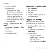
..., select back. You can log your results. 1. Select an option: • To begin navigation to find a geocache, you , select Find Next Closest. • To end the logging, select Done. 22 eTrex Owner's Manual Select items to a Geocache 1. Navigating to filter. 3. Navigate using the map (page 16) or compass (page 17). Select Setup > Geocaches > Filter...
..., select back. You can log your results. 1. Select an option: • To begin navigation to find a geocache, you , select Find Next Closest. • To end the logging, select Done. 22 eTrex Owner's Manual Select items to a Geocache 1. Navigating to filter. 3. Navigate using the map (page 16) or compass (page 17). Select Setup > Geocaches > Filter...

Owner's Manual
Page 23
... about programming a chirp, see the chirp Owner's Manual at http://www.garmin.com. Select Setup > Geocaches. 2. Only the owner of the chirp can program a chirp, but anyone can program and leave in a geocache. Begin navigating to the next stage of the geocache that you can find a chirp in... a geocache. Select chirp™ Searching > On. When you are within 33 feet (10 m) of the geocache. eTrex Owner's Manual 23 Select Geocaches > menu > Show ...
... about programming a chirp, see the chirp Owner's Manual at http://www.garmin.com. Select Setup > Geocaches. 2. Only the owner of the chirp can program a chirp, but anyone can program and leave in a geocache. Begin navigating to the next stage of the geocache that you can find a chirp in... a geocache. Select chirp™ Searching > On. When you are within 33 feet (10 m) of the geocache. eTrex Owner's Manual 23 Select Geocaches > menu > Show ...
Owner's Manual
Page 29
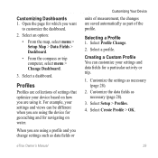
... and views can customize your device based on how you are using a profile and you change settings such as data fields or eTrex Owner's Manual Customizing Your Device units of measurement, the changes are saved automatically as part of settings that optimize your settings and data... 28). 3. When you are using the device for geocaching and for which you are using it. Select a profile. Customizing Dashboards 1. Open the page for navigating on water. Select an option: • From the map, select menu > Setup Map > Data Fields > Dashboard. • From the compass or trip...
... and views can customize your device based on how you are using a profile and you change settings such as data fields or eTrex Owner's Manual Customizing Your Device units of measurement, the changes are saved automatically as part of settings that optimize your settings and data... 28). 3. When you are using the device for geocaching and for which you are using it. Select a profile. Customizing Dashboards 1. Open the page for navigating on water. Select an option: • From the map, select menu > Setup Map > Data Fields > Dashboard. • From the compass or trip...

Owner's Manual
Page 30
...Settings Select Setup > Display. • Backlight Timeout-adjusts the length of AA battery you to Normal, WAAS/EGNOS (Wide Area Augmentation System/European Geostationary Navigation Overlay Service), or Demo Mode (GPS off . Enter the new name. 5. Select a profile. 3. Select Setup > Profiles. 2. Select a profile.... about WAAS, go to http://www.garmin.com/ aboutGPS/waas.html. • Language-sets the text language on the device. Select Setup > Profiles. 2. Note: To adjust the backlight brightness, see page 40. • Colors (eTrex 20/30)-sets the colors that display in...
...Settings Select Setup > Display. • Backlight Timeout-adjusts the length of AA battery you to Normal, WAAS/EGNOS (Wide Area Augmentation System/European Geostationary Navigation Overlay Service), or Demo Mode (GPS off . Enter the new name. 5. Select a profile. 3. Select Setup > Profiles. 2. Select a profile.... about WAAS, go to http://www.garmin.com/ aboutGPS/waas.html. • Language-sets the text language on the device. Select Setup > Profiles. 2. Note: To adjust the backlight brightness, see page 40. • Colors (eTrex 20/30)-sets the colors that display in...

Owner's Manual
Page 37
... when you are more readable. Simplifies map presentation for optimal use while fishing. • Appearance-allows you to set the appearance of marine navigation aids on the eTrex 20 and eTrex 30. Customizing Your Device Marine Map Settings This function is available on the map. • Lock On Road-locks the position icon, which...
... when you are more readable. Simplifies map presentation for optimal use while fishing. • Appearance-allows you to set the appearance of marine navigation aids on the eTrex 20 and eTrex 30. Customizing Your Device Marine Map Settings This function is available on the map. • Lock On Road-locks the position icon, which...

Owner's Manual
Page 46
... instructions included with your device. Bring the device within range (10 ft. Select Search for the eTrex 30. or 3 m) of the ANT+ accessory. 2. Select Setup > Fitness. 3. These accessories...or cadence data (page 28). 46 eTrex Owner's Manual Select Heart Rate Monitor or Bike Cadence Sensor. 4. Using Optional Fitness Accessories 1. Customize your Garmin dealer. Optional Maps You can purchase additional...Optional Fitness Accessories Fitness accessories are available at http://buy.garmin.com or from your data fields to the device. Appendix Appendix Optional Accessories Optional accessories,...
... instructions included with your device. Bring the device within range (10 ft. Select Search for the eTrex 30. or 3 m) of the ANT+ accessory. 2. Select Setup > Fitness. 3. These accessories...or cadence data (page 28). 46 eTrex Owner's Manual Select Heart Rate Monitor or Bike Cadence Sensor. 4. Using Optional Fitness Accessories 1. Customize your Garmin dealer. Optional Maps You can purchase additional...Optional Fitness Accessories Fitness accessories are available at http://buy.garmin.com or from your data fields to the device. Appendix Appendix Optional Accessories Optional accessories,...

Owner's Manual
Page 54
...advanced map setup 32 alarms clock 26 marine 38 proximity 24 tones for 31 almanac hunting and fishing 25 sunrise and sunset 25 altimeter calibrating 20 plot type 35 settings 34 ANT+ accessories 46 area calculation 25 automotive mode 31 auto mounts 17 auto zoom 32 B backlight timeout 40 ... satellite imagery 11 BlueChart g2 maps 11 54 C calculator 25 calendar 25 calibrating altimeter 20 compass 18 caring for the device 42 long-term storage 42 chirp 23 City Navigator maps 17 compass 17 calibrating 18 navigating 18 restore 39 setup options 34 connecting to another device 24 USB cable 44 wireless...
...advanced map setup 32 alarms clock 26 marine 38 proximity 24 tones for 31 almanac hunting and fishing 25 sunrise and sunset 25 altimeter calibrating 20 plot type 35 settings 34 ANT+ accessories 46 area calculation 25 automotive mode 31 auto mounts 17 auto zoom 32 B backlight timeout 40 ... satellite imagery 11 BlueChart g2 maps 11 54 C calculator 25 calendar 25 calibrating altimeter 20 compass 18 caring for the device 42 long-term storage 42 chirp 23 City Navigator maps 17 compass 17 calibrating 18 navigating 18 restore 39 setup options 34 connecting to another device 24 USB cable 44 wireless...

Owner's Manual
Page 55
...30 screen capture 30 settings 30 downloading geocaches 21 software 40 driving routes 37 E editing profiles 30 routes 12 waypoints 9 eTrex Owner's Manual elevation plot 19, 20 barometric altimeter 20 of a track 15 F file types 43 finding addresses 12 near your location 11 fishing times 25 fitness options 46 G... geocaches 21, 35 downloading 21 filter list 21 logging attempt 22 navigating to 22 settings 35 GPS signals 8, 26, 30, 47, ...
...30 screen capture 30 settings 30 downloading geocaches 21 software 40 driving routes 37 E editing profiles 30 routes 12 waypoints 9 eTrex Owner's Manual elevation plot 19, 20 barometric altimeter 20 of a track 15 F file types 43 finding addresses 12 near your location 11 fishing times 25 fitness options 46 G... geocaches 21, 35 downloading 21 filter list 21 logging attempt 22 navigating to 22 settings 35 GPS signals 8, 26, 30, 47, ...


