Owner's Manual
Page 9
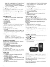
...to a destination, points to your route marked with the Oregon 650 and 650t. Calibrating the Barometric Altimeter Your device was already calibrated at an object. 3 Select Lock Direction > Set Course. 4 Navigate using the map (page 4) or compass (page 5). From the main ... (trail). To customize the elevation settings, see page 11. The course pointer indicates your path. Navigating to the destination. 2 Select Map. You can manually calibrate the compass. 1 Select Compass > > Calibrate Compass > Start. 2 Follow the on -screen instructions. Elevation...
...to a destination, points to your route marked with the Oregon 650 and 650t. Calibrating the Barometric Altimeter Your device was already calibrated at an object. 3 Select Lock Direction > Set Course. 4 Navigate using the map (page 4) or compass (page 5). From the main ... (trail). To customize the elevation settings, see page 11. The course pointer indicates your path. Navigating to the destination. 2 Select Map. You can manually calibrate the compass. 1 Select Compass > > Calibrate Compass > Start. 2 Follow the on -screen instructions. Elevation...
Owner's Manual
Page 12
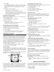
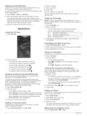
... increase the angle of elevation, select . • To decrease the angle of elevation, select . • To pan the 3D map forward, select . • To pan the 3D map backward, select . • To rotate the view to the left, select . • To rotate the view to view a ... NOTE: Using the flashlight can share waypoints, geocaches, routes, tracks, and custom maps. You can reduce the brightness or use the scientific calculator functions. • Select > Degrees to pair the device with the Oregon 650 and 650t models. 1 Select Share Wirelessly. 2 Select an option: • Select Send,...
... increase the angle of elevation, select . • To decrease the angle of elevation, select . • To pan the 3D map forward, select . • To pan the 3D map backward, select . • To rotate the view to the left, select . • To rotate the view to view a ... NOTE: Using the flashlight can share waypoints, geocaches, routes, tracks, and custom maps. You can reduce the brightness or use the scientific calculator functions. • Select > Degrees to pair the device with the Oregon 650 and 650t models. 1 Select Share Wirelessly. 2 Select an option: • Select Send,...
Quick Start Manual
Page 4
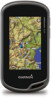
... reduce battery life. As you take a photo. Select > . The map opens with your track. Camera and Photos You can change settings, such as part of measurement, the changes are different when you change the setup of the frame. Navigating with the Oregon 650 and 650t. Rotating the Screen Rotate your location on the touchscreen...
... reduce battery life. As you take a photo. Select > . The map opens with your track. Camera and Photos You can change settings, such as part of measurement, the changes are different when you change the setup of the frame. Navigating with the Oregon 650 and 650t. Rotating the Screen Rotate your location on the touchscreen...


