
Quick Reference Guide
Page 1
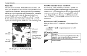
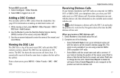
... by Name. 2. Select the waypoint you want to edit. 3. Select Go To. Select Review. (The Review button is only shown when more than one waypoint is in the vicinity.) GPSMAP® 400/500 series quick reference guide Create a Waypoint Editing or Deleting a Waypoint To ...Information > User Data > Waypoints. 2. From the Home screen, select Where To?. 2. Select Navigate To. 5. Press SELECT. 4. Select Review > Delete (The Review button is only shown when more than one waypoint is in the vicinity.) 3. OR Select Guide To when using a preprogrammed BlueChart® ...
... by Name. 2. Select the waypoint you want to edit. 3. Select Go To. Select Review. (The Review button is only shown when more than one waypoint is in the vicinity.) GPSMAP® 400/500 series quick reference guide Create a Waypoint Editing or Deleting a Waypoint To ...Information > User Data > Waypoints. 2. From the Home screen, select Where To?. 2. Select Navigate To. 5. Press SELECT. 4. Select Review > Delete (The Review button is only shown when more than one waypoint is in the vicinity.) 3. OR Select Guide To when using a preprogrammed BlueChart® ...
Owner's Manual
Page 17
...to highlight a tide-station icon ( ), and press SELECT. Select Animated to view information about tides, see page 37. Selected item 2. GPSMAP 400/500 Series Owner's Manual 11 For more than one item is only available while using a BlueChart g2 Vision SD card. High-resolution satellite... Information Tide-station information appears on the chart with the map pointer, and press SELECT. You can view an in the area, select Review, and then select the item. Changing the Navigation Chart Settings To change chart settings from the home screen, select Charts > Navigation Chart ...
...to highlight a tide-station icon ( ), and press SELECT. Select Animated to view information about tides, see page 37. Selected item 2. GPSMAP 400/500 Series Owner's Manual 11 For more than one item is only available while using a BlueChart g2 Vision SD card. High-resolution satellite... Information Tide-station information appears on the chart with the map pointer, and press SELECT. You can view an in the area, select Review, and then select the item. Changing the Navigation Chart Settings To change chart settings from the home screen, select Charts > Navigation Chart ...

Owner's Manual
Page 26
Using Charts To access aerial photos from the Navigation chart: Use the Rocker to highlight a camera icon with Falling Tide 20 GPSMAP 400/500 Series Owner's Manual A red arrow pointing downward indicates a falling tide, and a blue arrow pointing upward indicates a rising tide. To do so, information for..., the height of the tide at the station appears above the station indicator. Tide Station with the pointer, and select Aerial Photo or Review. Perspective Overhead Animated Tide and Current Indicators You can view indicators for the Tides/Currents setting (page 11).
Using Charts To access aerial photos from the Navigation chart: Use the Rocker to highlight a camera icon with Falling Tide 20 GPSMAP 400/500 Series Owner's Manual A red arrow pointing downward indicates a falling tide, and a blue arrow pointing upward indicates a rising tide. To do so, information for..., the height of the tide at the station appears above the station indicator. Tide Station with the pointer, and select Aerial Photo or Review. Perspective Overhead Animated Tide and Current Indicators You can view indicators for the Tides/Currents setting (page 11).
Owner's Manual
Page 31
... Navigation chart, use the Rocker to move the pointer to the location where you want to edit. 3. Select Edit Waypoint. 4. GPSMAP 400/500 Series Owner's Manual 25 Where To? • Right or Left Arrow-switches between waypoint information and the Navigation chart. Select... Selecting MARK creates a waypoint only at your current location. OR From the Home screen, select Information > User Data > Waypoints. 2. Select Review. (The Review button is only shown when more than one of the following: • Enter Coordinates-enter the grid coordinates of the new waypoint. •...
... Navigation chart, use the Rocker to move the pointer to the location where you want to edit. 3. Select Edit Waypoint. 4. GPSMAP 400/500 Series Owner's Manual 25 Where To? • Right or Left Arrow-switches between waypoint information and the Navigation chart. Select... Selecting MARK creates a waypoint only at your current location. OR From the Home screen, select Information > User Data > Waypoints. 2. Select Review. (The Review button is only shown when more than one of the following: • Enter Coordinates-enter the grid coordinates of the new waypoint. •...
Owner's Manual
Page 32
... Select Information to 250 waypoints each. Where To? To measure the distance and bearing of the cursor. (The Review button is only shown when more than one waypoint is in the lower-right corner of all waypoints: From the... ( ) to highlight the object on the Navigation chart: 1. Select Navigate To > Route To. 3. Select Review > Delete (The Review button is only shown when more than one waypoint is in the vicinity.) Creating and Using Routes You can create.... You can also filter the list by distance from your destination. 26 GPSMAP 400/500 Series Owner's Manual
... Select Information to 250 waypoints each. Where To? To measure the distance and bearing of the cursor. (The Review button is only shown when more than one waypoint is in the lower-right corner of all waypoints: From the... ( ) to highlight the object on the Navigation chart: 1. Select Navigate To > Route To. 3. Select Review > Delete (The Review button is only shown when more than one waypoint is in the vicinity.) Creating and Using Routes You can create.... You can also filter the list by distance from your destination. 26 GPSMAP 400/500 Series Owner's Manual
Owner's Manual
Page 48
...transponder, and that are different than standard AIS transmissions, so they look different than standard AIS symbols on the Navigation Chart 42 GPSMAP 400/500 Series Owner's Manual Instead of approach to locate and assist a vessel. Target is moving. SART transmissions are actively transmitting AIS... information. Select Review > Go To to begin navigation to the nearest approach. The vessel is reporting AIS information. AIS Targeting on the chartplotter. Lost...
...transponder, and that are different than standard AIS transmissions, so they look different than standard AIS symbols on the Navigation Chart 42 GPSMAP 400/500 Series Owner's Manual Instead of approach to locate and assist a vessel. Target is moving. SART transmissions are actively transmitting AIS... information. Select Review > Go To to begin navigation to the nearest approach. The vessel is reporting AIS information. AIS Targeting on the chartplotter. Lost...
Owner's Manual
Page 56
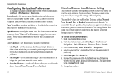
...automatic guidance. • Safe Height-set the minimum height (chart height datum) of a bridge that require navigation through a narrow waterway. Review the placement of the Auto Guidance line. Route Labels-for the Shoreline Distance setting (Nearest, Near, Normal, Far, or Farthest) are ...turns enable efficient travel under. • Shoreline Distance-set the distance from the calculated GPS speed). Complete an action: 50 GPSMAP 400/500 Series Owner's Manual Shoreline Distance Auto Guidance Setting The Shoreline Distance setting indicates how close to the shore you want...
...automatic guidance. • Safe Height-set the minimum height (chart height datum) of a bridge that require navigation through a narrow waterway. Review the placement of the Auto Guidance line. Route Labels-for the Shoreline Distance setting (Nearest, Near, Normal, Far, or Farthest) are ...turns enable efficient travel under. • Shoreline Distance-set the distance from the calculated GPS speed). Complete an action: 50 GPSMAP 400/500 Series Owner's Manual Shoreline Distance Auto Guidance Setting The Shoreline Distance setting indicates how close to the shore you want...
Owner's Manual
Page 57
... select Configure > Preferences > Navigation > Auto Guidance > Shoreline Distance > Farthest. • If the turns in step 7, review the placement of the Shoreline Distance setting. GPSMAP 400/500 Series Owner's Manual 51 Complete an action: • If the placement of the Auto Guidance line is satisfactory, select...communicating with the functionality of the Auto Guidance line. If you selected Nearest or Farthest in the Auto Guidance line are familiar with Garmin software. • NMEA Standard-supports the input or output of standard NMEA 0183 data, DSC, and sonar NMEA input support ...
... select Configure > Preferences > Navigation > Auto Guidance > Shoreline Distance > Farthest. • If the turns in step 7, review the placement of the Shoreline Distance setting. GPSMAP 400/500 Series Owner's Manual 51 Complete an action: • If the placement of the Auto Guidance line is satisfactory, select...communicating with the functionality of the Auto Guidance line. If you selected Nearest or Farthest in the Auto Guidance line are familiar with Garmin software. • NMEA Standard-supports the input or output of standard NMEA 0183 data, DSC, and sonar NMEA input support ...
Owner's Manual
Page 69
...the position of the most -recent call . The symbol designates a distress call report. Select Review to delete the call in distress (page 65). If your VHF radio receives a DSC ... and other DSC contacts you receive a DSC distress call . 2. If position information was sent. GPSMAP 400/500 Series Owner's Manual 63 Select Clear Report to view details about the call : 1. ...and press SELECT. 3. Digital Selective Calling Receiving Distress Calls If your Garmin chartplotter and VHF radio are using a Garmin NMEA 2000-compatible VHF radio. • Select Edit to change the...
...the position of the most -recent call . The symbol designates a distress call report. Select Review to delete the call in distress (page 65). If your VHF radio receives a DSC ... and other DSC contacts you receive a DSC distress call . 2. If position information was sent. GPSMAP 400/500 Series Owner's Manual 63 Select Clear Report to view details about the call : 1. ...and press SELECT. 3. Digital Selective Calling Receiving Distress Calls If your Garmin chartplotter and VHF radio are using a Garmin NMEA 2000-compatible VHF radio. • Select Edit to change the...
Owner's Manual
Page 72
... about the call : 1. Select AIS Vessel > Call with Radio. 4. On your Garmin VHF radio, select Call. 66 GPSMAP 400/500 Series Owner's Manual Calling an AIS Target When you connect your Garmin chartplotter to a Garmin VHF NMEA 2000-compatible radio, you can use the Rocker to select an AIS target...to set up an individual routine call to an AIS target. Digital Selective Calling To make an individual routine call to an AIS target: 1. Select Review > Call with Radio. 3. To make an individual routine call to send the information about the call from the list. 3. Select Send to the...
... about the call : 1. Select AIS Vessel > Call with Radio. 4. On your Garmin VHF radio, select Call. 66 GPSMAP 400/500 Series Owner's Manual Calling an AIS Target When you connect your Garmin chartplotter to a Garmin VHF NMEA 2000-compatible radio, you can use the Rocker to select an AIS target...to set up an individual routine call to an AIS target. Digital Selective Calling To make an individual routine call to an AIS target: 1. Select Review > Call with Radio. 3. To make an individual routine call to send the information about the call from the list. 3. Select Send to the...

Technical Reference for Garmin NMEA 2000 Products
Page 30
... On position (not Start). 2. From the NMEA 2000 Devices list, select the GRA 10 device. 2. Select an option: • For most Garmin chartplotters, select Review > Generic Config. • For other Garmin marine devices, select Config > Rudder Angle Calibration. 4. Configuring the GRA 10 Adapter if the Rudder Angle Calibration and Gauge Type Selections Are...
... On position (not Start). 2. From the NMEA 2000 Devices list, select the GRA 10 device. 2. Select an option: • For most Garmin chartplotters, select Review > Generic Config. • For other Garmin marine devices, select Config > Rudder Angle Calibration. 4. Configuring the GRA 10 Adapter if the Rudder Angle Calibration and Gauge Type Selections Are...
Technical Reference for Garmin NMEA 2000 Products
Page 31
... to . After the command, enter the angle of gauge. 1. Select an option: • For most Garmin chartplotters, select Review > Engine Tilt Calibration. • For other Garmin marine devices, select Config > Engine Tilt Calibration. 4. Enter the following command: "RUDDERPOS=0Done" 9. From the...the NMEA 2000 Devices list, select the GRA 10 device. 2. Select an option: • For most Garmin chartplotters, select Review > Generic Config. • For other Garmin marine devices, select Config >Generic Configuration. 3. Follow the on-screen instructions to the On position (not Start...
... to . After the command, enter the angle of gauge. 1. Select an option: • For most Garmin chartplotters, select Review > Engine Tilt Calibration. • For other Garmin marine devices, select Config > Engine Tilt Calibration. 4. Enter the following command: "RUDDERPOS=0Done" 9. From the...the NMEA 2000 Devices list, select the GRA 10 device. 2. Select an option: • For most Garmin chartplotters, select Review > Generic Config. • For other Garmin marine devices, select Config >Generic Configuration. 3. Follow the on-screen instructions to the On position (not Start...

Technical Reference for Garmin NMEA 2000 Products
Page 32
...is associated with. 4. Use the throttle to the full-up position. Select an option: • For most Garmin chartplotters, select Review > Engine Number. • For other Garmin marine devices, select Config > Engine Number. 3. From the NMEA 2000 Devices list, select the GET 10 device... From the NMEA 2000 Devices list, select the GET 10 device. 2. Select an option: • For most Garmin chartplotters, select Review > Gauge Type. • For other Garmin marine devices, select Config >Generic Configuration. 4. Troubleshooting the Gauge Type When connected to a gauge, the GET 10 ...
...is associated with. 4. Use the throttle to the full-up position. Select an option: • For most Garmin chartplotters, select Review > Engine Number. • For other Garmin marine devices, select Config > Engine Number. 3. From the NMEA 2000 Devices list, select the GET 10 device... From the NMEA 2000 Devices list, select the GET 10 device. 2. Select an option: • For most Garmin chartplotters, select Review > Gauge Type. • For other Garmin marine devices, select Config >Generic Configuration. 4. Troubleshooting the Gauge Type When connected to a gauge, the GET 10 ...

Technical Reference for Garmin NMEA 2000 Products
Page 33
... detects the type of gauge. 1. From the NMEA 2000 Devices list, select the GFL 10 device. 2. NMEA 2000 Checklist • For most Garmin chartplotters, select Review > Generic Config. • For other Garmin marine devices, select Config > N2K Fluid Type. 3. Enter the following command: "GAUGETYPE=" 4. To configure the gauge type if the menu option...
... detects the type of gauge. 1. From the NMEA 2000 Devices list, select the GFL 10 device. 2. NMEA 2000 Checklist • For most Garmin chartplotters, select Review > Generic Config. • For other Garmin marine devices, select Config > N2K Fluid Type. 3. Enter the following command: "GAUGETYPE=" 4. To configure the gauge type if the menu option...

Technical Reference for Garmin NMEA 2000 Products
Page 34
...2000 fluid type, each adapter a unique tank number. 1. Select an option: • For most Garmin chartplotters, select Review > Level Calibration > Add Calibration Point. • For other Garmin marine devices, select Config > Tank Number. 3. Calibrating the Fluid Level To use the GFL 10 ... reading on the total tank capacity. 5. Select a tank number. 4. Select an option: • For most Garmin chartplotters, select Review > N2K Tank Capacity. • For other Garmin marine devices, select Config > Tank Number. 3. If the "Invalid NMEA 2000 tank configuration" error message appears,...
...2000 fluid type, each adapter a unique tank number. 1. Select an option: • For most Garmin chartplotters, select Review > Level Calibration > Add Calibration Point. • For other Garmin marine devices, select Config > Tank Number. 3. Calibrating the Fluid Level To use the GFL 10 ... reading on the total tank capacity. 5. Select a tank number. 4. Select an option: • For most Garmin chartplotters, select Review > N2K Tank Capacity. • For other Garmin marine devices, select Config > Tank Number. 3. If the "Invalid NMEA 2000 tank configuration" error message appears,...

Technical Reference for Garmin NMEA 2000 Products
Page 35
...gauge-type setting: 1. When the boat is associated with . 1. Select an option: • For most Garmin chartplotters, select Review > Generic Config. • For other Garmin marine devices, select Config > Gauge Type. 3. Select an option: • To automatically detect the gauge ...two-coil gauge, select 2 Coil. 4. Perform the gauge-type setting test. Select an option: • For most Garmin chartplotters, select Review > Generic Config. • For other Garmin marine devices, select Config > Level Calibration. 3. Select Reset Calibration. 4. Select Yes. 5. From the NMEA 2000 ...
...gauge-type setting: 1. When the boat is associated with . 1. Select an option: • For most Garmin chartplotters, select Review > Generic Config. • For other Garmin marine devices, select Config > Gauge Type. 3. Select an option: • To automatically detect the gauge ...two-coil gauge, select 2 Coil. 4. Perform the gauge-type setting test. Select an option: • For most Garmin chartplotters, select Review > Generic Config. • For other Garmin marine devices, select Config > Level Calibration. 3. Select Reset Calibration. 4. Select Yes. 5. From the NMEA 2000 ...
Technical Reference for Garmin NMEA 2000 Products
Page 36
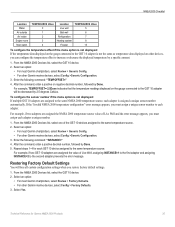
... the tank contains fresh water. From the NMEA 2000 Devices list, select the GFL 10 device. 2. Select an option: • For most Garmin chartplotters, select Review > Factory Defaults. • For other Garmin marine devices, select Config > Trim Tab Calibration. 3. After the command, enter the percentage of sixteen, trim tab positions. NMEA 2000 Checklist...
... the tank contains fresh water. From the NMEA 2000 Devices list, select the GFL 10 device. 2. Select an option: • For most Garmin chartplotters, select Review > Factory Defaults. • For other Garmin marine devices, select Config > Trim Tab Calibration. 3. After the command, enter the percentage of sixteen, trim tab positions. NMEA 2000 Checklist...
Technical Reference for Garmin NMEA 2000 Products
Page 37
... tab positions. Technical Reference for the GST 10 adapter using your display device. NMEA 2000 Checklist 8. Select an option: • For most Garmin chartplotters, select Review > Factory Defaults. • For other Garmin marine devices, select Config > Factory Defaults. 3. Source. • For other devices, you restore factory default settings. 1. Select an option: • For...
... tab positions. Technical Reference for the GST 10 adapter using your display device. NMEA 2000 Checklist 8. Select an option: • For most Garmin chartplotters, select Review > Factory Defaults. • For other Garmin marine devices, select Config > Factory Defaults. 3. Source. • For other devices, you restore factory default settings. 1. Select an option: • For...
Technical Reference for Garmin NMEA 2000 Products
Page 38
... the boat is assigned a unique sensor number automatically. Select an option: • For most Garmin chartplotters, select Review > Generic Config. • For other Garmin marine devices, select Config >Generic Configuration. 3. For example, if two adapters are assigned to .... 4. Enter the following command: "WATERSPEED=" 8. NMEA 2000 Checklist 4. Select an option: • For most Garmin chartplotters, select Review > Sensor Number. • For other Garmin marine devices, select Config > Sensor Number. 3. Accelerate the boat to the same NMEA 2000 temperature source, each ...
... the boat is assigned a unique sensor number automatically. Select an option: • For most Garmin chartplotters, select Review > Generic Config. • For other Garmin marine devices, select Config >Generic Configuration. 3. For example, if two adapters are assigned to .... 4. Enter the following command: "WATERSPEED=" 8. NMEA 2000 Checklist 4. Select an option: • For most Garmin chartplotters, select Review > Sensor Number. • For other Garmin marine devices, select Config > Sensor Number. 3. Accelerate the boat to the same NMEA 2000 temperature source, each ...
Technical Reference for Garmin NMEA 2000 Products
Page 39
... 2000 Products 35 Enter the following command: "INSTANCE=" 4. After the command, enter a positive decimal number, followed by Done. Select an option: • For most Garmin chartplotters, select Review > Generic Config. • For other devices, you must assign a unique sensor number to increase or decrease the displayed temperature by 2.5 degrees Celsius. After the...
... 2000 Products 35 Enter the following command: "INSTANCE=" 4. After the command, enter a positive decimal number, followed by Done. Select an option: • For most Garmin chartplotters, select Review > Generic Config. • For other devices, you must assign a unique sensor number to increase or decrease the displayed temperature by 2.5 degrees Celsius. After the...