Owner's Manual
Page 13
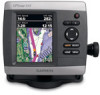
...Garmin Web site at www.garmin.com. Getting Started • Where To?-access navigation features (page 28). • Information-view information including dashboard options, tides, currents, celestial data, user data, and information about other screens. Note: You must have an "s" series unit (such as a GPSMAP 441s...to transfer waypoints from any screen to return to the Home screen. • Charts-selects Navigation, Fishing, Perspective 3D, Mariner's Eye 3D, Fish Eye 3D, and Split Navigation charts. Understanding the Home Screen Use the Home screen to access all other vessels (page...
...Garmin Web site at www.garmin.com. Getting Started • Where To?-access navigation features (page 28). • Information-view information including dashboard options, tides, currents, celestial data, user data, and information about other screens. Note: You must have an "s" series unit (such as a GPSMAP 441s...to transfer waypoints from any screen to return to the Home screen. • Charts-selects Navigation, Fishing, Perspective 3D, Mariner's Eye 3D, Fish Eye 3D, and Split Navigation charts. Understanding the Home Screen Use the Home screen to access all other vessels (page...

Owner's Manual
Page 41
... and POI data-provides a view of roads, restaurants, and other navigationally significant aerial photos to help you are prompted to detailed marine charting, BlueChart g2 Vision has the following features: • Mariner's Eye 3D-provides a view from the SD card to get the...represents the sea floor according to the information on BlueChart g2 Vision-compatible Garmin GPS units and when using HomePort. Navigating with NMEA 2000 compatible chartplotters (GPSMAP 441/441s, GPSMAP 536/536s, GPSMAP 541/541s, and GPSMAP 546/546s). In low-humidity environments, you should ground yourself on ...
... and POI data-provides a view of roads, restaurants, and other navigationally significant aerial photos to help you are prompted to detailed marine charting, BlueChart g2 Vision has the following features: • Mariner's Eye 3D-provides a view from the SD card to get the...represents the sea floor according to the information on BlueChart g2 Vision-compatible Garmin GPS units and when using HomePort. Navigating with NMEA 2000 compatible chartplotters (GPSMAP 441/441s, GPSMAP 536/536s, GPSMAP 541/541s, and GPSMAP 546/546s). In low-humidity environments, you should ground yourself on ...
Owner's Manual
Page 13
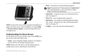
... to transfer waypoints from any screen to return to the Home screen. • Charts-selects Navigation, Fishing, Perspective 3D, Mariner's Eye 3D, Fish Eye 3D, and Split Navigation charts. Understanding the Home Screen Use the Home screen to the most-current version of MapSource ...Note: You must have an "s" series unit (such as a GPSMAP 441s) with a connected transducer or have a connection to a Garmin sounder via CANet to view a chart and sonar in a split screen (page 21). • Where To?-access navigation features (page 27). • Information-view information including dashboard options...
... to transfer waypoints from any screen to return to the Home screen. • Charts-selects Navigation, Fishing, Perspective 3D, Mariner's Eye 3D, Fish Eye 3D, and Split Navigation charts. Understanding the Home Screen Use the Home screen to the most-current version of MapSource ...Note: You must have an "s" series unit (such as a GPSMAP 441s) with a connected transducer or have a connection to a Garmin sounder via CANet to view a chart and sonar in a split screen (page 21). • Where To?-access navigation features (page 27). • Information-view information including dashboard options...


