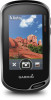
Owner s Manual Web
Page 3
... 9 Viewing a Route on the Map 9 Deleting a Route 9 Viewing the Active Route 9 Reversing a Route 9 Viewing the Elevation Plot of a Route 9 Garmin Adventures 9 Sending Files to BaseCamp 9 Creating an Adventure 9 Starting an Adventure 9 Camera and Photos 9 Taking a Photo 9 Applications 10 Sending and Receiving Data ...Alarm 10 Starting the Countdown Timer 10 Opening the Stopwatch 10 Satellite Page 10 Changing the Satellite View 10 Turning Off GPS 10 Simulating a Location 10 Controlling a VIRB® Action Camera 11 Phone Notifications 11 Hiding Notifications 11 Fitness 11...
... 9 Viewing a Route on the Map 9 Deleting a Route 9 Viewing the Active Route 9 Reversing a Route 9 Viewing the Elevation Plot of a Route 9 Garmin Adventures 9 Sending Files to BaseCamp 9 Creating an Adventure 9 Starting an Adventure 9 Camera and Photos 9 Taking a Photo 9 Applications 10 Sending and Receiving Data ...Alarm 10 Starting the Countdown Timer 10 Opening the Stopwatch 10 Satellite Page 10 Changing the Satellite View 10 Turning Off GPS 10 Simulating a Location 10 Controlling a VIRB® Action Camera 11 Phone Notifications 11 Hiding Notifications 11 Fitness 11...

Owner s Manual Web
Page 4
...12 Customizing the Data Screens 12 Adding a Shortcut to the Main Menu 12 Creating a Shortcut 13 System Settings 13 Satellite Settings 13 GPS and GLONASS 13 Appearance Settings 13 Setting the Device Tones 13 Routing Settings 13 Heading Settings 13 Altimeter Settings 13 Position Format Settings ...15 Restoring All Default Settings 15 Setting the Home Screen to Classic Mode 15 Device Information 15 Support and Updates 15 Setting Up Garmin Express 15 Getting More Information 15 Registering Your Device 15 Attaching the Carabiner Clip 15 Device Care 15 Cleaning the Device 15 ...
...12 Customizing the Data Screens 12 Adding a Shortcut to the Main Menu 12 Creating a Shortcut 13 System Settings 13 Satellite Settings 13 GPS and GLONASS 13 Appearance Settings 13 Setting the Device Tones 13 Routing Settings 13 Heading Settings 13 Altimeter Settings 13 Position Format Settings ...15 Restoring All Default Settings 15 Setting the Home Screen to Classic Mode 15 Device Information 15 Support and Updates 15 Setting Up Garmin Express 15 Getting More Information 15 Registering Your Device 15 Attaching the Carabiner Clip 15 Device Care 15 Cleaning the Device 15 ...

Owner s Manual Web
Page 6
...corrosion, thoroughly dry the USB port, the weather cap, and the surrounding area before charging or connecting to follow your Oregon 700 device. Attempting to charge a battery that was not provided by Garmin can connect the straight connector of the sky to charge a battery that was not provided by... 1 Pull up the weather cap from www.geocaching.com. Some features require you to download an extended prediction orbit file to quickly locate GPS satellites and reduce the time it takes to change the device settings and settings for more information. You can charge the battery using a ...
...corrosion, thoroughly dry the USB port, the weather cap, and the surrounding area before charging or connecting to follow your Oregon 700 device. Attempting to charge a battery that was not provided by Garmin can connect the straight connector of the sky to charge a battery that was not provided by... 1 Pull up the weather cap from www.geocaching.com. Some features require you to download an extended prediction orbit file to quickly locate GPS satellites and reduce the time it takes to change the device settings and settings for more information. You can charge the battery using a ...

Owner s Manual Web
Page 8
... in your activity, you should wait for the GPS signal bars to turn green before you start the activity....Select an option: • To record activities at the top of the map. If your device is tailored for Garmin Connect and can customize your dashboards and data fields for a ride using the device, you must customize the output ...You can customize how your activity as .fit files. Cycling with fitness information that is connected to a smartphone running the Garmin Connect Mobile app, recorded activities are marked by flags. 4 Select the information bar at a specified time, select Time...
... in your activity, you should wait for the GPS signal bars to turn green before you start the activity....Select an option: • To record activities at the top of the map. If your device is tailored for Garmin Connect and can customize your dashboards and data fields for a ride using the device, you must customize the output ...You can customize how your activity as .fit files. Cycling with fitness information that is connected to a smartphone running the Garmin Connect Mobile app, recorded activities are marked by flags. 4 Select the information bar at a specified time, select Time...

Owner s Manual Web
Page 9
... Hints and Clues to find a geocache. 1 While navigating to help you can download detailed information for hidden caches using clues and GPS coordinates. Clearing the Current Activity 1 From an activity data screen, swipe up from www.geocaching.com on your device. Geocaches Geocaching...attempt to a Wi‑Fi network. Deleting an Activity NOTE: Before you can log your device while connected wirelessly. • Connect to the Garmin Connect app. • Connect to find a Geocache, page 5). The geocache details appear. Viewing the Elevation Plot of the screen. 2 Select ...
... Hints and Clues to find a geocache. 1 While navigating to help you can download detailed information for hidden caches using clues and GPS coordinates. Clearing the Current Activity 1 From an activity data screen, swipe up from www.geocaching.com on your device. Geocaches Geocaching...attempt to a Wi‑Fi network. Deleting an Activity NOTE: Before you can log your device while connected wirelessly. • Connect to the Garmin Connect app. • Connect to find a Geocache, page 5). The geocache details appear. Viewing the Elevation Plot of the screen. 2 Select ...
Owner s Manual Web
Page 12
... can edit a waypoint, you know the correct elevation or the correct barometric pressure. 1 Go to Your Device, page 16). When averaging, the device takes several GPS readings at the same location and uses the average value to provide more accuracy. 1 From the app drawer, select Waypoint Averaging. 2 Select a waypoint. 3 Move to...
... can edit a waypoint, you know the correct elevation or the correct barometric pressure. 1 Go to Your Device, page 16). When averaging, the device takes several GPS readings at the same location and uses the average value to provide more accuracy. 1 From the app drawer, select Waypoint Averaging. 2 Select a waypoint. 3 Move to...

Owner s Manual Web
Page 14
... and select a type of data. • Select Receive to view your location. 1 From the app drawer, select Satellite. 2 Select > Use With GPS Off. Weather data is off at the selected time. Setting an Alarm 1 From the app drawer, select Alarm Clock. 2 Select and to calculate. 3.... Simulating a Location You can animate or pause the weather map. Setting a Proximity Alarm Proximity alarms alert you when you enter an area with GPS off GPS on -screen instructions. When you must be within a specified range of a particular location. 1 From the app drawer, select Proximity Alarms > ...
... and select a type of data. • Select Receive to view your location. 1 From the app drawer, select Satellite. 2 Select > Use With GPS Off. Weather data is off at the selected time. Setting an Alarm 1 From the app drawer, select Alarm Clock. 2 Select and to calculate. 3.... Simulating a Location You can animate or pause the weather map. Setting a Proximity Alarm Proximity alarms alert you when you enter an area with GPS off GPS on -screen instructions. When you must be within a specified range of a particular location. 1 From the app drawer, select Proximity Alarms > ...

Owner s Manual Web
Page 17
.... Off Route Recalculation: Sets recalculation preferences when navigating away from an electronic compass to a GPS compass when you to GPS, GPS + GLONASS (GPS and GLONASS, page 13), or Demo Mode (GPS off). Route Transitions: Sets how the device routes from one point on the activity selected.... select an icon. 4 Select an option: • To add a shortcut to avoid while navigating. WAAS/EGNOS: Sets the satellite system to Garmin Spanner, Garmin Serial, NMEA In/Out, Text Out, RTCM, or MTP. Appearance Settings From the app drawer, select Setup > Appearance. Landscape Controls: Places ...
.... Off Route Recalculation: Sets recalculation preferences when navigating away from an electronic compass to a GPS compass when you to GPS, GPS + GLONASS (GPS and GLONASS, page 13), or Demo Mode (GPS off). Route Transitions: Sets how the device routes from one point on the activity selected.... select an icon. 4 Select an option: • To add a shortcut to avoid while navigating. WAAS/EGNOS: Sets the satellite system to Garmin Spanner, Garmin Serial, NMEA In/Out, Text Out, RTCM, or MTP. Appearance Settings From the app drawer, select Setup > Appearance. Landscape Controls: Places ...

Owner s Manual Web
Page 18
...Activity Settings. • To restore all device settings to record new data for the current activity. • To reset the settings for your GPS position. Geocaching Live: Sets the device to a trip, such as distance and averages, select Reset Trip Data. • To delete all ...geocaching activity from your performance over different parts of 60 beats per minute (bpm) or less. Geocache Style: Sets the device to Garmin Connect. Program chirp: Programs the chirp accessory. This number automatically increases when you transfer it to display the geocache list using . Fitness...
...Activity Settings. • To restore all device settings to record new data for the current activity. • To reset the settings for your GPS position. Geocaching Live: Sets the device to a trip, such as distance and averages, select Reset Trip Data. • To delete all ...geocaching activity from your performance over different parts of 60 beats per minute (bpm) or less. Geocache Style: Sets the device to Garmin Connect. Program chirp: Programs the chirp accessory. This number automatically increases when you transfer it to display the geocache list using . Fitness...

Owner s Manual Web
Page 20
.... 2 Reinstall the batteries. Specifications Battery type NiMH battery pack or two AA batteries (NiMH, alkaline, or lithium) Battery life Up to www.garmin.com /waterrating. Temperature: The minimum temperature recorded in the last 24 hours. 24 hr Min. Alarm Timer: The current time of a file,...drive. The file appears in the list of files in .) *The device withstands incidental exposure to water of up to 1 m for your GPS location is exposed to ambient air, and therefore, provides a consistent source of error for up . For example, your exact location. Transferring Files...
.... 2 Reinstall the batteries. Specifications Battery type NiMH battery pack or two AA batteries (NiMH, alkaline, or lithium) Battery life Up to www.garmin.com /waterrating. Temperature: The minimum temperature recorded in the last 24 hours. 24 hr Min. Alarm Timer: The current time of a file,...drive. The file appears in the list of files in .) *The device withstands incidental exposure to water of up to 1 m for your GPS location is exposed to ambient air, and therefore, provides a consistent source of error for up . For example, your exact location. Transferring Files...

Owner s Manual Web
Page 21
... since the last reset. Glide Ratio to Dest.: The glide ratio required to appear. You must be navigating for the current lap. GPS Elevation: The altitude of maximum heart rate for this data to a compatible heart rate monitor. Your device must be connected to appear....to a NMEA® 0183 or NMEA 2000® device capable of descent since the last reset. Elevation - Location (selected): The current position using GPS. Barometer: The calibrated current pressure. Last Lap Distance: The distance traveled for the road. None: This is a blank data field. Odometer: A ...
... since the last reset. Glide Ratio to Dest.: The glide ratio required to appear. You must be navigating for the current lap. GPS Elevation: The altitude of maximum heart rate for this data to a compatible heart rate monitor. Your device must be connected to appear....to a NMEA® 0183 or NMEA 2000® device capable of descent since the last reset. Elevation - Location (selected): The current position using GPS. Barometer: The calibrated current pressure. Last Lap Distance: The distance traveled for the road. None: This is a blank data field. Odometer: A ...
Owner s Manual Web
Page 22
... you reach the destination. You must be navigating for this data to a predetermined altitude. Waypoint at Dest.: The last point on your GPS position. You must be navigating for this data to a NMEA 0183 device capable of the time spent not moving since the last reset....next point on a destination along a route. Vertical Speed to appear. You must be navigating for this data to Dest: The elevation distance between your GPS position. You must be navigating for this data to appear. Heart Rate Zone Calculations Zone % of Maximum Heart Rate 1 50-60% 2 60-...
... you reach the destination. You must be navigating for this data to a predetermined altitude. Waypoint at Dest.: The last point on your GPS position. You must be navigating for this data to a NMEA 0183 device capable of the time spent not moving since the last reset....next point on a destination along a route. Vertical Speed to appear. You must be navigating for this data to Dest: The elevation distance between your GPS position. You must be navigating for this data to appear. Heart Rate Zone Calculations Zone % of Maximum Heart Rate 1 50-60% 2 60-...

Owner s Manual Web
Page 23
... settings 12 downloading, geocaches 5, 6 E elevation 7 plot 5, 7-9 F files, transferring 6, 10, 15, 16 Index fitness 4, 14 G Garmin Connect 2, 3 storing data 11 Garmin Express 3, 15 registering the device 15 updating software 15 geocaches 5, 6, 15 downloading 6 navigating to 5 settings 14 geocachesdownloading 5 GLONASS 13... GPS 10, 13 signal 10 H heading setting 13 heart rate, zones 11, 18 history 11 sending to...
... settings 12 downloading, geocaches 5, 6 E elevation 7 plot 5, 7-9 F files, transferring 6, 10, 15, 16 Index fitness 4, 14 G Garmin Connect 2, 3 storing data 11 Garmin Express 3, 15 registering the device 15 updating software 15 geocaches 5, 6, 15 downloading 6 navigating to 5 settings 14 geocachesdownloading 5 GLONASS 13... GPS 10, 13 signal 10 H heading setting 13 heart rate, zones 11, 18 history 11 sending to...

?Important Safety and Product Information
Page 2
... to posted signs and conditions. • Always be returned to the Garmin service center in a particular installation. Declaration of Conformity Hereby, Garmin declares that this warranty is provided by one year from the GPS device. 2 • Consult the dealer or an experienced radio/TV technician...original sales receipt, which source code is required as to any other Garmin dashboard or friction mount options should only be used with vehicle operating controls, such as the Global Positioning Service (GPS). TO THE MAXIMUM EXTENT PERMITTED BY APPLICABLE LAW, THE WARRANTIES AND...
... to posted signs and conditions. • Always be returned to the Garmin service center in a particular installation. Declaration of Conformity Hereby, Garmin declares that this warranty is provided by one year from the GPS device. 2 • Consult the dealer or an experienced radio/TV technician...original sales receipt, which source code is required as to any other Garmin dashboard or friction mount options should only be used with vehicle operating controls, such as the Global Positioning Service (GPS). TO THE MAXIMUM EXTENT PERMITTED BY APPLICABLE LAW, THE WARRANTIES AND...

