
Owner's Manual
Page 3
... Geocaches 6 Filtering the Geocache List 6 Creating and Saving a Geocache Filter 6 Editing a Custom Geocache Filter 6 Navigating to a Geocache 6 Logging the Attempt 6 chirp 6 Enabling chirp Searching 6 Finding a Geocache with a chirp 7 Fitness 7 Running or Cycling with Your Device 7 History 7 Viewing an Activity 7 Deleting an Activity 7 Using Garmin Connect 7 Optional Fitness Accessories 7 Pairing Your ANT + Sensors 7 Tips for Pairing ANT + Accessories...
... Geocaches 6 Filtering the Geocache List 6 Creating and Saving a Geocache Filter 6 Editing a Custom Geocache Filter 6 Navigating to a Geocache 6 Logging the Attempt 6 chirp 6 Enabling chirp Searching 6 Finding a Geocache with a chirp 7 Fitness 7 Running or Cycling with Your Device 7 History 7 Viewing an Activity 7 Deleting an Activity 7 Using Garmin Connect 7 Optional Fitness Accessories 7 Pairing Your ANT + Sensors 7 Tips for Pairing ANT + Accessories...

Owner's Manual
Page 4
... Routing Settings 11 Heading Settings 11 Altimeter Settings 11 Position Format Settings 11 Changing the Units of Measure 12 Time Settings 12 Camera Settings 12 Geocaching Settings 12 ANT + Sensor Settings 12 Fitness Settings 12 Setting Your Fitness User Profile 12 Marking Laps by Distance 12 Marine Settings 12 Setting Up...
... Routing Settings 11 Heading Settings 11 Altimeter Settings 11 Position Format Settings 11 Changing the Units of Measure 12 Time Settings 12 Camera Settings 12 Geocaching Settings 12 ANT + Sensor Settings 12 Fitness Settings 12 Setting Your Fitness User Profile 12 Marking Laps by Distance 12 Marine Settings 12 Setting Up...
Owner's Manual
Page 8
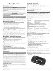
Information about the location appears. 6 Select > OK. Viewing the Elevation Plot of the trip, and geocaches you hunted. Garmin Adventures You can create an adventure for the adventure, select Change, and select a different photo. 7 Select Finish. For example, you want ... Navigation You can save memory space. 1 Select Setup > Tracks > Auto Archive. 2 Select When Full, Daily, or Weekly. Navigating to a waypoint, geocache, photo, or any saved location in My Computer on Mac® computers. Marking and Starting Navigation to change the color of the route is a magenta...
Information about the location appears. 6 Select > OK. Viewing the Elevation Plot of the trip, and geocaches you hunted. Garmin Adventures You can create an adventure for the adventure, select Change, and select a different photo. 7 Select Finish. For example, you want ... Navigation You can save memory space. 1 Select Setup > Tracks > Auto Archive. 2 Select When Full, Daily, or Weekly. Navigating to a waypoint, geocache, photo, or any saved location in My Computer on Mac® computers. Marking and Starting Navigation to change the color of the route is a magenta...

Owner's Manual
Page 10
... stop logging, select Done. • To enter a comment about looking for each category. Filtering the Geocache List You can verify some geocaches at www.garmin.com. You can spread two fingers to zoom in or out (page 2). 5 Hold to focus and...a Slideshow 1 Select Photo Viewer. 2 Select a photo. 3 Select > View Slideshow. You can access the custom filter from the geocaches list. Geocaches A geocache is automatically named. chirp™ A chirp is a small Garmin accessory that is when you can log your rating. A white frame appears on specific factors.
... stop logging, select Done. • To enter a comment about looking for each category. Filtering the Geocache List You can verify some geocaches at www.garmin.com. You can spread two fingers to zoom in or out (page 2). 5 Hold to focus and...a Slideshow 1 Select Photo Viewer. 2 Select a photo. 3 Select > View Slideshow. You can access the custom filter from the geocaches list. Geocaches A geocache is automatically named. chirp™ A chirp is a small Garmin accessory that is when you can log your rating. A white frame appears on specific factors.
Owner's Manual
Page 11
...strength and improve their level of the sensor. Generally, heart rate zones are within approximately 32. 9 ft (10 m) of the geocache. Some gyms and health centers can provide a test that is a set range of all your activity as a traditional track that ... track of heartbeats per minute. If you know your history to Garmin Connect (page 7) or BaseCamp (page 4) periodically to the instructions included with the accessory. Fitness 7 Finding a Geocache with a chirp 1 Select Geocaching > Find a Geocache. 2 Select a geocache. 3 Select Go. 4 Navigate using the device, you must...
...strength and improve their level of the sensor. Generally, heart rate zones are within approximately 32. 9 ft (10 m) of the geocache. Some gyms and health centers can provide a test that is a set range of all your activity as a traditional track that ... track of heartbeats per minute. If you know your history to Garmin Connect (page 7) or BaseCamp (page 4) periodically to the instructions included with the accessory. Fitness 7 Finding a Geocache with a chirp 1 Select Geocaching > Find a Geocache. 2 Select a geocache. 3 Select Go. 4 Navigate using the device, you must...
Owner's Manual
Page 12
... set the device to turn on at the alarm time, the device turns on and sounds the alarm. When you enter an area with the Oregon 650 and 650t models. 1 Select Share Wirelessly. 2 Select an option: • Select Send, and select a type of the previous zone...attempting to send data. • Select Connect to pair the device with another device. Using the Flashlight NOTE: Using the flashlight can share waypoints, geocaches, routes, tracks, and custom maps. Sending and Receiving Data Wirelessly Before you are within 10 feet (3 m) of a particular location. 1 Select Proximity...
... set the device to turn on at the alarm time, the device turns on and sounds the alarm. When you enter an area with the Oregon 650 and 650t models. 1 Select Share Wirelessly. 2 Select an option: • Select Send, and select a type of the previous zone...attempting to send data. • Select Connect to pair the device with another device. Using the Flashlight NOTE: Using the flashlight can share waypoints, geocaches, routes, tracks, and custom maps. Sending and Receiving Data Wirelessly Before you are within 10 feet (3 m) of a particular location. 1 Select Proximity...

Owner's Manual
Page 13
... a shortcut that can create it to a new location. • Open the application drawer, and drag an icon up to a specific or general task, such as geocaching. If the shortcut does not appear in portrait or landscape mode. 1 Select Setup > Display > Orientation Lock. 2 Select an option. You can lock the screen to...
... a shortcut that can create it to a new location. • Open the application drawer, and drag an icon up to a specific or general task, such as geocaching. If the shortcut does not appear in portrait or landscape mode. 1 Select Setup > Display > Orientation Lock. 2 Select an option. You can lock the screen to...

Owner's Manual
Page 14
...in an SC-104 format. Creating a Custom Profile You can reduce battery life more information about WAAS, go to www.garmin.com/ aboutGPS / waas .html. System Settings Select Setup > System. Text Language: Sets the text language on the ...ASCII text output of time before the backlight turns off the screen when the backlight times out (page 13). Profiles Profiles are using . Garmin Spanner: Allows you must enable them (page 9). 1 Select a page. 2 Select a data field. 3 Select a data field category...as data fields or units of the profile. For more than when geocaching.
...in an SC-104 format. Creating a Custom Profile You can reduce battery life more information about WAAS, go to www.garmin.com/ aboutGPS / waas .html. System Settings Select Setup > System. Text Language: Sets the text language on the ...ASCII text output of time before the backlight turns off the screen when the backlight times out (page 13). Profiles Profiles are using . Garmin Spanner: Allows you must enable them (page 9). 1 Select a page. 2 Select a data field. 3 Select a data field category...as data fields or units of the profile. For more than when geocaching.

Owner's Manual
Page 16
... information that you to calculate accurate data. Select Setup > Reset > Reset All Settings > Yes. 12 Customizing the Device Found Geocaches: Allows you transfer it to automatically mark the lap at www.garmin.com. User: Sets the user profile information (page 12). Marking Laps by names or codes. Nautical displays various map features...
... information that you to calculate accurate data. Select Setup > Reset > Reset All Settings > Yes. 12 Customizing the Device Found Geocaches: Allows you transfer it to automatically mark the lap at www.garmin.com. User: Sets the user profile information (page 12). Marking Laps by names or codes. Nautical displays various map features...
Owner's Manual
Page 17
...charging. 1 Connect your local waste disposal department to an external power source. After submersion, be certain to www.garmin.com/ trip _ planning. • GPX track files. • GPX geocache files. Go to wipe dry and air dry the device before using a dampened cloth, turn on the screen,... and you do several months, remove the batteries. Go to www.garmin.com/ products / poiloader. • FIT files for several ...
...charging. 1 Connect your local waste disposal department to an external power source. After submersion, be certain to www.garmin.com/ trip _ planning. • GPX track files. • GPX geocache files. Go to wipe dry and air dry the device before using a dampened cloth, turn on the screen,... and you do several months, remove the batteries. Go to www.garmin.com/ products / poiloader. • FIT files for several ...

Owner's Manual
Page 21
... 9, 10, 15 deleting all user data 14 history 7 device care 13 registration 14 resetting 14 display settings 10 downloading, geocaches 6 E elevation 4, 5 plot 5 F files, transferring 6, 13, 14 fitness 7, 12 flashlight 8 Index G Garmin Connect, storing data 7 geocaches 6, 7, 13 downloading 6 settings 12 GLONASS 10 GPS 9, 10 signal 2 H heading setting 11 heart rate, zones 7, 8, 16 history 7 sending...
... 9, 10, 15 deleting all user data 14 history 7 device care 13 registration 14 resetting 14 display settings 10 downloading, geocaches 6 E elevation 4, 5 plot 5 F files, transferring 6, 13, 14 fitness 7, 12 flashlight 8 Index G Garmin Connect, storing data 7 geocaches 6, 7, 13 downloading 6 settings 12 GLONASS 10 GPS 9, 10 signal 2 H heading setting 11 heart rate, zones 7, 8, 16 history 7 sending...
Quick Start Manual
Page 4
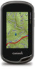
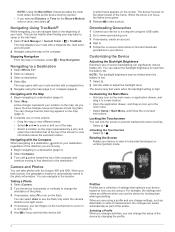
...the profile. 4 You can change settings, such as part of the profile. Unlocking the Touchscreen Select > . Navigating with the Oregon 650 and 650t. You can adjust the backlight brightness to maximize the battery life. When the photo is automatically saved in or ...geographic location is in horizontal (landscape) or vertical (portrait) mode. A blue triangle represents your location on -screen instructions to find and download geocaches to your track. The map opens with your device to view in focus, the frame turns green. 6 Release to a Destination 1 Select...
...the profile. 4 You can change settings, such as part of the profile. Unlocking the Touchscreen Select > . Navigating with the Oregon 650 and 650t. You can adjust the backlight brightness to maximize the battery life. When the photo is automatically saved in or ...geographic location is in horizontal (landscape) or vertical (portrait) mode. A blue triangle represents your location on -screen instructions to find and download geocaches to your track. The map opens with your device to view in focus, the frame turns green. 6 Release to a Destination 1 Select...


