
Garmin eTrex 20 Support Question
Garmin eTrex 20 Support Question
Find answers below for this question about Garmin eTrex 20.Need a Garmin eTrex 20 manual? We have 2 online manuals for this item!
Question posted by gbaggins on March 16th, 2013
Loaded Geocaches Will Not Display
When I "send to GPS" from geocaching.com, the GPX file loads into the GPX folder but cache will not display on the 20's Geocache list. What's up with that?
Current Answers
Related Garmin eTrex 20 Manual Pages
Owner's Manual - Page 3

...........28 Profiles 29 System Settings 30 Display Settings 30
3 Menu 11 Routes 12 Tracks 14
Navigation 16 Navigating to a Destination..........16 Map 16 Compass 17 Elevation Plot 19 Trip Computer 20
eTrex Owner's Manual
Table of Contents
Geocaches 21 Downloading Geocaches 21 Filtering the Geocache List..........21 Navigating to a Geocache............22 Logging the Attempt 22 chirp...
Owner's Manual - Page 11

...find a destination to navigate to http://buy.garmin.com or contact your device, you can search for ...eTrex Owner's Manual
11 Menu
You can use the Where To? For more information, go to . categories are available in all Where To? Finding a Location Near Another Location 1. Waypoints, Routes, and Tracks
Finding a Location by Name Depending on the maps loaded on the eTrex 20 and eTrex...
Owner's Manual - Page 17

... lines. • Select a location on the eTrex 20 and eTrex 30. Select Profile Change > Automotive.
2.
eTrex Owner's Manual
17 Navigation
Compass
The eTrex 30 has a 3-axis, electronic compass. Use the map to navigate to the destination.
3.
Navigating a Driving Route Driving route navigation is using the automotive profile, the compass displays GPS heading, not magnetic heading.
Owner's Manual - Page 20

... pressure.
1. Go to zero. Select Trip Computer > menu > Reset > Reset Trip Data > Yes. To customize the trip computer, see page 28.
20
eTrex Owner's Manual
Trip Computer
The trip computer displays your current speed, average speed, maximum speed, trip odometer, and other helpful statistics. Select Elevation Plot > menu > Calibrate Altimeter.
3. Resetting the Trip...
Owner's Manual - Page 21

... your device to the geocache list, select Search.
• To save custom filters for hidden treasures using GPS coordinates posted online by those hiding the geocache. Connect your device. Select an option:
• To apply the filter to a computer (page 44).
2.
eTrex Owner's Manual
21 Select items to www.OpenCaching.com.
3. Downloading Geocaches
1. After you set up...
Owner's Manual - Page 22
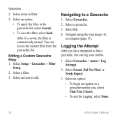
You can log your results.
1. Select an item to find a geocache, you can access the custom filter from the geocaches list. Select Go. 4. Logging the Attempt
After you , select Find Next Closest. • To end the logging, select Done.
22
eTrex Owner's Manual Select Geocaches > menu > Log Attempt.
2. Select Found, Did Not Find, or Needs Repair...
Owner's Manual - Page 24

... area, the device sounds a tone (eTrex 20/30).
24
eTrex Owner's Manual
Select Send or Receive. 3.
Select Share Wirelessly. ...Sending and Receiving Data Wirelessly Before you can share information wirelessly. Enter a radius.
7. Select Done. Your device can share waypoints, geocaches, routes, and tracks. Follow the on-screen instructions.
Applications
Applications
Sharing Data
The eTrex...
Owner's Manual - Page 26

..., and signal strength. Satellite Page
The satellite page shows your current track toward the top of that satellite (eTrex 20/30). Select an option. Turning Off GPS Select Satellite > menu > Use With GPS Off.
26
eTrex Owner's Manual If necessary, select Track Up to change the view of the satellites to the signal strength bar...
Owner's Manual - Page 28
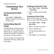
...and style of data that can be helpful to a specific or general task, such as geocaching. For data field descriptions, see page 47.
4. Customizing Your Device
Customizing Your Device
Customizing...computer. Select Map > menu > Change Data Fields.
2. Customizing Specific Pages
Data fields display information about your location or other specified data. Dashboards are a custom grouping of data ...
Owner's Manual - Page 30

... WAAS, go to Normal, WAAS/EGNOS (Wide Area Augmentation System/European Geostationary Navigation Overlay Service), or Demo Mode (GPS off . Note: To adjust the backlight brightness, see page 40.
• Colors (eTrex 20/30)-sets the colors that display in Night and Day mode.
◦◦ Mode-sets a light background (Day), a dark background
30...
Owner's Manual - Page 32
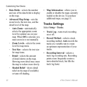
..., see page 11. Showing more detail may cause the map to enable or disable the maps currently loaded on the device. Tracks Settings
Select Setup > Tracks.
• Track Log-turns track recording on...redraw more -detailed track, but fills the track log faster.
32
eTrex Owner's Manual
Auto records the tracks at a variable rate to display on the map.
• Advanced Map Setup-sets the zoom levels...
Owner's Manual - Page 33

• Auto Archive-selects an automatic archive method to organize your GPS position. Select a measurement type.
3.
Position Format Settings
Note: Do not ...select Automatic to select a 12-hour or a 24-hour display time.
• Time Zone-allows you are saved and cleared automatically based on the user setting.
• Color (eTrex 20/30)-changes the color of the track line on your ...
Owner's Manual - Page 34

...9702;◦ Bearing (Small or Large)-
Select Setup > Heading.
• Display-sets the type of directional heading on the eTrex 30. Altimeter Settings
This function is available on the compass.
• ... > Altimeter.
• Auto Calibration-allows the altimeter to self-calibrate each time you to a GPS compass when you are traveling at a higher rate of speed for a set period of the compass...
Owner's Manual - Page 35

...This can be useful when you to display the geocache list by names or codes. eTrex Owner's Manual
35 records pressure data... Calibrate Altimeter-page 20.
• Barometer Mode
◦◦ Variable Elevation-allows the barometer to weather.
• Pressure Trending
◦◦ Save When Power On- Geocaching Settings
Select Setup > Geocaches.
• Geocache List-allows you are moving...
Owner's Manual - Page 37

... select a nautical chart or a fishing chart:
◦◦ Nautical-displays various map features in different colors so that the marine POIs are within a specified distance of bottom contours and depth soundings.
eTrex Owner's Manual
37 • Lock On Road-locks the position icon,... next point on the route.
◦◦ Distance-routes you to the next point on the eTrex 20 and eTrex 30.
Owner's Manual - Page 43

... in the battery compartment.
➊➋
eTrex Owner's Manual
43 File Types The device supports these file types.
• Files from BaseCamp™ or HomePort™
Go to http://www.garmin.com.
• GPI custom POI files from the Garmin POI Loader
• GPX geocache files
Device Information
Installing a microSD Card The eTrex 20 and eTrex 30 can use microSD cards for...
Owner's Manual - Page 45
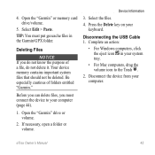
... must put geocache files in your system tray.
• For Mac computers, drag the volume icon to your computer (page 44).
1. If necessary, open a folder or volume. Your device memory contains important system files that should not be deleted. Complete an action:
• For Windows computers, click the eject icon in the Garmin\GPX folder. Before...
Owner's Manual - Page 49
... while moving since last reset.
Displays the current position in beats per minute (bpm).
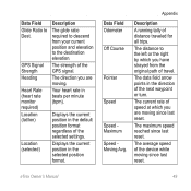
Displays the current position in the direction of the GPS signal. The distance to the ...Speed Maximum Speed Moving Avg. eTrex Owner's Manual
49
Appendix
Description
A running tally of the selected settings. The strength of the next waypoint or turn. GPS Signal Strength Heading
Heart Rate ...
Owner's Manual - Page 55

...
E editing
profiles 30 routes 12 waypoints 9
eTrex Owner's Manual
elevation plot 19, 20 barometric altimeter 20 of a track 15
F file types 43 finding
addresses 12 near your location 11 fishing times 25 fitness options 46
G geocaches 21, 35
downloading 21 filter list 21 logging attempt 22 navigating to 22 settings 35 GPS signals 8, 26, 30, 47, 49...
Owner's Manual - Page 56

...16
driving routes 17 to a geocache 22 to waypoints 9 with bearing ... your device 8 resetting
all settings 52 data 38 device 52 elevation plot 20 restoring default settings 39 routes 12-13 active route 13 avoidance 37 creating 12... satellite signals 8, 26, 47,
49, 52 system settings 30 turning off GPS 26, 27
saving tracks 15
sharing data 24 Sight N' Go 10 software
updating...eTrex Owner's Manual
Similar Questions


Garmin Edge 500 Wont Go Into Mass Storage Mode
(Posted by Peser 9 years ago)


Deleting Geocaches
I would like to know how to delete geocaches from my Garmin eTrex 20 to free up memory space.
I would like to know how to delete geocaches from my Garmin eTrex 20 to free up memory space.
(Posted by skiegazer 12 years ago)