
Important Safety and Product Information
Page 4
...be made at no warranty as the proof of any interference, including interference that the customer shall be responsible for warranty repairs. or (v) damage to the accuracy or completeness of map data in contravention of the laws of purchase for any transportation cost. SUCH REMEDY ... radiocommunication devices comply with Industry Canada license-exempt RSS standard(s). Within this device must accept any country. In addition, Garmin reserves the right to the customer for parts or labor, provided that may cause undesired operation of the purchase price at its sole discretion...
...be made at no warranty as the proof of any interference, including interference that the customer shall be responsible for warranty repairs. or (v) damage to the accuracy or completeness of map data in contravention of the laws of purchase for any transportation cost. SUCH REMEDY ... radiocommunication devices comply with Industry Canada license-exempt RSS standard(s). Within this device must accept any country. In addition, Garmin reserves the right to the customer for parts or labor, provided that may cause undesired operation of the purchase price at its sole discretion...
Important Safety and Product Information
Page 3
..., freight charges prepaid, to the accuracy or completeness of map data in this device under the Australian Consumer Law. Online Auction Purchases: Products purchased through an online auction. Distributor warranties are not eligible for service. Garmin makes no charge to a product that the customer shall be made at no warranty as batteries, unless...
..., freight charges prepaid, to the accuracy or completeness of map data in this device under the Australian Consumer Law. Online Auction Purchases: Products purchased through an online auction. Distributor warranties are not eligible for service. Garmin makes no charge to a product that the customer shall be made at no warranty as batteries, unless...

Owner's Manual
Page 3
...with Your Device 7 History 7 Viewing an Activity 7 Deleting an Activity 7 Using Garmin Connect 7 Optional Fitness Accessories 7 Pairing Your ANT + Sensors 7 Tips for Pairing ANT + Accessories with Your Garmin Device 7 About Heart Rate Zones 7 Fitness Goals 7 Setting Your Heart Rate ... the Screen Orientation 9 Creating a Shortcut 9 Adding a Shortcut to the Main Menu 9 Custom Data Fields and Dashboards 9 Enabling the Map Data Fields 9 Customizing the Data Fields 10 Customizing Dashboards 10 Profiles 10 Selecting a Profile 10 Table of a Waypoint Location 2 Projecting a ...
...with Your Device 7 History 7 Viewing an Activity 7 Deleting an Activity 7 Using Garmin Connect 7 Optional Fitness Accessories 7 Pairing Your ANT + Sensors 7 Tips for Pairing ANT + Accessories with Your Garmin Device 7 About Heart Rate Zones 7 Fitness Goals 7 Setting Your Heart Rate ... the Screen Orientation 9 Creating a Shortcut 9 Adding a Shortcut to the Main Menu 9 Custom Data Fields and Dashboards 9 Enabling the Map Data Fields 9 Customizing the Data Fields 10 Customizing Dashboards 10 Profiles 10 Selecting a Profile 10 Table of a Waypoint Location 2 Projecting a ...

Owner's Manual
Page 4
...Name 10 Deleting a Profile 10 Customizing the Keys 10 System Settings 10 About GPS and GLONASS 10 Serial Interface Settings 10 Display Settings 10 Appearance Settings 10 Turning On Scroll Controls 10 Setting the Touchscreen Sensitivity 11 Setting the Device Tones 11 Map Settings 11 Advanced Map Settings 11 Tracks Settings 11 ... the Device 14 Registering Your Device 14 Getting More Information 14 Appendix 14 Attaching the Carabiner Clip 14 Removing the Carabiner Clip 14 Optional Maps 14 tempe 14 Data Fields 15 Heart Rate Zone Calculations 16 Index 17 ii Table of Contents
...Name 10 Deleting a Profile 10 Customizing the Keys 10 System Settings 10 About GPS and GLONASS 10 Serial Interface Settings 10 Display Settings 10 Appearance Settings 10 Turning On Scroll Controls 10 Setting the Touchscreen Sensitivity 11 Setting the Device Tones 11 Map Settings 11 Advanced Map Settings 11 Tracks Settings 11 ... the Device 14 Registering Your Device 14 Getting More Information 14 Appendix 14 Attaching the Carabiner Clip 14 Removing the Carabiner Clip 14 Optional Maps 14 tempe 14 Data Fields 15 Heart Rate Zone Calculations 16 Index 17 ii Table of Contents
Owner's Manual
Page 7
..., select Distance. • To record tracks at a variable rate that leads you selected Auto for each point. Customizing Your Track Log You can customize how your device displays and records tracks. 1 Select Current Track > . 2 Select an option: • To...name, and select . Where To? menu to find a destination to navigate to http: / / buy .garmin .com or contact your final destination. Optional Maps You can use optional City Navigator maps to your Garmin dealer. Editing a Route 1 Select Route Planner. 2 Select a route. 3 Select Edit Route. 4 ...
..., select Distance. • To record tracks at a variable rate that leads you selected Auto for each point. Customizing Your Track Log You can customize how your device displays and records tracks. 1 Select Current Track > . 2 Select an option: • To...name, and select . Where To? menu to find a destination to navigate to http: / / buy .garmin .com or contact your final destination. Optional Maps You can use optional City Navigator maps to your Garmin dealer. Editing a Route 1 Select Route Planner. 2 Select a route. 3 Select Edit Route. 4 ...
Owner's Manual
Page 8
... 1 Open BaseCamp. 2 Connect the device to the MOB location. See your operating system help file to learn how to map the drive. 3 Open the Garmin or memory card drive or volume. 4 Select an option: • Select an item from a connected device and drag ...describe the adventure. 6 If you must send an adventure from BaseCamp to http: / / adventures .garmin .com. You can customize a key to a destination (page 4). 4 Navigation The map opens with family, friends, and the Garmin community. Viewing Track Information 1 Select Track Manager. 2 Select a track. 3 Select . Changing the...
... 1 Open BaseCamp. 2 Connect the device to the MOB location. See your operating system help file to learn how to map the drive. 3 Open the Garmin or memory card drive or volume. 4 Select an option: • Select an item from a connected device and drag ...describe the adventure. 6 If you must send an adventure from BaseCamp to http: / / adventures .garmin .com. You can customize a key to a destination (page 4). 4 Navigation The map opens with family, friends, and the Garmin community. Viewing Track Information 1 Select Track Manager. 2 Select a track. 3 Select . Changing the...
Owner's Manual
Page 9
...> Calibrate Altimeter. 3 Follow the on the map (represented by a pin), and select the information bar at the factory, and the device uses automatic calibration by default. You can customize the trip computer layout, dashboard, and data... Navigating with a magenta line. 6 Navigate using the compass. A blue triangle represents your path. To customize the elevation settings, see page 11. It also helps you experience irregular compass behavior, for example, after... Computer > > Reset > Reset Trip Data > Reset. The map opens with the Oregon 650 and 650t.
...> Calibrate Altimeter. 3 Follow the on the map (represented by a pin), and select the information bar at the factory, and the device uses automatic calibration by default. You can customize the trip computer layout, dashboard, and data... Navigating with a magenta line. 6 Navigate using the compass. A blue triangle represents your path. To customize the elevation settings, see page 11. It also helps you experience irregular compass behavior, for example, after... Computer > > Reset > Reset Trip Data > Reset. The map opens with the Oregon 650 and 650t.

Owner's Manual
Page 10
... On A Specific Date, and enter a date. You can verify some geocaches at www.garmin.com. Viewing Photos You can access the custom filter from the geocaches list. Viewing the Location of a Photo 1 Select Photo Viewer. 2 Select a photo. 3 Select > View Map. For more information about the cache itself, select Edit Comment, enter a comment, and...
... On A Specific Date, and enter a date. You can verify some geocaches at www.garmin.com. Viewing Photos You can access the custom filter from the geocaches list. Viewing the Location of a Photo 1 Select Photo Viewer. 2 Select a photo. 3 Select > View Map. For more information about the cache itself, select Edit Comment, enter a comment, and...
Owner's Manual
Page 11
... Select an activity. 3 Select Review. The device is activated. You can customize a data field to display sensor data. 1 Bring the device within range 3 m (10 ft. ) of fitness. Optional Fitness Accessories You can customize your device, you from 1 to 5 according to measure and increase their ...timer is paired with Your Device Before you go near other ANT + accessories. • Bring the Garmin device within range (3 m) of the calculators available on the map and used for navigation. • Select FIT to determine the best heart rate zone for Pairing ANT...
... Select an activity. 3 Select Review. The device is activated. You can customize a data field to display sensor data. 1 Bring the device within range 3 m (10 ft. ) of fitness. Optional Fitness Accessories You can customize your device, you from 1 to 5 according to measure and increase their ...timer is paired with Your Device Before you go near other ANT + accessories. • Bring the Garmin device within range (3 m) of the calculators available on the map and used for navigation. • Select FIT to determine the best heart rate zone for Pairing ANT...
Owner's Manual
Page 12
... or ANT + wireless technology. Setting a Proximity Alarm Proximity alarms alert you when you can share waypoints, geocaches, routes, tracks, and custom maps. The alarm sounds at the alarm time, the device turns on the minimum heart rate of strobes per second. You can share data.... The maximum heart rate for zone 5. For example, if you must be attempting to send data. • Select Connect to pair the device with the Oregon 650 and 650t models. 1 Select Share Wirelessly. 2 Select an option: • Select Send, and select a type of the batteries. 1 Select Flashlight...
... or ANT + wireless technology. Setting a Proximity Alarm Proximity alarms alert you when you can share waypoints, geocaches, routes, tracks, and custom maps. The alarm sounds at the alarm time, the device turns on the minimum heart rate of strobes per second. You can share data.... The maximum heart rate for zone 5. For example, if you must be attempting to send data. • Select Connect to pair the device with the Oregon 650 and 650t models. 1 Select Share Wirelessly. 2 Select an option: • Select Send, and select a type of the batteries. 1 Select Flashlight...

Owner's Manual
Page 13
... Fields 1 Select Map > > Setup Map > Dashboard. 2 Select Small Data Fields or Large Data Field. 2 Select and to a specific device setting. • Select Where To? Dashboards are a custom grouping of data that can customize the data fields and dashboards of that begins navigation to a specific ...waypoint. • Select Application to add a shortcut to the signal strength bar of the map, compass, trip computer, elevation plot, ...
... Fields 1 Select Map > > Setup Map > Dashboard. 2 Select Small Data Fields or Large Data Field. 2 Select and to a specific device setting. • Select Where To? Dashboards are a custom grouping of data that can customize the data fields and dashboards of that begins navigation to a specific ...waypoint. • Select Application to add a shortcut to the signal strength bar of the map, compass, trip computer, elevation plot, ...

Owner's Manual
Page 14
...(RTCM) data in portrait or landscape mode, or allows the screen to exchange waypoint, route, and track data with most NMEA 0183-compliant mapping programs by creating a virtual serial port. For example, select Trip Data > Speed - When you are using a profile and you change ...when the NiMH battery pack is GPS. Text Language: Sets the text language on the screen when a menu, list, or grid is scrollable. 10 Customizing the Device Garmin Spanner: Allows you to a menu, setting, or application. 1 Select Setup > System > Configure Keys. 2 Select Power Key or User Key. ...
...(RTCM) data in portrait or landscape mode, or allows the screen to exchange waypoint, route, and track data with most NMEA 0183-compliant mapping programs by creating a virtual serial port. For example, select Trip Data > Speed - When you are using a profile and you change ...when the NiMH battery pack is GPS. Text Language: Sets the text language on the screen when a menu, list, or grid is scrollable. 10 Customizing the Device Garmin Spanner: Allows you to a menu, setting, or application. 1 Select Setup > System > Configure Keys. 2 Select Power Key or User Key. ...

Owner's Manual
Page 15
... the tracks at a fixed elevation, so the barometric pressure should not change due to weather. You can customize the compass settings. Activity: Sets an activity for map items. Tracks Settings Select Setup > Tracks. Lock On Road: Locks the blue triangle, which represents your ... altimeter if you are tailored for Garmin Connect. Heading Settings You can select Both to suit your activity. See page 5. TIP: You can adjust the touchscreen sensitivity to record your current point. Orientation: Adjusts how the map is a small blue triangle. Automotive...
... the tracks at a fixed elevation, so the barometric pressure should not change due to weather. You can customize the compass settings. Activity: Sets an activity for map items. Tracks Settings Select Setup > Tracks. Lock On Road: Locks the blue triangle, which represents your ... altimeter if you are tailored for Garmin Connect. Heading Settings You can select Both to suit your activity. See page 5. TIP: You can adjust the touchscreen sensitivity to record your current point. Orientation: Adjusts how the map is a small blue triangle. Automotive...

Owner's Manual
Page 16
... distance. Fitness Settings Select Setup > Fitness. HR Zones: Sets the five heart rate zones for the device. Resetting Data You can customize units of measure for comparing your performance over different parts of 60 beats per minute (bpm) or less. Save Photos To: Sets ...The device uses information that you enter water of bottom contours and depth soundings and simplifies map presentation for geocache data. chirp Searching: Allows the device to automatically mark the lap at www.garmin.com. Time Settings Select Setup > Time. See the chirp owner's manual at a ...
... distance. Fitness Settings Select Setup > Fitness. HR Zones: Sets the five heart rate zones for the device. Resetting Data You can customize units of measure for comparing your performance over different parts of 60 beats per minute (bpm) or less. Save Photos To: Sets ...The device uses information that you enter water of bottom contours and depth soundings and simplifies map presentation for geocache data. chirp Searching: Allows the device to automatically mark the lap at www.garmin.com. Time Settings Select Setup > Time. See the chirp owner's manual at a ...
Owner's Manual
Page 17
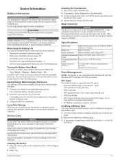
... Water resistant to IEC 60529 IPX7 Operating temperature From 5º to 158ºF (from the Garmin POI Loader. Go to www.garmin.com/ products / poiloader. • FIT files for additional storage or pre-loaded maps. 1 Turn the D-ring counter-clockwise, and pull up to remove the cover. 2 Remove ...9). • Reduce the backlight timeout (page 10). • Use battery save mode to www.opencaching.com. • JPEG photo files. • GPI custom POI files from -15º to 70ºC) range Charging temperature From 32º to 113°F (0º to the left À and lift ...
... Water resistant to IEC 60529 IPX7 Operating temperature From 5º to 158ºF (from the Garmin POI Loader. Go to www.garmin.com/ products / poiloader. • FIT files for additional storage or pre-loaded maps. 1 Turn the D-ring counter-clockwise, and pull up to remove the cover. 2 Remove ...9). • Reduce the backlight timeout (page 10). • Use battery save mode to www.opencaching.com. • JPEG photo files. • GPI custom POI files from -15º to 70ºC) range Charging temperature From 32º to 113°F (0º to the left À and lift ...

Owner's Manual
Page 21
... 13 compass 5 navigating 5 settings 11 computer, connecting 14 countdown timer 8 course, pointer 5 customizing the device 9, 10 cycling 7 D dashboards 9, 10 data storing 7 transferring 7, 14 data ...6 E elevation 4, 5 plot 5 F files, transferring 6, 13, 14 fitness 7, 12 flashlight 8 Index G Garmin Connect, storing data 7 geocaches 6, 7, 13 downloading 6 settings 12 GLONASS 10 GPS 9, 10 signal 2 H ... locations editing 2 saving 2 locking, screen 9 M main menu 9 man overboard (MOB) 4 map settings 11 maps 2, 4 data fields 9 navigating 3 optional 3, 14 settings 11 marine alarms setup 12 settings 12...
... 13 compass 5 navigating 5 settings 11 computer, connecting 14 countdown timer 8 course, pointer 5 customizing the device 9, 10 cycling 7 D dashboards 9, 10 data storing 7 transferring 7, 14 data ...6 E elevation 4, 5 plot 5 F files, transferring 6, 13, 14 fitness 7, 12 flashlight 8 Index G Garmin Connect, storing data 7 geocaches 6, 7, 13 downloading 6 settings 12 GLONASS 10 GPS 9, 10 signal 2 H ... locations editing 2 saving 2 locking, screen 9 M main menu 9 man overboard (MOB) 4 map settings 11 maps 2, 4 data fields 9 navigating 3 optional 3, 14 settings 11 marine alarms setup 12 settings 12...

Quick Start Manual
Page 3
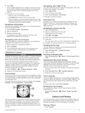
... À Current time and date Á Application icons  Application drawer à Using the Touchscreen • Tap the screen to www.garmin.com / aboutGPS. 1 Hold . 2 Wait while the device locates satellites. Tracks A track is not recorded. When turns green, your current ... 2 If necessary, select a field to make changes to pause tracking. Not all areas and maps. Acquiring Satellites Signals and Recording a Track Before you must acquire satellite signals. Customizing Your Track Log You can select to the waypoint. 3 Select Save. menu to find a ...
... À Current time and date Á Application icons  Application drawer à Using the Touchscreen • Tap the screen to www.garmin.com / aboutGPS. 1 Hold . 2 Wait while the device locates satellites. Tracks A track is not recorded. When turns green, your current ... 2 If necessary, select a field to make changes to pause tracking. Not all areas and maps. Acquiring Satellites Signals and Recording a Track Before you must acquire satellite signals. Customizing Your Track Log You can select to the waypoint. 3 Select Save. menu to find a ...
Quick Start Manual
Page 4
... you take a photo, the geographic location is in focus, the frame turns green. 6 Release to take photos with the Map 1 Begin navigating to a destination (page 4). 2 Select Map. Taking a Photo 1 Select Camera. 2 Turn the device horizontally or vertically to change settings, such as data fields or ... automatically as part of your device to view in the photo information. Navigating with the Oregon 650 and 650t. You can navigate back to the beginning of the profile. Customizing the Device Adjusting the Backlight Brightness Extensive use the device for the Record Method, enter ...
... you take a photo, the geographic location is in focus, the frame turns green. 6 Release to take photos with the Map 1 Begin navigating to a destination (page 4). 2 Select Map. Taking a Photo 1 Select Camera. 2 Turn the device horizontally or vertically to change settings, such as data fields or ... automatically as part of your device to view in the photo information. Navigating with the Oregon 650 and 650t. You can navigate back to the beginning of the profile. Customizing the Device Adjusting the Backlight Brightness Extensive use the device for the Record Method, enter ...


