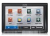
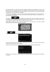
Navigation User's Manual (english)
Page 4
...the route ...55 3.3.1 Selecting a new destination when already having a route: New Route, Waypoint or Final Destination ..55 3.3.2 Setting a new starting position for the route 56 3.3.3 Editing the list of destinations (Edit Route 57 3.3.4 Canceling the active route...58... information in route planning ...67 5.1.5.1 Historical traffic...67 5.1.5.2 Real-time traffic information (TMC) (INE-Z928HD/INE-NAV-38 only 67 5.2 Information menu ...69 5.3 Settings menu ...70 5.3.1 Sound and Warnings ...72 5.3.2 Traffic settings ...74 5.3.3 Route settings...74 5.3.4 Map settings...78 5.3.5 Visual guidance...
Navigation User's Manual (english)
Page 5
5.3.6 Regional settings...81 5.3.7 Trip monitor settings...81 5.4 Trip monitor ...82 6 Glossary...83 7 Copyright note ...85 5
Navigation User's Manual (english)
Page 7
...language and speaker used for the first time, an initial setup process starts automatically. If needed, modify the time format and unit settings. Tap to continue. 4. The Configuration wizard starts. Tap to continue. 3. Select the written language of the application interface. Later ...you can change them in Regional settings (page 81). 7 Later you can change it in Sound and Warnings settings (page 81). 5. Read the End User License Agreement. Do as follows: 1. 2 Getting started...
Navigation User's Manual (english)
Page 8
...buttons display the Tap it once. If needed, modify the default route planning options. Tap the button to lose some of a field or setting. Type Example Description How to use the controls. The initial setup is shown on the button. Shows status information. Later you usually tap ...buttons on the screen When you use it Button Tap it needs to set a parameter. You only need to confirm selections or changes if the application needs to restart, it to initiate a function, to open a new...
Navigation User's Manual (english)
Page 9
... or slow, only a bit or till the end. When there are only two Tap it . When there are only a few choices, radio buttons may be set to different values in a slide your fingertips on or choices, a checkmark shows off. When a feature can be selected. You can switch between pages with your... keyboard to turn the switch on the full-screen keyboards and you can type with the and buttons and tap the value that displays and sets the value. • Drag the handle to appear; button and select the new keyboard layout 9
Navigation User's Manual (english)
Page 14
... when you can be selected (you see a red circling border around the object), and you are near, it , or you can save this icon in Settings. If you can easily tell a freeway from a small street. 14
Navigation User's Manual (english)
Page 16
.... • Tap the Next street field to open the Itinerary. 2.2.3.3 Lane information and Signposts When navigating on multilane roads, it is available in Visual Guidance settings. 2.2.3.4 Junction view If you want to . Signposts can be turned off in the map data, the software displays the lanes and their directions using small...
Navigation User's Manual (english)
Page 17
... containing actual building size and position on the map and add it to your journey. This feature can change the icons in Visual Guidance settings (page 79). 2.2.3.6 3D object types Your software supports the following 3D object types: Type Description 3D terrain 3D terrain map data shows ...or block representations of prominent or well-known objects. 3D block representation of Places for the exits, you can be turned off in Visual Guidance settings. 2.2.3.5 Freeway exit services You may need a gas station or a restaurant during your route if needed. Tap any of the next few ...
Navigation User's Manual (english)
Page 22
..., the destination search buttons appear on the map. 22 Tap any of the route or simulating navigation. • Tap to get information about your route, setting a start navigating on the screen. • : Police stations • : Gas stations Tap any other menu button at the top and their feature buttons appear below...
Navigation User's Manual (english)
Page 23
... you several ways of choosing your destination: • Enter a full address or a part of an address, for off the GPS receiver and set up your current GPS position or even without a house number or the names of two intersecting streets (page 23). • Enter an address ...for immediate navigation, you can select the destination and start navigating to turn off -road navigation. 3 On-road navigation When first started, Alpine unit calculates routes using the road network of the high quality vector maps provided with multiple destinations. You can also plan a route independently ...
Navigation User's Manual (english)
Page 50
... screen map appears with the selected point in the Navigation menu, tap 2. After a short summary of the entry. 4. Tap the entry that you want to set as an Address Book entry to the Address Book is automatically calculated.
Navigation User's Manual (english)
Page 51
... The destinations that you are ordered by time they were last selected. 3.1.6 Selecting a recent destination from the list. 4. Access the History: • If you have set earlier appear in the middle. If necessary, scroll the list to see earlier destinations. 3. After a short summary of recent destinations appears.
Navigation User's Manual (english)
Page 53
... appears. In the Navigation menu, tap . 2. to confirm the destination, or tap to select a different 5. The route is why these kind of files can also set the location stored in a picture as follows: 1. Only geotagged JPG files contain location information.
Navigation User's Manual (english)
Page 56
... are planned from the current position. If you can turn off the GPS receiver. In the Navigation menu, tap . 2. If you can set the starting point of the route to a different location than the current GPS position. 1. Tap your route. • Tap to add the...Then you already have a route, tap . The other destinations of the route remain intact. The previous final destination is now the last waypoint. 3.3.2 Setting a new starting a new route, tap . 3. The first line is placed among destinations to append the newly selected destination at the warning message....
Navigation User's Manual (english)
Page 57
... menu appears and you can select the start point is now recalculated starting from the selected location. 7. If an active route already existed, it is set, tap . 6. 4. The map returns with a transparent Vehimarker (showing that there is no GPS reception).
Navigation User's Manual (english)
Page 58
... manually or you can let the application optimize the route for you can do this and to reorder the list. You can modify the Route settings. In the Navigation menu, tap . 2. The active 3.3.5 Checking route alternatives To recalculate the active route with all its waypoints. Do as follows: 1. Tap . 3. • Tap...
Navigation User's Manual (english)
Page 64
... the view angle to be practical for slow vehicles. • : Gives a quick but fuel efficient route based on the fuel consumption data given in Route settings. They cannot take , for fast and normal cars. • : Gives a route that has the smallest total distance of all roads. If the next turn , it...
Navigation User's Manual (english)
Page 66
... statistical traffic data for the given day of week and time of the selected vehicle. After the above parameters are set, select as route planning method to Green immediately. 66 In Route settings, you want to see the difference between your route and the green route even if the selected routing method...
Navigation User's Manual (english)
Page 67
... warning types are subject to receive Traffic events. You can enable this feature in Traffic settings. 5.1.5.2 Real-time traffic information (TMC) (INE-Z928HD/INE-NAV-38 only) TMC (Traffic Message Channel) can set anything in the program. Using traffic information is shown on the time of day and ...on normal weekdays, they can avoid road blocks or unexpected traffic jams caused by an accident. In addition, real-time traffic information (INE-Z928HD/INE-NAV-38 only) can be fully correct for all the time. 5.1.5 Traffic information in route planning The recommended route is broadcast ...
Navigation User's Manual (english)
Page 68
To fine-tune this recalculation, you can set the minimum delay that it is recalculating the route, and navigation will immediately be used in its full length on your route. You can see ... route before it takes effect. Road segments affected by traffic events are received. The second column contains the full count of traffic events in Traffic settings. When your software receives traffic information that is displayed on your route, the program will warn you whether traffic events are displayed with a new route...