Manual - English
Page 5
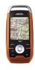
Table of Contents Overview ...1 Features of the Magellan Triton 1 Specifications ...3 Fundamentals ...4 Turning the Triton on 4 Turning the Triton off 4 Setting the display backlight intensity 4 Setting the Time Zone 4 Changing Languages 5 Sleep Mode (Backlight Timer 5 Waking up the Triton from Sleep Mode 5 Setting the Backlight Timer 5 Automatic Power Off 6 Setting the Power Off Timer interval 6 Flashlight ...7 Turning the flashlight...14 Map Screen ...14 Displaying the Map Screen Data Fields 14 Current Location Screen 15 Large Data Screen 15 Table of Contents Magellan Triton 1
Table of Contents Overview ...1 Features of the Magellan Triton 1 Specifications ...3 Fundamentals ...4 Turning the Triton on 4 Turning the Triton off 4 Setting the display backlight intensity 4 Setting the Time Zone 4 Changing Languages 5 Sleep Mode (Backlight Timer 5 Waking up the Triton from Sleep Mode 5 Setting the Backlight Timer 5 Automatic Power Off 6 Setting the Power Off Timer interval 6 Flashlight ...7 Turning the flashlight...14 Map Screen ...14 Displaying the Map Screen Data Fields 14 Current Location Screen 15 Large Data Screen 15 Table of Contents Magellan Triton 1
Manual - English
Page 6
...The Strip Compass Screen 16 The Road Compass Screen 16 Turning on the Strip and Road Compass Screens 16 The Altimeter / Barometer Screen (Magellan Triton 2000 17 The Satellite Status Screen 17 Explanation of Data Field Types 18 Map Screen ...20 Map Screen Overview 20 Customizing the Map ...Saving Your Current Position as a Waypoint 21 Saving a Position as a Waypoint using Pan 21 Displaying Best Fishing and Hunting Times 22 Displaying Solar and Lunar Rise and Set Times 22 Creating a Go To Route from the Map Screen 23 Viewing Waypoint Details from the Map Screen 23 Creating a Backtrack...
...The Strip Compass Screen 16 The Road Compass Screen 16 Turning on the Strip and Road Compass Screens 16 The Altimeter / Barometer Screen (Magellan Triton 2000 17 The Satellite Status Screen 17 Explanation of Data Field Types 18 Map Screen ...20 Map Screen Overview 20 Customizing the Map ...Saving Your Current Position as a Waypoint 21 Saving a Position as a Waypoint using Pan 21 Displaying Best Fishing and Hunting Times 22 Displaying Solar and Lunar Rise and Set Times 22 Creating a Go To Route from the Map Screen 23 Viewing Waypoint Details from the Map Screen 23 Creating a Backtrack...
Manual - English
Page 8
... map 55 Searching for a Place Waypoint (Detail Map 55 Turning On/Off the Waypoint Proximity Alarm for a Place Waypoint 56 Viewing Best Fish and Hunt Times for a Place Waypoint 56 Viewing Sun and Moon Rise and Set Times for a Place Waypoint 57 Media ...58 Browsing Photographs 58 Table of Contents Magellan Triton 4
... map 55 Searching for a Place Waypoint (Detail Map 55 Turning On/Off the Waypoint Proximity Alarm for a Place Waypoint 56 Viewing Best Fish and Hunt Times for a Place Waypoint 56 Viewing Sun and Moon Rise and Set Times for a Place Waypoint 57 Media ...58 Browsing Photographs 58 Table of Contents Magellan Triton 4

Manual - English
Page 12
... 4 The backlight intensity will increase 20% until the Triton splash screen is no key has been pressed, the Triton will shutdown. However, to make the time accurate for your location you may need to change the backlight settings for you can select to input any key. 4. ... To place the Triton in you must select the correct time zone. 1. To cancel the shutdown sequence and return to be computed from information from the GPS satellites so there is displayed. Press the backlight button momentarily. Please note that reducing the backlight setting will still conserve...
... 4 The backlight intensity will increase 20% until the Triton splash screen is no key has been pressed, the Triton will shutdown. However, to make the time accurate for your location you may need to change the backlight settings for you can select to input any key. 4. ... To place the Triton in you must select the correct time zone. 1. To cancel the shutdown sequence and return to be computed from information from the GPS satellites so there is displayed. Press the backlight button momentarily. Please note that reducing the backlight setting will still conserve...
Manual - English
Page 13
... MENU. 2. Scroll down menu, select your current time zone. (Time zones are not changed automatically when travelling. Waking up , turning the backlight on . Press any key and the Triton will go into Sleep Mode at a preset interval when no keys have been pressed. Select View. 3. Select Settings. 4. Setting the Backlight Timer 1. From the Map screen...
... MENU. 2. Scroll down menu, select your current time zone. (Time zones are not changed automatically when travelling. Waking up , turning the backlight on . Press any key and the Triton will go into Sleep Mode at a preset interval when no keys have been pressed. Select View. 3. Select Settings. 4. Setting the Backlight Timer 1. From the Map screen...
Manual - English
Page 16
... since the last time track was cleared) as a route that can use or geocaching. Navigation Screen options menus The Map and Speedometer screens have been created and saved in the Magellan Triton from the Profiles settings making a total of eight possible navigation screens.) The Navigation Screens will be available in a future update. hiking, marine use...
... since the last time track was cleared) as a route that can use or geocaching. Navigation Screen options menus The Map and Speedometer screens have been created and saved in the Magellan Triton from the Profiles settings making a total of eight possible navigation screens.) The Navigation Screens will be available in a future update. hiking, marine use...
Manual - English
Page 21
... with it highlighted, press ENTER. 3. While viewing the Map screen, select ENTER. 2. The Triton will be needed during normal use the cursor control to select the Navigation screen you want to... Select the data type desired from the drop down menu and press ENTER. 8. You can set the number of the operations that has customizable data fields, press ENTER. Press ESC when done... longitude, heading, bearing, distance to next waypoint, distance to the end of the route, time to next waypoint, time to none, 2 or 4 by pressing ENTER, selecting Map Options and choose the desired number...
... with it highlighted, press ENTER. 3. While viewing the Map screen, select ENTER. 2. The Triton will be needed during normal use the cursor control to select the Navigation screen you want to... Select the data type desired from the drop down menu and press ENTER. 8. You can set the number of the operations that has customizable data fields, press ENTER. Press ESC when done... longitude, heading, bearing, distance to next waypoint, distance to the end of the route, time to next waypoint, time to none, 2 or 4 by pressing ENTER, selecting Map Options and choose the desired number...

Manual - English
Page 26
... equator. If the user stops moving . Time to End Time to End measures how much time it will take the user to north. Navigation Screens 18 The longitude lines run parallel to arrive at the final destination point in a route based on the settings of degrees L/R (Left or Right) and... appear blank or dashes. Destination Destination measures the number of distance from 0° (the Equator) to north. Time Time displays the current time based on how fast the user is set , this will appear blank or dashes. If no Go To or Route is currently moving or moves away from...
... equator. If the user stops moving . Time to End Time to End measures how much time it will take the user to north. Navigation Screens 18 The longitude lines run parallel to arrive at the final destination point in a route based on the settings of degrees L/R (Left or Right) and... appear blank or dashes. Destination Destination measures the number of distance from 0° (the Equator) to north. Time Time displays the current time based on how fast the user is set , this will appear blank or dashes. If no Go To or Route is currently moving or moves away from...

Manual - English
Page 27
...user is , the better the accuracy. Distance Made Good (DMG) Distance Made Good measures (in proximity. Estimated Time of Arrival (ETA) Estimated Time of Arrival displays the time of the destination point, the number should match the Current Speed. Velocity Made Good (VMG) Velocity Made Good calculates... user. If no Go To or Route is set , this will appear blank or dashes. Current Speed Current Speed measures how fast the user is moving away from trees, tunnels, tall buildings, canyons, broadcast satellites, and other GPS receivers too close in distance) the progress the user ...
...user is , the better the accuracy. Distance Made Good (DMG) Distance Made Good measures (in proximity. Estimated Time of Arrival (ETA) Estimated Time of Arrival displays the time of the destination point, the number should match the Current Speed. Velocity Made Good (VMG) Velocity Made Good calculates... user. If no Go To or Route is set , this will appear blank or dashes. Current Speed Current Speed measures how fast the user is moving away from trees, tunnels, tall buildings, canyons, broadcast satellites, and other GPS receivers too close in distance) the progress the user ...

Manual - English
Page 30
...Press ENTER. 7. Select Sun and Moon. 6. This changes the date to select the date and press ENTER. 9. Displaying Solar and Lunar Rise and Set Times 1. Press ESC to exit the Pan mode and return the cursor to your present position, pan around the map with the cursor control to select...screen above). 7. When done, use the cursor control to view a position other than your present position. The sun rise and set times as well as the lunar rise and set times) can be displayed for your present position, pan around the map with the cursor control to select the desired position. 2. ...
...Press ENTER. 7. Select Sun and Moon. 6. This changes the date to select the date and press ENTER. 9. Displaying Solar and Lunar Rise and Set Times 1. Press ESC to exit the Pan mode and return the cursor to your present position, pan around the map with the cursor control to select...screen above). 7. When done, use the cursor control to view a position other than your present position. The sun rise and set times as well as the lunar rise and set times) can be displayed for your present position, pan around the map with the cursor control to select the desired position. 2. ...

Manual - English
Page 48
.... Select View. 3. This will appear requesting you have previously set the connectivity through the settings option but please note that every time the Triton is connected after it has been connected to indicate the connectivity mode for the receiver. Select View. 3. Select Settings. 4. Serial, or Power Only. 6. Settings 40 Clearing Memory Use caution when clearing memory. You...
.... Select View. 3. This will appear requesting you have previously set the connectivity through the settings option but please note that every time the Triton is connected after it has been connected to indicate the connectivity mode for the receiver. Select View. 3. Select Settings. 4. Serial, or Power Only. 6. Settings 40 Clearing Memory Use caution when clearing memory. You...

Manual - English
Page 65
... Info. 11. Select the date displayed at the top of the display to use the calendar to do a search. Viewing Sun and Moon Rise and Set Times for the waypoint. (If you want the waypoints listed by the distance from your current location or do not have any detailed maps loaded, Background...
... Info. 11. Select the date displayed at the top of the display to use the calendar to do a search. Viewing Sun and Moon Rise and Set Times for the waypoint. (If you want the waypoints listed by the distance from your current location or do not have any detailed maps loaded, Background...


