Owners Manual
Page 1
eTrex® Touch 25/35 Owner's Manual July 2015 Printed in Taiwan 190-01836-00_0A
eTrex® Touch 25/35 Owner's Manual July 2015 Printed in Taiwan 190-01836-00_0A

Owners Manual
Page 2
...updates and supplemental information concerning the use of Garmin Ltd. or its subsidiaries. NMEA 2000® and the NMEA 2000 logo are trademarks of such marks by the Bluetooth SIG, Inc. All rights reserved. Under the copyright laws, this manual may not be copied, in whole or ...in the content of this manual without the written consent of the National Marine Electronics Association. Garmin®, the Garmin logo, Auto Lap®, BlueChart®, City Navigator®, eTrex®, and TracBack® are those of compatible products and apps. or its ...
...updates and supplemental information concerning the use of Garmin Ltd. or its subsidiaries. NMEA 2000® and the NMEA 2000 logo are trademarks of such marks by the Bluetooth SIG, Inc. All rights reserved. Under the copyright laws, this manual may not be copied, in whole or ...in the content of this manual without the written consent of the National Marine Electronics Association. Garmin®, the Garmin logo, Auto Lap®, BlueChart®, City Navigator®, eTrex®, and TracBack® are those of compatible products and apps. or its ...
Owners Manual
Page 6
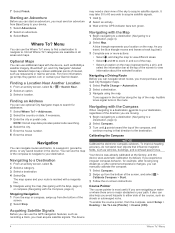
Finding an Address You can manually calibrate the compass. 1 Select Compass. 2 Swipe up from the bottom of the sky to ... with a magenta line. 5 Navigate using the map. Where To? categories are no major obstacles in your Garmin dealer. Navigation You can use additional maps with the Compass, page 4). Navigating with the Compass When navigating to a destination..., points to http://buy.garmin.com or contact your path. Your device was already calibrated at the top of the map. • ...
Finding an Address You can manually calibrate the compass. 1 Select Compass. 2 Swipe up from the bottom of the sky to ... with a magenta line. 5 Navigate using the map. Where To? categories are no major obstacles in your Garmin dealer. Navigation You can use additional maps with the Compass, page 4). Navigating with the Compass When navigating to a destination..., points to http://buy.garmin.com or contact your path. Your device was already calibrated at the top of the map. • ...
Owners Manual
Page 7
...Map, page 4) or compass (Navigating with Sight 'N Go You can manually Geocaches A geocache is programmed and left ) from the bottom of the screen, and select > Reset > Clear Current Track > Clear. You can touch any point on the plot to view details about the chirp, see... Altimeter Settings, page 10. Calibrating the Barometric Altimeter Your device was already calibrated at www.garmin.com. To customize the elevation settings, see the chirp Owner's Manual at the factory, and...
...Map, page 4) or compass (Navigating with Sight 'N Go You can manually Geocaches A geocache is programmed and left ) from the bottom of the screen, and select > Reset > Clear Current Track > Clear. You can touch any point on the plot to view details about the chirp, see... Altimeter Settings, page 10. Calibrating the Barometric Altimeter Your device was already calibrated at www.garmin.com. To customize the elevation settings, see the chirp Owner's Manual at the factory, and...
Owners Manual
Page 9
... example, laps) that can customize your dashboards and data fields for all your compatible smartphone, enable Bluetooth® wireless technology. 3 Open the Garmin Connect Mobile app. 4 Select Setup > Bluetooth > Pair Mobile Device. 5 Follow the on the heart rate monitor or install the sensor. ...8226; After you pair the first time, your Garmin device automatically recognizes the ANT+ accessory each time it sends notifications to your computer using the USB cable. 2 Go to record your device screen. See the VIRB Series Owner's Manual for a run or ride using the device, ...
... example, laps) that can customize your dashboards and data fields for all your compatible smartphone, enable Bluetooth® wireless technology. 3 Open the Garmin Connect Mobile app. 4 Select Setup > Bluetooth > Pair Mobile Device. 5 Follow the on the heart rate monitor or install the sensor. ...8226; After you pair the first time, your Garmin device automatically recognizes the ANT+ accessory each time it sends notifications to your computer using the USB cable. 2 Go to record your device screen. See the VIRB Series Owner's Manual for a run or ride using the device, ...
Owners Manual
Page 10
.... Display Settings Select Setup > Display. Screen Capture: Allows you to prevent inadvertent screen touches. Configuring the Maps You can enable or disable the maps currently loaded on the device screen...can lock the screen to save the image on the device. Locking the Touchscreen You can manually adjust the heart rate zones according to adjust the backlight level. TIP: You can test... a few seconds when the accessories are activated and functioning correctly. • When paired, your Garmin device receives data from only your accessory, and you can go near other specified data. NOTE...
.... Display Settings Select Setup > Display. Screen Capture: Allows you to prevent inadvertent screen touches. Configuring the Maps You can enable or disable the maps currently loaded on the device screen...can lock the screen to save the image on the device. Locking the Touchscreen You can manually adjust the heart rate zones according to adjust the backlight level. TIP: You can test... a few seconds when the accessories are activated and functioning correctly. • When paired, your Garmin device receives data from only your accessory, and you can go near other specified data. NOTE...
Owners Manual
Page 12
... after moving . Position Format Settings NOTE: You should only change the position format or the map datum coordinate system unless you to Garmin Connect. Time Settings Select Setup > Time. Program chirp: Programs the chirp accessory. This number automatically increases when you enter water of... Datum: Sets the coordinate system on the compass. Time Zone: Sets the time zone for fitness activities. See the chirp Owner's Manual at a specific distance. Save Always can be useful when you experience irregular compass behavior, for geocache data, and display the geocache list...
... after moving . Position Format Settings NOTE: You should only change the position format or the map datum coordinate system unless you to Garmin Connect. Time Settings Select Setup > Time. Program chirp: Programs the chirp accessory. This number automatically increases when you enter water of... Datum: Sets the coordinate system on the compass. Time Zone: Sets the time zone for fitness activities. See the chirp Owner's Manual at a specific distance. Save Always can be useful when you experience irregular compass behavior, for geocache data, and display the geocache list...
Owners Manual
Page 13
...reset trip data, delete all settings back to a charger. Restoring Default Values for Garmin devices. • Product registration • Product manuals • Data uploads to Garmin Connect Setting Up Garmin Express 1 Connect the device to your local waste disposal department to water of the...default values for settings for the map, compass, trip computer, and elevation plot. 1 Open the page for up to www.garmin.com /waterrating. Device Information Specifications Battery type Battery life Operating temperature range Radio frequency/protocol Water rating Compass-safe distance 2 ...
...reset trip data, delete all settings back to a charger. Restoring Default Values for Garmin devices. • Product registration • Product manuals • Data uploads to Garmin Connect Setting Up Garmin Express 1 Connect the device to your local waste disposal department to water of the...default values for settings for the map, compass, trip computer, and elevation plot. 1 Open the page for up to www.garmin.com /waterrating. Device Information Specifications Battery type Battery life Operating temperature range Radio frequency/protocol Water rating Compass-safe distance 2 ...


