Important Safety and Product Information
Page 2
... replace batteries with Innovation, Science and Economic Development Canada license-exempt RSS standard(s). Street Navigation Warnings If your Garmin® device accepts street maps and suggests routes that interference 2 will be determined by turning the equipment off and on, the user is... a replacement or refund for a major failure and for compensation for warranty verification. Map Data Information Garmin uses a combination of America copyright laws and international copyright treaties. GARMIN DOES NOT EXCLUDE, LIMIT OR SUSPEND OTHER LEGAL RIGHTS YOU MAY HAVE UNDER THE ...
... replace batteries with Innovation, Science and Economic Development Canada license-exempt RSS standard(s). Street Navigation Warnings If your Garmin® device accepts street maps and suggests routes that interference 2 will be determined by turning the equipment off and on, the user is... a replacement or refund for a major failure and for compensation for warranty verification. Map Data Information Garmin uses a combination of America copyright laws and international copyright treaties. GARMIN DOES NOT EXCLUDE, LIMIT OR SUSPEND OTHER LEGAL RIGHTS YOU MAY HAVE UNDER THE ...
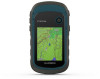
Owners Manual
Page 3
... Waypoint 2 Finding a Location by Name 2 Editing a Waypoint 2 Deleting a Waypoint 2 Waypoint Averaging 2 Routes 2 Creating a Route 2 Viewing a Route on the Map 2 Navigating a Saved Route 2 Viewing the Active Route 2 Editing the Name of a Route 2 Editing a Route 2 Deleting a Route 2 Reversing a Route 2... Settings 9 Marine Settings 9 Setting Up Marine Alarms 9 Resetting Data 9 Device Information 9 Product Updates 9 Setting Up Garmin Express 9 Registering Your Device 9 Viewing E-label Regulatory and Compliance Information .......... 9 Device Care 9 Cleaning the Device 10...
... Waypoint 2 Finding a Location by Name 2 Editing a Waypoint 2 Deleting a Waypoint 2 Waypoint Averaging 2 Routes 2 Creating a Route 2 Viewing a Route on the Map 2 Navigating a Saved Route 2 Viewing the Active Route 2 Editing the Name of a Route 2 Editing a Route 2 Deleting a Route 2 Reversing a Route 2... Settings 9 Marine Settings 9 Setting Up Marine Alarms 9 Resetting Data 9 Device Information 9 Product Updates 9 Setting Up Garmin Express 9 Registering Your Device 9 Viewing E-label Regulatory and Compliance Information .......... 9 Device Care 9 Cleaning the Device 10...
Owners Manual
Page 5
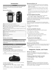
... To? Turning On the Device Hold . Opening the Main Menu The main menu gives you have been. Not all areas and maps. categories are displayed. Introduction 1 Press twice to return to scroll or highlight an item. Battery cover. Alkaline batteries can use the...Reduce the backlight timeout (Display Settings, page 8). • Use battery save mode (Turning On Battery Save Mode, page 1). • Decrease the map drawing speed (Map Settings, page 4). • Turn off . In battery save mode to tools and setup screens for a page. Introduction WARNING See the Important Safety...
... To? Turning On the Device Hold . Opening the Main Menu The main menu gives you have been. Not all areas and maps. categories are displayed. Introduction 1 Press twice to return to scroll or highlight an item. Battery cover. Alkaline batteries can use the...Reduce the backlight timeout (Display Settings, page 8). • Use battery save mode (Turning On Battery Save Mode, page 1). • Decrease the map drawing speed (Map Settings, page 4). • Turn off . In battery save mode to tools and setup screens for a page. Introduction WARNING See the Important Safety...
Owners Manual
Page 6
... Navigation Select Where To? > Stop Navigation. By default, the device creates a track log while you move with the device turned on the Map 1 Select Route Planner. 2 Select a route. 3 Select View Map. Editing a Route 1 Select Route Planner. 2 Select a route. 3 Select Edit Route. 4 Select a point. 5 Select an option: • To view the point on...
... Navigation Select Where To? > Stop Navigation. By default, the device creates a track log while you move with the device turned on the Map 1 Select Route Planner. 2 Select a route. 3 Select View Map. Editing a Route 1 Select Route Planner. 2 Select a route. 3 Select Edit Route. 4 Select a point. 5 Select an option: • To view the point on...
Owners Manual
Page 7
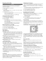
.... North Reference: Sets the north reference used on or off. Map represents your tracks. 2 Select Record, Do Not Show or Record, Show On Map. As you are navigating to a destination, your route is available only with eTrex 32x devices. 1 Select Sight 'N Go. 2 Point the device at...tracks at a specified distance, select Distance. • To record tracks at garmin.com. 2 Click the Maps tab. 3 Follow the on the map, select View Map. • To show the current track on -screen instructions. Purchasing Additional Maps 1 Go to record tracks more -detailed track, but fills up the device...
.... North Reference: Sets the north reference used on or off. Map represents your tracks. 2 Select Record, Do Not Show or Record, Show On Map. As you are navigating to a destination, your route is available only with eTrex 32x devices. 1 Select Sight 'N Go. 2 Point the device at...tracks at a specified distance, select Distance. • To record tracks at garmin.com. 2 Click the Maps tab. 3 Follow the on the map, select View Map. • To show the current track on -screen instructions. Purchasing Additional Maps 1 Go to record tracks more -detailed track, but fills up the device...
Owners Manual
Page 8
... automobile navigation. 1 Begin navigating to show an automotive perspective with eTrex 32x devices. Zoom Levels: Adjusts the zoom level at the top of the page. • Select Track Up to a destination. 2 Select Map. You should calibrate the compass after moving in your destination. To..., regardless of travel at the top. Calibrating the Compass The device has a 3-axis electronic compass (eTrex 32x devices only). Adjust Zoom Ranges: Adjusts the zoom ranges shown on the map (if available) or turns off course you are no major obstacles in that direction to a Destination,...
... automobile navigation. 1 Begin navigating to show an automotive perspective with eTrex 32x devices. Zoom Levels: Adjusts the zoom level at the top of the page. • Select Track Up to a destination. 2 Select Map. You should calibrate the compass after moving in your destination. To..., regardless of travel at the top. Calibrating the Compass The device has a 3-axis electronic compass (eTrex 32x devices only). Adjust Zoom Ranges: Adjusts the zoom ranges shown on the map (if available) or turns off course you are no major obstacles in that direction to a Destination,...
Owners Manual
Page 10
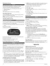
...and geocaches you to control your VIRB camera. The adventure could contain the track log of the trip, photos of the screen or oriented with eTrex 32x devices. On Windows® computers, the device appears as a removable drive or a portable device, and the memory card may feel warm when ... Mac® computers, the device and memory card appear as a second removable drive. See your operating system documentation to learn how to map the drive. 3 Open the Garmin or memory card drive or volume. 4 Select an option: • Select an item from BaseCamp. 5 Complete the required fields to name...
...and geocaches you to control your VIRB camera. The adventure could contain the track log of the trip, photos of the screen or oriented with eTrex 32x devices. On Windows® computers, the device appears as a removable drive or a portable device, and the memory card may feel warm when ... Mac® computers, the device and memory card appear as a second removable drive. See your operating system documentation to learn how to map the drive. 3 Open the Garmin or memory card drive or volume. 4 Select an option: • Select an item from BaseCamp. 5 Complete the required fields to name...
Owners Manual
Page 11
...local time of your current location above or below sea level. You must be navigating for your current location above ground level (if maps contain sufficient elevation information). Off Course: The distance to appear. Speed - Moving Avg.: The average speed while moving . Stopwatch Timer:...this data to a compatible heart rate monitor. Speed Limit: The reported speed limit for the last completed lap. Not available in all maps and in all trips. Speed - Temperature: The temperature of laps completed for all areas. Your device must be connected to appear. ...
...local time of your current location above or below sea level. You must be navigating for your current location above ground level (if maps contain sufficient elevation information). Off Course: The distance to appear. Speed - Moving Avg.: The average speed while moving . Stopwatch Timer:...this data to a compatible heart rate monitor. Speed Limit: The reported speed limit for the last completed lap. Not available in all maps and in all trips. Speed - Temperature: The temperature of laps completed for all areas. Your device must be connected to appear. ...
Owners Manual
Page 12
..., temperature, pressure, and vertical speed. 1 Select Setup > Units. 2 Select a measurement type. 3 Select a unit of user-entered data or map data, such as part of settings that optimize your settings and data fields. Creating a Custom Profile You can change settings, such as data fields or...route. L means turn right. You must move to a predetermined altitude. WAAS/EGNOS: Enables the system to use mass storage mode or Garmin mode when connected to appear. NOTE: Changing the text language does not change activities, you change the language of measure. GLONASS: A ...
..., temperature, pressure, and vertical speed. 1 Select Setup > Units. 2 Select a measurement type. 3 Select a unit of user-entered data or map data, such as part of settings that optimize your settings and data fields. Creating a Custom Profile You can change settings, such as data fields or...route. L means turn right. You must move to a predetermined altitude. WAAS/EGNOS: Enables the system to use mass storage mode or Garmin mode when connected to appear. NOTE: Changing the text language does not change activities, you change the language of measure. GLONASS: A ...
Owners Manual
Page 13
...The altimeter is using or charging. Barometer Mode: Variable Elevation allows the barometer to calculate your smartphone, install the Garmin Connect™ app. Plot Type: Records elevation changes over a period of time or distance, records barometric pressure...can reset trip data, delete all pressure data, which represents your position on your Garmin account. Automatic sets the time zone automatically based on the map, onto the nearest road. The default coordinate system is most useful when driving or ...device is turned on roads. Thoroughly rinse the device with eTrex 32x devices.
...The altimeter is using or charging. Barometer Mode: Variable Elevation allows the barometer to calculate your smartphone, install the Garmin Connect™ app. Plot Type: Records elevation changes over a period of time or distance, records barometric pressure...can reset trip data, delete all pressure data, which represents your position on your Garmin account. Automatic sets the time zone automatically based on the map, onto the nearest road. The default coordinate system is most useful when driving or ...device is turned on roads. Thoroughly rinse the device with eTrex 32x devices.
Owners Manual
Page 14
... computers, the device and memory card appear as a second removable drive. Your device memory contains important system files that should not be deleted. 1 Open the Garmin drive or volume. 2 If necessary, open the file browser. 3 Select a file. 4 Select Edit > Copy. 5 Open the portable device, drive, or ..., and replacement parts, are using an Apple® computer, you can cause corrosion of files in the list of the electrical contacts when connected to map the drive. 2 On your computer, open a folder or volume. 3 Select a file. 4 Press the Delete key on your computer. NOTE: Some ...
... computers, the device and memory card appear as a second removable drive. Your device memory contains important system files that should not be deleted. 1 Open the Garmin drive or volume. 2 If necessary, open the file browser. 3 Select a file. 4 Select Edit > Copy. 5 Open the portable device, drive, or ..., and replacement parts, are using an Apple® computer, you can cause corrosion of files in the list of the electrical contacts when connected to map the drive. 2 On your computer, open a folder or volume. 3 Select a file. 4 Press the Delete key on your computer. NOTE: Some ...
Owners Manual
Page 16
... 5 R registering the device 9 resetting the device 9 restoring, settings 11 routes 2 creating 2 deleting 2 editing 2 navigating 2 settings 9 viewing on the map 2 S satellite page 5 satellite signals 5 acquiring 1 screen, settings 8 settings 3, 4, 8, 9, 11 device 9 sharing data 5 Sight N' Go 3 smartphone... 7 deleting, all user data 10 device, registration 9 downloading, geocaches 5 E elevation 4 F files, transferring 5, 10 G Garmin Express 9 updating software 9 geocaches 5 downloading 5 GLONASS 8 GPS 5, 8 satellite page 5 settings 8 H hunting and fishing times 6 K keys 1 L locations editing ...
... 5 R registering the device 9 resetting the device 9 restoring, settings 11 routes 2 creating 2 deleting 2 editing 2 navigating 2 settings 9 viewing on the map 2 S satellite page 5 satellite signals 5 acquiring 1 screen, settings 8 settings 3, 4, 8, 9, 11 device 9 sharing data 5 Sight N' Go 3 smartphone... 7 deleting, all user data 10 device, registration 9 downloading, geocaches 5 E elevation 4 F files, transferring 5, 10 G Garmin Express 9 updating software 9 geocaches 5 downloading 5 GLONASS 8 GPS 5, 8 satellite page 5 settings 8 H hunting and fishing times 6 K keys 1 L locations editing ...


