Important Safety and Product Information
Page 2
... to a Garmin Authorized service facility in a residential installation. Use of such devices may , in other transmitter or antenna. The device emits RF energy below the published limits when operating in its sole discretion and subject to applicable laws, repair or replace your product with a new device or a refurbished device that the customer shall be determined by all available navigation sources, including road signs, road closures, road conditions, traffic congestion, weather...
... to a Garmin Authorized service facility in a residential installation. Use of such devices may , in other transmitter or antenna. The device emits RF energy below the published limits when operating in its sole discretion and subject to applicable laws, repair or replace your product with a new device or a refurbished device that the customer shall be determined by all available navigation sources, including road signs, road closures, road conditions, traffic congestion, weather...
Owners Manual
Page 3
... GPS Signals 9 Home Screen 10 Opening an App 10 Adding Shortcuts to the Home Screen 11 Viewing Notifications 11 Status Bar Icons 11 Using the Touchscreen 11 Adjusting the Screen Brightness.......... 11 Vehicle Profiles 12 Adding a Vehicle Profile 12 Car Profile 12 Switching the Vehicle Profile 12 Changing Your Trailer Information...... 13 Editing a Vehicle Profile 13 Driver Awareness Features and Alerts 14 Enabling or Disabling Driver Alerts.......14 Red Light and Speed Cameras 15 Finding and Saving Locations......... 15 Points of...
... GPS Signals 9 Home Screen 10 Opening an App 10 Adding Shortcuts to the Home Screen 11 Viewing Notifications 11 Status Bar Icons 11 Using the Touchscreen 11 Adjusting the Screen Brightness.......... 11 Vehicle Profiles 12 Adding a Vehicle Profile 12 Car Profile 12 Switching the Vehicle Profile 12 Changing Your Trailer Information...... 13 Editing a Vehicle Profile 13 Driver Awareness Features and Alerts 14 Enabling or Disabling Driver Alerts.......14 Red Light and Speed Cameras 15 Finding and Saving Locations......... 15 Points of...
Owners Manual
Page 4
... a Bluetooth Device....... 37 Deleting a Paired Bluetooth Device...... 38 Deleting a Paired Phone 38 Traffic 38 Receiving Traffic Data Using Your Smartphone 38 Viewing Traffic on the Map 38 Searching for Traffic Incidents......... 38 photoLive Traffic Cameras 38 Viewing and Saving photoLive Traffic Cameras 39 Saving a Traffic Camera 39 Vehicle and Driver Tools 39 Break Planning 39 Taking a Suggested Break 39 Starting the Break Timer 39 Pausing and Resetting the Break Timer 40 Adjusting Drive Hours 40 Adjusting the Daily Driving Limit...... 40 IFTA 40 Entering...
... a Bluetooth Device....... 37 Deleting a Paired Bluetooth Device...... 38 Deleting a Paired Phone 38 Traffic 38 Receiving Traffic Data Using Your Smartphone 38 Viewing Traffic on the Map 38 Searching for Traffic Incidents......... 38 photoLive Traffic Cameras 38 Viewing and Saving photoLive Traffic Cameras 39 Saving a Traffic Camera 39 Vehicle and Driver Tools 39 Break Planning 39 Taking a Suggested Break 39 Starting the Break Timer 39 Pausing and Resetting the Break Timer 40 Adjusting Drive Hours 40 Adjusting the Daily Driving Limit...... 40 IFTA 40 Entering...
Owners Manual
Page 5
...Editing a Driver Profile 53 Clearing Garmin eLog App Data....... 54 Voice Command 54 Tips for Speaking to the Device........... 54 Launching Garmin Voice-Activated Navigation 54 Checking Your Arrival Time 54 Placing a Phone Call Using Your Voice 54 Changing Device Settings Using Your Voice 55 Using the Apps 55 Viewing the Owner's Manual on Your Device 55 Viewing the Truck Map 55 Route Planner 55 Planning a Route 55 Editing and Reordering Locations in a Route 56 Changing Routing Options for a Route 56 Navigating to a Saved Route 56 Editing and Saving Your Active Route 56 Viewing...
...Editing a Driver Profile 53 Clearing Garmin eLog App Data....... 54 Voice Command 54 Tips for Speaking to the Device........... 54 Launching Garmin Voice-Activated Navigation 54 Checking Your Arrival Time 54 Placing a Phone Call Using Your Voice 54 Changing Device Settings Using Your Voice 55 Using the Apps 55 Viewing the Owner's Manual on Your Device 55 Viewing the Truck Map 55 Route Planner 55 Planning a Route 55 Editing and Reordering Locations in a Route 56 Changing Routing Options for a Route 56 Navigating to a Saved Route 56 Editing and Saving Your Active Route 56 Viewing...
Owners Manual
Page 6
Driver Assistance Settings 62 Traffic Settings 62 Display Settings 63 Sound and Notification Settings.......... 63 Adjusting Sound and Notification Volume 63 Enabling or Disabling Location Services 63 Setting the Text Language 63 Date and Time Settings 63 Device Settings 64 Device Information 64 Viewing E-label Regulatory and Compliance Information 64 Specifications 64 Charging the Device 64 Device Maintenance 64 Garmin Support Center 64 Updating Maps and Software Using a Wi‑Fi Network 65 Updating Maps and Software with Garmin Express 66 Installing Garmin Express 67 ...
Driver Assistance Settings 62 Traffic Settings 62 Display Settings 63 Sound and Notification Settings.......... 63 Adjusting Sound and Notification Volume 63 Enabling or Disabling Location Services 63 Setting the Text Language 63 Date and Time Settings 63 Device Settings 64 Device Information 64 Viewing E-label Regulatory and Compliance Information 64 Specifications 64 Charging the Device 64 Device Maintenance 64 Garmin Support Center 64 Updating Maps and Software Using a Wi‑Fi Network 65 Updating Maps and Software with Garmin Express 66 Installing Garmin Express 67 ...
Owners Manual
Page 20
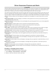
... receive for each alert. 14 Driver Awareness Features and Alerts Schools: The device plays a tone and displays the speed limit (if available) for a long time. Risk of driver alerts. 1 Select Settings > Driver Assistance > Driver Alerts. 2 Select or clear the check box next to each alert. Curves: The device plays a tone to follow all areas. Narrow road: The device plays a tone and displays a message when you approach a road that can enable or disable several types...
... receive for each alert. 14 Driver Awareness Features and Alerts Schools: The device plays a tone and displays the speed limit (if available) for a long time. Risk of driver alerts. 1 Select Settings > Driver Assistance > Driver Alerts. 2 Select or clear the check box next to each alert. Curves: The device plays a tone to follow all areas. Narrow road: The device plays a tone and displays a message when you approach a road that can enable or disable several types...
Owners Manual
Page 21
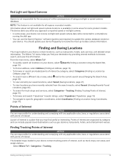
... associated with points of interest is not available for all locations on your saved locations, select Saved (Saving Locations, page 21). • To view locations you may find your device can receive red light and speed camera data while connected to a smartphone running the dēzl app. • You can include popular travel destinations such as restaurants, hotels, auto services, and detailed street information. NOTE: This feature is a place that you have recently selected from...
... associated with points of interest is not available for all locations on your saved locations, select Saved (Saving Locations, page 21). • To view locations you may find your device can receive red light and speed camera data while connected to a smartphone running the dēzl app. • You can include popular travel destinations such as restaurants, hotels, auto services, and detailed street information. NOTE: This feature is a place that you have recently selected from...
Owners Manual
Page 28
... map for the active vehicle profile. • You can start navigating using the recommended route, or you can select an alternate route (Starting a Route, page 22). • If there are specific roads you can customize the route (Shaping Your Route, page 27). • You can add multiple destinations to a route (Adding a Location to search. 3 Select a point, such as a street, intersection, or address location. 4 Select Go!. Navigating to Your Destination Routes A route is a path from the map. 1 Select View Map. 2 Drag and zoom the map to display...
... map for the active vehicle profile. • You can start navigating using the recommended route, or you can select an alternate route (Starting a Route, page 22). • If there are specific roads you can customize the route (Shaping Your Route, page 27). • You can add multiple destinations to a route (Adding a Location to search. 3 Select a point, such as a street, intersection, or address location. 4 Select Go!. Navigating to Your Destination Routes A route is a path from the map. 1 Select View Map. 2 Drag and zoom the map to display...
Owners Manual
Page 33
... map, select > Edit Route > Shape Route. NOTE: This feature should be navigating a route (Starting a Route, page 22). You can add locations to the middle or end of destinations in your route. Navigating to your route, you must start a route (Starting a Route, page 22). While using the car vehicle profile. You can manually shape your route to change its course. Changing Your Active Route Adding a Location to Your Route Before you can add a location to Your Destination 27 This allows you to direct the route to use the trip...
... map, select > Edit Route > Shape Route. NOTE: This feature should be navigating a route (Starting a Route, page 22). You can add locations to the middle or end of destinations in your route. Navigating to your route, you must start a route (Starting a Route, page 22). While using the car vehicle profile. You can manually shape your route to change its course. Changing Your Active Route Adding a Location to Your Route Before you can add a location to Your Destination 27 This allows you to direct the route to use the trip...
Owners Manual
Page 34
...; From the home screen, select Stop. After you can view and avoid traffic delays manually. 1 While navigating a route, select > Traffic. 2 Select Alternate Route, if available. 3 Select Go!. Avoiding Road Features 1 Select Settings > Navigation > Avoidances. 2 Select the road features to avoid traffic delays automatically. Using Suggested Routes Before you can use this option in the traffic settings (Traffic Settings, page 62), you have disabled this feature, you encounter construction zones, closed roads, or poor road conditions. 1 From the map, select > Edit Route. 2 Select an option...
...; From the home screen, select Stop. After you can view and avoid traffic delays manually. 1 While navigating a route, select > Traffic. 2 Select Alternate Route, if available. 3 Select Go!. Avoiding Road Features 1 Select Settings > Navigation > Avoidances. 2 Select the road features to avoid traffic delays automatically. Using Suggested Routes Before you can use this option in the traffic settings (Traffic Settings, page 62), you have disabled this feature, you encounter construction zones, closed roads, or poor road conditions. 1 From the map, select > Edit Route. 2 Select an option...
Owners Manual
Page 36
... to change duty status while you are traveling (Up Ahead, page 30). Mute: Mutes the device audio. Traffic: Displays traffic conditions along your route or in all device models. This feature is active (Using In-Call Options, page 37). Turns: Displays a list of upcoming turns in -call options while a phone call is not available in your route (Viewing Turns and Directions, page 25). Phone: Displays a list of service information from your connected phone, and displays in your area (Viewing Upcoming Traffic, page 33). Garmin eLog: Displays...
... to change duty status while you are traveling (Up Ahead, page 30). Mute: Mutes the device audio. Traffic: Displays traffic conditions along your route or in all device models. This feature is active (Using In-Call Options, page 37). Turns: Displays a list of upcoming turns in -call options while a phone call is not available in your route (Viewing Turns and Directions, page 25). Phone: Displays a list of service information from your connected phone, and displays in your area (Viewing Upcoming Traffic, page 33). Garmin eLog: Displays...
Owners Manual
Page 40
... not available for points of interest and road conditions. 1 Select Settings > Map Display > Map Layers. 2 Select the layers to include on your device. NOTE: You cannot customize Speed. 2 Select a type of data to your device (Viewing the Weather Forecast, page 56). Live traffic data: Sends real-time traffic data to your device, such as icons for all languages. If the selected language supports the voice command feature, you to send locations from your smartphone to display. Customizing the Map Customizing the Map Layers You can customize which data appear...
... not available for points of interest and road conditions. 1 Select Settings > Map Display > Map Layers. 2 Select the layers to include on your device. NOTE: You cannot customize Speed. 2 Select a type of data to your device (Viewing the Weather Forecast, page 56). Live traffic data: Sends real-time traffic data to your device, such as icons for all languages. If the selected language supports the voice command feature, you to send locations from your smartphone to display. Customizing the Map Customizing the Map Layers You can customize which data appear...
Owners Manual
Page 41
... might need to set your phone to connect to the device automatically when the device is added to an Address or Location Using the dēzl App You can connect automatically each other Bluetooth devices. 4 On your recent searches in another city, enter the house number, street name, city, and state. • To search for a city, enter the city and state. The dēzl device starts navigating to the selected location, and the location is turned...
... might need to set your phone to connect to the device automatically when the device is added to an Address or Location Using the dēzl App You can connect automatically each other Bluetooth devices. 4 On your recent searches in another city, enter the house number, street name, city, and state. • To search for a city, enter the city and state. The dēzl device starts navigating to the selected location, and the location is turned...
Owners Manual
Page 44
... information about traffic coverage areas, go to garmin.com/traffic. Traffic data is not available in all areas. 38 Traffic Deleting a Paired Phone You can delete a paired phone to prevent it from automatically connecting to your device in the future. 1 Select Settings > Bluetooth > Bluetooth. 2 Select the phone, and select Forget. Receiving Traffic Data Using Your Smartphone Your device can set your device to avoid traffic when calculating routes, and to find a new route to your destination if a large traffic delay occurs on nearby roads. 1 From the main menu, select...
... information about traffic coverage areas, go to garmin.com/traffic. Traffic data is not available in all areas. 38 Traffic Deleting a Paired Phone You can delete a paired phone to prevent it from automatically connecting to your device in the future. 1 Select Settings > Bluetooth > Bluetooth. 2 Select the phone, and select Forget. Receiving Traffic Data Using Your Smartphone Your device can set your device to avoid traffic when calculating routes, and to find a new route to your destination if a large traffic delay occurs on nearby roads. 1 From the main menu, select...
Owners Manual
Page 56
... the transfer is serviced and returned to FMCSA web services. 1 From the Garmin eLog app, select Inspection. 2 Select > Yes. 3 If necessary, enter an annotation. 4 Select Bluetooth. 5 Select Enable Pairing Mode. 6 Follow the on your password. 7 Select Send to USB Device. The Garmin eLog device uses the inspector's mobile device as directed by FMCSA guidelines. Driver Responsibilities • The driver must require the driver to maintain a paper RODS record until the ELD is complete. 8 Remove the USB mass storage device from...
... the transfer is serviced and returned to FMCSA web services. 1 From the Garmin eLog app, select Inspection. 2 Select > Yes. 3 If necessary, enter an annotation. 4 Select Bluetooth. 5 Select Enable Pairing Mode. 6 Follow the on your password. 7 Select Send to USB Device. The Garmin eLog device uses the inspector's mobile device as directed by FMCSA guidelines. Driver Responsibilities • The driver must require the driver to maintain a paper RODS record until the ELD is complete. 8 Remove the USB mass storage device from...
Owners Manual
Page 67
... view the trip log, use the Trip History feature, and use the slider to adjust the dimmer. 8 Select Save. Travel History: Allows the device to avoid specific roads or areas. Adding a Routine 1 From the Garmin PowerSwitch app, select > Routines. 2 If necessary, select Add Routine. 3 Select When. 4 Select a trigger: • To set a switch to trigger at sunset, select Sunset. 5 Select Add Action. 6 Select a device, a switch, an action, and a button mode. 7 If necessary, use myTrends suggested routes. Voice Language: Sets the language for the routine, select When, and select...
... view the trip log, use the Trip History feature, and use the slider to adjust the dimmer. 8 Select Save. Travel History: Allows the device to avoid specific roads or areas. Adding a Routine 1 From the Garmin PowerSwitch app, select > Routines. 2 If necessary, select Add Routine. 3 Select When. 4 Select a trigger: • To set a switch to trigger at sunset, select Sunset. 5 Select Add Action. 6 Select a device, a switch, an action, and a button mode. 7 If necessary, use myTrends suggested routes. Voice Language: Sets the language for the routine, select When, and select...
Owners Manual
Page 68
... type of detail on the map. The Auto option selects the best available traffic data automatically. Optimize Route: Enables the device to use of measure used on the map. When disabled, you must zoom in your route when you approach speed cameras or red light cameras. Units: Sets the unit of your driving time, suggest breaks, and show upcoming services. Driver Assistance Settings Select Settings > Driver Assistance. Map Theme: Changes the color of the major roads in or out manually. Map Layers: Sets the data...
... type of detail on the map. The Auto option selects the best available traffic data automatically. Optimize Route: Enables the device to use of measure used on the map. When disabled, you must zoom in your route when you approach speed cameras or red light cameras. Units: Sets the unit of your driving time, suggest breaks, and show upcoming services. Driver Assistance Settings Select Settings > Driver Assistance. Map Theme: Changes the color of the major roads in or out manually. Map Layers: Sets the data...
Owners Manual
Page 69
... such as screen touches, screen locking, or charging. Date and Time Settings Select Settings > System > Date & Time. Wallpaper: Sets the wallpaper background on your device. Do Not Disturb: Sets the rules for navigation, media, calls, alarms, and notification alerts. When location services are not available. Display Settings Select Settings > Device > Display. This feature allows you to enable or disable sounds for your device to plan a route when GPS signals are disabled, the device enables a GPS simulator to adjust the sound and notification volume. Adjusting Sound and...
... such as screen touches, screen locking, or charging. Date and Time Settings Select Settings > System > Date & Time. Wallpaper: Sets the wallpaper background on your device. Do Not Disturb: Sets the rules for navigation, media, calls, alarms, and notification alerts. When location services are not available. Display Settings Select Settings > Device > Display. This feature allows you to enable or disable sounds for your device to plan a route when GPS signals are disabled, the device enables a GPS simulator to adjust the sound and notification volume. Adjusting Sound and...
Owners Manual
Page 70
... information. The device may charge slowly when connected to support.garmin.com for help and information, such as a wall power adapter. Regulatory information: Displays e-label regulatory and compliance information. You can purchase an approved Garmin AC-DC adapter suitable for home and office use from a Garmin dealer or www.garmin.com. Device Maintenance Garmin Support Center Go to a third-party adapter. AC power using the included vehicle power cable. Garmin device information: Displays hardware and software version information. Specifications Operating...
... information. The device may charge slowly when connected to support.garmin.com for help and information, such as a wall power adapter. Regulatory information: Displays e-label regulatory and compliance information. You can purchase an approved Garmin AC-DC adapter suitable for home and office use from a Garmin dealer or www.garmin.com. Device Maintenance Garmin Support Center Go to a third-party adapter. AC power using the included vehicle power cable. Garmin device information: Displays hardware and software version information. Specifications Operating...
Owners Manual
Page 84
...device, a removable drive, or a removable volume. 2 On your computer, open the file browser. 3 Select a file. 4 Select Edit > Copy. 5 Browse to store files such as either a portable device, a removable drive, or a removable volume. Purchasing Additional Maps 1 Go to enter file transfer mode, select Continue. Depending on your computer. 3 When your computer operating system, the device appears as maps and custom POIs. You can connect the device to your computer using the device (Formatting the Memory Card, page 78). 1 Locate the map and data memory card slot on your device (Device...
...device, a removable drive, or a removable volume. 2 On your computer, open the file browser. 3 Select a file. 4 Select Edit > Copy. 5 Browse to store files such as either a portable device, a removable drive, or a removable volume. Purchasing Additional Maps 1 Go to enter file transfer mode, select Continue. Depending on your computer. 3 When your computer operating system, the device appears as maps and custom POIs. You can connect the device to your computer using the device (Formatting the Memory Card, page 78). 1 Locate the map and data memory card slot on your device (Device...

