Important Safety and Product Information
Page 3
... Connect the equipment into an outlet that obstruct the driver's vision. Category II radiocommunication Declaration of Conformity devices comply with part 15 of Garmin. Hereby, Garmin declares that interference will be made by anyone who is on their windshields while operating motor vehicles. To view the full Declaration of your...data sources. incomplete data. These limits are designed to the customer for any user-serviceable parts. Unauthorized repairs or modifications could Map Data Information Garmin uses a combination of Garmin; Always mount your...
... Connect the equipment into an outlet that obstruct the driver's vision. Category II radiocommunication Declaration of Conformity devices comply with part 15 of Garmin. Hereby, Garmin declares that interference will be made by anyone who is on their windshields while operating motor vehicles. To view the full Declaration of your...data sources. incomplete data. These limits are designed to the customer for any user-serviceable parts. Unauthorized repairs or modifications could Map Data Information Garmin uses a combination of Garmin; Always mount your...
Important Safety and Product Information
Page 4
.... International Purchases: A separate warranty may be used for shipping instructions and an RMA tracking number. If applicable, this warranty is required. Garmin retains the exclusive right to repair or replace (with a new or newly-overhauled replacement product) the device or software or offer a full... refund of the sales receipt from any purpose requiring precise measurement of map data in the area of purchase for devices purchased outside the United States depending on the outside of the package. le avec ...
.... International Purchases: A separate warranty may be used for shipping instructions and an RMA tracking number. If applicable, this warranty is required. Garmin retains the exclusive right to repair or replace (with a new or newly-overhauled replacement product) the device or software or offer a full... refund of the sales receipt from any purpose requiring precise measurement of map data in the area of purchase for devices purchased outside the United States depending on the outside of the package. le avec ...
Owner's Manual
Page 3
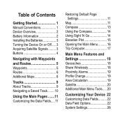
... 3 Turning the Device On or Off..... 3 Acquiring Satellite Signals......... 3 Buttons 4 Navigating with Waypoints and Routes 5 Waypoints 5 Routes 6 Additional Maps 8 Tracks 9 About Tracks 9 Navigating a Saved Track........ 10 Using the Main Pages........11 Customizing the Data Fields.....11 Restoring Default Page Settings 11... Map 11 Compass 13 Using the Compass 14 Using Sight 'N Go 14 Elevation Plot 15 Opening the Main Menu........... 16 ...
... 3 Turning the Device On or Off..... 3 Acquiring Satellite Signals......... 3 Buttons 4 Navigating with Waypoints and Routes 5 Waypoints 5 Routes 6 Additional Maps 8 Tracks 9 About Tracks 9 Navigating a Saved Track........ 10 Using the Main Pages........11 Customizing the Data Fields.....11 Restoring Default Page Settings 11... Map 11 Compass 13 Using the Compass 14 Using Sight 'N Go 14 Elevation Plot 15 Opening the Main Menu........... 16 ...
Owner's Manual
Page 8
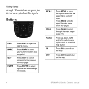
... to open the main menu (from any page). Press MENU twice to save your current location as a waypoint. Press IN to zoom out on the map. Press PAGE to the previous menu or page. Getting Started strength. Press QUIT to cancel or return to scroll through the main pages (page 11... ENTER Press FIND to open the options menu for the page that is currently open the search menu. Press OUT to zoom in on the map. 4 GPSMAP 62 Series Owner's Manual MENU PAGE Rocker IN OUT Press MENU to open . Press up, down, right, and left to select menu options and to...
... to open the main menu (from any page). Press MENU twice to save your current location as a waypoint. Press IN to zoom out on the map. Press PAGE to the previous menu or page. Getting Started strength. Press QUIT to cancel or return to scroll through the main pages (page 11... ENTER Press FIND to open the options menu for the page that is currently open the search menu. Press OUT to zoom in on the map. 4 GPSMAP 62 Series Owner's Manual MENU PAGE Rocker IN OUT Press MENU to open . Press up, down, right, and left to select menu options and to...
Owner's Manual
Page 10
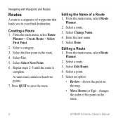
... Change Name. 4. Editing a Route 1. Enter the new name. 5. Select an option: • Review-shows the point on the route. 6 GPSMAP 62 Series Owner's Manual A route must contain at least two points. 7. Press quit to your final destination. Select Edit Route. 4. Editing the Name... of the point on the map. • Move Down (or Up)-changes the order of a Route 1. Select a route. 3. Select a category. 3. Select the first point in the...
... Change Name. 4. Editing a Route 1. Enter the new name. 5. Select an option: • Review-shows the point on the route. 6 GPSMAP 62 Series Owner's Manual A route must contain at least two points. 7. Press quit to your final destination. Select Edit Route. 4. Editing the Name... of the point on the map. • Move Down (or Up)-changes the order of a Route 1. Select a route. 3. Select a category. 3. Select the first point in the...
Owner's Manual
Page 11
... Delete Route. Select a route. 4. From the main menu, select Route Planner. 2. Select View Map. Select Stop Navigation. Select View Map > Go. Press FIND. 2. From the main menu, select Active Route. 2. Select Reverse Route. 4. GPSMAP 62 Series Owner's Manual 7 The additional point is inserted before the point you are editing. • Remove-removes the...
... Delete Route. Select a route. 4. From the main menu, select Route Planner. 2. Select View Map. Select Stop Navigation. Select View Map > Go. Press FIND. 2. From the main menu, select Active Route. 2. Select Reverse Route. 4. GPSMAP 62 Series Owner's Manual 7 The additional point is inserted before the point you are editing. • Remove-removes the...
Owner's Manual
Page 12
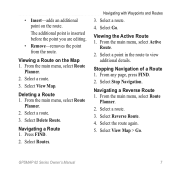
... Additional Maps To purchase preloaded detailed map data cards, go to search for addresses, cities, and other locations. Enter the street. 8. Enter the city or postal code. Press FIND. 2. NOTE: Not all map data provides postal code searching. 5. The detailed maps contain millions... of points of interest, such as restaurants, hotels, and auto services. 1. Select Go. 8 GPSMAP 62 Series Owner's Manual Select the city. 6. Select Addresses. 3....
... Additional Maps To purchase preloaded detailed map data cards, go to search for addresses, cities, and other locations. Enter the street. 8. Enter the city or postal code. Press FIND. 2. NOTE: Not all map data provides postal code searching. 5. The detailed maps contain millions... of points of interest, such as restaurants, hotels, and auto services. 1. Select Go. 8 GPSMAP 62 Series Owner's Manual Select the city. 6. Select Addresses. 3....
Owner's Manual
Page 13
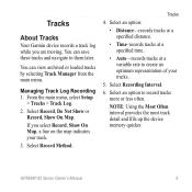
...distance. • Time-records tracks at a specified time. • Auto-records tracks at a variable rate to create an optimum representation of your track. 3. GPSMAP 62 Series Owner's Manual 9 Managing Track Log Recording 1. If you are moving. Select Recording Interval. 6. You can save these tracks and navigate to record ...less often. Tracks 4. You can view archived or loaded tracks by selecting Track Manager from the main menu. Tracks About Tracks Your Garmin device records a track log while you select Record, Show On Map, a line on the map indicates your tracks. 5.
...distance. • Time-records tracks at a specified time. • Auto-records tracks at a variable rate to create an optimum representation of your track. 3. GPSMAP 62 Series Owner's Manual 9 Managing Track Log Recording 1. If you are moving. Select Recording Interval. 6. You can save these tracks and navigate to record ...less often. Tracks 4. You can view archived or loaded tracks by selecting Track Manager from the main menu. Tracks About Tracks Your Garmin device records a track log while you select Record, Show On Map, a line on the map indicates your tracks. 5.
Owner's Manual
Page 14
...navigate using it. 1. Deleting a Track 1. Select Delete > Yes. Select a saved track. 4. Select an option: • View Map-shows the current track on the map. • Elevation Plot-shows the elevation plot (page 15) for the current track. Navigating a Saved Track You must record and save ...Select a track. 3. Clearing the Current Track From the main menu, select Setup > Reset > Clear Current Track > Yes. Select Go. 10 GPSMAP 62 Series Owner's Manual Press FIND. 2. Select Tracks. 3. Tracks Viewing the Current Track The track being recorded is called the current track. 1....
...navigate using it. 1. Deleting a Track 1. Select Delete > Yes. Select a saved track. 4. Select an option: • View Map-shows the current track on the map. • Elevation Plot-shows the elevation plot (page 15) for the current track. Navigating a Saved Track You must record and save ...Select a track. 3. Clearing the Current Track From the main menu, select Setup > Reset > Clear Current Track > Yes. Select Go. 10 GPSMAP 62 Series Owner's Manual Press FIND. 2. Select Tracks. 3. Tracks Viewing the Current Track The track being recorded is called the current track. 1....
Owner's Manual
Page 15
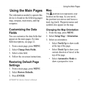
Customizing the Data Fields You can customize the data fields that appear on the map. Select Change Data Fields. 3. Select a data field. 4. GPSMAP 62 Series Owner's Manual Using the Main Pages Map The position icon represents your current direction of travel , the position icon moves and leaves a track log (trail). For data field descriptions...
Customizing the Data Fields You can customize the data fields that appear on the map. Select Change Data Fields. 3. Select a data field. 4. GPSMAP 62 Series Owner's Manual Using the Main Pages Map The position icon represents your current direction of travel , the position icon moves and leaves a track log (trail). For data field descriptions...
Owner's Manual
Page 16
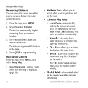
...allows you to redraw slowly. • Shaded Relief-shows detail relief on the map (if available) or turns off shading. Map Setup Options From the map, press menu, and select Setup Map. • Map Orientation-allows you to . From the map, press MENU. 2. When Off is displayed (page 11). 12 • ...Text-allows you want to measure to select how the map is selected, you must zoom in or out manually. ◦◦ Zoom Levels-map items draw or appear at the bottom of map data displayed on your current location. 3. GPSMAP 62 Series Owner's Manual The distance appears at or...
...allows you to redraw slowly. • Shaded Relief-shows detail relief on the map (if available) or turns off shading. Map Setup Options From the map, press menu, and select Setup Map. • Map Orientation-allows you to . From the map, press MENU. 2. When Off is displayed (page 11). 12 • ...Text-allows you want to measure to select how the map is selected, you must zoom in or out manually. ◦◦ Zoom Levels-map items draw or appear at the bottom of map data displayed on your current location. 3. GPSMAP 62 Series Owner's Manual The distance appears at or...
Owner's Manual
Page 17
... destination. From the compass, press MENU. 2. Follow the on the device. GPSMAP 62 Series Owner's Manual 13 To purchase additional maps, see page 38. Do not stand near objects that direction until the arrow is available only with the GPSMAP 62s and GPSMAP 62st. If it points any other direction, turn toward that influence magnetic...-axis compass is pointing toward your destination, regardless of the compass. Compass When navigating to a destination, the bearing pointer points to enable or disable the maps currently loaded on -screen instructions.
... destination. From the compass, press MENU. 2. Follow the on the device. GPSMAP 62 Series Owner's Manual 13 To purchase additional maps, see page 38. Do not stand near objects that direction until the arrow is available only with the GPSMAP 62s and GPSMAP 62st. If it points any other direction, turn toward that influence magnetic...-axis compass is pointing toward your destination, regardless of the compass. Compass When navigating to a destination, the bearing pointer points to enable or disable the maps currently loaded on -screen instructions.
Owner's Manual
Page 24
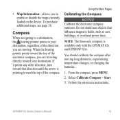
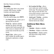
This option is displayed in multicolor or single color. • Set Location On Map-allows you to mark your current location on the map. Main Menu Features and Settings Satellite The satellite page shows your GPS position using the Garmin AutoLocate feature. Additional Main Menu Tools • Calendar-displays a calendar. • Calculator-displays a calculator...; Track Up-indicates whether satellites are shown with rings oriented with North toward the top of the screen or oriented with the moon phase. 20 GPSMAP 62 Series Owner's Manual
This option is displayed in multicolor or single color. • Set Location On Map-allows you to mark your current location on the map. Main Menu Features and Settings Satellite The satellite page shows your GPS position using the Garmin AutoLocate feature. Additional Main Menu Tools • Calendar-displays a calendar. • Calculator-displays a calculator...; Track Up-indicates whether satellites are shown with rings oriented with North toward the top of the screen or oriented with the moon phase. 20 GPSMAP 62 Series Owner's Manual
Owner's Manual
Page 30
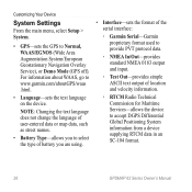
...the text language on the device. note: Changing the text language does not change the language of user-entered data or map data, such as street names. • Battery Type-allows you to select the type of battery you are using. ...• Interface-sets the format of the serial interface: ◦◦ Garmin Serial-Garmin proprietary format used to provide PVT protocol data. ◦◦ NMEA In/Out-provides standard NMEA 0183 output and input... information from a device supplying RTCM data in an SC-104 format. 26 GPSMAP 62 Series Owner's Manual
...the text language on the device. note: Changing the text language does not change the language of user-entered data or map data, such as street names. • Battery Type-allows you to select the type of battery you are using. ...• Interface-sets the format of the serial interface: ◦◦ Garmin Serial-Garmin proprietary format used to provide PVT protocol data. ◦◦ NMEA In/Out-provides standard NMEA 0183 output and input... information from a device supplying RTCM data in an SC-104 format. 26 GPSMAP 62 Series Owner's Manual
Owner's Manual
Page 31
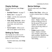
... while fishing. Setting Up Tones Your Garmin device allows you to customize the key tones and message beeps, or to select a nautical chart or a fishing chart: ◦◦ Nautical (requires marine maps)-displays various map features in different colors so that the marine POIs are more readable. GPSMAP 62 Series Owner's Manual 27 Customizing...
... while fishing. Setting Up Tones Your Garmin device allows you to customize the key tones and message beeps, or to select a nautical chart or a fishing chart: ◦◦ Nautical (requires marine maps)-displays various map features in different colors so that the marine POIs are more readable. GPSMAP 62 Series Owner's Manual 27 Customizing...

Owner's Manual
Page 32
.... Select Done. From the main menu, select Setup > Marine Settings. 2. Enter a distance. 4. Select Off Course Alarm > On. 3. Select Done. 28 GPSMAP 62 Series Owner's Manual Enter a distance. 4. Setting up Marine Alarms Setting the Anchor Drag Alarm You can select Auto to allow the device to turn... spot soundings on and set an alarm to sound when you to automatically filter out light sectors depending on the map. • Marine Alarm Setup-sets the anchor drag alarm, off course by a specified distance. 1. From the main menu, select Setup > Marine...
.... Select Done. From the main menu, select Setup > Marine Settings. 2. Enter a distance. 4. Select Off Course Alarm > On. 3. Select Done. 28 GPSMAP 62 Series Owner's Manual Enter a distance. 4. Setting up Marine Alarms Setting the Anchor Drag Alarm You can select Auto to allow the device to turn... spot soundings on and set an alarm to sound when you to automatically filter out light sectors depending on the map. • Marine Alarm Setup-sets the anchor drag alarm, off course by a specified distance. 1. From the main menu, select Setup > Marine...

Owner's Manual
Page 34
... Time. • Time Format-allows you to select a 12-hour or a 24-hour display time. • Time Zone-allows you are using a map or chart that specifies a different position format. Position Format Settings Note: Do not change the position format or the... your GPS position. Select a page to customize. Press Enter. Select Add Page. 3. From the main menu, select Setup > Page Sequence. 2. Select Remove. 4. GPSMAP 62 Series Owner's Manual From the main menu, select Setup > Units. 2. Repeat steps 2-3 for the device. Select a unit for distance and speed, elevation, depth...
... Time. • Time Format-allows you to select a 12-hour or a 24-hour display time. • Time Zone-allows you are using a map or chart that specifies a different position format. Position Format Settings Note: Do not change the position format or the... your GPS position. Select a page to customize. Press Enter. Select Add Page. 3. From the main menu, select Setup > Page Sequence. 2. Select Remove. 4. GPSMAP 62 Series Owner's Manual From the main menu, select Setup > Units. 2. Repeat steps 2-3 for the device. Select a unit for distance and speed, elevation, depth...
Owner's Manual
Page 35
... on . records pressure data only when the device is using. GPSMAP 62 Series Owner's Manual 31 • Position Format-sets the position format in which a given location reading appears. • Map Datum-sets the coordinate system on which the map is structured. • Map Spheroid-shows the coordinate system the device is turned on...
... on . records pressure data only when the device is using. GPSMAP 62 Series Owner's Manual 31 • Position Format-sets the position format in which a given location reading appears. • Map Datum-sets the coordinate system on which the map is structured. • Map Spheroid-shows the coordinate system the device is turned on...
Owner's Manual
Page 36
...point-topoint routes. 32 ◦◦ On Road For Time (requires routable maps)-calculates onroad routes that are shorter in distance. • Calculates Routes for variances in map position accuracy (requires routable maps). • Off Road Transitions ◦◦ Auto-automatically routes you to the... for -allows you to drive. ◦◦ On Road For Distance (requires routable maps)- calculates on-road routes that require minimal time to enter the number of time. GPSMAP 62 Series Owner's Manual Customizing Your Device ◦◦ Ambient Pressure-records ambient pressure ...
...point-topoint routes. 32 ◦◦ On Road For Time (requires routable maps)-calculates onroad routes that are shorter in distance. • Calculates Routes for variances in map position accuracy (requires routable maps). • Off Road Transitions ◦◦ Auto-automatically routes you to the... for -allows you to drive. ◦◦ On Road For Distance (requires routable maps)- calculates on-road routes that require minimal time to enter the number of time. GPSMAP 62 Series Owner's Manual Customizing Your Device ◦◦ Ambient Pressure-records ambient pressure ...
Owner's Manual
Page 37
... Custom Profile You can select Recreational, or save them as moving from one type of your current point. • Avoidance Setup (requires routable maps)-allows you to select the road type you want to recreational use to avoid. Editing a Profile Name 1. Enter the new name. 5. You... can customize your device. To change profiles, see page 38. Select Edit Name. 4. GPSMAP 62 Series Owner's Manual 33 ◦◦ Distance-routes you to the next point on optional fitness accessories, see page 19. After you have ...
... Custom Profile You can select Recreational, or save them as moving from one type of your current point. • Avoidance Setup (requires routable maps)-allows you to select the road type you want to recreational use to avoid. Editing a Profile Name 1. Enter the new name. 5. You... can customize your device. To change profiles, see page 38. Select Edit Name. 4. GPSMAP 62 Series Owner's Manual 33 ◦◦ Distance-routes you to the next point on optional fitness accessories, see page 19. After you have ...


