
Owner's Manual
Page 19
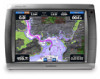
... information. Hazard Colors-Turns hazard colors on page 11. The Off setting shows the land as beacons, lights, and obstructions: 1. GPSMAP® 4000/5000 Series Owner's Manual 15 For settings and options related to Waypoints & Tracks, Other Vessels, Surface Radar, and Data Bars, see page 12. Mariner's Eye... Style-Selects how chart data is displayed over the navaid, a button is very shallow water. Press the RANGE (-) key (GPSMAP 4000 series) or touch the key (GPSMAP 5000 series) to move the view closer to your boat and lower to the water. Mariner's Eye 3D Settings To access ...
... information. Hazard Colors-Turns hazard colors on page 11. The Off setting shows the land as beacons, lights, and obstructions: 1. GPSMAP® 4000/5000 Series Owner's Manual 15 For settings and options related to Waypoints & Tracks, Other Vessels, Surface Radar, and Data Bars, see page 12. Mariner's Eye... Style-Selects how chart data is displayed over the navaid, a button is very shallow water. Press the RANGE (-) key (GPSMAP 4000 series) or touch the key (GPSMAP 5000 series) to move the view closer to your boat and lower to the water. Mariner's Eye 3D Settings To access ...
Owner's Manual
Page 56
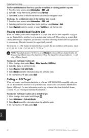
...color of the following channels on which you select a different channel, the chartplotter will use that are available in all frequency bands: 6, 8, 9, 10, 13, 15, 16, 17, 67, 68, 69, 71, 72, 73, or 77. When setting up an individual routine call to communicate. The selection of a DSC ...to select a different channel from the list, and then select Review. 3. DSC 52 GPSMAP® 4000/5000 Series Owner's Manual Select Symbol to edit the symbol, or select Trail Line to call : 1. On your Garmin VHF radio, select Call. Select the station to edit the line color. Select Trail to...
...color of the following channels on which you select a different channel, the chartplotter will use that are available in all frequency bands: 6, 8, 9, 10, 13, 15, 16, 17, 67, 68, 69, 71, 72, 73, or 77. When setting up an individual routine call to communicate. The selection of a DSC ...to select a different channel from the list, and then select Review. 3. DSC 52 GPSMAP® 4000/5000 Series Owner's Manual Select Symbol to edit the symbol, or select Trail Line to call : 1. On your Garmin VHF radio, select Call. Select the station to edit the line color. Select Trail to...
Owner's Manual
Page 57
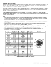
...: 45 seconds AutoLocate: 2 minutes Update Rate: 1/second, continuous GPS Accuracy: Position: Range: from 5° to 131°F (from -15° to : www.garmin.com/aboutGarmin/environment/disposal.jsp. For more information go to 55°C) Compass Safe Distance GPSMAP 4008/5008: 2.6 ft. (80 cm) GPSMAP 4012/5012: 3.3 ft. (1 m) GPSMAP 4010: 3.3 ft. (1 m) GPSMAP 5015: 1.3 ft. (40 cm) Hg -
...: 45 seconds AutoLocate: 2 minutes Update Rate: 1/second, continuous GPS Accuracy: Position: Range: from 5° to 131°F (from -15° to : www.garmin.com/aboutGarmin/environment/disposal.jsp. For more information go to 55°C) Compass Safe Distance GPSMAP 4008/5008: 2.6 ft. (80 cm) GPSMAP 4012/5012: 3.3 ft. (1 m) GPSMAP 4010: 3.3 ft. (1 m) GPSMAP 5015: 1.3 ft. (40 cm) Hg -
Owner's Manual
Page 58
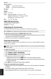
... the SD card from the chartplotter and insert it to any location on the computer. When you are on the Garmin RF Wireless Remote Control for at least six seconds. • (GPSMAP 5000 series) Press the HOME button on a screen you want to turn screenshot captures On. 4. From Windows Explorer..., open the Garmin\scrn folder on the card and paste it into an SD card reader that is displayed. Appendix 54 GPSMAP® 4000/5000 Series Owner's Manual Select Screenshot Capture to capture: • (GPSMAP 4000 series) Press the HOME button on the unit...
... the SD card from the chartplotter and insert it to any location on the computer. When you are on the Garmin RF Wireless Remote Control for at least six seconds. • (GPSMAP 5000 series) Press the HOME button on a screen you want to turn screenshot captures On. 4. From Windows Explorer..., open the Garmin\scrn folder on the card and paste it into an SD card reader that is displayed. Appendix 54 GPSMAP® 4000/5000 Series Owner's Manual Select Screenshot Capture to capture: • (GPSMAP 4000 series) Press the HOME button on the unit...
Owner's Manual
Page 59
... User Card-cannot write card when attempting a user data transfer. Contact Garmin Product Support for blockage and calibrate again. Cooling Fan Voltage Too Low-the cooling-fan voltage is a short in directory. GPSMAP® 4000/5000 Series Owner's Manual Appendix Deep Water Alarm-(sonar)... Its Stored Settings-The GPS antenna memory has been cleared. Check the network and the antenna wiring. Enter a number between (0 - 15)-invalid NMEA 2000 System instance. Lost Heading Sensor Connection- (radar/NMEA) the unit has lost communications with the heading sensor. Approaching Waypoint...
... User Card-cannot write card when attempting a user data transfer. Contact Garmin Product Support for blockage and calibrate again. Cooling Fan Voltage Too Low-the cooling-fan voltage is a short in directory. GPSMAP® 4000/5000 Series Owner's Manual Appendix Deep Water Alarm-(sonar)... Its Stored Settings-The GPS antenna memory has been cleared. Check the network and the antenna wiring. Enter a number between (0 - 15)-invalid NMEA 2000 System instance. Lost Heading Sensor Connection- (radar/NMEA) the unit has lost communications with the heading sensor. Approaching Waypoint...
Owner's Manual
Page 63
... mode 3 color scheme 47 combinations 19-20 communications settings 33 configure 5, 32-36 my boat 35 other boats 36 water speed 36 contact Garmin 57 course up 10 create waypoint 8 creating routes 25 cruising screen (radar) 40 current information 27 current station 18, 27 D data clear user data ... 37 GMR 404/406 37, 39 go to 21 GPS satellite signals 3, 32 GSD 22 37 guide to 21 H Hazard Colors 15 heading 33 Heading Line 10 GPSMAP® 4000/5000 Series Owner's Manual Index heading line 11 cruising screen 44 Head Up 10 high-resolution satellite imagery 17 home screen...
... mode 3 color scheme 47 combinations 19-20 communications settings 33 configure 5, 32-36 my boat 35 other boats 36 water speed 36 contact Garmin 57 course up 10 create waypoint 8 creating routes 25 cruising screen (radar) 40 current information 27 current station 18, 27 D data clear user data ... 37 GMR 404/406 37, 39 go to 21 GPS satellite signals 3, 32 GSD 22 37 guide to 21 H Hazard Colors 15 heading 33 Heading Line 10 GPSMAP® 4000/5000 Series Owner's Manual Index heading line 11 cruising screen 44 Head Up 10 high-resolution satellite imagery 17 home screen...
Owner's Manual
Page 64
... removing 4 search for a destination by name 22 Service Points 9 settings alarms 34 chart 9 combinations 20 communications 33 fish eye 3D 16 initializing 2 mariner's eye 3D 15 navigation chart 6 sonar 47 sonar (advanced) 48 system 32 simulator mode 4, 32 soft keys i, 1 sonar 45-48 a-scope 48 color scheme 47 depth line 48... 11, 24 man overboard 23 mark current location 23 moving 24 Waypoints & Tracks 6 where to 5, 21-26 whiteline 47 wireless devices 34 Z zoom 6, 48 60 GPSMAP® 4000/5000 Series Owner's Manual
... removing 4 search for a destination by name 22 Service Points 9 settings alarms 34 chart 9 combinations 20 communications 33 fish eye 3D 16 initializing 2 mariner's eye 3D 15 navigation chart 6 sonar 47 sonar (advanced) 48 system 32 simulator mode 4, 32 soft keys i, 1 sonar 45-48 a-scope 48 color scheme 47 depth line 48... 11, 24 man overboard 23 mark current location 23 moving 24 Waypoints & Tracks 6 where to 5, 21-26 whiteline 47 wireless devices 34 Z zoom 6, 48 60 GPSMAP® 4000/5000 Series Owner's Manual
Installation Instructions
Page 1
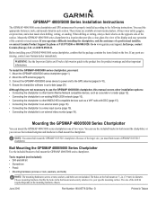
... and easy operation of the larger size, you must flush mount a GPSMAP 5015/5215 chartplotter. Mount the GPSMAP 4000/5000 series chartplotter in each section. In Europe, contact Garmin (Europe) Ltd. Connect the GPSMAP 4000/5000 series device to power and to the following instructions. Because ...of the controls or touch screen. G Printed in the product box for product warnings and other NMEA 0183-compatible devices such as a VHF radio with DSC (page 15)....
... and easy operation of the larger size, you must flush mount a GPSMAP 5015/5215 chartplotter. Mount the GPSMAP 4000/5000 series chartplotter in each section. In Europe, contact Garmin (Europe) Ltd. Connect the GPSMAP 4000/5000 series device to power and to the following instructions. Because ...of the controls or touch screen. G Printed in the product box for product warnings and other NMEA 0183-compatible devices such as a VHF radio with DSC (page 15)....

Installation Instructions
Page 15
Garmin GPSMAP 4000/5000 series chartplotter wire color + - BATTERY 10-35 Vdc Wire Power cable NMEA ...B, +, or -), connect the orange/white wire to ground. • Consult the installation instructions of your GPSMAP 4000/5000 series chartplotter to wire various NMEA 0183-compliant devices, such as an AIS or DSC device. ...a NMEA 0183-compliant Device (AIS) NMEA 0183-compliant device (AIS) Garmin GPSMAP 4000/5000 series chartplotter wire color + - GPSMAP 4000/5000 Series Installation Instructions 15 Wiring Additional NMEA 0183 Devices The NMEA 0183 data cable included with heat...
Garmin GPSMAP 4000/5000 series chartplotter wire color + - BATTERY 10-35 Vdc Wire Power cable NMEA ...B, +, or -), connect the orange/white wire to ground. • Consult the installation instructions of your GPSMAP 4000/5000 series chartplotter to wire various NMEA 0183-compliant devices, such as an AIS or DSC device. ...a NMEA 0183-compliant Device (AIS) NMEA 0183-compliant device (AIS) Garmin GPSMAP 4000/5000 series chartplotter wire color + - GPSMAP 4000/5000 Series Installation Instructions 15 Wiring Additional NMEA 0183 Devices The NMEA 0183 data cable included with heat...
Installation Instructions
Page 16
...Black Pin Number 1 2 5 6 9 10 11 12 3 4 7 8 13 14 15 16 17 18 19 Connector Pin 1 Pin 3 Pin 8 Pin 17 NMEA 0183 Cable End View GPSMAP 4000/5000 Series NMEA 0183 Data Cable 16 GPSMAP 4000/5000 Series Installation Instructions See the owner's manual for extended runs of each... NMEA 0183 sentences-GPBWC, GPRMC, GPGGA, GPGSA, GPGSV, GPGLL, GPBOD, GPRMB, GPRTE, GPVTG, GPWPL, GPXTE, and Garmin proprietary sentences-PGRME, PGRMM, and PGRMZ. • The GPSMAP 4000/5000 series chartplotter also includes support for the WPL sentence, DSC, and sonar NMEA 0183 input with support for the...
...Black Pin Number 1 2 5 6 9 10 11 12 3 4 7 8 13 14 15 16 17 18 19 Connector Pin 1 Pin 3 Pin 8 Pin 17 NMEA 0183 Cable End View GPSMAP 4000/5000 Series NMEA 0183 Data Cable 16 GPSMAP 4000/5000 Series Installation Instructions See the owner's manual for extended runs of each... NMEA 0183 sentences-GPBWC, GPRMC, GPGGA, GPGSA, GPGSV, GPGLL, GPBOD, GPRMB, GPRTE, GPVTG, GPWPL, GPXTE, and Garmin proprietary sentences-PGRME, PGRMM, and PGRMZ. • The GPSMAP 4000/5000 series chartplotter also includes support for the WPL sentence, DSC, and sonar NMEA 0183 input with support for the...

Installation Instructions
Page 19
...the chartplotter display on the chartplotter to which they are attached and will not transmit over the Garmin Marine Network. ➊ and ➋ VIDEO 1 and VIDEO 2 Inputs (RCA connectors)...output (4008/4208/4010/4210/5008/5208 = VGA output, 4012/4212/5012/5212/5015/5215 = XGA output). Marine Video Cable The included Marine Video 17-pin cable ...15 Pin 6 8 VGA, analog-red, gnd HD-15 Pin 7 8 VGA, analog-green, gnd HD-15 Pin 8 8 VGA, analog-blue, gnd HD-15 Pin 10 13 VGA, sync-Gnd HD-15 Pin 13 7 VGA, H-sync HD-15 Pin 14 12 VGA, V-sync HD-15 Pin shell 9 VGA, overall shield GPSMAP...
...the chartplotter display on the chartplotter to which they are attached and will not transmit over the Garmin Marine Network. ➊ and ➋ VIDEO 1 and VIDEO 2 Inputs (RCA connectors)...output (4008/4208/4010/4210/5008/5208 = VGA output, 4012/4212/5012/5212/5015/5215 = XGA output). Marine Video Cable The included Marine Video 17-pin cable ...15 Pin 6 8 VGA, analog-red, gnd HD-15 Pin 7 8 VGA, analog-green, gnd HD-15 Pin 8 8 VGA, analog-blue, gnd HD-15 Pin 10 13 VGA, sync-Gnd HD-15 Pin 13 7 VGA, H-sync HD-15 Pin 14 12 VGA, V-sync HD-15 Pin shell 9 VGA, overall shield GPSMAP...
Installation Instructions
Page 21
.../5008: 35 W max. Range: from 5°F to 131°F (from -15°C to IEC 529-IPX Temp. Rapid Update 127505 Fluid Level 128259 Speed - Water Referenced 128267 Water Depth 129025 Position - D (240.5 × 330 × 119.2 mm) GPSMAP 5015: 11 /21 32 in . W (228.1 × 304.1 mm) Case: Fully Gasketed, high-impact plastic...
.../5008: 35 W max. Range: from 5°F to 131°F (from -15°C to IEC 529-IPX Temp. Rapid Update 127505 Fluid Level 128259 Speed - Water Referenced 128267 Water Depth 129025 Position - D (240.5 × 330 × 119.2 mm) GPSMAP 5015: 11 /21 32 in . W (228.1 × 304.1 mm) Case: Fully Gasketed, high-impact plastic...