
Owner's Manual
Page 4
... i Warning iv Important Information iv Basic Operation 1 Turning on the GPSMAP 292/298 1 Using Simulator Mode 3 Adjusting the Backlight 4 Using the GPSMAP 292/298 Keypad 5 Entering Data and Selecting Options 6 Using the Map Pointer 7 Creating and Using Waypoints...27 Compass Page 32 3D Highway Page 33 Active Route Page 36 Main Menu 37 GPS Tab 37 Tide Tab 40 Trip Tab 44 Celes (Celestial) Tab 45 Points Tab ...59 Card Tab 59 Msgs Tab 60 Pages Tab 61 Map Tab 61 Hiway (Highway) Tab 64 Temp (Temperature) Tab 64 Sonar Tab 64 Systm (System) Tab 65 Alarm Tab 70 ii GPSMAP 292/298...
... i Warning iv Important Information iv Basic Operation 1 Turning on the GPSMAP 292/298 1 Using Simulator Mode 3 Adjusting the Backlight 4 Using the GPSMAP 292/298 Keypad 5 Entering Data and Selecting Options 6 Using the Map Pointer 7 Creating and Using Waypoints...27 Compass Page 32 3D Highway Page 33 Active Route Page 36 Main Menu 37 GPS Tab 37 Tide Tab 40 Trip Tab 44 Celes (Celestial) Tab 45 Points Tab ...59 Card Tab 59 Msgs Tab 60 Pages Tab 61 Map Tab 61 Hiway (Highway) Tab 64 Temp (Temperature) Tab 64 Sonar Tab 64 Systm (System) Tab 65 Alarm Tab 70 ii GPSMAP 292/298...
Owner's Manual
Page 5
... Map Split Page 85 Appendix 86 Specifications 86 Installing the GPSMAP 292/298 External GPS Antenna..... 87 Mounting the GPSMAP 292/298 88 Installing the Transducer 90 Connecting the Power/Data Cable 92 Interfacing 93 Caring for the Screen 93 Installing and Removing Data Cards 94 INTRODUCTION > TABLE OF CONTENTS Satellite Information 95 What is WAAS... 105 Software License Agreement 106 Product Registration 106 Limited Warranty 107 FCC Compliance 108 Industry Canada Compliance 108 Declaration of Conformity (DoC 108 Index 109 GPSMAP 292/298 Owner's Manual iii
... Map Split Page 85 Appendix 86 Specifications 86 Installing the GPSMAP 292/298 External GPS Antenna..... 87 Mounting the GPSMAP 292/298 88 Installing the Transducer 90 Connecting the Power/Data Cable 92 Interfacing 93 Caring for the Screen 93 Installing and Removing Data Cards 94 INTRODUCTION > TABLE OF CONTENTS Satellite Information 95 What is WAAS... 105 Software License Agreement 106 Product Registration 106 Limited Warranty 107 FCC Compliance 108 Industry Canada Compliance 108 Declaration of Conformity (DoC 108 Index 109 GPSMAP 292/298 Owner's Manual iii
Owner's Manual
Page 25
... to your current location as Anchorages, Businesses, Exits, Navaids, Restricted Areas, and Wrecks Obstructions, appear if an optional BlueChart data card is located. GPSMAP 292/298 Owner's Manual Find Items List 19 BASIC OPERATION > FIND Find The FIND key searches the unit for BlueChart information. The... following options are available on a data card. Additional items, such as the active leg (the active leg defines the ...
... to your current location as Anchorages, Businesses, Exits, Navaids, Restricted Areas, and Wrecks Obstructions, appear if an optional BlueChart data card is located. GPSMAP 292/298 Owner's Manual Find Items List 19 BASIC OPERATION > FIND Find The FIND key searches the unit for BlueChart information. The... following options are available on a data card. Additional items, such as the active leg (the active leg defines the ...
Owner's Manual
Page 27
...and sets up the Digital Selective Calling (DSC) features on the optional data card. Conversely, the VHF radio requires input from a Distress Call or ...Digital Selective Calling (DSC) uses marine VHF radio and Global Positioning System (GPS) technologies to highlight the individual tabs, and show alerts from a GPS to highlight a map item, and...GPSMAP 292/298 Owner's Manual 21 Use the ROCKER to transmit and receive location information. When any nearby rescuer receives the DSC signal, an alarm sounds and they immediately receive the location of data loaded on the GPSMAP 292...
...and sets up the Digital Selective Calling (DSC) features on the optional data card. Conversely, the VHF radio requires input from a Distress Call or ...Digital Selective Calling (DSC) uses marine VHF radio and Global Positioning System (GPS) technologies to highlight the individual tabs, and show alerts from a GPS to highlight a map item, and...GPSMAP 292/298 Owner's Manual 21 Use the ROCKER to transmit and receive location information. When any nearby rescuer receives the DSC signal, an alarm sounds and they immediately receive the location of data loaded on the GPSMAP 292...

Owner's Manual
Page 36
... shows cartography as long as the status bar or first and second rows of these options. 30 GPSMAP 292/298 Owner's Manual To change data field contents and configuration: 1. Only functions with a check mark in the check box to add or remove, such as...data cards or other MapSource data. Press and hold DATA/CNFG. To show and select the Map Page options: 1. Following are details on using the data with the best resolution. • When the selected zoom range exceeds the resolution of the data in use of data field options. MAIN PAGES > MAP PAGE The GPSMAP 292...
... shows cartography as long as the status bar or first and second rows of these options. 30 GPSMAP 292/298 Owner's Manual To change data field contents and configuration: 1. Only functions with a check mark in the check box to add or remove, such as...data cards or other MapSource data. Press and hold DATA/CNFG. To show and select the Map Page options: 1. Following are details on using the data with the best resolution. • When the selected zoom range exceeds the resolution of the data in use of data field options. MAIN PAGES > MAP PAGE The GPSMAP 292...

Owner's Manual
Page 41
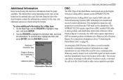
Preview window 3D Highway Page Setup GPSMAP 292/298 Owner's Manual 35 3D Highway Page Options The 3D Highway options page selects the waypoints and tracks shown and shows/hides cartography. Use the ... ENTER keys to show and select the 3D Highway Page options: 1. Select the Hiway tab. 2. This option is only available when an optional BlueChart g2 data card is inserted in the unit. • Setup-selects what waypoints and tracks are available from the 3D Highway Page menu: • Hide/Show Cartography-toggles...
Preview window 3D Highway Page Setup GPSMAP 292/298 Owner's Manual 35 3D Highway Page Options The 3D Highway options page selects the waypoints and tracks shown and shows/hides cartography. Use the ... ENTER keys to show and select the 3D Highway Page options: 1. Select the Hiway tab. 2. This option is only available when an optional BlueChart g2 data card is inserted in the unit. • Setup-selects what waypoints and tracks are available from the 3D Highway Page menu: • Hide/Show Cartography-toggles...
Owner's Manual
Page 65
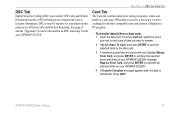
... units and Garmin's MapSource PC program. If transferring data from a data card: 1. Insert the data card. DSC is used by mariners to the data card. 3. From the Card tab, select the check box next to transmit and receive location information. DSC Tab Digital Selective Calling (DSC) uses marine VHF radio and Global Positioning System (GPS) technologies to each type of your GPSMAP 292/298. MAIN...
... units and Garmin's MapSource PC program. If transferring data from a data card: 1. Insert the data card. DSC is used by mariners to the data card. 3. From the Card tab, select the check box next to transmit and receive location information. DSC Tab Digital Selective Calling (DSC) uses marine VHF radio and Global Positioning System (GPS) technologies to each type of your GPSMAP 292/298. MAIN...

Owner's Manual
Page 69
...Notes. To view the notes for each area, highlight a name, and press ENTER. GPSMAP 292/298 Owner's Manual 63 MAIN MENU > MAP TAB To show detailed information and notes for that map. 4. To show the Advanced Map Card Setup: 1. Highlight the Advanced option box, and press ENTER. 2. Source Sub Tab... on or off . • Advanced-On, Off: turns all of map family. Press ENTER to view all optional BlueChart/ MapSource data loaded on the data card on the data card. To scroll through the list of the maps within a map family. 3. Each area is selected and appears on the Map Page...
...Notes. To view the notes for each area, highlight a name, and press ENTER. GPSMAP 292/298 Owner's Manual 63 MAIN MENU > MAP TAB To show detailed information and notes for that map. 4. To show the Advanced Map Card Setup: 1. Highlight the Advanced option box, and press ENTER. 2. Source Sub Tab... on or off . • Advanced-On, Off: turns all of map family. Press ENTER to view all optional BlueChart/ MapSource data loaded on the data card on the data card. To scroll through the list of the maps within a map family. 3. Each area is selected and appears on the Map Page...
Owner's Manual
Page 71
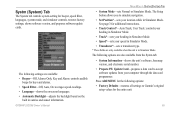
...-restores all settings to simulate navigation. • Set Position*-sets your computer through the data card programmer. GPSMAP 292/298 Owner's Manual MAIN MENU > SYSTM (SYSTEM) TAB • System Mode-sets Normal or Simulator Mode. The Setup button allows you to Garmin's original setup values for beeper, speed filter, languages, system mode, and simulator...
...-restores all settings to simulate navigation. • Set Position*-sets your computer through the data card programmer. GPSMAP 292/298 Owner's Manual MAIN MENU > SYSTM (SYSTEM) TAB • System Mode-sets Normal or Simulator Mode. The Setup button allows you to Garmin's original setup values for beeper, speed filter, languages, system mode, and simulator...
Owner's Manual
Page 95
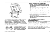
... leave 1.25" (32 mm) clearance below the data card slot for drilling starter holes. Using the swivel base as a template, mark the location of the mount over the swivel base and secure with three bolts or screws. DO NOT OVERTIGHTEN. 4. When flush mounting the GPSMAP 292/298, be secured using a pan head screw...
... leave 1.25" (32 mm) clearance below the data card slot for drilling starter holes. Using the swivel base as a template, mark the location of the mount over the swivel base and secure with three bolts or screws. DO NOT OVERTIGHTEN. 4. When flush mounting the GPSMAP 292/298, be secured using a pan head screw...
Owner's Manual
Page 100
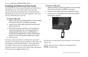
... DATA CARDS Installing and Removing Data Cards The GPSMAP 292/298 uses optional Garmin marine BlueChart g2 and MapSource data cards to show digital charts and maps on or off. Insert the card, with the card. It in not necessary to moisture or excessive static charges. If the card is properly inserted. After the data card is on, a confirmation tone sounds when the data card...
... DATA CARDS Installing and Removing Data Cards The GPSMAP 292/298 uses optional Garmin marine BlueChart g2 and MapSource data cards to show digital charts and maps on or off. Insert the card, with the card. It in not necessary to moisture or excessive static charges. If the card is properly inserted. After the data card is on, a confirmation tone sounds when the data card...
Owner's Manual
Page 106
... than the amount set value. Can't Unlock Maps-data on data card is deeper than the voltage where the unit automatically turns off. Contact your dealer or Garmin Product Support. Distress Call-a DSC distress call has been received. Take appropriate action. APPENDIX > MESSAGES Messages Accuracy Alarm-the GPS accuracy has fallen outside of user-set in...
... than the amount set value. Can't Unlock Maps-data on data card is deeper than the voltage where the unit automatically turns off. Contact your dealer or Garmin Product Support. Distress Call-a DSC distress call has been received. Take appropriate action. APPENDIX > MESSAGES Messages Accuracy Alarm-the GPS accuracy has fallen outside of user-set in...
Owner's Manual
Page 107
... name or delete the previous route name. Contact your dealer or Garmin Product Support to fit. No Proximity Waypoints Found, On User Card-see combined definition. No User Waypoints Found, On User Card-see combined definition. Proximity Alarm Memory Full-you are ...sky. Do not use for that already exists in Simulator Mode. GPSMAP 292/298 Owner's Manual 101 Check antenna connections or try moving to transfer user data from another proximity waypoint. Route Truncated-uploaded route from a data card that does not contain the specified type of points or...
... name or delete the previous route name. Contact your dealer or Garmin Product Support to fit. No Proximity Waypoints Found, On User Card-see combined definition. No User Waypoints Found, On User Card-see combined definition. Proximity Alarm Memory Full-you are ...sky. Do not use for that already exists in Simulator Mode. GPSMAP 292/298 Owner's Manual 101 Check antenna connections or try moving to transfer user data from another proximity waypoint. Route Truncated-uploaded route from a data card that does not contain the specified type of points or...
Owner's Manual
Page 108
... is on . No additional track log data can be stored without a data card containing user data being present in memory. User Card Not Found, Please Insert Card-attempted to transfer user data without deleting old data to create memory space. Modify the waypoint name or delete the existing waypoint. Sonar Service Lost-(GPSMAP 292 only) the external sonar device you...
... is on . No additional track log data can be stored without a data card containing user data being present in memory. User Card Not Found, Please Insert Card-attempted to transfer user data without deleting old data to create memory space. Modify the waypoint name or delete the existing waypoint. Sonar Service Lost-(GPSMAP 292 only) the external sonar device you...
Owner's Manual
Page 111
... numbers, marine data, topographical information, and more . Pre-Programmed Data Cards-data cards pre-programmed with vehicle Power Adapter-connects the GPSMAP 292/298 to a data card, either Garmin BlueChart or Fishing Hot Spots map data. MapSource Software CD-ROMs-enhances the basemap, create waypoints and routes from MapSource CD-ROMs to a vehicle's electrical system on one end, and a PC, beacon receiver, marine autopilot...
... numbers, marine data, topographical information, and more . Pre-Programmed Data Cards-data cards pre-programmed with vehicle Power Adapter-connects the GPSMAP 292/298 to a data card, either Garmin BlueChart or Fishing Hot Spots map data. MapSource Software CD-ROMs-enhances the basemap, create waypoints and routes from MapSource CD-ROMs to a vehicle's electrical system on one end, and a PC, beacon receiver, marine autopilot...
Owner's Manual
Page 115
...105 accuracy 37 Accuracy Circle 62 Active Route Page 36 options 36 additional information 21 advanced map card 63 alarms anchor drag 70 arrival 71 battery 70 clock 70 DSC 25 fish 71 ...Communication Tab 68 Compass Page 32 Course Line 62 Course Up 62 custom range 80 D data cards 94 data entry 6 GPSMAP 292/298 Owner's Manual date and time 95 Daylight Saving Time 68 delete DSC directory item ...nd 19 Find Key 5, 19 Fish Alarm 71 Flasher Page 84 G gain 73 Garmin Data Transfer 68 Go To 13 Distress Call 24 Position Report 24 GPS Tab 37 Options 39 H hard bottom 84 Heading Line 62 Highway Page 33 ...
...105 accuracy 37 Accuracy Circle 62 Active Route Page 36 options 36 additional information 21 advanced map card 63 alarms anchor drag 70 arrival 71 battery 70 clock 70 DSC 25 fish 71 ...Communication Tab 68 Compass Page 32 Course Line 62 Course Up 62 custom range 80 D data cards 94 data entry 6 GPSMAP 292/298 Owner's Manual date and time 95 Daylight Saving Time 68 delete DSC directory item ...nd 19 Find Key 5, 19 Fish Alarm 71 Flasher Page 84 G gain 73 Garmin Data Transfer 68 Go To 13 Distress Call 24 Position Report 24 GPS Tab 37 Options 39 H hard bottom 84 Heading Line 62 Highway Page 33 ...
Quick Reference Guide
Page 2
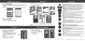
... Menu Main Pages The GPSMAP 292/298 contains seven main pages. To cycle through the main pages in Taiwan ENTER-press to adjust the screen backlighting. MOB (Man OverBoard)-press and hold for user points, map items, and any optional data card information. 190-00652-01 Rev B. © Copyright 2006 Garmin Ltd. FIND-press to...
... Menu Main Pages The GPSMAP 292/298 contains seven main pages. To cycle through the main pages in Taiwan ENTER-press to adjust the screen backlighting. MOB (Man OverBoard)-press and hold for user points, map items, and any optional data card information. 190-00652-01 Rev B. © Copyright 2006 Garmin Ltd. FIND-press to...


