
Owner's Manual
Page 3
... contains the Table of the box. The GPSMAP 292/298 Sounder is provided at the end of Garmin GPS and full-featured mapping to configure your unit in the Appendix. This manual is organized into the following sections. GPSMAP 292/298 Owner's Manual i Take a moment now to configure your Garmin dealer immediately. The GPSMAP 292/298 utilizes the proven performance of the...
... contains the Table of the box. The GPSMAP 292/298 Sounder is provided at the end of Garmin GPS and full-featured mapping to configure your unit in the Appendix. This manual is organized into the following sections. GPSMAP 292/298 Owner's Manual i Take a moment now to configure your Garmin dealer immediately. The GPSMAP 292/298 utilizes the proven performance of the...
Owner's Manual
Page 4
... to a Destination 12 Routes 17 Find 19 Additional Information 21 DSC 21 AIS 25 Main Pages 26 Map Page 27 Compass Page 32 3D Highway Page 33 Active Route Page 36 Main Menu 37 GPS Tab 37 Tide Tab 40 Trip Tab 44 Celes (Celestial) Tab 45 Points Tab 46 Route Tab... 51 Track Tab 57 DSC Tab 59 Card Tab 59 Msgs Tab 60 Pages Tab 61 Map Tab 61 Hiway (Highway) Tab 64 Temp (Temperature) Tab 64 Sonar Tab 64 Systm (System) Tab 65 Alarm Tab 70 ii GPSMAP 292/298 Owner's Manual
... to a Destination 12 Routes 17 Find 19 Additional Information 21 DSC 21 AIS 25 Main Pages 26 Map Page 27 Compass Page 32 3D Highway Page 33 Active Route Page 36 Main Menu 37 GPS Tab 37 Tide Tab 40 Trip Tab 44 Celes (Celestial) Tab 45 Points Tab 46 Route Tab... 51 Track Tab 57 DSC Tab 59 Card Tab 59 Msgs Tab 60 Pages Tab 61 Map Tab 61 Hiway (Highway) Tab 64 Temp (Temperature) Tab 64 Sonar Tab 64 Systm (System) Tab 65 Alarm Tab 70 ii GPSMAP 292/298 Owner's Manual
Owner's Manual
Page 5
Using Sonar 72 Sonar Page 72 Sonar Tab Options 77 Understanding Sonar 80 Flasher Page 84 Map Split Page 85 Appendix 86 Specifications 86 Installing the GPSMAP 292/298 External GPS Antenna..... 87 Mounting the GPSMAP 292/298 88 Installing the Transducer 90 Connecting the Power/Data Cable 92 Interfacing 93 Caring for the Screen 93 Installing... 105 Software License Agreement 106 Product Registration 106 Limited Warranty 107 FCC Compliance 108 Industry Canada Compliance 108 Declaration of Conformity (DoC 108 Index 109 GPSMAP 292/298 Owner's Manual iii
Using Sonar 72 Sonar Page 72 Sonar Tab Options 77 Understanding Sonar 80 Flasher Page 84 Map Split Page 85 Appendix 86 Specifications 86 Installing the GPSMAP 292/298 External GPS Antenna..... 87 Mounting the GPSMAP 292/298 88 Installing the Transducer 90 Connecting the Power/Data Cable 92 Interfacing 93 Caring for the Screen 93 Installing... 105 Software License Agreement 106 Product Registration 106 Limited Warranty 107 FCC Compliance 108 Industry Canada Compliance 108 Declaration of Conformity (DoC 108 Index 109 GPSMAP 292/298 Owner's Manual iii
Owner's Manual
Page 8
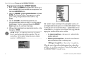
...Press and hold ADJ/MENU for Navigation" during this process, it helps to use . 2 GPSMAP 292/298 Owner's Manual Using the ROCKER, highlight Initialize Position, and press ENTER. Use the ROCKER to move the map pointer to initialize the unit. NOTE: This does not calibrate the unit in view appears on... GPSMAP 292/298 is highlighted, and then press ADJ/MENU once. 2. If you have difficulty identifying your approximate location with the appropriate satellite number under each bar. • No signal strength bars-the receiver is ready to speed up or down on the ROCKER until the GPS ...
...Press and hold ADJ/MENU for Navigation" during this process, it helps to use . 2 GPSMAP 292/298 Owner's Manual Using the ROCKER, highlight Initialize Position, and press ENTER. Use the ROCKER to move the map pointer to initialize the unit. NOTE: This does not calibrate the unit in view appears on... GPSMAP 292/298 is highlighted, and then press ADJ/MENU once. 2. If you have difficulty identifying your approximate location with the appropriate satellite number under each bar. • No signal strength bars-the receiver is ready to speed up or down on the ROCKER until the GPS ...
Owner's Manual
Page 27
.... Digital Selective Calling (DSC) uses marine VHF radio and Global Positioning System (GPS) technologies to scroll. The chartplotter repeats the call on the GPSMAP 292/298. When any nearby rescuer receives the DSC signal, an alarm sounds and they immediately receive the location of data loaded on page 92. Information Window GPSMAP 292/298 Owner's Manual 21 Any additional options are shown...
.... Digital Selective Calling (DSC) uses marine VHF radio and Global Positioning System (GPS) technologies to scroll. The chartplotter repeats the call on the GPSMAP 292/298. When any nearby rescuer receives the DSC signal, an alarm sounds and they immediately receive the location of data loaded on page 92. Information Window GPSMAP 292/298 Owner's Manual 21 Any additional options are shown...
Owner's Manual
Page 72
... position format, datum, heading and units of the map or chart. You should appear somewhere on your GPS, make sure the settings under the Units tab of the GPSMAP 292/298 match that of measure are being used to describe geographic locations for best overall performance. 66 GPSMAP 292/298 Owner's Manual NOTE: The Units tab settings affects how navigation...
... position format, datum, heading and units of the map or chart. You should appear somewhere on your GPS, make sure the settings under the Units tab of the GPSMAP 292/298 match that of measure are being used to describe geographic locations for best overall performance. 66 GPSMAP 292/298 Owner's Manual NOTE: The Units tab settings affects how navigation...
Owner's Manual
Page 106
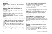
...reached maximum of the antenna wiring is detected. APPENDIX > MESSAGES Messages Accuracy Alarm-the GPS accuracy has fallen outside of user-set in the Deep Water Alarm. Anchor Drag Alarm-...message banner. 100 GPSMAP 292/298 Owner's Manual Distress Call-a DSC distress call has been received. Battery Alarm-battery voltage has fallen below the value entered in DSC directory. Contact your dealer or Garmin Product Support if...in the upper left part of the specified distance range. Can't Unlock Maps-data on data card is deeper than the amount set value. Contact your unit...
...reached maximum of the antenna wiring is detected. APPENDIX > MESSAGES Messages Accuracy Alarm-the GPS accuracy has fallen outside of user-set in the Deep Water Alarm. Anchor Drag Alarm-...message banner. 100 GPSMAP 292/298 Owner's Manual Distress Call-a DSC distress call has been received. Battery Alarm-battery voltage has fallen below the value entered in DSC directory. Contact your dealer or Garmin Product Support if...in the upper left part of the specified distance range. Can't Unlock Maps-data on data card is deeper than the amount set value. Contact your unit...
Owner's Manual
Page 115
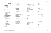
...accessories 105 accuracy 37 Accuracy Circle 62 Active Route Page 36 options 36 additional information 21 advanced map card 63 alarms anchor drag 70 arrival 71 battery 70 clock 70 DSC 25 fish 71... 32 Course Line 62 Course Up 62 custom range 80 D data cards 94 data entry 6 GPSMAP 292/298 Owner's Manual date and time 95 Daylight Saving Time 68 delete DSC directory item 23 Depth Line 74 Dilution ... 19 Find Key 5, 19 Fish Alarm 71 Flasher Page 84 G gain 73 Garmin Data Transfer 68 Go To 13 Distress Call 24 Position Report 24 GPS Tab 37 Options 39 H hard bottom 84 Heading Line 62 Highway Page 33...
...accessories 105 accuracy 37 Accuracy Circle 62 Active Route Page 36 options 36 additional information 21 advanced map card 63 alarms anchor drag 70 arrival 71 battery 70 clock 70 DSC 25 fish 71... 32 Course Line 62 Course Up 62 custom range 80 D data cards 94 data entry 6 GPSMAP 292/298 Owner's Manual date and time 95 Daylight Saving Time 68 delete DSC directory item 23 Depth Line 74 Dilution ... 19 Find Key 5, 19 Fish Alarm 71 Flasher Page 84 G gain 73 Garmin Data Transfer 68 Go To 13 Distress Call 24 Position Report 24 GPS Tab 37 Options 39 H hard bottom 84 Heading Line 62 Highway Page 33...


