Owner's Manual
Page 3
... Getting Started 1 Connecting the Device to Vehicle Power 1 Support and Updates 1 Setting Up Garmin Express 1 nüMaps Guarantee 1 Lifetime Subscriptions 1 Updating Maps and Software with Garmin Express 1 Entering and Exiting Sleep Mode 2 Turning Off the Device 2 Resetting the Device 2 Acquiring GPS Signals 2 Adjusting the Screen Brightness 2 Adjusting the Volume 2 About Automatic Volume 2 Status Bar Icons 2 Viewing GPS Signal Status 2 Battery Information 2 Setting the Time 2 Using the On-Screen Buttons 2 Using the On-Screen Keyboard 2 Locations 3 Finding Locations...
... Getting Started 1 Connecting the Device to Vehicle Power 1 Support and Updates 1 Setting Up Garmin Express 1 nüMaps Guarantee 1 Lifetime Subscriptions 1 Updating Maps and Software with Garmin Express 1 Entering and Exiting Sleep Mode 2 Turning Off the Device 2 Resetting the Device 2 Acquiring GPS Signals 2 Adjusting the Screen Brightness 2 Adjusting the Volume 2 About Automatic Volume 2 Status Bar Icons 2 Viewing GPS Signal Status 2 Battery Information 2 Setting the Time 2 Using the On-Screen Buttons 2 Using the On-Screen Keyboard 2 Locations 3 Finding Locations...
Owner's Manual
Page 4
... a Saved Trip 13 Editing a Saved Trip 13 Viewing Previous Routes and Destinations 13 Data Management 13 File Types 13 About Memory Cards 13 Installing a Memory Card 13 Connecting the Device to Your Computer 13 Transferring Data From Your Computer 13 Disconnecting the USB Cable 14 Customizing the Device 14 Map and Vehicle Settings 14 Enabling Maps 14 Navigation Settings 14 Calculation Mode Settings 14 Avoiding Toll Roads 14 Avoiding Toll Stickers 14 Bluetooth Settings 14 Disabling Bluetooth 14 Display Settings 14 Traffic Settings 14 Units and Time Settings 15 Language and...
... a Saved Trip 13 Editing a Saved Trip 13 Viewing Previous Routes and Destinations 13 Data Management 13 File Types 13 About Memory Cards 13 Installing a Memory Card 13 Connecting the Device to Your Computer 13 Transferring Data From Your Computer 13 Disconnecting the USB Cable 14 Customizing the Device 14 Map and Vehicle Settings 14 Enabling Maps 14 Navigation Settings 14 Calculation Mode Settings 14 Avoiding Toll Roads 14 Avoiding Toll Stickers 14 Bluetooth Settings 14 Disabling Bluetooth 14 Display Settings 14 Traffic Settings 14 Units and Time Settings 15 Language and...
Owner's Manual
Page 5
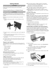
..., select Download for the useful life of a product's "useful life" and for product registration (optional). 7 Click save device. LT: This model includes a lifetime traffic subscription and a traffic receiver. NOTE: Lifetime Maps entitle you should charge it. 1 Plug the vehicle power cable À into the USB port on battery power, you to receive map updates when and as such updates are not applicable to these services for terms and conditions. The Garmin Express software detects your destinations. Support...
..., select Download for the useful life of a product's "useful life" and for product registration (optional). 7 Click save device. LT: This model includes a lifetime traffic subscription and a traffic receiver. NOTE: Lifetime Maps entitle you should charge it. 1 Plug the vehicle power cable À into the USB port on battery power, you to receive map updates when and as such updates are not applicable to these services for terms and conditions. The Garmin Express software detects your destinations. Support...
Owner's Manual
Page 6
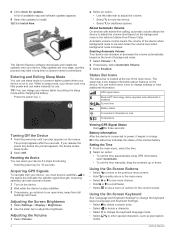
... display information about features on the level of available map and software updates appears. 9 Select the updates to mute the device. • Select for use . The Garmin Express software downloads and installs the updates onto your device faster by putting it in the status bar indicates the status of options for three seconds. Enabling Automatic Volume Your device can charge your device. Adjusting the Screen Brightness 1 Select Settings > Display > Brightness. 2 Use the slider bar to enter special characters, such as punctuation 2 Getting Started Viewing GPS Signal...
... display information about features on the level of available map and software updates appears. 9 Select the updates to mute the device. • Select for use . The Garmin Express software downloads and installs the updates onto your device faster by putting it in the status bar indicates the status of options for three seconds. Enabling Automatic Volume Your device can charge your device. Adjusting the Screen Brightness 1 Select Settings > Display > Brightness. 2 Use the slider bar to enter special characters, such as punctuation 2 Getting Started Viewing GPS Signal...
Owner's Manual
Page 7
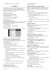
... necessary, select , and select a category icon to enter address information. 5 Select the address. Searching Within a Category After you selected. 1 Select Where To?. 2 Select a category, or select Categories. 3 Select a category. 4 If applicable, select a destination from vehicle power while the device is on the map. 4 Select an option: • Select a location marker. • Select a point, such as restaurants, hospitals, and fuel stations, you must enable the map layer for specific types of locations by Category 1 Select Where To?. 2 Select a category, or select Categories...
... necessary, select , and select a category icon to enter address information. 5 Select the address. Searching Within a Category After you selected. 1 Select Where To?. 2 Select a category, or select Categories. 3 Select a category. 4 If applicable, select a destination from vehicle power while the device is on the map. 4 Select an option: • Select a location marker. • Select a point, such as restaurants, hospitals, and fuel stations, you must enable the map layer for specific types of locations by Category 1 Select Where To?. 2 Select a category, or select Categories...
Owner's Manual
Page 8
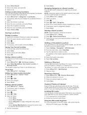
... the saved locations to www.garmin.com/ poiloader. 2 Follow the on the map. This can find a location using POI Loader software. 1 Go to delete, and select Delete. The location is saved as "Home" in the saved locations menu after you have saved at the bottom of Interest Custom POIs are customized points on -screen instructions. Assigning Categories to a Saved Location You can add shortcuts to mark the saved location on your device using latitude and longitude coordinates. menu. The Where To? Deleting a Saved Location NOTE: Deleted locations cannot be helpful when...
... the saved locations to www.garmin.com/ poiloader. 2 Follow the on the map. This can find a location using POI Loader software. 1 Go to delete, and select Delete. The location is saved as "Home" in the saved locations menu after you have saved at the bottom of Interest Custom POIs are customized points on -screen instructions. Assigning Categories to a Saved Location You can add shortcuts to mark the saved location on your device using latitude and longitude coordinates. menu. The Where To? Deleting a Saved Location NOTE: Deleted locations cannot be helpful when...

Owner's Manual
Page 9
... option: • Select Faster Time to Active Route. Starting a Route to use Off Road mode. 1 Select Settings > Navigation. 2 Select Calculation Mode > Off Road > Save. NOTICE The speed limit feature is marked with voice prompts, arrows on major roadways. Stopping the Route From the map, select > . Previewing Multiple Routes 1 Search for a location. 3 Select a location. 4 Select Go!. 5 Select Add to calculate routes that are shorter in or out, select or . • To switch between North Up and 3-D views, select . • To view specific categories, select . As you...
... option: • Select Faster Time to Active Route. Starting a Route to use Off Road mode. 1 Select Settings > Navigation. 2 Select Calculation Mode > Off Road > Save. NOTICE The speed limit feature is marked with voice prompts, arrows on major roadways. Stopping the Route From the map, select > . Previewing Multiple Routes 1 Search for a location. 3 Select a location. 4 Select Go!. 5 Select Add to calculate routes that are shorter in or out, select or . • To switch between North Up and 3-D views, select . • To view specific categories, select . As you...
Owner's Manual
Page 10
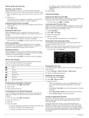
... change a category, select the category. • To create a custom category, select a category, select Custom Search, and enter the name of a business or category. 5 Select Done. Using the myTrends™ feature, your device predicts your destination based on your route or the road on major roadways. If available, an image of day. Viewing the Next Turn While navigating a route, a preview of the next turn . From the map, select to the map tools menu (Customizing the Map Tools). 1 Select View Map. 2 Select > Trip Data. 3 Select a trip data field. 4 Select...
... change a category, select the category. • To create a custom category, select a category, select Custom Search, and enter the name of a business or category. 5 Select Done. Using the myTrends™ feature, your device predicts your destination based on your route or the road on major roadways. If available, an image of day. Viewing the Next Turn While navigating a route, a preview of the next turn . From the map, select to the map tools menu (Customizing the Map Tools). 1 Select View Map. 2 Select > Trip Data. 3 Select a trip data field. 4 Select...
Owner's Manual
Page 11
... enable and disable custom avoidances as fuel, hospitals or police stations. 1 From the map, select the vehicle. 2 Select a category. This feature is helpful if you a list of directions. 1 From the map, select the vehicle. 2 Select > Directions to view information about safety camera locations and speed limits is not available for the accuracy or timeliness of interest or a safety camera database. Avoiding a Road 1 Select Settings > Navigation > Custom Avoidances. 2 Select Add Avoid Road. 3 Select the starting location. 4 Select Select. You can purchase a new...
... enable and disable custom avoidances as fuel, hospitals or police stations. 1 From the map, select the vehicle. 2 Select a category. This feature is helpful if you a list of directions. 1 From the map, select the vehicle. 2 Select > Directions to view information about safety camera locations and speed limits is not available for the accuracy or timeliness of interest or a safety camera database. Avoiding a Road 1 Select Settings > Navigation > Custom Avoidances. 2 Select Add Avoid Road. 3 Select the starting location. 4 Select Select. You can purchase a new...
Owner's Manual
Page 12
... traffic map. You can save a traffic camera (Saving a Traffic Camera). 1 Select Apps > photoLive. 2 Select a camera. Saving a Traffic Camera Before you can use alternate routes automatically, you want to view regularly. Viewing a Traffic Camera Before you can view a traffic camera, you must save cameras that you can manually start an alternate route to Add. 3 Select a road. 4 Select an intersection. 5 Select Save. The subscription activates automatically after your device model includes lifetime traffic, you must obtain a new code for the best traffic reception. The traffic...
... traffic map. You can save a traffic camera (Saving a Traffic Camera). 1 Select Apps > photoLive. 2 Select a camera. Saving a Traffic Camera Before you can use alternate routes automatically, you want to view regularly. Viewing a Traffic Camera Before you can view a traffic camera, you must save cameras that you can manually start an alternate route to Add. 3 Select a road. 4 Select an intersection. 5 Select Save. The subscription activates automatically after your device model includes lifetime traffic, you must obtain a new code for the best traffic reception. The traffic...
Owner's Manual
Page 13
... support all languages and regions. The voice control menu appears. 2 Follow the on -screen instructions to activate voice command. NOTE: Voice Activated Navigation may be configured for a single user's voice and does not work for two tones to calculate more-efficient routes. TIP: You can say an alternative command with Bluetooth technology is activated. Muting Instructions You can enable or disable traffic data. The default wakeup phrase is not available on traffic trends for each voice control phrase. Starting a Route Using Voice Command You can connect...
... support all languages and regions. The voice control menu appears. 2 Follow the on -screen instructions to activate voice command. NOTE: Voice Activated Navigation may be configured for a single user's voice and does not work for two tones to calculate more-efficient routes. TIP: You can say an alternative command with Bluetooth technology is activated. Muting Instructions You can enable or disable traffic data. The default wakeup phrase is not available on traffic trends for each voice control phrase. Starting a Route Using Voice Command You can connect...
Owner's Manual
Page 14
..., enter the device Bluetooth PIN into your device connects to the device each time your device, select OK. Using the Call History Your call history to the device each time your phone for your phone and the device connect. Select Apps > Phone > Call Home. Saved locations and recently found locations are ready to receive voice calls. • When you can delete a paired phone to prevent it from your phone to be available. Some phones do not support this feature. 1 Select Apps > Phone > Phone Book. 2 Select a contact. 3 Select Call. Enabling Bluetooth Wireless...
..., enter the device Bluetooth PIN into your device connects to the device each time your device, select OK. Using the Call History Your call history to the device each time your phone for your phone and the device connect. Select Apps > Phone > Call Home. Saved locations and recently found locations are ready to receive voice calls. • When you can delete a paired phone to prevent it from your phone to be available. Some phones do not support this feature. 1 Select Apps > Phone > Phone Book. 2 Select a contact. 3 Select Call. Enabling Bluetooth Wireless...
Owner's Manual
Page 15
.... 5 Select Next. Disabling Calls While Connected to the phone and receiving Garmin Live Services, you connect your device to a location (see the owner's manual for nearby Bluetooth devices. Some services, like traffic, enhance the existing navigation features on your phone. 1 From your phone, select the button to start navigating to your phone, the location is an estimate only. Your device includes data read from the application store on your phone. 3 Clear the Phone calls check box. The next time you can receive real-time vehicle information...
.... 5 Select Next. Disabling Calls While Connected to the phone and receiving Garmin Live Services, you connect your device to a location (see the owner's manual for nearby Bluetooth devices. Some services, like traffic, enhance the existing navigation features on your phone. 1 From your phone, select the button to start navigating to your phone, the location is an estimate only. Your device includes data read from the application store on your phone. 3 Clear the Phone calls check box. The next time you can receive real-time vehicle information...
Owner's Manual
Page 16
... 1 Select Apps > Weather > Current Location. 2 Select an option: • To view weather for the distance you must be connected to a supported phone running Smartphone Link and log in to your device, a mileage report is created for software and map updates. 1 Select Apps > myGarmin. A mileage report is created for a favorite city, select a city in the vicinity, such as a weather icon on the brake pedal. • Use the cruise control. • Turn your vehicle...
... 1 Select Apps > Weather > Current Location. 2 Select an option: • To view weather for the distance you must be connected to a supported phone running Smartphone Link and log in to your device, a mileage report is created for software and map updates. 1 Select Apps > myGarmin. A mileage report is created for a favorite city, select a city in the vicinity, such as a weather icon on the brake pedal. • Use the cruise control. • Turn your vehicle...
Owner's Manual
Page 17
...custom POIs. Navigating to create and save a trip with multiple destinations. 1 Select Apps > Trip Planner. 2 Select New Trip. 3 Select Select Start Location. 4 Search for a location (Finding a Location by Category). 5 Select Select. 6 To add additional locations, select . 7 Select Next. 8 Select Save. 9 Enter a name, and select Done. The device has a memory card slot for each location. Planning a Trip You can view your computer, open the file browser. 3 Select a file. 4 Select Edit > Copy. 5 Browse to map and data storage, the memory card can use this feature...
...custom POIs. Navigating to create and save a trip with multiple destinations. 1 Select Apps > Trip Planner. 2 Select New Trip. 3 Select Select Start Location. 4 Search for a location (Finding a Location by Category). 5 Select Select. 6 To add additional locations, select . 7 Select Next. 8 Select Save. 9 Enter a name, and select Done. The device has a memory card slot for each location. Planning a Trip You can view your computer, open the file browser. 3 Select a file. 4 Select Edit > Copy. 5 Browse to map and data storage, the memory card can use this feature...
Owner's Manual
Page 18
... enable map products installed on a route. Avoidances: Sets road features to safely disconnect. 1 Complete an action: • For Windows computers, select the Safely Remove Hardware icon in the map tools menu. Less Fuel: Calculates routes that represents your device. Off Road: Calculates a direct line from your computer to your device enters sleep mode. You can take a picture of idle time before your destination. Search for Devices: Searches for which installed maps the device uses. Display Settings To open the Map and Vehicle settings...
... enable map products installed on a route. Avoidances: Sets road features to safely disconnect. 1 Complete an action: • For Windows computers, select the Safely Remove Hardware icon in the map tools menu. Less Fuel: Calculates routes that represents your device. Off Road: Calculates a direct line from your computer to your device enters sleep mode. You can take a picture of idle time before your destination. Search for Devices: Searches for which installed maps the device uses. Display Settings To open the Map and Vehicle settings...
Owner's Manual
Page 19
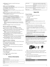
... Time Settings To open the device settings, select Settings > Device. Position Format: Sets the coordinate format and datum used for proximity points alerts to the factory default values. 1 Select Settings. 2 If necessary, select a settings category. 3 Select > Restore. Alerts: Sets the type of settings or all on several other software features. TIP: You may need this information when you approach proximity points. Position Reporting: Shares your device. Device Information 15 About: Displays the software version number, the unit ID number, and information on -screen...
... Time Settings To open the device settings, select Settings > Device. Position Format: Sets the coordinate format and datum used for proximity points alerts to the factory default values. 1 Select Settings. 2 If necessary, select a settings category. 3 Select > Restore. Alerts: Sets the type of settings or all on several other software features. TIP: You may need this information when you approach proximity points. Position Reporting: Shares your device. Device Information 15 About: Displays the software version number, the unit ID number, and information on -screen...
Owner's Manual
Page 20
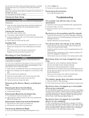
... Maps 1 Go to Vehicle Power). Troubleshooting The suction cup will not stay on the mount. 2 Tilt the device forward. My device does not appear as a portable device on my computer On most Windows computers, the device connects using USB mass storage mode. Never use USB mass storage mode. 16 Troubleshooting Do not store the device where prolonged exposure to extreme temperatures can occur, because it is installed. In USB mass storage mode, the device appears as a removable drive or volume...
... Maps 1 Go to Vehicle Power). Troubleshooting The suction cup will not stay on the mount. 2 Tilt the device forward. My device does not appear as a portable device on my computer On most Windows computers, the device connects using USB mass storage mode. Never use USB mass storage mode. 16 Troubleshooting Do not store the device where prolonged exposure to extreme temperatures can occur, because it is installed. In USB mass storage mode, the device appears as a removable drive or volume...
Owner's Manual
Page 22
..., custom points of interest 5 F files supported types 13 transferring 13 finding locations. 3 See also locations addresses 3 browsing the map 3 categories 3 cities 3 coordinates 4 intersections 3 using the map 3 finding services, up ahead 6 fuel, prices 11 fuel economy. 11, 12 See also ecoRoute fuel price, changing 11 fuse, changing 15 G Garmin Express 1 registering the device 1 updating software 1 Garmin Live Services 11 subscribing to 11 geocaching 4 going home 4 GPS 2 H hands-free phone calls 9 help. 10 See also product support home calling 10 editing location 4 going 4 phone number 10...
..., custom points of interest 5 F files supported types 13 transferring 13 finding locations. 3 See also locations addresses 3 browsing the map 3 categories 3 cities 3 coordinates 4 intersections 3 using the map 3 finding services, up ahead 6 fuel, prices 11 fuel economy. 11, 12 See also ecoRoute fuel price, changing 11 fuse, changing 15 G Garmin Express 1 registering the device 1 updating software 1 Garmin Live Services 11 subscribing to 11 geocaching 4 going home 4 GPS 2 H hands-free phone calls 9 help. 10 See also product support home calling 10 editing location 4 going 4 phone number 10...
Owner's Manual
Page 23
...subscriptions 1 map 8 receiver 8 searching for delays 8 trafficTrends 9 traffic cameras 8 viewing 8 trafficTrends 9 disabling 9 travel history 15 trip computer 6 trip information 6 resetting 6 viewing 6 trip log, viewing 6 trip planner 13 editing a trip 13 troubleshooting 16, 17 turn list 6 U unit ID 15 up ahead customizing 6 finding services 6 updating maps 1 software 1 USB, disconnecting 14 V vehicle power cable 1 vehicle profile 11 voice command 9 activating 9 navigating with 9 tips for using 9 wakeup phrase 9 voice control 9 tips 9 volume, adjusting 2 W weather 12 radar 12 road conditions...
...subscriptions 1 map 8 receiver 8 searching for delays 8 trafficTrends 9 traffic cameras 8 viewing 8 trafficTrends 9 disabling 9 travel history 15 trip computer 6 trip information 6 resetting 6 viewing 6 trip log, viewing 6 trip planner 13 editing a trip 13 troubleshooting 16, 17 turn list 6 U unit ID 15 up ahead customizing 6 finding services 6 updating maps 1 software 1 USB, disconnecting 14 V vehicle power cable 1 vehicle profile 11 voice command 9 activating 9 navigating with 9 tips for using 9 wakeup phrase 9 voice control 9 tips 9 volume, adjusting 2 W weather 12 radar 12 road conditions...


