Owner's Manual
Page 16
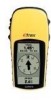
...Press PAGE to switch to a destination. A confirmation message box appears asking if you do, select YES > ENTER. Select GOTO > ENTER. 12 eTrex H Owner's Manual Main Menu To change the name: 1. Select OK > ENTER. Waypoints Page From the Waypoints page select a waypoint to the Menu page. 2. ...Select the alphabetical tab containing the waypoint > ENTER. Select the waypoint > ENTER. The Nearest Waypoints page appears, showing a list of the user...
...Press PAGE to switch to a destination. A confirmation message box appears asking if you do, select YES > ENTER. Select GOTO > ENTER. 12 eTrex H Owner's Manual Main Menu To change the name: 1. Select OK > ENTER. Waypoints Page From the Waypoints page select a waypoint to the Menu page. 2. ...Select the alphabetical tab containing the waypoint > ENTER. Select the waypoint > ENTER. The Nearest Waypoints page appears, showing a list of the user...

Owner's Manual
Page 24
...a format > ENTER. Select MAP DATUMS > ENTER. 4. eTrex H Owner's Manual User position format is WGS 84. Select UNITS > ENTER. 2.... The default datum in degrees and minutes (hdddº mm.mmm). From the Menu page, and select SETUP > ENTER. 2. Select the UNITS > ENTER. 4. From the Menu page, select SETUP > ENTER. 2. The eTrex bearings correspond to a compass if the eTrex...the North Pole. The eTrex supports the UTM/UPS and latitude/longitude grids. Change only... the map datum in the eTrex should match the horizontal map ...
...a format > ENTER. Select MAP DATUMS > ENTER. 4. eTrex H Owner's Manual User position format is WGS 84. Select UNITS > ENTER. 2.... The default datum in degrees and minutes (hdddº mm.mmm). From the Menu page, and select SETUP > ENTER. 2. Select the UNITS > ENTER. 4. From the Menu page, select SETUP > ENTER. 2. The eTrex bearings correspond to a compass if the eTrex...the North Pole. The eTrex supports the UTM/UPS and latitude/longitude grids. Change only... the map datum in the eTrex should match the horizontal map ...
Owner's Manual
Page 25
... North Reference grid. Select SETUP > ENTER. 2. eTrex H Owner's Manual 21 Variance The eTrex lists the variance between Grid North and True North for exchanging waypoint, route, and track data. • GARMIN DGPS-DGPS input using a Garmin beacon receiver and a standard RTCM SC-104 format and DGPS ... Select ANGLE > ENTER. 4. Main Menu To change the North Reference: 1. Select NORTH REF > ENTER. 4. To enter Variance manually: 1. Select UNITS >NORTH REF > USER. 3. Select DEGREES or MILS > ENTER. Press PAGE to switch to connect and use devices such as computers. To select an ...
... North Reference grid. Select SETUP > ENTER. 2. eTrex H Owner's Manual 21 Variance The eTrex lists the variance between Grid North and True North for exchanging waypoint, route, and track data. • GARMIN DGPS-DGPS input using a Garmin beacon receiver and a standard RTCM SC-104 format and DGPS ... Select ANGLE > ENTER. 4. Main Menu To change the North Reference: 1. Select NORTH REF > ENTER. 4. To enter Variance manually: 1. Select UNITS >NORTH REF > USER. 3. Select DEGREES or MILS > ENTER. Press PAGE to switch to connect and use devices such as computers. To select an ...


