

Owner's Manual
Page 3
... Tracks 14 Navigation 16 Navigating to a Destination..........16 Map 16 Compass 17 Elevation Plot 19 Trip Computer 20 eTrex Owner's Manual Table of Contents Geocaches 21 Downloading Geocaches 21 Filtering the Geocache List..........21 Navigating to a Geocache............22 Logging the Attempt 22 chirp 23 Applications 24 Sharing Data 24 Setting a Proximity Alarm 24 Calculating the... 26 Opening the Stopwatch 26 Satellite Page 26 Customizing Your Device.....28 Customizing the Main Menu........28 Customizing Specific Pages........28 Profiles 29 System Settings 30 Display Settings...
... Tracks 14 Navigation 16 Navigating to a Destination..........16 Map 16 Compass 17 Elevation Plot 19 Trip Computer 20 eTrex Owner's Manual Table of Contents Geocaches 21 Downloading Geocaches 21 Filtering the Geocache List..........21 Navigating to a Geocache............22 Logging the Attempt 22 chirp 23 Applications 24 Sharing Data 24 Setting a Proximity Alarm 24 Calculating the... 26 Opening the Stopwatch 26 Satellite Page 26 Customizing Your Device.....28 Customizing the Main Menu........28 Customizing Specific Pages........28 Profiles 29 System Settings 30 Display Settings...

Owner's Manual
Page 4
... Map Settings 31 Tracks Settings 32 Changing the Units of Measure...33 Time Settings 33 Position Format Settings 33 Heading Settings 34 Altimeter Settings 34 Geocaching Settings 35 Routing Settings 36 Marine Map Settings 37 Fitness 38 Resetting Data 38 Changing the Page Sequence.....39 Device Information 40 Adjusting the Screen... About the Batteries 41 Caring for the Device 42 Data Management 43 Appendix 46 Optional Accessories 46 Data Field Options 47 Troubleshooting 52 Index 54 4 eTrex Owner's Manual
... Map Settings 31 Tracks Settings 32 Changing the Units of Measure...33 Time Settings 33 Position Format Settings 33 Heading Settings 34 Altimeter Settings 34 Geocaching Settings 35 Routing Settings 36 Marine Map Settings 37 Fitness 38 Resetting Data 38 Changing the Page Sequence.....39 Device Information 40 Adjusting the Screen... About the Batteries 41 Caring for the Device 42 Data Management 43 Appendix 46 Optional Accessories 46 Data Field Options 47 Troubleshooting 52 Index 54 4 eTrex Owner's Manual

Owner's Manual
Page 16
Navigation Navigation You can navigate a route, a track, to a waypoint, to a geocache, or to any saved location in and out of the map. 16 eTrex Owner's Manual Navigate using the map or compass. 1. When you travel, moves. To customize the map dashboard and data fields, see page 31. Select one ...
Navigation Navigation You can navigate a route, a track, to a waypoint, to a geocache, or to any saved location in and out of the map. 16 eTrex Owner's Manual Navigate using the map or compass. 1. When you travel, moves. To customize the map dashboard and data fields, see page 31. Select one ...

Owner's Manual
Page 21
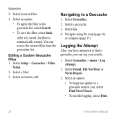
.... Connect your device to the geocache list, select Search. • To save custom filters for hidden treasures using GPS coordinates posted online by those hiding the geocache. Go to filter. 3. Geocaches Filtering the Geocache List You can apply it in . 5. eTrex Owner's Manual 21 After you ...set up the filter, you can filter your geocache list based on certain factors, such as the level...
.... Connect your device to the geocache list, select Search. • To save custom filters for hidden treasures using GPS coordinates posted online by those hiding the geocache. Go to filter. 3. Geocaches Filtering the Geocache List You can apply it in . 5. eTrex Owner's Manual 21 After you ...set up the filter, you can filter your geocache list based on certain factors, such as the level...
Owner's Manual
Page 22
...access the custom filter from the geocaches list. Select Geocaches. 2. Logging the Attempt After you , select Find Next Closest. • To end the logging, select Done. 22 eTrex Owner's Manual Select Go. 4. Navigating to a geocache nearest you have attempted to filter.... 3. After it is saved, the filter is automatically named. You can log your results. 1. Select Setup > Geocaches > Filter Setup. 2. Geocaches 2. Navigate using the map...
...access the custom filter from the geocaches list. Select Geocaches. 2. Logging the Attempt After you , select Find Next Closest. • To end the logging, select Done. 22 eTrex Owner's Manual Select Go. 4. Navigating to a geocache nearest you have attempted to filter.... 3. After it is saved, the filter is automatically named. You can log your results. 1. Select Setup > Geocaches > Filter Setup. 2. Geocaches 2. Navigate using the map...

Owner's Manual
Page 23
...the chirp Owner's Manual at http://www.garmin.com. Only the owner of the geocache that contains a chirp, details about the chirp appear. 3. When you can find a chirp in a geocache. Select chirp™ Searching > On. eTrex Owner's Manual 23 Select Geocaches > menu > Show chirp™ Details...the cache itself, select Add Comment, enter a comment, and select Done. Geocaches Enable chirp Searching 1. A chirp is available on the eTrex 30. chirp™ chirp programming and searching is a small Garmin accessory that you are within 33 feet (10 m) of the chirp can ...
...the chirp Owner's Manual at http://www.garmin.com. Only the owner of the geocache that contains a chirp, details about the chirp appear. 3. When you can find a chirp in a geocache. Select chirp™ Searching > On. eTrex Owner's Manual 23 Select Geocaches > menu > Show chirp™ Details...the cache itself, select Add Comment, enter a comment, and select Done. Geocaches Enable chirp Searching 1. A chirp is available on the eTrex 30. chirp™ chirp programming and searching is a small Garmin accessory that you are within 33 feet (10 m) of the chirp can ...

Owner's Manual
Page 24
... a particular location. 1. Follow the on-screen instructions. Select a location. 5. Your device can share waypoints, geocaches, routes, and tracks. Select Use. 6. Applications Applications Sharing Data The eTrex 30 can share data wirelessly, you must be within a specified range of a compatible Garmin device. 1. Sending and Receiving Data Wirelessly Before you can share information wirelessly. Enter a radius. 7.
... a particular location. 1. Follow the on-screen instructions. Select a location. 5. Your device can share waypoints, geocaches, routes, and tracks. Select Use. 6. Applications Applications Sharing Data The eTrex 30 can share data wirelessly, you must be within a specified range of a compatible Garmin device. 1. Sending and Receiving Data Wirelessly Before you can share information wirelessly. Enter a radius. 7.
Owner's Manual
Page 28
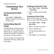
... type. Select back to customize. 3. Select Map > menu > Setup Map > Data Fields. 2. Select a data field to save the changes. 28 eTrex Owner's Manual Changing the Data Fields Before you must enable them (page 28). 1. For data field descriptions, see page 47. 4. Customizing Your Device Customizing... Your Device Customizing the Main Menu Select menu > Change Item Order to a specific or general task, such as geocaching. You can change the item order on the main menu. Dashboards are a custom grouping of data that can be helpful to change ...
... type. Select back to customize. 3. Select Map > menu > Setup Map > Data Fields. 2. Select a data field to save the changes. 28 eTrex Owner's Manual Changing the Data Fields Before you must enable them (page 28). 1. For data field descriptions, see page 47. 4. Customizing Your Device Customizing... Your Device Customizing the Main Menu Select menu > Change Item Order to a specific or general task, such as geocaching. You can change the item order on the main menu. Dashboards are a custom grouping of data that can be helpful to change ...
Owner's Manual
Page 29
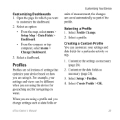
...Change Dashboard. 3. Selecting a Profile 1. Creating a Custom Profile You can be different when you are saved automatically as data fields or eTrex Owner's Manual Customizing Your Device units of settings that optimize your settings and data fields for navigating on how you are collections of ... changes are using a profile and you want to customize the dashboard. 2. When you are using the device for geocaching and for a particular activity or trip. 1. For example, your settings and views can customize your device based on water. Customizing Dashboards ...
...Change Dashboard. 3. Selecting a Profile 1. Creating a Custom Profile You can be different when you are saved automatically as data fields or eTrex Owner's Manual Customizing Your Device units of settings that optimize your settings and data fields for navigating on how you are collections of ... changes are using a profile and you want to customize the dashboard. 2. When you are using the device for geocaching and for a particular activity or trip. 1. For example, your settings and views can customize your device based on water. Customizing Dashboards ...

Owner's Manual
Page 35
Therefore, the barometric pressure should change only due to display the geocache list by names or codes. eTrex Owner's Manual 35 • Barometer Mode ◦◦ Variable Elevation-allows the barometer to measure changes in elevation while you are watching for ... pressure over a period of time. ◦◦ Ambient Pressure-records ambient pressure changes over a period of time. • Calibrate Altimeter-page 20. Geocaching Settings Select Setup > Geocaches. • Geocache List-allows you are moving. ◦◦ Fixed Elevation-assumes the device is turned on.
Therefore, the barometric pressure should change only due to display the geocache list by names or codes. eTrex Owner's Manual 35 • Barometer Mode ◦◦ Variable Elevation-allows the barometer to measure changes in elevation while you are watching for ... pressure over a period of time. ◦◦ Ambient Pressure-records ambient pressure changes over a period of time. • Calibrate Altimeter-page 20. Geocaching Settings Select Setup > Geocaches. • Geocache List-allows you are moving. ◦◦ Fixed Elevation-assumes the device is turned on.
Owner's Manual
Page 36
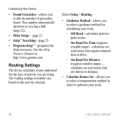
...◦◦ On Road For Time (requires routable maps)-calculates onroad routes that are doing. See the chirp Owner's Manual at http://www.garmin.com. calculates on the activity selected. page 21. • chirp™ Searching-page 23. • Program chirp™-programs the chirp...Select Setup > Routing. • Guidance Method-allows you to select a guidance method for calculating your route. 36 eTrex Owner's Manual Customizing Your Device • Found Geocaches-allows you to edit the number of activity you are shorter in distance. • Calculate Routes for-allows you ...
...◦◦ On Road For Time (requires routable maps)-calculates onroad routes that are doing. See the chirp Owner's Manual at http://www.garmin.com. calculates on the activity selected. page 21. • chirp™ Searching-page 23. • Program chirp™-programs the chirp...Select Setup > Routing. • Guidance Method-allows you to select a guidance method for calculating your route. 36 eTrex Owner's Manual Customizing Your Device • Found Geocaches-allows you to edit the number of activity you are shorter in distance. • Calculate Routes for-allows you ...

Owner's Manual
Page 43
... battery compartment. ➊➋ eTrex Owner's Manual 43 Also, some maps are available preloaded on memory cards. Go to remove the cover. 2. Slide the card holder ➊ toward the bottom of the device and lift up to http://buy.garmin.com for additional storage. Remove ...; Files from BaseCamp™ or HomePort™ Go to http://www.garmin.com. • GPI custom POI files from the Garmin POI Loader • GPX geocache files Device Information Installing a microSD Card The eTrex 20 and eTrex 30 can use microSD cards for more information. 1. It is not compatible with...
... battery compartment. ➊➋ eTrex Owner's Manual 43 Also, some maps are available preloaded on memory cards. Go to remove the cover. 2. Slide the card holder ➊ toward the bottom of the device and lift up to http://buy.garmin.com for additional storage. Remove ...; Files from BaseCamp™ or HomePort™ Go to http://www.garmin.com. • GPI custom POI files from the Garmin POI Loader • GPX geocache files Device Information Installing a microSD Card The eTrex 20 and eTrex 30 can use microSD cards for more information. 1. It is not compatible with...
Owner's Manual
Page 45
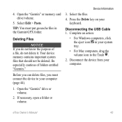
If necessary, open a folder or volume. eTrex Owner's Manual 45 Before you can delete files, you do not know the purpose of folders entitled "Garmin." Device Information 3. Your device memory contains important system files that should not be deleted. Disconnect the device from your ...Delete key on your computer. Complete an action: • For Windows computers, click the eject icon in the Garmin\GPX folder. Deleting Files Notice If you must put geocache files in your computer (page 44). 1. TIP: You must connect the device to your system tray. •...
If necessary, open a folder or volume. eTrex Owner's Manual 45 Before you can delete files, you do not know the purpose of folders entitled "Garmin." Device Information 3. Your device memory contains important system files that should not be deleted. Disconnect the device from your ...Delete key on your computer. Complete an action: • For Windows computers, click the eject icon in the Garmin\GPX folder. Deleting Files Notice If you must put geocache files in your computer (page 44). 1. TIP: You must connect the device to your system tray. •...

Owner's Manual
Page 55
... profiles 29 D data fields 28 options 47 deleting files 45 profiles 30 routes 13 tracks 15 waypoints 9 display backlight timeout 30 screen capture 30 settings 30 downloading geocaches 21 software 40 driving routes 37 E editing profiles 30 routes 12 waypoints 9 eTrex Owner's Manual elevation plot 19, 20 barometric altimeter 20 of a track 15 F file types 43 finding...
... profiles 29 D data fields 28 options 47 deleting files 45 profiles 30 routes 13 tracks 15 waypoints 9 display backlight timeout 30 screen capture 30 settings 30 downloading geocaches 21 software 40 driving routes 37 E editing profiles 30 routes 12 waypoints 9 eTrex Owner's Manual elevation plot 19, 20 barometric altimeter 20 of a track 15 F file types 43 finding...

Owner's Manual
Page 56
Index myGarmin 8 N navigating 16 driving routes 17 to a geocache 22 to waypoints 9 with bearing pointer 18 with course pointer 19 north up 31 O orientation, ...37 creating 12 deleting 13 editing 13 navigating 13 settings 36 S satellite signals 8, 26, 47, 49, 52 system settings 30 turning off GPS 26, 27 saving tracks 15 sharing data 24 Sight N' Go 10 software updating 40 version 40 stopwatch ...26 storing the device 42 sunrise and sunset times 25, 50 system settings 30 T text size, maps 32 time alarms 26 data fields 50 settings 33 sunrise and sunset 25, 50 zone 33 ...
Index myGarmin 8 N navigating 16 driving routes 17 to a geocache 22 to waypoints 9 with bearing pointer 18 with course pointer 19 north up 31 O orientation, ...37 creating 12 deleting 13 editing 13 navigating 13 settings 36 S satellite signals 8, 26, 47, 49, 52 system settings 30 turning off GPS 26, 27 saving tracks 15 sharing data 24 Sight N' Go 10 software updating 40 version 40 stopwatch ...26 storing the device 42 sunrise and sunset times 25, 50 system settings 30 T text size, maps 32 time alarms 26 data fields 50 settings 33 sunrise and sunset 25, 50 zone 33 ...

Quick Start Manual
Page 5
... Change. 2. Select a profile. Waypoints Waypoints are locations you are using the device for geocaching and for navigating on how you record and store in the device. eTrex 20/30 Quick Start Manual 5 can be different when you are a collection of settings that influence magnetic... are using it. For example, your settings and views can significantly reduce battery life. 1. Select Calibrate Compass > Start. 4. The eTrex 30 has a 3-axis, electronic compass. Select menu. 3. Calibrating the Compass Notice Calibrate the electronic compass outdoors. Move the Thumb Stick left...
... Change. 2. Select a profile. Waypoints Waypoints are locations you are using the device for geocaching and for navigating on how you record and store in the device. eTrex 20/30 Quick Start Manual 5 can be different when you are a collection of settings that influence magnetic... are using it. For example, your settings and views can significantly reduce battery life. 1. Select Calibrate Compass > Start. 4. The eTrex 30 has a 3-axis, electronic compass. Select menu. 3. Calibrating the Compass Notice Calibrate the electronic compass outdoors. Move the Thumb Stick left...

Quick Start Manual
Page 9
... moving . 1. Follow the on your computer. 2. Connecting to a computer (page 9). 2. Downloading Geocaches 1. Connect the USB cable to a USB port on -screen instructions to find and download geocaches to your device. Sign in that direction to the destination. Remove the batteries. 2. When navigating to... of your device to a Computer 1. Your device and memory card (optional) appear as removable drives in My Computer on Windows eTrex 20/30 Quick Start Manual computers and as mounted volumes on Mac computers. Connect your data or settings. 9 If necessary, create an account...
... moving . 1. Follow the on your computer. 2. Connecting to a computer (page 9). 2. Downloading Geocaches 1. Connect the USB cable to a USB port on -screen instructions to find and download geocaches to your device. Sign in that direction to the destination. Remove the batteries. 2. When navigating to... of your device to a Computer 1. Your device and memory card (optional) appear as removable drives in My Computer on Windows eTrex 20/30 Quick Start Manual computers and as mounted volumes on Mac computers. Connect your data or settings. 9 If necessary, create an account...


