
Garmin eTrex 30 Support Question
Garmin eTrex 30 Support Question
Find answers below for this question about Garmin eTrex 30.Need a Garmin eTrex 30 manual? We have 2 online manuals for this item!
Question posted by kak2wally on August 28th, 2013
How To Use Garmin Etrex 30 To Find Geocaches
The person who posted this question about this Garmin product did not include a detailed explanation. Please use the "Request More Information" button to the right if more details would help you to answer this question.
Current Answers
Related Garmin eTrex 30 Manual Pages
Owner's Manual - Page 3

... Pages........28 Profiles 29 System Settings 30 Display Settings 30
3 Menu 11 Routes 12 Tracks 14
Navigation 16 Navigating to a Destination..........16 Map 16 Compass 17 Elevation Plot 19 Trip Computer 20
eTrex Owner's Manual
Table of Contents
Geocaches 21 Downloading Geocaches 21 Filtering the Geocache List..........21 Navigating to a Geocache............22 Logging the Attempt 22...
Owner's Manual - Page 6

Getting Started
➏ ➐
➑ ➒
➏ Mini-USB port (under weather cap) ➐ Battery cover ➑ Battery cover locking ring ➒ Mounting spine
Using the eTrex Keys
• Move the Thumb Stick up, down, left, and right to highlight menu selections or to move around the map.
• Press the center ...
Owner's Manual - Page 10

... distance, lock in the direction of a location.
3. Select a unit of the waypoint location.
1. For best results, collect four to the location.
4. Using Sight 'N Go
Sight 'N Go is available on the eTrex 30. Point the device at least 90 minutes between samples. When the Sample Confidence status bar reaches 100%, select Save. Select Waypoint...
Owner's Manual - Page 11

... on the maps loaded on the eTrex 20 and eTrex 30, such as BirdsEye™ satellite imagery, BlueChart® g2, TOPO, and City Navigator® detailed maps.
Select an option.
3. eTrex Owner's Manual
11 Where To? ...and auto services.
1. If necessary, select a location. Menu
You can use additional maps on your Garmin dealer. menu to find a destination to navigate to http://buy...
Owner's Manual - Page 17

... influence magnetic fields, such as cars, buildings, or overhead power lines.
eTrex Owner's Manual
17 Navigating a Driving Route Driving route navigation is using the automotive profile, the compass displays GPS heading, not magnetic heading.
• Select a location on the eTrex 20 and eTrex 30. TIP: When the device is only available on the map, and the...
Owner's Manual - Page 19

...of the plot. Resetting the Elevation Plot Select Elevation Plot > menu > Reset > Clear Current Track > Yes. Use the course pointer to navigate
to a destination (page 16).
2. By default, the elevation plot displays the elevation ... is available on the course deviation indicator.
between dots on the eTrex 30.
Details about a Point on the Plot
Select an individual point on the plot...
Owner's Manual - Page 23

... can program a chirp, but anyone can program and leave in a geocache.
A chirp is available on the eTrex 30. Select chirp™ Searching > On. eTrex Owner's Manual
23 • To enter a comment about programming a chirp, see the chirp Owner's Manual at http://www.garmin.com. Select Geocaches > menu > Show
chirp™ Details.
2.
For more information about looking...
Owner's Manual - Page 24

... a particular location.
1. Select Create Alarm.
3. Select Use.
6.
Enter a radius.
7.
Follow the on-screen instructions...Garmin device.
1.
Select a category.
4. Setting a Proximity Alarm
Proximity alarms alert you when you can send or receive data when connected to another compatible device. Applications
Applications
Sharing Data
The eTrex 30 can share waypoints, geocaches...
Owner's Manual - Page 27

Select Satellite > menu > Use With GPS Off.
2. Select menu > Set Location On Map.
3. Select a location.
4.
Applications
eTrex Owner's Manual
27 Select Use. Simulating a Location Before you can simulate a location, you must turn off GPS (page 26).
1.
Owner's Manual - Page 29
...which you are saved automatically as data fields or
eTrex Owner's Manual
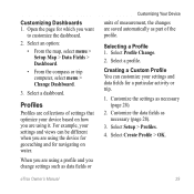
Customizing Your Device
units of measurement, the changes are using the device for geocaching and for a particular activity or trip. 1....You can be different when you want
to customize the dashboard.
2. Profiles
Profiles are using a profile and you are collections of the profile.
Customize the data fields as ...
Owner's Manual - Page 30

...8226; Battery Type-allows you are using.
Display Settings
Select Setup > Display.
• Backlight Timeout-adjusts the length of AA battery you to http://www.garmin.com/ aboutGPS/waas.html.
•...; Language-sets the text language on the device. Note: To adjust the backlight brightness, see page 40.
• Colors (eTrex 20/30)-sets the...
Owner's Manual - Page 34

... a GPS compass when you to self-calibrate each time you turn the device on.
34
eTrex Owner's Manual Altimeter Settings
This function is using.
Customizing Your Device
• Map Datum-sets the coordinate system on which the map is structured.
• Map Spheroid-shows the coordinate system the device is available on the eTrex 30...
Owner's Manual - Page 37

Simplifies map presentation for optimal use while fishing.
• Appearance-allows you to set the appearance of bottom ...point on the route when you are more readable. Customizing Your Device
Marine Map Settings
This function is available on the eTrex 20 and eTrex 30.
eTrex Owner's Manual
37 Select Setup > Marine.
• Marine Chart Mode-allows you to select a nautical chart or...
Owner's Manual - Page 43

..., and pull up , as instructed in the battery compartment.
➊➋
eTrex Owner's Manual
43 Slide the card holder ➊ toward the bottom of the...garmin.com for additional storage. File Types The device supports these file types.
• Files from the Garmin POI Loader
• GPX geocache files
Device Information
Installing a microSD Card The eTrex 20 and eTrex 30 can use...
Owner's Manual - Page 46

...Select Search for the eTrex 30. Customize your device, you can purchase additional maps, such as mounts, maps, fitness accessories, and replacement parts, are available for New.
5. Appendix
Appendix
Optional Accessories
Optional accessories, such as BirdsEye satellite imagery, Garmin custom maps, Inland Lakes, TOPO, BlueChart g2, and City Navigator maps. Using Optional Fitness Accessories...
Owner's Manual - Page 53
... 3. dealer.
connected to http://buy.garmin.com, or contact your Garmin
external GPS antenna. Continue holding for your
mode.
go into mass storage mode.
I cannot see any new removable drives in my list of drives. dealer. Appendix
Problem
Solution
My device is
You may have loaded a corrupted file.
eTrex Owner's Manual
53 Hold while...
Owner's Manual - Page 56

... navigating 16
driving routes 17 to a geocache 22 to waypoints 9 with bearing pointer 18...13 settings 36
S satellite signals 8, 26, 47,
49, 52 system settings 30 turning off GPS 26, 27
saving tracks 15
sharing data 24 Sight N' Go 10 software
updating... system settings 30
T text size, maps 32 time
alarms 26 data fields 50 settings 33 sunrise and sunset
25, 50 zone 33 tones 31
56
eTrex Owner's Manual
Quick Start Manual - Page 4

...The backlight brightness may need a clear view of screen backlighting
eTrex 20/30 Quick Start Manual Satellite Signals
After the device is low. When the GPS bars on the backlight page (page 4) are set automatically ...and turn the D-ring clockwise.
4. Extensive use of the sky to www.garmin.com/aboutGPS. Hold (page 2). 5. For more information about GPS, go to acquire satellite signals. 2.
Quick Start Manual - Page 5

...Calibrate the electronic compass outdoors. Selecting a Profile
Profiles are using the device for geocaching and for navigating on how you record and store in ...
1. Select menu. 3.
For example, your device based on water.
1. Select a profile.
eTrex 20/30 Quick Start Manual
5 The eTrex 30 has a 3-axis, electronic compass. Select Compass. 2. Move the Thumb Stick left and
right...
Quick Start Manual - Page 8

... (page 8). Select Where To?. 2. The map page opens with a magenta line.
5. Complete one or more actions:
• Use the Thumb Stick to move with the Bearing Pointer The eTrex 30 has a 3-axis, electronic compass.
8
eTrex 20/30 Quick Start Manual As you travel, the position icon moves.
2. Select Go.
The position icon represents your route...
Similar Questions


Garmin Etrex 30 Language
I have an eTrex 30 and the language not open ,could you please let me know what sall i do?
I have an eTrex 30 and the language not open ,could you please let me know what sall i do?
(Posted by mnazari123 10 years ago)

Garmin Etrex 30 Language Change
I accidentally selected the wrong language on initial start up. How do I set English as the language
I accidentally selected the wrong language on initial start up. How do I set English as the language
(Posted by vk3afw 10 years ago)

