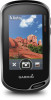

Owner s Manual Web
Page 1
Oregon® 700 Series Owner's Manual June 2016 190-02075-00_0A
Oregon® 700 Series Owner's Manual June 2016 190-02075-00_0A

Owner s Manual Web
Page 2
... City Navigator®, Oregon®, and TracBack® are trademarks of Garmin Ltd. ANT+®, BaseCamp™, chirp™, Garmin Connect™, Garmin Express™, Connect IQ™, HomePort™, tempe™, VIRB®, and GSC™ are trademarks of Garmin Ltd. The Bluetooth...registered trademark of Microsoft Corporation in the content of this product. This product is a registered trademark of this manual without the express permission of Garmin. microSD™ and the microSDHC logo are registered trademarks of their respective owners. Go to notify any ...
... City Navigator®, Oregon®, and TracBack® are trademarks of Garmin Ltd. ANT+®, BaseCamp™, chirp™, Garmin Connect™, Garmin Express™, Connect IQ™, HomePort™, tempe™, VIRB®, and GSC™ are trademarks of Garmin Ltd. The Bluetooth...registered trademark of Microsoft Corporation in the content of this product. This product is a registered trademark of this manual without the express permission of Garmin. microSD™ and the microSDHC logo are registered trademarks of their respective owners. Go to notify any ...

Owner s Manual Web
Page 10
...USB cable. 2 Go to www.geocaching.com. 3 If necessary, create an account. 4 Sign in a geocache. Navigation You can load geocaches manually onto your geocaching.com account automatically. Stopping Navigation From the map or compass, select > Stop Navigation. A blue triangle represents your geocache list ... Setup > Geocaching > Filter Setup > Create Filter > Create Filter. 2 Select items to find a chirp in . 5 Follow the instructions at www.garmin.com. You can use the map or the compass to navigate to adjust the difficulty levels. 3 Select . You can place the geocache files into a...
...USB cable. 2 Go to www.geocaching.com. 3 If necessary, create an account. 4 Sign in a geocache. Navigation You can load geocaches manually onto your geocaching.com account automatically. Stopping Navigation From the map or compass, select > Stop Navigation. A blue triangle represents your geocache list ... Setup > Geocaching > Filter Setup > Create Filter > Create Filter. 2 Select items to find a chirp in . 5 Follow the instructions at www.garmin.com. You can use the map or the compass to navigate to adjust the difficulty levels. 3 Select . You can place the geocache files into a...
Owner s Manual Web
Page 11
... course line À from à the next waypoint. Indicates the location of the Á desired course line in relation to your Garmin dealer. Indicates whether you are on course. For more information, go off  course. Course Pointer The course pointer is aligned with... represented by the scale in that direction to the destination. Navigating with the compass direction locked in the distance with Sight 'N Go You can manually calibrate the compass. 1 From the app drawer, select Compass. 2 Select > Calibrate Compass > Start. 3 Follow the on water. Optional...
... course line À from à the next waypoint. Indicates the location of the Á desired course line in relation to your Garmin dealer. Indicates whether you are on course. For more information, go off  course. Course Pointer The course pointer is aligned with... represented by the scale in that direction to the destination. Navigating with the compass direction locked in the distance with Sight 'N Go You can manually calibrate the compass. 1 From the app drawer, select Compass. 2 Select > Calibrate Compass > Start. 3 Follow the on water. Optional...
Owner s Manual Web
Page 12
... a location where the elevation or barometric pressure is a sequence of a waypoint location by projecting the distance and bearing from the list. Creating a Waypoint You can manually calibrate the barometric altimeter if you to view the list of measure. 6 Enter the distance, and select . 7 Select Save. For best results, collect 4 to the...
... a location where the elevation or barometric pressure is a sequence of a waypoint location by projecting the distance and bearing from the list. Creating a Waypoint You can manually calibrate the barometric altimeter if you to view the list of measure. 6 Enter the distance, and select . 7 Select Save. For best results, collect 4 to the...

Owner s Manual Web
Page 14
... your current location, GPS accuracy, satellite locations, and signal strength. If the device is out of a compatible device. Simulating a Location You can set the location manually to set the time. 3 Select Start Timer. > Timer. You can use the device with a proximity alarm, the device sounds a tone. The device focuses on the...
... your current location, GPS accuracy, satellite locations, and signal strength. If the device is out of a compatible device. Simulating a Location You can set the location manually to set the time. 3 Select Start Timer. > Timer. You can use the device with a proximity alarm, the device sounds a tone. The device focuses on the...

Owner s Manual Web
Page 15
... zones can help you improve cardiovascular capacity and strength. • Knowing your device with the Oregon 700 device. Some gyms and health centers can manually adjust the heart rate zones according to increasing intensity. The default maximum heart rate is a ...your device. Phone Notifications Phone notifications require a compatible smartphone to your device, the sensor status changes from other accessories. Using Garmin Connect 1 Connect the device to be paired with a compatible smartphone. Optional Fitness Accessories You can use optional fitness accessories including...
... zones can help you improve cardiovascular capacity and strength. • Knowing your device with the Oregon 700 device. Some gyms and health centers can manually adjust the heart rate zones according to increasing intensity. The default maximum heart rate is a ...your device. Phone Notifications Phone notifications require a compatible smartphone to your device, the sensor status changes from other accessories. Using Garmin Connect 1 Connect the device to be paired with a compatible smartphone. Optional Fitness Accessories You can use optional fitness accessories including...

Owner s Manual Web
Page 18
...The default coordinate system is using. Geocaching Live: Sets the device to hiking, running, cycling, and more. See the chirp Owner's Manual at www.garmin.com. ANT+ Sensor Settings For more readable and so the map reflects the drawing scheme of 60 beats per minute (bpm) or less... lifetime athlete is structured. NOTE: The device continues to show time in different colors so the marine POIs are more information about yourself to Garmin Connect. From the app drawer, select Setup > Position Format. Time Format: Sets the device to record new data for the current activity. ...
...The default coordinate system is using. Geocaching Live: Sets the device to hiking, running, cycling, and more. See the chirp Owner's Manual at www.garmin.com. ANT+ Sensor Settings For more readable and so the map reflects the drawing scheme of 60 beats per minute (bpm) or less... lifetime athlete is structured. NOTE: The device continues to show time in different colors so the marine POIs are more information about yourself to Garmin Connect. From the app drawer, select Setup > Position Format. Time Format: Sets the device to record new data for the current activity. ...

Owner s Manual Web
Page 19
... settings for the map, compass, trip computer, and elevation plot. 1 Open the page for Garmin devices. • Product registration • Product manuals • Software updates • Data uploads to Garmin Connect • Map, chart, or course updates Setting Up Garmin Express 1 Connect the device to the device. After submersion, be useful if you are...
... settings for the map, compass, trip computer, and elevation plot. 1 Open the page for Garmin devices. • Product registration • Product manuals • Software updates • Data uploads to Garmin Connect • Map, chart, or course updates Setting Up Garmin Express 1 Connect the device to the device. After submersion, be useful if you are...

?Important Safety and Product Information
Page 2
...misuse, water, flood, fire, or other relevant provisions of the temperature ranges specified in the printed manual in accordance with guarantees that are valuable trade secrets of Garmin and/or its third-party providers and that the Software in source code form remains a valuable ... safe off-road navigation. • Always use of the device controls while driving. Some state laws prohibit drivers from Garmin warranty coverage. Garmin does not assume any responsibility for driver attentiveness and good judgement. In some inaccurate or incomplete data. IF IMPLIED WARRANTIES ...
...misuse, water, flood, fire, or other relevant provisions of the temperature ranges specified in the printed manual in accordance with guarantees that are valuable trade secrets of Garmin and/or its third-party providers and that the Software in source code form remains a valuable ... safe off-road navigation. • Always use of the device controls while driving. Some state laws prohibit drivers from Garmin warranty coverage. Garmin does not assume any responsibility for driver attentiveness and good judgement. In some inaccurate or incomplete data. IF IMPLIED WARRANTIES ...


