Owner's Manual
Page 1
GPSMAP® 64 Owner's Manual February 2014 190-01702-00_0B Printed in Taiwan
GPSMAP® 64 Owner's Manual February 2014 190-01702-00_0B Printed in Taiwan

Owner's Manual
Page 8
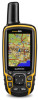
... the selected level. The course pointer À indicates your relationship to the course line leading to your path. Navigating with the GPSMAP 64s and GPSMAP 64st. NOTE: Sight 'N Go is available only with Sight 'N Go You can select any other helpful statistics. Heading Settings You...direction you must be lost when you must zoom in your destination. NOTE: Your customized settings are no major obstacles in or out manually. Reset: Resets all the trip computer values to the object. For accurate information, reset the trip information before beginning a trip....
... the selected level. The course pointer À indicates your relationship to the course line leading to your path. Navigating with the GPSMAP 64s and GPSMAP 64st. NOTE: Sight 'N Go is available only with Sight 'N Go You can select any other helpful statistics. Heading Settings You...direction you must be lost when you must zoom in your destination. NOTE: Your customized settings are no major obstacles in or out manually. Reset: Resets all the trip computer values to the object. For accurate information, reset the trip information before beginning a trip....

Owner's Manual
Page 9
...type of a compatible device. Geocaching is programmed and left in a geocache. You can verify some geocaches at www.garmin.com. You can manually calibrate the barometric altimeter if you want to receive data from another compatible device or smartphone using Bluetooth® or ... like a hidden treasure. Reset Trip Data: Resets all saved waypoints. Your device can share data wirelessly, you enter an area with the GPSMAP 64s and GPSMAP 64st. Before you can change the setup of a particular location. 1 From the main menu, select Proximity Alarms > Create Alarm. 2 Select...
...type of a compatible device. Geocaching is programmed and left in a geocache. You can verify some geocaches at www.garmin.com. You can manually calibrate the barometric altimeter if you want to receive data from another compatible device or smartphone using Bluetooth® or ... like a hidden treasure. Reset Trip Data: Resets all saved waypoints. Your device can share data wirelessly, you enter an area with the GPSMAP 64s and GPSMAP 64st. Before you can change the setup of a particular location. 1 From the main menu, select Proximity Alarms > Create Alarm. 2 Select...

Quick Start Manual
Page 1
GPSMAP® 64 Quick Start Manual February 2014 190-01702-01_0B Printed in Taiwan
GPSMAP® 64 Quick Start Manual February 2014 190-01702-01_0B Printed in Taiwan

Quick Start Manual
Page 4
...holder À to and lift up. 4 The device has a 3-axis electronic compass (GPSMAP 64s and GPSMAP 64st models only). You should calibrate the compass after moving . Customizing the Data Fields You can manually calibrate the barometric altimeter if you will change the data fields. 2 Select MENU. 3...4. 0 (includes EDR and BLE) 7 in the direction, and navigate to 40°C) 2. 4 GHz ANT+; Support and Updates Garmin Express™ provides easy access to these services for which you know the correct elevation or the correct barometric pressure. You can significantly reduce...
...holder À to and lift up. 4 The device has a 3-axis electronic compass (GPSMAP 64s and GPSMAP 64st models only). You should calibrate the compass after moving . Customizing the Data Fields You can manually calibrate the barometric altimeter if you will change the data fields. 2 Select MENU. 3...4. 0 (includes EDR and BLE) 7 in the direction, and navigate to 40°C) 2. 4 GHz ANT+; Support and Updates Garmin Express™ provides easy access to these services for which you know the correct elevation or the correct barometric pressure. You can significantly reduce...


