Installation Instructions
Page 1
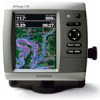
... The chartplotters in the product box for product warnings and other important information. Chartplotter GPSMAP 420/430/430x/440/440x/450 GPSMAP 520/525/530/535/540/545/550/555 GPSMAP 421/441/451 GPSMAP 431/531 GPSMAP 521/526/536/541/546/551/556 NMEA 2000 No No Yes No Yes NMEA 0183 Yes Yes... Yes Yes Yes Garmin CANet Yes Yes No No No Sonar "s" version only "s" version only "s" version...
... The chartplotters in the product box for product warnings and other important information. Chartplotter GPSMAP 420/430/430x/440/440x/450 GPSMAP 520/525/530/535/540/545/550/555 GPSMAP 421/441/451 GPSMAP 431/531 GPSMAP 521/526/536/541/546/551/556 NMEA 2000 No No Yes No Yes NMEA 0183 Yes Yes... Yes Yes Yes Garmin CANet Yes Yes No No No Sonar "s" version only "s" version only "s" version...

Owner's Manual
Page 41
... data and specified boat safe depth to determine the best course to your PC. Navigating with NMEA 2000 compatible chartplotters (GPSMAP 441/441s, GPSMAP 536/536s, GPSMAP 541/541s, and GPSMAP 546/546s). NOTE: Autopilot can only use the SD card on the Navigation chart. • Aerial Photos-provides a...Imagery-provides high-resolution satellite images for a realistic view of the land and water on BlueChart g2 Vision-compatible Garmin GPS units and when using HomePort. GPSMAP 400/500 Series Owner's Manual 35 Optional BlueChart g2 Vision preprogrammed SD cards allow you to get the most...
... data and specified boat safe depth to determine the best course to your PC. Navigating with NMEA 2000 compatible chartplotters (GPSMAP 441/441s, GPSMAP 536/536s, GPSMAP 541/541s, and GPSMAP 546/546s). NOTE: Autopilot can only use the SD card on the Navigation chart. • Aerial Photos-provides a...Imagery-provides high-resolution satellite images for a realistic view of the land and water on BlueChart g2 Vision-compatible Garmin GPS units and when using HomePort. GPSMAP 400/500 Series Owner's Manual 35 Optional BlueChart g2 Vision preprogrammed SD cards allow you to get the most...
Owner's Manual
Page 52
...NOTE: If your unit is transferred from the list. • Select Add New File to the chartplotter. From Windows® Explorer, open the Garmin\UserData folder on the front of the unit. 2. Copy the appropriate .ADM file on the card, and paste it to a computer. 5....to other chartplotters connected to copy the maps loaded onto your chartplotter. 4. Complete one of the following units are NMEA 2000 compatible: GPSMAP 441/441s GPSMAP 541/541s GPSMAP 536/536s GPSMAP 546/546s 2. Select the file name from a NMEA 2000 network: 1. From the Home screen, select Information > User Data ...
...NOTE: If your unit is transferred from the list. • Select Add New File to the chartplotter. From Windows® Explorer, open the Garmin\UserData folder on the front of the unit. 2. Copy the appropriate .ADM file on the card, and paste it to a computer. 5....to other chartplotters connected to copy the maps loaded onto your chartplotter. 4. Complete one of the following units are NMEA 2000 compatible: GPSMAP 441/441s GPSMAP 541/541s GPSMAP 536/536s GPSMAP 546/546s 2. Select the file name from a NMEA 2000 network: 1. From the Home screen, select Information > User Data ...
Owner's Manual
Page 89
... information is merely supplemental and advisory in the transmission or reception of the Services. GPSMAP 441/441s GPSMAP 541/541s GPSMAP 536/536s GPSMAP 546/546s provided "as safety-critical in connection with any aircraft, sea craft or automobile usage. XM and Garmin further do not warrant the accuracy, reliability, completeness or timeliness of the Services. You...
... information is merely supplemental and advisory in the transmission or reception of the Services. GPSMAP 441/441s GPSMAP 541/541s GPSMAP 536/536s GPSMAP 546/546s provided "as safety-critical in connection with any aircraft, sea craft or automobile usage. XM and Garmin further do not warrant the accuracy, reliability, completeness or timeliness of the Services. You...


