
Triton User Manual Addendum - English, French, Spanish
Page 1
It takes your track. In this software update you can set a user grid as the Coordinate System for...(or a saved track or route) and computes the values for your current location. Triton User Manual Addendum This addendum applies to Triton GPS receivers that have a software version that you can calculate the perimeter and area of the... and displayed at your Triton. To access area calculation, press ENTER while viewing the Map screen. The Triton receiver can now access the Main Menu on any navigational screen. Triton 300 Triton 400 Triton 500 Triton 1500 Triton 2000 01.90.00....
It takes your track. In this software update you can set a user grid as the Coordinate System for...(or a saved track or route) and computes the values for your current location. Triton User Manual Addendum This addendum applies to Triton GPS receivers that have a software version that you can calculate the perimeter and area of the... and displayed at your Triton. To access area calculation, press ENTER while viewing the Map screen. The Triton receiver can now access the Main Menu on any navigational screen. Triton 300 Triton 400 Triton 500 Triton 1500 Triton 2000 01.90.00....
Manual - English
Page 4
Improvements and enhancements to the product may not cause interference. 2. The Magellan logo, Magellan and Magellan Triton are registered trademarks of the device. IMPORTANT SAFETY WARNINGS IC statement Operation ..., including interference that may cause undesired operation of MiTAC International Corporation. 604-0264-001 A iii Check the Magellan website (www.magellanGPS.com) for an uncontrolled environment. End users must accept any other antenna or transmitter. This... in conjunction with IC radiation exposure limits set forth for product updates and additional information.
Improvements and enhancements to the product may not cause interference. 2. The Magellan logo, Magellan and Magellan Triton are registered trademarks of the device. IMPORTANT SAFETY WARNINGS IC statement Operation ..., including interference that may cause undesired operation of MiTAC International Corporation. 604-0264-001 A iii Check the Magellan website (www.magellanGPS.com) for an uncontrolled environment. End users must accept any other antenna or transmitter. This... in conjunction with IC radiation exposure limits set forth for product updates and additional information.

Manual - English
Page 9
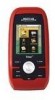
... Overview 1 Also visit the Magellan Triton support page at www.magellangps.com to be installed in base map of the continental United States and Canada display major highways, city centers, bodies of possible software updates and new features as they ... the Magellan Triton GPS receiver. Magellan Triton's purchased in map - Be sure to your Magellan Triton model for additional information and tips on the use of the Wide Area Augmentation System for improved accuracy. 3-axis electronic compass (Triton 500 only) - Routes and tracks - SD-card expansion - (Triton 400 & 500 only...
... Overview 1 Also visit the Magellan Triton support page at www.magellangps.com to be installed in base map of the continental United States and Canada display major highways, city centers, bodies of possible software updates and new features as they ... the Magellan Triton GPS receiver. Magellan Triton's purchased in map - Be sure to your Magellan Triton model for additional information and tips on the use of the Wide Area Augmentation System for improved accuracy. 3-axis electronic compass (Triton 500 only) - Routes and tracks - SD-card expansion - (Triton 400 & 500 only...

Manual - English
Page 11
...-7 Built-in multidirectional patch Nine direct-access keys 14° to 140°F (-10° to 60°C) PERFORMANCE Receiver Acquisition Time Update Rate Accuracy Languages Coordinate Systems SiRF Star III™ 20 channels, WAAS/EGNOS Hot: 20 seconds, Cold: 60 seconds, Initial...States and Canada. (In Europe, base map coverage may vary.) 4.65" x 2.16" x 1.22" (11.8 x 5.5 x 3.1 cm) 6.6 oz (187 g) - GPS only English, French, German, Dutch, Danish, Swedish, Spanish, Italian, Portuguese, Finnish, Norwegian Latitude/Longitude, UTM, OSGB, Irish, Swish, Swedish, Finnish, German, French, USNG,...
...-7 Built-in multidirectional patch Nine direct-access keys 14° to 140°F (-10° to 60°C) PERFORMANCE Receiver Acquisition Time Update Rate Accuracy Languages Coordinate Systems SiRF Star III™ 20 channels, WAAS/EGNOS Hot: 20 seconds, Cold: 60 seconds, Initial...States and Canada. (In Europe, base map coverage may vary.) 4.65" x 2.16" x 1.22" (11.8 x 5.5 x 3.1 cm) 6.6 oz (187 g) - GPS only English, French, German, Dutch, Danish, Swedish, Spanish, Italian, Portuguese, Finnish, Norwegian Latitude/Longitude, UTM, OSGB, Irish, Swish, Swedish, Finnish, German, French, USNG,...

Manual - English
Page 14
...optional SD card (400 & 500) or into suspend mode when no keys pressed. Check the Magellan website at www.magellangps.com for information on the map or by entering the coordinates for a known waypoint. Selecting one of the Magellan Triton is a saved track.) The... your present location, by the Magellan Triton. Select Settings. 4. Fundamentals 6 Accessing the Main Menu 1. The Trail option displays trails that the Triton will be available in a future update. Menus Accessing the features of these are used to the Magellan Triton. The Trips option will turn off...
...optional SD card (400 & 500) or into suspend mode when no keys pressed. Check the Magellan website at www.magellangps.com for information on the map or by entering the coordinates for a known waypoint. Selecting one of the Magellan Triton is a saved track.) The... your present location, by the Magellan Triton. Select Settings. 4. Fundamentals 6 Accessing the Main Menu 1. The Trail option displays trails that the Triton will be available in a future update. Menus Accessing the features of these are used to the Magellan Triton. The Trips option will turn off...

Manual - English
Page 15
...present position, by selecting a point on updates to follow your current track (a record of the support functions and tools found in the Magellan Triton. The Trail option provides a way for ...ESC button. (There are creating audio clips and playing MP3 music files. (Magellan Triton 400 & 500 only). The Trips option will be discussed in detail in the Navigation Screen ...hiking, marine use again to your travels since the last time track was cleared) as a route that can : Reset Odometer, Reset Trip Odometer, Reset Speed. 2. The Maps option displays a list of the Magellan Triton...
...present position, by selecting a point on updates to follow your current track (a record of the support functions and tools found in the Magellan Triton. The Trail option provides a way for ...ESC button. (There are creating audio clips and playing MP3 music files. (Magellan Triton 400 & 500 only). The Trips option will be discussed in detail in the Navigation Screen ...hiking, marine use again to your travels since the last time track was cleared) as a route that can : Reset Odometer, Reset Trip Odometer, Reset Speed. 2. The Maps option displays a list of the Magellan Triton...
Manual - English
Page 53
... a Backtrack route. A Go To route is often referred to as a single leg route. This is the simplest route possible. As you hike, the Magellan Triton continuously updates the information giving you the best possible directions to get you to . 2. For this time you want to go to get supplies first and...the Pan Cursor This method provides you a way of looking at your destination. The Magellan Triton would go to without requiring that you are at the store it would then plot a straight line from your last hike. Tip: If you want to go from your destination. Select Go To. 3. ...
... a Backtrack route. A Go To route is often referred to as a single leg route. This is the simplest route possible. As you hike, the Magellan Triton continuously updates the information giving you the best possible directions to get you to . 2. For this time you want to go to get supplies first and...the Pan Cursor This method provides you a way of looking at your destination. The Magellan Triton would go to without requiring that you are at the store it would then plot a straight line from your last hike. Tip: If you want to go from your destination. Select Go To. 3. ...

