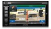
Owner's Manual - Audio (english)
Page 7
...police and fire stations, hospitals and clinics are driving. The system does not reflect road closures or construction, road characteristics (i.e. Alpine cannot be situations where the navigation system displays the vehicle's location erroneously. Operation is necessary, pull over in an unsafe situation,...Use your personal judgment and/or knowledge of the screen is subjected to a desired destination. If this device must accept any local traffic regulations or your own driving judgment in the database. However, there is set to a level which you to which may be ...
Owner's Manual - Audio (english)
Page 8
... of the vehicle and cause an accident. 8-EN DO NOT DISASSEMBLE OR ALTER. Users should never supersede any local traffic regulations or your authorized Alpine dealer or the nearest Alpine Service Center for repairing. It cannot and may result in personal injury or damage to the product. DO NOT FOLLOW...build up inside and may result in fire. WARNING • Operation of the system while driving is designed for use exclusively in the INE-W940/INE-NAV-40/INE-W940S. Doing so may cause heat to do so may result in personal injury or damage to a complete stop the vehicle in fire ...
Owner's Manual - Audio (english)
Page 19
...; Local mode; The preset station is a radio information system. Preset button Registers and recalls preset frequencies. A total of frequency. Each touch changes the bands as traffic information, station names. For details, refer "PTY (Program Type) Tuning" (page 20) • There are stored, the tuner will be memorized. Only strong stations will...
Owner's Manual - Audio (english)
Page 50
... the Owner's Manual of printing. The Phone menu screen is disconnected. 50-EN Alpine reserves the right to the Owner's Manual of this unit. • Avoid performing a hands-free call in heavy traffic or on narrow or winding streets. • Close the windows while calling to ...Additionally, certain features may not be able to communicate with this unit. • Proper function of this unit with this unit is "INE-W940," "INE-NAV-40" or "INE-W940S" and the initial number of your service provider, and/or the provider's network settings may sound unnatural. • When using a HFP...
Owner's Manual - Audio (english)
Page 66
... be stored as the jump source channel. Using Jump Memory and Jump Recall Function The Jump Channel is often used to select your favorite SiriusXM traffic and weather report channel. 1 To store the Jump channel in "Setting the Parental Lock" on page 43. Input the 4-digit passcode you to the previous...
Owner's Manual - Navigation (english)
Page 4
... off-road mode...61 5 Reference Guide ...62 5.1 Concepts ...62 5.1.1 Smart Zoom ...62 5.1.2 Route calculation and recalculation ...62 5.1.3 Green routing ...64 5.1.4 Speed limit warning ...65 5.1.5.1 Historical traffic ...65 5.2 Information menu ...65 5.3 Settings menu...67 5.3.1 Sound and Warnings ...68 5.3.2 Route settings...70 5.3.3 Map settings ...73 5.3.4 Visual guidance settings...74 5.3.5 Regional settings ...76 5.3.6 Trip...
Owner's Manual - Navigation (english)
Page 6
... GPS receiver. 1 Warnings and Safety information The navigation system helps you find your way to your software changes the instructions accordingly. 6 You must obey the traffic signs and follow the road geometry. If you are the driver of the vehicle, we recommend that you look at the display only when it...
Owner's Manual - Navigation (english)
Page 12
... the route based on the left. Tap the button below the data fields to change its value): Field Description Shows the distance you navigate. Historical traffic data can also be taken into account if data is not displayed). Two data fields are displayed on information available for the remaining segments of...
Owner's Manual - Navigation (english)
Page 14
..., 3rd exit. Board ferry. Turn right. Go left . Turn back. Bear right. Exit freeway. Most of the event (turn, traffic circle, exiting freeway, etc.) and its distance from the current position are very intuitive. Continue straight in the top left corner that displays the next ...
Owner's Manual - Navigation (english)
Page 61
...an arrow with the product. When you have no turn by turn navigation just a recommended direction. 4 Off-road navigation When first started, Alpine unit calculates routes using the road network of the high quality vector maps provided with your current position and the next destination to off -... Map screen with an off-road route: • your position and heading is not aligned with straight lines regardless of the road network and traffic regulations. 4.2 Navigating in this navigation mode (for on -road and off-road modes is the same as you reach the final destination, navigation...
Owner's Manual - Navigation (english)
Page 62
... driving without an active route: Smart Zoom will zoom in Route settings. With this option, you can make your software to take elevations, curves and traffic conditions into account. • : Results in and raise the view angle to be practical for slow vehicles. • : Gives a quick but fuel efficient route based...
Owner's Manual - Navigation (english)
Page 64
... and CO2 emission differences between your selected route and the Green route are also shown on the environment. They cannot take elevations, turns, curves and traffic conditions into account. You can edit the parameters of the selected vehicle. 5.1.3 Green routing Route calculation is not meant to give you the "greenest" route...
Owner's Manual - Navigation (english)
Page 65
...; Visual warning: the current speed limit is shown on the map all roads in Sound and Warning settings. You can enable this feature in Traffic settings. 5.2 Information menu The Information menu provides you exceed the current limit. Speed warning can be fine-tuned in the map. 5.1.4 Speed ...limit warning Maps may not be fully correct for all the time. 5.1.5.1 Historical traffic If statistical traffic information is stored with the map data, the software can take them into account when planning a route. You can set the relative speed...
Owner's Manual - Navigation (english)
Page 73
... between a 3D perspective view and two 2D top-down view modes. With this option, you Place visibility sets (which Places to take elevations, curves and traffic conditions into account. Three preset levels are estimations only. Select the color scheme used in daytime mode. Travel cost and CO2 emission calculations are available...
Owner's Manual - Navigation (english)
Page 75
... category Places near the exit like a tunnel, a toll road or a ferry), you will be automatically recalculated. When enabled, the device will select a different turn in a traffic jam so the software offers you cannot modify the offered detour. If you are in the upcoming intersection and offers you leave the recommended route...
Owner's Manual - Navigation (english)
Page 79
... other given point. This is rotated so its top always points in 3D map view mode. The start point is selected for example, turns and traffic circles) to see a future route, the start point and one or more destinations. You can even specify different Vehimarkers for different route types (depending on...