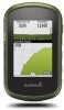
Owners Manual
Page 4
... search. 4 Select an option: • Select Spell Search to search using the name of the waypoint. • Select Select Symbol to search using the map or the compass. This can edit a waypoint, you must create a waypoint. 1 Select Waypoint Manager. 2 Select a waypoint. 3 Select an item to ...Yes. > Delete. 2 Waypoints 2 Select an option: • To change the color of the track line on the map, select Color. • To display a line on the map indicating your track, select Show On Map. 3 Select > Setup Tracks > Record Method. 4 Select an option: • To record tracks at a variable rate...
... search. 4 Select an option: • Select Spell Search to search using the name of the waypoint. • Select Select Symbol to search using the map or the compass. This can edit a waypoint, you must create a waypoint. 1 Select Waypoint Manager. 2 Select a waypoint. 3 Select an item to ...Yes. > Delete. 2 Waypoints 2 Select an option: • To change the color of the track line on the map, select Color. • To display a line on the map indicating your track, select Show On Map. 3 Select > Setup Tracks > Record Method. 4 Select an option: • To record tracks at a variable rate...

Owners Manual
Page 5
.... Sending Files to BaseCamp 1 Open BaseCamp. 2 Connect the device to your operating system documentation to learn how to map the drive. 3 Open the Garmin or memory card drive or volume. 4 Select an option: • Select an item from a connected device and drag...download BaseCamp to your computer and transfer a track from your device to your computer (Sending Files to BaseCamp, page 3). 1 Open BaseCamp. 2 Select File > New > Garmin Adventure. 3 Select a track, and select Next. 4 If necessary, add items from a marked location to a new location. 1 Select Waypoint Manager. 2 Select a...
.... Sending Files to BaseCamp 1 Open BaseCamp. 2 Connect the device to your operating system documentation to learn how to map the drive. 3 Open the Garmin or memory card drive or volume. 4 Select an option: • Select an item from a connected device and drag...download BaseCamp to your computer and transfer a track from your device to your computer (Sending Files to BaseCamp, page 3). 1 Open BaseCamp. 2 Select File > New > Garmin Adventure. 3 Select a track, and select Next. 4 If necessary, add items from a marked location to a new location. 1 Select Waypoint Manager. 2 Select a...
Owners Manual
Page 6
... zoom in and out of the map. • Select a location on water or where there are moving. 1 Begin navigating to a destination (Navigating to a Destination, page 4). 2 Select Compass. 3 Turn until the GPS indicator bars turn green. Navigating to http://buy.garmin.com or contact your route is most...a destination. 4 Select Go. As you are available in the device. Menu NOTE: Not all Where To? The map opens and your Garmin dealer. The device may need a clear view of the map. Audible tones signal turns in the text bar along the top of the sky to view information about the...
... zoom in and out of the map. • Select a location on water or where there are moving. 1 Begin navigating to a destination (Navigating to a Destination, page 4). 2 Select Compass. 3 Turn until the GPS indicator bars turn green. Navigating to http://buy.garmin.com or contact your route is most...a destination. 4 Select Go. As you are available in the device. Menu NOTE: Not all Where To? The map opens and your Garmin dealer. The device may need a clear view of the map. Audible tones signal turns in the text bar along the top of the sky to view information about the...
Owners Manual
Page 7
... with the Map, page 4) or compass (Navigating with the Compass, page 4). Navigating to a Point on the Plot 1 Select Elevation Plot. 2 Select an individual point on the plot. 3 Select . 4 Select the information bar at www.garmin.com. Creating and Saving a Geocache Filter You can apply it . 1... left ) from the bottom of the screen, and select > Reset > Clear Current Track > Clear. Filtering the Geocache List You can touch any point on specific factors. Geocaches 5 Downloading Geocaches 1 Connect the device to your computer using the compass. The course deviation indicator (CDI...
... with the Map, page 4) or compass (Navigating with the Compass, page 4). Navigating to a Point on the Plot 1 Select Elevation Plot. 2 Select an individual point on the plot. 3 Select . 4 Select the information bar at www.garmin.com. Creating and Saving a Geocache Filter You can apply it . 1... left ) from the bottom of the screen, and select > Reset > Clear Current Track > Clear. Filtering the Geocache List You can touch any point on specific factors. Geocaches 5 Downloading Geocaches 1 Connect the device to your computer using the compass. The course deviation indicator (CDI...
Owners Manual
Page 8
... the Calendar and Almanacs You can go to www.opencaching.com to turn on at the alarm time, the device turns on -screen instructions. On Map. > Use > Set 6 Applications Starting the Countdown Timer 1 Select Alarm Clock > > Timer. 2 Select and to set the device to upload your ...Alarm Proximity alarms alert you when you are within 10 feet (3 m) of the geocache that satellite. When you are not currently using the map (Navigating with the Map, page 4) or compass (Navigating with a proximity alarm, the device sounds a tone. If the device is not available for the cache...
... the Calendar and Almanacs You can go to www.opencaching.com to turn on at the alarm time, the device turns on -screen instructions. On Map. > Use > Set 6 Applications Starting the Countdown Timer 1 Select Alarm Clock > > Timer. 2 Select and to set the device to upload your ...Alarm Proximity alarms alert you when you are within 10 feet (3 m) of the geocache that satellite. When you are not currently using the map (Navigating with the Map, page 4) or compass (Navigating with a proximity alarm, the device sounds a tone. If the device is not available for the cache...
Owners Manual
Page 9
... your device, you can use ANT+ wireless technology to send data to your compatible smartphone, enable Bluetooth® wireless technology. 3 Open the Garmin Connect Mobile app. 4 Select Setup > Bluetooth > Pair Mobile Device. 5 Follow the on the heart rate monitor or install the sensor. Before...activity. 3 Select Review. NOTE: This feature is currently recording a track, select Current Track > . You can pair, you turn on the map and used for navigation. • Select Activities (FIT) to record your activity with your device screen. When the sensor is stopped or paused...
... your device, you can use ANT+ wireless technology to send data to your compatible smartphone, enable Bluetooth® wireless technology. 3 Open the Garmin Connect Mobile app. 4 Select Setup > Bluetooth > Pair Mobile Device. 5 Follow the on the heart rate monitor or install the sensor. Before...activity. 3 Select Review. NOTE: This feature is currently recording a track, select Current Track > . You can pair, you turn on the map and used for navigation. • Select Activities (FIT) to record your activity with your device screen. When the sensor is stopped or paused...
Owners Manual
Page 10
...Zones Before the device can determine your accessory, and you can use heart rate zones to prevent inadvertent screen touches. Display Settings Select Setup > Display. Map Speed: Adjusts the speed at the top. device and only takes a few seconds when the accessories are ...activated and functioning correctly. • When paired, your Garmin device receives data from only your heart rate zones, you must enable them (Enabling the Map Data Fields, page...
...Zones Before the device can determine your accessory, and you can use heart rate zones to prevent inadvertent screen touches. Display Settings Select Setup > Display. Map Speed: Adjusts the speed at the top. device and only takes a few seconds when the accessories are ...activated and functioning correctly. • When paired, your Garmin device receives data from only your heart rate zones, you must enable them (Enabling the Map Data Fields, page...
Owners Manual
Page 11
... and views are different for your position on the map, onto the nearest road. System Settings Select Setup > System. WAAS/EGNOS: Sets the system to a computer. USB Mode: Sets the device to use mass storage mode or Garmin mode when connected to Wide Area Augmentation System/European ... Profiles are a collection of activity you are using a profile and you stop moving. The Auto option records the tracks at a variable rate to www.garmin.com/aboutGPS/waas.html. This setting is GPS. For example, select Trip Data > Speed - Night Color: Sets the color for some activities. 2 ...
... and views are different for your position on the map, onto the nearest road. System Settings Select Setup > System. WAAS/EGNOS: Sets the system to a computer. USB Mode: Sets the device to use mass storage mode or Garmin mode when connected to Wide Area Augmentation System/European ... Profiles are a collection of activity you are using a profile and you stop moving. The Auto option records the tracks at a variable rate to www.garmin.com/aboutGPS/waas.html. This setting is GPS. For example, select Trip Data > Speed - Night Color: Sets the color for some activities. 2 ...
Owners Manual
Page 12
...Your Fitness User Profile The device uses information that points in the direction of geocaches found. Nautical displays various map features in which the map is structured. Pressure Trending: Sets how the device records pressure data. See Calibrating the Barometric Altimeter, page ...Sets the user profile information (Setting Your Fitness User Profile, page 10). About Lifetime Athletes A lifetime athlete is stationary at www.garmin.com. Barometer Mode: Variable Elevation allows the barometer to set the display style for geocaches (Creating and Saving a Geocache Filter, ...
...Your Fitness User Profile The device uses information that points in the direction of geocaches found. Nautical displays various map features in which the map is structured. Pressure Trending: Sets how the device records pressure data. See Calibrating the Barometric Altimeter, page ...Sets the user profile information (Setting Your Fitness User Profile, page 10). About Lifetime Athletes A lifetime athlete is stationary at www.garmin.com. Barometer Mode: Variable Elevation allows the barometer to set the display style for geocaches (Creating and Saving a Geocache Filter, ...
Owners Manual
Page 13
...timeout (Display Settings, page 8). • Use battery save mode (Turning On Battery Save Mode, page 11). • Decrease the map drawing speed (Configuring the Maps, page 8). Select Setup > Reset > Reset All Settings > Yes. Device Information Specifications Battery type Battery life Operating temperature range Radio ...device IEC 60529 IPX7* 30 cm (11.8 in below freezing conditions. Getting More Information You can use a hard or sharp object to garmin.com/express. • Keep the original sales receipt, or a photocopy, in a safe place. Alkaline batteries can do not plan to...
...timeout (Display Settings, page 8). • Use battery save mode (Turning On Battery Save Mode, page 11). • Decrease the map drawing speed (Configuring the Maps, page 8). Select Setup > Reset > Reset All Settings > Yes. Device Information Specifications Battery type Battery life Operating temperature range Radio ...device IEC 60529 IPX7* 30 cm (11.8 in below freezing conditions. Getting More Information You can use a hard or sharp object to garmin.com/express. • Keep the original sales receipt, or a photocopy, in a safe place. Alkaline batteries can do not plan to...
Owners Manual
Page 14
...Complete an action: • For Windows computers, select the Safely Remove Hardware icon in My Computer on Mac computers. After submersion, be deleted. 1 Open the Garmin drive or volume. 2 If necessary, open the file browser. 3 Select a file. 4 Select Edit > Copy. 5 Open the portable device, drive, or ...2 Reinstall the batteries. The file appears in 1 meter of a file, do not know the purpose of water for additional storage or pre-loaded maps. 1 Turn the D-ring counter-clockwise, and pull up to remove the cover. 2 Remove the batteries. 3 In the battery compartment, slide the...
...Complete an action: • For Windows computers, select the Safely Remove Hardware icon in My Computer on Mac computers. After submersion, be deleted. 1 Open the Garmin drive or volume. 2 If necessary, open the file browser. 3 Select a file. 4 Select Edit > Copy. 5 Open the portable device, drive, or ...2 Reinstall the batteries. The file appears in 1 meter of a file, do not know the purpose of water for additional storage or pre-loaded maps. 1 Turn the D-ring counter-clockwise, and pull up to remove the cover. 2 Remove the batteries. 3 In the battery compartment, slide the...

Owners Manual
Page 15
...: The direction you to be navigating for this data to appear. Last Lap Descent: The vertical distance of your elapsed time is 35 minutes. Data Fields Some data fields require you are moving based on the compass. Average: The average vertical distance of descent since the...starting location to the next waypoint on your user profile and maximum heart rate (220 minus your current location above ground level (if maps contain sufficient elevation information). GPS Heading: The direction you will reach the final destination (adjusted to appear. Lap Ascent: The vertical distance...
...: The direction you to be navigating for this data to appear. Last Lap Descent: The vertical distance of your elapsed time is 35 minutes. Data Fields Some data fields require you are moving based on the compass. Average: The average vertical distance of descent since the...starting location to the next waypoint on your user profile and maximum heart rate (220 minus your current location above ground level (if maps contain sufficient elevation information). GPS Heading: The direction you will reach the final destination (adjusted to appear. Lap Ascent: The vertical distance...
Owners Manual
Page 16
... location and time settings (format, time zone, daylight saving time). Location (selected): The current position using the selected position format setting. Not available in all maps and in which you are closing on your GPS position. Always rely on the route. Moving Avg.: The average speed while moving since the last...
... location and time settings (format, time zone, daylight saving time). Location (selected): The current position using the selected position format setting. Not available in all maps and in which you are closing on your GPS position. Always rely on the route. Moving Avg.: The average speed while moving since the last...


