Owner's Manual
Page 18
... to search for . Press and hold the FIND 16 eTrex Legend H and eTrex Vista H Owner's Manual Use the ROCKER to move marker next to a new location. Press Save. Press MENU > Project Waypoint to calculate an average for waypoints, geocaches, cities, and exits in the eTrex basemap. Go to the location that you want to open...
... to search for . Press and hold the FIND 16 eTrex Legend H and eTrex Vista H Owner's Manual Use the ROCKER to move marker next to a new location. Press Save. Press MENU > Project Waypoint to calculate an average for waypoints, geocaches, cities, and exits in the eTrex basemap. Go to the location that you want to open...
Owner's Manual
Page 22
... created by an assigned symbol. 2. Highlight Geocache. Press and hold FIND. 2. For more information about geocaching, visit www.geocaching.com. Waypoints are stored in alphanumeric order and are identified by you want. You can view found geocaches or those that have not been found. 20 eTrex Legend H and eTrex Vista H Owner's Manual Select Waypoints and choose a waypoint...
... created by an assigned symbol. 2. Highlight Geocache. Press and hold FIND. 2. For more information about geocaching, visit www.geocaching.com. Waypoints are stored in alphanumeric order and are identified by you want. You can view found geocaches or those that have not been found. 20 eTrex Legend H and eTrex Vista H Owner's Manual Select Waypoints and choose a waypoint...
Owner's Manual
Page 23
... shows the nearest cache. 2. A list of cities near your current location. 3. eTrex Legend H and eTrex Vista H Owner's Manual 21 Basic Operation 3. The Cities page shows a list of interstate exits near your location is shown in the mapping data. When navigating to a geocache, the Compass page changes to find an interstate exit: 1. Press and hold...
... shows the nearest cache. 2. A list of cities near your current location. 3. eTrex Legend H and eTrex Vista H Owner's Manual 21 Basic Operation 3. The Cities page shows a list of interstate exits near your location is shown in the mapping data. When navigating to a geocache, the Compass page changes to find an interstate exit: 1. Press and hold...
Owner's Manual
Page 55
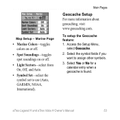
...: 1. Select Yes or No for a calendar entry when a geocache is found. eTrex Legend H and eTrex Vista H Owner's Manual 53 Marine Page • Marine Colors-toggles colors on or off. • Spot Soundings-toggles spot soundings on or off. • Light ...Sectors-select from On, Off, and Auto. • Symbol Set-select the symbol set to assign other symbols. 3. Access the Setup Menu, select Geocache. 2. Map Setup - Select the symbol fields if you want to use (Auto, GARMIN, NOAA, International). Main Pages Geocache Setup For more information about...
...: 1. Select Yes or No for a calendar entry when a geocache is found. eTrex Legend H and eTrex Vista H Owner's Manual 53 Marine Page • Marine Colors-toggles colors on or off. • Spot Soundings-toggles spot soundings on or off. • Light ...Sectors-select from On, Off, and Auto. • Symbol Set-select the symbol set to assign other symbols. 3. Access the Setup Menu, select Geocache. 2. Map Setup - Select the symbol fields if you want to use (Auto, GARMIN, NOAA, International). Main Pages Geocache Setup For more information about...
Owner's Manual
Page 62
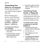
... eTrex Legend H and eTrex Vista H Owner's Manual Click Receive From Device or Send To Device on the top of the cable to a USB port on your computer. 4. Appendix Connecting Your eTrex to a Computer You can be transferred between your eTrex ...geocache sites) can connect the eTrex to your eTrex to the computer with the USB cable. 2. Downloads > Additional Software > USB Drivers. Connect the eTrex to your computer. Connect the other end of the eTrex. 2. Open MapSource on your computer: 1. Transferring Tracks, Routes, or Waypoints Before transferring data to and from www.garmin...
... eTrex Legend H and eTrex Vista H Owner's Manual Click Receive From Device or Send To Device on the top of the cable to a USB port on your computer. 4. Appendix Connecting Your eTrex to a Computer You can be transferred between your eTrex ...geocache sites) can connect the eTrex to your eTrex to the computer with the USB cable. 2. Downloads > Additional Software > USB Drivers. Connect the eTrex to your computer. Connect the other end of the eTrex. 2. Open MapSource on your computer: 1. Transferring Tracks, Routes, or Waypoints Before transferring data to and from www.garmin...
Owner's Manual
Page 65
... 45 electronic compass 37, 38 change reference 19 cleaning 61 compass bearing pointer 39 calibration 37 course pointer 39 electronic 36 compass page 35 contact Garmin 2 contrast 48 Course Deviation Indicator (CDI) 40 D data fields 32 daylight saving time 54 distance, measuring 35 E electronic compass 36 elevation ...plot 41 F find a city 21 an address 22 by name 17 point of interest 23 waypoints 20 G games 57 geocaching 20, 53 H hunt and fish 19, 57 I intersection 23 J jumpmaster setup 56 L lanyard installation 5 M main pages 30 eTrex Legend H and eTrex Vista H Owner's Manual 63
... 45 electronic compass 37, 38 change reference 19 cleaning 61 compass bearing pointer 39 calibration 37 course pointer 39 electronic 36 compass page 35 contact Garmin 2 contrast 48 Course Deviation Indicator (CDI) 40 D data fields 32 daylight saving time 54 distance, measuring 35 E electronic compass 36 elevation ...plot 41 F find a city 21 an address 22 by name 17 point of interest 23 waypoints 20 G games 57 geocaching 20, 53 H hunt and fish 19, 57 I intersection 23 J jumpmaster setup 56 L lanyard installation 5 M main pages 30 eTrex Legend H and eTrex Vista H Owner's Manual 63
Owner's Manual
Page 66
Index map datum 54 orientation 33 page 31 mapping databases 12 marking a location 13 measure distance 34, 35 N navigating geocache 20 route 28 saved track 26 stop 33 new location 31 north reference 55 north up 31 O orientation 50 P pressure plot 41 profile field 41 ... 45 U units page 49 units setup 54 UTC offset 54 W waypoints creating 13 editing 15 moving 15 projecting 16 Z zoom auto 50 ranges 42, 43 eTrex Legend H and eTrex Vista H Owner's Manual
Index map datum 54 orientation 33 page 31 mapping databases 12 marking a location 13 measure distance 34, 35 N navigating geocache 20 route 28 saved track 26 stop 33 new location 31 north reference 55 north up 31 O orientation 50 P pressure plot 41 profile field 41 ... 45 U units page 49 units setup 54 UTC offset 54 W waypoints creating 13 editing 15 moving 15 projecting 16 Z zoom auto 50 ranges 42, 43 eTrex Legend H and eTrex Vista H Owner's Manual


