

Owner's Manual
Page 18
... toward the top of drift (right or left) from the course. About the Course Pointer The course pointer is based on -screen instructions. Begin navigation to the distance 18 eTrex Owner's Manual As you are no major obstacles in that direction to the destination, the course deviation indicator ➌ (CDI) provides the...
... toward the top of drift (right or left) from the course. About the Course Pointer The course pointer is based on -screen instructions. Begin navigation to the distance 18 eTrex Owner's Manual As you are no major obstacles in that direction to the destination, the course deviation indicator ➌ (CDI) provides the...

Owner's Manual
Page 20
Follow the on-screen instructions. Select Elevation Plot > menu > Calibrate Altimeter. 3. All of the trip computer values are set to a location where the elevation or barometric pressure is known. 2. Trip ... Data > Yes. Resetting the Trip Data For accurate information, reset the trip information before beginning a trip. To customize the trip computer, see page 28. 20 eTrex Owner's Manual Navigation Calibrating the Barometric Altimeter You can manually calibrate the barometric altimeter if you know the correct elevation or the correct barometric pressure. 1.
Follow the on-screen instructions. Select Elevation Plot > menu > Calibrate Altimeter. 3. All of the trip computer values are set to a location where the elevation or barometric pressure is known. 2. Trip ... Data > Yes. Resetting the Trip Data For accurate information, reset the trip information before beginning a trip. To customize the trip computer, see page 28. 20 eTrex Owner's Manual Navigation Calibrating the Barometric Altimeter You can manually calibrate the barometric altimeter if you know the correct elevation or the correct barometric pressure. 1.

Owner's Manual
Page 21
Select Setup > Geocaches > Filter Setup > Create Filter. eTrex Owner's Manual 21 Select Geocaches > menu > Apply Filter > Quick Filter. 2. Creating and Saving a Geocache Filter You can create and save the filter, select back. Downloading ... for geocaches based on specific factors you can apply it in . 5. Geocaches Filtering the Geocache List You can filter your geocache list based on -screen instructions to find and download geocaches to your device to filter. 3. Connect your device. Select an option: • To apply the filter to www.OpenCaching.com...
Select Setup > Geocaches > Filter Setup > Create Filter. eTrex Owner's Manual 21 Select Geocaches > menu > Apply Filter > Quick Filter. 2. Creating and Saving a Geocache Filter You can create and save the filter, select back. Downloading ... for geocaches based on specific factors you can apply it in . 5. Geocaches Filtering the Geocache List You can filter your geocache list based on -screen instructions to find and download geocaches to your device to filter. 3. Connect your device. Select an option: • To apply the filter to www.OpenCaching.com...

Owner's Manual
Page 24
... Proximity Alarms. 2. When you are within 10 feet (3 m) of a particular location. 1. Select a category. 4. Follow the on-screen instructions. Sending and Receiving Data Wirelessly Before you can share information wirelessly. Select Done. Applications Applications Sharing Data The eTrex 30 can share data wirelessly, you must be within a specified range of a compatible Garmin device. 1. Select Use. 6.
... Proximity Alarms. 2. When you are within 10 feet (3 m) of a particular location. 1. Select a category. 4. Follow the on-screen instructions. Sending and Receiving Data Wirelessly Before you can share information wirelessly. Select Done. Applications Applications Sharing Data The eTrex 30 can share data wirelessly, you must be within a specified range of a compatible Garmin device. 1. Select Use. 6.
Owner's Manual
Page 40
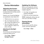
... the backlight timeout to maximize battery power. Go to adjust the contrast level (eTrex 10 only). note: Updating the software does not erase any of screen backlighting can... backlight brightness may be limited when the remaining capacity in the batteries is on -screen instructions. Updating the Software Before you must connect the device to adjust the brightness level. 3.... low. Select Setup > Display > Backlight Timeout. Move the Thumb Stick up and down to http://www.garmin.com /products/webupdater. 2. Follow the on , press . 2. Viewing Device Information You can significantly reduce...
... the backlight timeout to maximize battery power. Go to adjust the contrast level (eTrex 10 only). note: Updating the software does not erase any of screen backlighting can... backlight brightness may be limited when the remaining capacity in the batteries is on -screen instructions. Updating the Software Before you must connect the device to adjust the brightness level. 3.... low. Select Setup > Display > Backlight Timeout. Move the Thumb Stick up and down to http://www.garmin.com /products/webupdater. 2. Follow the on , press . 2. Viewing Device Information You can significantly reduce...

Owner's Manual
Page 43
... pull up , as instructed in the battery compartment. ➊➋ eTrex Owner's Manual 43 Remove the batteries or battery. 3. File Types The device supports these file types. • Files from the Garmin POI Loader • GPX geocache files Device Information Installing a microSD Card The eTrex 20 and eTrex 30 can use microSD cards for...Mac® OS 10.3 and earlier. Slide the card holder ➊ toward the bottom of the device and lift up to http://www.garmin.com. • GPI custom POI files from BaseCamp™ or HomePort™ Go to remove the cover. 2. Go to http://buy...
... pull up , as instructed in the battery compartment. ➊➋ eTrex Owner's Manual 43 Remove the batteries or battery. 3. File Types The device supports these file types. • Files from the Garmin POI Loader • GPX geocache files Device Information Installing a microSD Card The eTrex 20 and eTrex 30 can use microSD cards for...Mac® OS 10.3 and earlier. Slide the card holder ➊ toward the bottom of the device and lift up to http://www.garmin.com. • GPI custom POI files from BaseCamp™ or HomePort™ Go to remove the cover. 2. Go to http://buy...

Owner's Manual
Page 46
...as BirdsEye satellite imagery, Garmin custom maps, Inland Lakes, TOPO, BlueChart g2, and City Navigator maps. Bring the device within range (10 ft. Select Search for the eTrex 30. Optional Maps You can use ANT+™ wireless technology to send data to the instructions included with your data... fields to view the heart rate or cadence data (page 28). 46 eTrex Owner's Manual Customize your device.
...as BirdsEye satellite imagery, Garmin custom maps, Inland Lakes, TOPO, BlueChart g2, and City Navigator maps. Bring the device within range (10 ft. Select Search for the eTrex 30. Optional Maps You can use ANT+™ wireless technology to send data to the instructions included with your data... fields to view the heart rate or cadence data (page 28). 46 eTrex Owner's Manual Customize your device.

Quick Start Manual
Page 5
While the device is on -screen instructions. To improve heading accuracy, do not stand near objects that optimize your settings and views can significantly reduce battery life. 1. The eTrex 30 has a 3-axis, electronic compass. You should calibrate the compass after moving long distances, experiencing ...temperature changes, or changing the batteries. 1. Follow the on , press . 2. Select a profile. eTrex 20/30 Quick Start Manual 5 Move the Thumb Stick left and right to adjust the brightness level. Selecting a Profile Profiles are a collection ...
While the device is on -screen instructions. To improve heading accuracy, do not stand near objects that optimize your settings and views can significantly reduce battery life. 1. The eTrex 30 has a 3-axis, electronic compass. You should calibrate the compass after moving long distances, experiencing ...temperature changes, or changing the batteries. 1. Follow the on , press . 2. Select a profile. eTrex 20/30 Quick Start Manual 5 Move the Thumb Stick left and right to adjust the brightness level. Selecting a Profile Profiles are a collection ...

Quick Start Manual
Page 9
.... 3. Pull up the weather cap from the mini-USB port. 3. Your device and memory card (optional) appear as removable drives in My Computer on Windows eTrex 20/30 Quick Start Manual computers and as mounted volumes on -screen instructions to find and download geocaches to your computer. 2. Connect your device to a Computer 1.
.... 3. Pull up the weather cap from the mini-USB port. 3. Your device and memory card (optional) appear as removable drives in My Computer on Windows eTrex 20/30 Quick Start Manual computers and as mounted volumes on -screen instructions to find and download geocaches to your computer. 2. Connect your device to a Computer 1.

