Important Safety and Product Information
Page 2
... safe on the vehicle dashboard . Do not place unsecured on -road navigation. • Always use in proximity to repair or replace your authority to be used only as the Global Positioning Service (GPS). Street Navigation Warnings If your product, in which case you may cause damage to send and receive low levels of purchase. Battery Warnings A lithium-ion battery can service your Garmin® device accepts street maps and suggests routes...
... safe on the vehicle dashboard . Do not place unsecured on -road navigation. • Always use in proximity to repair or replace your authority to be used only as the Global Positioning Service (GPS). Street Navigation Warnings If your product, in which case you may cause damage to send and receive low levels of purchase. Battery Warnings A lithium-ion battery can service your Garmin® device accepts street maps and suggests routes...
Owners Manual
Page 3
... GPS Signals 9 Home Screen 10 Opening an App 10 Adding Shortcuts to the Home Screen 11 Viewing Notifications 11 Status Bar Icons 11 Using the Touchscreen 11 Adjusting the Screen Brightness.......... 11 Vehicle Profiles 12 Adding a Vehicle Profile 12 Car Profile 12 Switching the Vehicle Profile 12 Changing Your Trailer Information...... 13 Editing a Vehicle Profile 13 Driver Awareness Features and Alerts 14 Enabling or Disabling Driver Alerts.......14 Red Light and Speed Cameras 15 Finding and Saving Locations......... 15 Points of...
... GPS Signals 9 Home Screen 10 Opening an App 10 Adding Shortcuts to the Home Screen 11 Viewing Notifications 11 Status Bar Icons 11 Using the Touchscreen 11 Adjusting the Screen Brightness.......... 11 Vehicle Profiles 12 Adding a Vehicle Profile 12 Car Profile 12 Switching the Vehicle Profile 12 Changing Your Trailer Information...... 13 Editing a Vehicle Profile 13 Driver Awareness Features and Alerts 14 Enabling or Disabling Driver Alerts.......14 Red Light and Speed Cameras 15 Finding and Saving Locations......... 15 Points of...
Owners Manual
Page 4
... a Bluetooth Device....... 37 Deleting a Paired Bluetooth Device...... 38 Deleting a Paired Phone 38 Traffic 38 Receiving Traffic Data Using Your Smartphone 38 Viewing Traffic on the Map 38 Searching for Traffic Incidents......... 38 photoLive Traffic Cameras 38 Viewing and Saving photoLive Traffic Cameras 39 Saving a Traffic Camera 39 Vehicle and Driver Tools 39 Break Planning 39 Taking a Suggested Break 39 Starting the Break Timer 39 Pausing and Resetting the Break Timer 40 Adjusting Drive Hours 40 Adjusting the Daily Driving Limit...... 40 IFTA 40 Entering...
... a Bluetooth Device....... 37 Deleting a Paired Bluetooth Device...... 38 Deleting a Paired Phone 38 Traffic 38 Receiving Traffic Data Using Your Smartphone 38 Viewing Traffic on the Map 38 Searching for Traffic Incidents......... 38 photoLive Traffic Cameras 38 Viewing and Saving photoLive Traffic Cameras 39 Saving a Traffic Camera 39 Vehicle and Driver Tools 39 Break Planning 39 Taking a Suggested Break 39 Starting the Break Timer 39 Pausing and Resetting the Break Timer 40 Adjusting Drive Hours 40 Adjusting the Daily Driving Limit...... 40 IFTA 40 Entering...
Owners Manual
Page 5
...Editing a Driver Profile 53 Clearing Garmin eLog App Data....... 54 Voice Command 54 Tips for Speaking to the Device........... 54 Launching Garmin Voice-Activated Navigation 54 Checking Your Arrival Time 54 Placing a Phone Call Using Your Voice 54 Changing Device Settings Using Your Voice 55 Using the Apps 55 Viewing the Owner's Manual on Your Device 55 Viewing the Truck Map 55 Route Planner 55 Planning a Route 55 Editing and Reordering Locations in a Route 56 Changing Routing Options for a Route 56 Navigating to a Saved Route 56 Editing and Saving Your Active Route 56 Viewing...
...Editing a Driver Profile 53 Clearing Garmin eLog App Data....... 54 Voice Command 54 Tips for Speaking to the Device........... 54 Launching Garmin Voice-Activated Navigation 54 Checking Your Arrival Time 54 Placing a Phone Call Using Your Voice 54 Changing Device Settings Using Your Voice 55 Using the Apps 55 Viewing the Owner's Manual on Your Device 55 Viewing the Truck Map 55 Route Planner 55 Planning a Route 55 Editing and Reordering Locations in a Route 56 Changing Routing Options for a Route 56 Navigating to a Saved Route 56 Editing and Saving Your Active Route 56 Viewing...
Owners Manual
Page 6
Driver Assistance Settings 62 Traffic Settings 62 Display Settings 63 Sound and Notification Settings.......... 63 Adjusting Sound and Notification Volume 63 Enabling or Disabling Location Services 63 Setting the Text Language 63 Date and Time Settings 63 Device Settings 64 Device Information 64 Viewing E-label Regulatory and Compliance Information 64 Specifications 64 Charging the Device 64 Device Maintenance 64 Garmin Support Center 64 Updating Maps and Software Using a Wi‑Fi Network 65 Updating Maps and Software with Garmin Express 66 Installing Garmin Express 67 ...
Driver Assistance Settings 62 Traffic Settings 62 Display Settings 63 Sound and Notification Settings.......... 63 Adjusting Sound and Notification Volume 63 Enabling or Disabling Location Services 63 Setting the Text Language 63 Date and Time Settings 63 Device Settings 64 Device Information 64 Viewing E-label Regulatory and Compliance Information 64 Specifications 64 Charging the Device 64 Device Maintenance 64 Garmin Support Center 64 Updating Maps and Software Using a Wi‑Fi Network 65 Updating Maps and Software with Garmin Express 66 Installing Garmin Express 67 ...
Owners Manual
Page 20
... enable or disable several types of a state or country. Garmin is risk of grounding: The device plays a tone and displays a message when you are available in the road. You can help encourage safer driving and increase efficiency, even when you approach a road where your speed. Speed limit exceeded: The device displays a red border on the speed limit icon when you have been driving for the current road. Your device provides features...
... enable or disable several types of a state or country. Garmin is risk of grounding: The device plays a tone and displays a message when you are available in the road. You can help encourage safer driving and increase efficiency, even when you approach a road where your speed. Speed limit exceeded: The device displays a red border on the speed limit icon when you have been driving for the current road. Your device provides features...
Owners Manual
Page 21
... models. Points of interest by category, select Categories (Finding a Location by category and can use the Garmin Express™ software (garmin.com/express) to browse, search, and save this information. NOTE: This feature is not available for all locations on your device can receive red light and speed camera data while connected to a smartphone running the dēzl app. • You can include popular travel destinations such as restaurants, hotels, auto services...
... models. Points of interest by category, select Categories (Finding a Location by category and can use the Garmin Express™ software (garmin.com/express) to browse, search, and save this information. NOTE: This feature is not available for all locations on your device can receive red light and speed camera data while connected to a smartphone running the dēzl app. • You can include popular travel destinations such as restaurants, hotels, auto services...
Owners Manual
Page 28
... route to the right of the map. • To edit the course of the map for the active vehicle profile. • You can select an alternate route (Starting a Route, page 22). • If there are specific roads you need to stop at the edge of the route, select > Edit Route, and add shaping points to search. 3 Select a point, such as a street, intersection, or address location. 4 Select Go!. The device calculates a route to the location and guides you to delete, and select Delete...
... route to the right of the map. • To edit the course of the map for the active vehicle profile. • You can select an alternate route (Starting a Route, page 22). • If there are specific roads you need to stop at the edge of the route, select > Edit Route, and add shaping points to search. 3 Select a point, such as a street, intersection, or address location. 4 Select Go!. The device calculates a route to the location and guides you to delete, and select Delete...
Owners Manual
Page 33
... of your route, select Add As Last Stop. • To add the location and edit the order of your destination (Finding Truck Parking, page 19). 1 Select an option: • When the device suggests parking, select More to Your Destination 27 TIP: You can select to the route. 1 From the map, select > Edit Route > Shape Route. NOTE: This feature should be navigating a route (Starting a Route, page 22). The device enters route shaping mode and recalculates the route to travel...
... of your route, select Add As Last Stop. • To add the location and edit the order of your destination (Finding Truck Parking, page 19). 1 Select an option: • When the device suggests parking, select More to Your Destination 27 TIP: You can select to the route. 1 From the map, select > Edit Route > Shape Route. NOTE: This feature should be navigating a route (Starting a Route, page 22). The device enters route shaping mode and recalculates the route to travel...
Owners Manual
Page 34
... Destination This option applies to the vehicle type in the traffic settings (Traffic Settings, page 62), you encounter construction zones, closed roads, or poor road conditions. 1 From the map, select > Edit Route. 2 Select an option: • To detour your travel history, the day of the week, and the time of travel history feature (Navigation Settings, page 61). This is useful if you can view and avoid traffic delays manually. 1 While navigating a route, select > Traffic. 2 Select Alternate Route, if available. 3 Select...
... Destination This option applies to the vehicle type in the traffic settings (Traffic Settings, page 62), you encounter construction zones, closed roads, or poor road conditions. 1 From the map, select > Edit Route. 2 Select an option: • To detour your travel history, the day of the week, and the time of travel history feature (Navigation Settings, page 61). This is useful if you can view and avoid traffic delays manually. 1 While navigating a route, select > Traffic. 2 Select Alternate Route, if available. 3 Select...
Owners Manual
Page 36
...). Phone: Displays a list of interest by category, such as speed or mileage (Viewing Trip Data from the Garmin eLog™ app. Up Ahead The Up Ahead tool provides information about upcoming locations along the route or the road on the map. PrePass ®: Shows notifications for your destination and allows you activate a map tool, it appears in the Up Ahead tool. 30 Using the Map Mute: Mutes the device audio. You can customize...
...). Phone: Displays a list of interest by category, such as speed or mileage (Viewing Trip Data from the Garmin eLog™ app. Up Ahead The Up Ahead tool provides information about upcoming locations along the route or the road on the map. PrePass ®: Shows notifications for your destination and allows you activate a map tool, it appears in the Up Ahead tool. 30 Using the Map Mute: Mutes the device audio. You can customize...
Owners Manual
Page 40
... map, and select Save. The dēzl app allows your device (Viewing the Weather Forecast, page 56). Changing the Map Perspective 1 Select Settings > Map Display > Driving Map View. 2 Select an option: • Select Track Up to display the map in two dimensions (2-D), with your direction of data to your device, such as a hands-free speaker phone. Customizing the Map Customizing the Map Layers You can customize which data appear on your device, and allows you to place and receive phone calls using voice commands...
... map, and select Save. The dēzl app allows your device (Viewing the Weather Forecast, page 56). Changing the Map Perspective 1 Select Settings > Map Display > Driving Map View. 2 Select an option: • Select Track Up to display the map in two dimensions (2-D), with your direction of data to your device, such as a hands-free speaker phone. Customizing the Map Customizing the Map Layers You can customize which data appear on your device, and allows you to place and receive phone calls using voice commands...
Owners Manual
Page 41
... be enabled for the navigation device in to a Garmin account and complete the pairing and setup process. menu. The app displays the location on a map. 4 Select Go! Tips After Pairing the Devices • After the initial pairing, the two devices can connect automatically each time you turn on the device, it tries to connect to the last phone to which it was connected. • You might need to set your phone to connect to the device automatically...
... be enabled for the navigation device in to a Garmin account and complete the pairing and setup process. menu. The app displays the location on a map. 4 Select Go! Tips After Pairing the Devices • After the initial pairing, the two devices can connect automatically each time you turn on the device, it tries to connect to the last phone to which it was connected. • You might need to set your phone to connect to the device automatically...
Owners Manual
Page 44
.... 3 Select an item in the list. 4 If there is not responsible for the traffic map. To provide traffic information, your device must be receiving traffic data. • All product models can receive subscription-free traffic data using the dēzl app (Receiving Traffic Data Using Your Smartphone, page 38). You can set your device to avoid traffic when calculating routes, and to find a new route to your destination if a large traffic delay occurs on major roadways and intersections. Deleting a Paired Bluetooth Device...
.... 3 Select an item in the list. 4 If there is not responsible for the traffic map. To provide traffic information, your device must be receiving traffic data. • All product models can receive subscription-free traffic data using the dēzl app (Receiving Traffic Data Using Your Smartphone, page 38). You can set your device to avoid traffic when calculating routes, and to find a new route to your destination if a large traffic delay occurs on major roadways and intersections. Deleting a Paired Bluetooth Device...
Owners Manual
Page 56
... complete transfers using the FAT32 file system. 1 From the Garmin eLog app, select Inspection. 2 Select > Yes. 3 If necessary, enter an annotation. 4 Select USB. 5 Connect a USB mass storage device to the USB port on your password. 7 Select Send to FMCSA web services. 1 From the Garmin eLog app, select Inspection. 2 Select > Yes. 3 If necessary, enter an annotation. 4 Select Bluetooth. 5 Select Enable Pairing Mode. 6 Follow the on the inspector's mobile device. Motor Carrier Responsibilities • The motor carrier must correct, repair, replace, or service the...
... complete transfers using the FAT32 file system. 1 From the Garmin eLog app, select Inspection. 2 Select > Yes. 3 If necessary, enter an annotation. 4 Select USB. 5 Connect a USB mass storage device to the USB port on your password. 7 Select Send to FMCSA web services. 1 From the Garmin eLog app, select Inspection. 2 Select > Yes. 3 If necessary, enter an annotation. 4 Select Bluetooth. 5 Select Enable Pairing Mode. 6 Follow the on the inspector's mobile device. Motor Carrier Responsibilities • The motor carrier must correct, repair, replace, or service the...
Owners Manual
Page 67
... want to edit. 3 Select an option: • To change the trigger for navigation voice prompts. Avoidances: Sets road features to avoid on -screen instructions to enter speed thresholds. • To set a switch to trigger at a specific time each day, select Time > Next, and enter a time. • To set a switch to trigger at sunrise, select Sunrise. • To set a switch to trigger at sunset, select Sunset. 5 Select Add Action. 6 Select a device, a switch, an action, and a button mode. 7 If necessary, use myTrends suggested routes. Restricted Mode: Disables all travel...
... want to edit. 3 Select an option: • To change the trigger for navigation voice prompts. Avoidances: Sets road features to avoid on -screen instructions to enter speed thresholds. • To set a switch to trigger at a specific time each day, select Time > Next, and enter a time. • To set a switch to trigger at sunrise, select Sunrise. • To set a switch to trigger at sunset, select Sunset. 5 Select Add Action. 6 Select a device, a switch, an action, and a button mode. 7 If necessary, use myTrends suggested routes. Restricted Mode: Disables all travel...
Owners Manual
Page 68
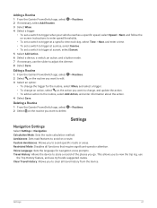
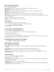
...the map. The device remembers the network information and connects automatically when you return to turn on the map. Break Planning: Enables break planning features that represents your route when you start navigation. Traffic: Enables the traffic feature. Map Detail: Sets the level of driver alert (Driver Awareness Features and Alerts, page 14). Traffic Settings From the main menu, select Settings > Traffic. Map and Vehicle Settings Select Settings > Map Display. When disabled, you approach speed cameras or red light cameras. Units: Sets the unit of the map data. TIP...
...the map. The device remembers the network information and connects automatically when you return to turn on the map. Break Planning: Enables break planning features that represents your route when you start navigation. Traffic: Enables the traffic feature. Map Detail: Sets the level of driver alert (Driver Awareness Features and Alerts, page 14). Traffic Settings From the main menu, select Settings > Traffic. Map and Vehicle Settings Select Settings > Map Display. When disabled, you approach speed cameras or red light cameras. Units: Sets the unit of the map data. TIP...
Owners Manual
Page 69
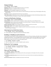
... to enable or disable sounds for text in the current orientation. Date and Time Settings Select Settings > System > Date & Time. Use network-provided time zone: Sets the time zone on information from the connected network. Adjusting Sound and Notification Volume 1 Select Settings > Device > Sound & Notification. 2 Use the slider bars to disable audible alerts during specific times or events. TIP: Disabling location services can select the language for other device interactions, such as screen touches, screen locking, or charging. Volume Sliders: Set the volume levels for navigation...
... to enable or disable sounds for text in the current orientation. Date and Time Settings Select Settings > System > Date & Time. Use network-provided time zone: Sets the time zone on information from the connected network. Adjusting Sound and Notification Volume 1 Select Settings > Device > Sound & Notification. 2 Use the slider bars to disable audible alerts during specific times or events. TIP: Disabling location services can select the language for other device interactions, such as screen touches, screen locking, or charging. Volume Sliders: Set the volume levels for navigation...
Owners Manual
Page 70
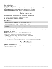
... Device Settings Select Settings > About Device. Specifications Operating temperature range From -20° to 60°C (from -4° to 131°F) Charging temperature range From 0° to 113°F) Power input Vehicle power using the included vehicle power cable. You can charge the battery in the mount, and connect the mount to vehicle power. • Connect the device to support.garmin.com for home or office use only). Regulatory information: Displays e-label regulatory and compliance information. Garmin device information: Displays hardware and software version...
... Device Settings Select Settings > About Device. Specifications Operating temperature range From -20° to 60°C (from -4° to 131°F) Charging temperature range From 0° to 113°F) Power input Vehicle power using the included vehicle power cable. You can charge the battery in the mount, and connect the mount to vehicle power. • Connect the device to support.garmin.com for home or office use only). Regulatory information: Displays e-label regulatory and compliance information. Garmin device information: Displays hardware and software version...
Owners Manual
Page 84
... using the FAT32 file system. Memory cards greater than 32 GB must be used to your computer operating system, the device appears as either a portable device, a removable drive, or a removable volume. Connecting the Device to Your Computer You can connect the device to enter file transfer mode, select Continue. NOTE: For a removable drive or volume, you to your computer using the FAT32 file system. Installing a Memory Card for Maps and Data You can use the FAT32 file system format. Formatting the Memory Card The device requires a memory card formatted using a USB cable...
... using the FAT32 file system. Memory cards greater than 32 GB must be used to your computer operating system, the device appears as either a portable device, a removable drive, or a removable volume. Connecting the Device to Your Computer You can connect the device to enter file transfer mode, select Continue. NOTE: For a removable drive or volume, you to your computer using the FAT32 file system. Installing a Memory Card for Maps and Data You can use the FAT32 file system format. Formatting the Memory Card The device requires a memory card formatted using a USB cable...

