Pilot's Guide
Page 18
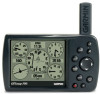
... press left to move to page 109 in a data field: 1. You also should update your GPSMAP 196. GPSMAP 196 Databases Your GPSMAP 196 comes with a serial connector) is used to transfer MapSource CD-ROM data to the previous character. MapSource Detailed Maps Optional Garmin Data Cards and MapSource CD-ROMs enhance the versatility of data, keep pressing right...
... press left to move to page 109 in a data field: 1. You also should update your GPSMAP 196. GPSMAP 196 Databases Your GPSMAP 196 comes with a serial connector) is used to transfer MapSource CD-ROM data to the previous character. MapSource Detailed Maps Optional Garmin Data Cards and MapSource CD-ROMs enhance the versatility of data, keep pressing right...

Pilot's Guide
Page 35
... VNAV indicator. NOTE: In Aviation (and Water) Mode, the Goto line and navigation guidance are directly on the map is locked and unusable. In Land Mode, the Goto line on course. GPSMAP 196 Pilot's Guide 27 The From point is a graphic view of your flight plan (or route), the...destination using a variety of your flight plans (routes) in a saved route, the route is constantly updated to determine if you are fixed. For complete information about the Map Page and the features of alerts appear on page 36. Following your Flight Plan When you have created and ...
... VNAV indicator. NOTE: In Aviation (and Water) Mode, the Goto line and navigation guidance are directly on the map is locked and unusable. In Land Mode, the Goto line on course. GPSMAP 196 Pilot's Guide 27 The From point is a graphic view of your flight plan (or route), the...destination using a variety of your flight plans (routes) in a saved route, the route is constantly updated to determine if you are fixed. For complete information about the Map Page and the features of alerts appear on page 36. Following your Flight Plan When you have created and ...

Pilot's Guide
Page 38
...right, or left . 30 GPSMAP 196 Pilot's Guide Map feature highlighted Panning Arrow data window: Shows the distance and bearing from your present location, and arrow's location coordinates. The map automatically moves to select on the ROCKER. If there are finished panning the Map, press QUIT. 2. The ...;eld, and the distance and bearing from your present location update as shown in closer for a better view. When you are several items grouped closely together, zoom in the image to the left on -screen map items, allowing you to the arrow is highlighted on -screen...
...right, or left . 30 GPSMAP 196 Pilot's Guide Map feature highlighted Panning Arrow data window: Shows the distance and bearing from your present location, and arrow's location coordinates. The map automatically moves to select on the ROCKER. If there are finished panning the Map, press QUIT. 2. The ...;eld, and the distance and bearing from your present location update as shown in closer for a better view. When you are several items grouped closely together, zoom in the image to the left on -screen map items, allowing you to the arrow is highlighted on -screen...

Pilot's Guide
Page 48
...GPSMAP 196 Pilot's Guide You need to select the descent rate. AVIATION MODE PAGES > ACTIVE ROUTE PAGE Target Altitude-enter the altitude you want to indicate the active point first. To set a target location at when you navigate a route, the list automatically updates..., Distance, and several other fields of zero. Active Route Page Whenever you perform an update to select any waypoint along the currently active route (or Goto) as your Jeppesen Database, the... Page shows each point (waypoint or map item) of the active route, with settings of the same features and options.
...GPSMAP 196 Pilot's Guide You need to select the descent rate. AVIATION MODE PAGES > ACTIVE ROUTE PAGE Target Altitude-enter the altitude you want to indicate the active point first. To set a target location at when you navigate a route, the list automatically updates..., Distance, and several other fields of zero. Active Route Page Whenever you perform an update to select any waypoint along the currently active route (or Goto) as your Jeppesen Database, the... Page shows each point (waypoint or map item) of the active route, with settings of the same features and options.

Pilot's Guide
Page 68
.... Press MENU to complete saving the route. 60 GPSMAP 196 Pilot's Guide LAND MODE PAGES AND FEATURES > CURRENT ROUTE PAGE Current Route Page Whenever you navigate a route, the turn list automatically updates to indicate the next turn at the top of the turns on a map. Next Turn Page Current Route Page You can save...
.... Press MENU to complete saving the route. 60 GPSMAP 196 Pilot's Guide LAND MODE PAGES AND FEATURES > CURRENT ROUTE PAGE Current Route Page Whenever you navigate a route, the turn list automatically updates to indicate the next turn at the top of the turns on a map. Next Turn Page Current Route Page You can save...

Pilot's Guide
Page 87
... up , then continue in Water Mode The middle of the compass ring. Like the Map Page, the Compass Page features user-selectable data fields on the Compass Page allows... is open the options menu. The right side of the destination (bearing) relative to accurately update and show your heading. For definitions of your movement and the direction to open ...eld settings, refer to the BASIC OPERATION AND PAGES IN WATER MODE > COMPASS PAGE waypoint. GPSMAP 196 Pilot's Guide 79 The compass ring and bearing indicators work independently to show additional information during ...
... up , then continue in Water Mode The middle of the compass ring. Like the Map Page, the Compass Page features user-selectable data fields on the Compass Page allows... is open the options menu. The right side of the destination (bearing) relative to accurately update and show your heading. For definitions of your movement and the direction to open ...eld settings, refer to the BASIC OPERATION AND PAGES IN WATER MODE > COMPASS PAGE waypoint. GPSMAP 196 Pilot's Guide 79 The compass ring and bearing indicators work independently to show additional information during ...

Pilot's Guide
Page 94
...the Tide Station for the date you view the tide information want to right. The list is updated with the chart shown, highlight the On field, and press ENTER. 2. Select a tide... search requirements. 3. Press ENTER. Press MENU, highlight Use Current Date, and press ENTER. 86 GPSMAP 196 Pilot's Guide You can choose from the list, and press ENTER. The bottom of the page ... Largest tides for the AM hours Tide Tab Smallest and Largest tides for another location using the map), or Near Destination. The Find Menu opens showing the tide stations. 2. Press MENU and select...
...the Tide Station for the date you view the tide information want to right. The list is updated with the chart shown, highlight the On field, and press ENTER. 2. Select a tide... search requirements. 3. Press ENTER. Press MENU, highlight Use Current Date, and press ENTER. 86 GPSMAP 196 Pilot's Guide You can choose from the list, and press ENTER. The bottom of the page ... Largest tides for the AM hours Tide Tab Smallest and Largest tides for another location using the map), or Near Destination. The Find Menu opens showing the tide stations. 2. Press MENU and select...
Pilot's Guide
Page 126
... Follow Roads 54 FSS 17 Fuel Flow 41, 44, 65 G GARMIN DGPS 96 Getting Satellite Signals 4-6 Going to a Destination 49 Go ...52 Initialize 3, 104 Installation Information 101-103 Intersection 109 J Jeppesen Database 26, 109 Updates 10 K Keypad 7 L Land at Closest Point 18 Language 88 Legs, Track 76...Map Data 35 Map Datum 108 Map Orientation 29 Map Page Aviation Mode 28-35 Declutter 32 Land Mode 59 Setup 33 Water Mode 78 Maritime Mobile Service Identity. See MMSI Marking a Waypoint 25, 55, 56 Mark my Location 25 Maximum Speed 44, 82 Measuring Distance 33 Messages 114-116 Military Time 93 GPSMAP 196...
... Follow Roads 54 FSS 17 Fuel Flow 41, 44, 65 G GARMIN DGPS 96 Getting Satellite Signals 4-6 Going to a Destination 49 Go ...52 Initialize 3, 104 Installation Information 101-103 Intersection 109 J Jeppesen Database 26, 109 Updates 10 K Keypad 7 L Land at Closest Point 18 Language 88 Legs, Track 76...Map Data 35 Map Datum 108 Map Orientation 29 Map Page Aviation Mode 28-35 Declutter 32 Land Mode 59 Setup 33 Water Mode 78 Maritime Mobile Service Identity. See MMSI Marking a Waypoint 25, 55, 56 Mark my Location 25 Maximum Speed 44, 82 Measuring Distance 33 Messages 114-116 Military Time 93 GPSMAP 196...

Pilot's Guide
Page 128
... Mark 25 Name 67 Proximity 72 Symbol 67 Weight & Balance 45 Wide Area Augmentation System. See WAAS Winds Aloft 47 Z Zoom 29 120 GPSMAP 196 Pilot's Guide INDEX Show Map 68 Signal Strength 5 Simulated Navigation 11-12 Simulator 11 Specifications 99 Speed 36, 44 Storage vi Sun & Moon Tab 83 Switch... Planning 65 True Airspeed 47 Tuning Beacon 105 Turn-by-Turn Route 49, 58, 63 Turn On and Off 3 U Units Tab 94 Unpaved Roads 92 Updates to Jeppesen Database 109 Usage Mode 13, 88 Usage Restrictions 16 User Points Tab 69 UTC 93 UTM/UPS 108 V Vectors 23 Vertical Navigation.
... Mark 25 Name 67 Proximity 72 Symbol 67 Weight & Balance 45 Wide Area Augmentation System. See WAAS Winds Aloft 47 Z Zoom 29 120 GPSMAP 196 Pilot's Guide INDEX Show Map 68 Signal Strength 5 Simulated Navigation 11-12 Simulator 11 Specifications 99 Speed 36, 44 Storage vi Sun & Moon Tab 83 Switch... Planning 65 True Airspeed 47 Tuning Beacon 105 Turn-by-Turn Route 49, 58, 63 Turn On and Off 3 U Units Tab 94 Unpaved Roads 92 Updates to Jeppesen Database 109 Usage Mode 13, 88 Usage Restrictions 16 User Points Tab 69 UTC 93 UTM/UPS 108 V Vectors 23 Vertical Navigation.

Pilot's Guide
Page 132
Garmin Corporation No. 68, Jangshu 2nd Road, Shijr, Taipei County, Taiwan www.garmin.com Part Number 190-00283-00 Rev. Unit 5, The Quadrangle, Abbey Park Industrial Estate, Romsey, SO51 9DL, U.K. or its subsidiaries Garmin International, Inc. 1200 East 151st Street, Olathe, Kansas 66062, U.S.A. D Garmin (Europe) Ltd. For the latest free software updates (excluding map data) throughout the life of your Garmin products, visit the Garmin Web site at www.garmin.com. © Copyright 2004, 2005 Garmin Ltd.
Garmin Corporation No. 68, Jangshu 2nd Road, Shijr, Taipei County, Taiwan www.garmin.com Part Number 190-00283-00 Rev. Unit 5, The Quadrangle, Abbey Park Industrial Estate, Romsey, SO51 9DL, U.K. or its subsidiaries Garmin International, Inc. 1200 East 151st Street, Olathe, Kansas 66062, U.S.A. D Garmin (Europe) Ltd. For the latest free software updates (excluding map data) throughout the life of your Garmin products, visit the Garmin Web site at www.garmin.com. © Copyright 2004, 2005 Garmin Ltd.


