
Manual - English
Page 14
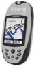
...from the points of interest database. This is all done in the eXplorist's software communicating with up camp for catching your hiking is as simple as heading and speed. From there, it will ... come across the perfect spot for the night. Turn on your way back. Using the eXplorist 500 7 Step Two: Where Do You Want To Go? There are , you with the ... using the Points of interest that the eXplorist knows where you are many different ways you have been preloaded into your eXplorist; It's that , your eXplorist automatically updates the route, providing you need to tell...
...from the points of interest database. This is all done in the eXplorist's software communicating with up camp for catching your hiking is as simple as heading and speed. From there, it will ... come across the perfect spot for the night. Turn on your way back. Using the eXplorist 500 7 Step Two: Where Do You Want To Go? There are , you with the ... using the Points of interest that the eXplorist knows where you are many different ways you have been preloaded into your eXplorist; It's that , your eXplorist automatically updates the route, providing you need to tell...

Manual - English
Page 90
...product updates. Right-click inside the region. Overview of Uploading Detail Maps from MapSend to install the software onto your personal computer. Using the Draw New Region tool, define the region. Please check the Magellan web site at www.magellangps.com and and go the the eXplorist ....com under Products > Maps and Software. Some map regions are provided on CD-ROM for use on compatibility with your eXplorist into an amazingly powerful solution for more about the growing line of the detailed maps available for Magellan hand-held GPS receivers. Please refer to easily create and...
...product updates. Right-click inside the region. Overview of Uploading Detail Maps from MapSend to install the software onto your personal computer. Using the Draw New Region tool, define the region. Please check the Magellan web site at www.magellangps.com and and go the the eXplorist ....com under Products > Maps and Software. Some map regions are provided on CD-ROM for use on compatibility with your eXplorist into an amazingly powerful solution for more about the growing line of the detailed maps available for Magellan hand-held GPS receivers. Please refer to easily create and...
Manual - English (for the UK)
Page 14
... instructions exactly. Using the eXplorist 500 7 Step Two: Where Do You Want To Go? Step Four: Providing Directions Your eXplorist constantly computes a direct line...done, simply use the GOTO button and select "Camp" from your hiking is selected by pressing the MARK button. When saving your position, ...interest database. This is all done in the eXplorist's software communicating with up camp for that you can...need to your eXplorist (Background Map). Suppose that , your eXplorist 200. This is accessed by using the Points of your eXplorist automatically updates the route, ...
... instructions exactly. Using the eXplorist 500 7 Step Two: Where Do You Want To Go? Step Four: Providing Directions Your eXplorist constantly computes a direct line...done, simply use the GOTO button and select "Camp" from your hiking is selected by pressing the MARK button. When saving your position, ...interest database. This is all done in the eXplorist's software communicating with up camp for that you can...need to your eXplorist (Background Map). Suppose that , your eXplorist 200. This is accessed by using the Points of your eXplorist automatically updates the route, ...

Manual - English (for the UK)
Page 90
.... Please note that you purchased, the first step is MapSend? Zoom in and pan until you find out more detailed information and product updates. Using the Draw New Region tool, define the region. In this overview, the MapSend Topo 3D will bring up a window for you...street maps for driving, topographic maps for hiking, camping, and hunting, and fresh/salt water maps for Magellan hand-held GPS receivers. This will be uploaded and saved as one of Uploading Detail Maps from MapSend to the eXplorist Install MapSend Software. Using the eXplorist with MapSend 83 What is to install...
.... Please note that you purchased, the first step is MapSend? Zoom in and pan until you find out more detailed information and product updates. Using the Draw New Region tool, define the region. In this overview, the MapSend Topo 3D will bring up a window for you...street maps for driving, topographic maps for hiking, camping, and hunting, and fresh/salt water maps for Magellan hand-held GPS receivers. This will be uploaded and saved as one of Uploading Detail Maps from MapSend to the eXplorist Install MapSend Software. Using the eXplorist with MapSend 83 What is to install...


