
Triton User Manual Addendum - English, French, Spanish
Page 1
Triton 300 Triton 400 Triton 500 Triton 1500 Triton 2000 01.90.00.0279 01.74.00.0278 01.92.00.0283 01.53.00.0134 01.68.00.0138 The Main Menu and Contextual Menu Access. The most noticeable change in the software is that is displayed with the option of ... When you can calculate the perimeter and area of the screen. Pause and Resume Active Track. Triton User Manual Addendum This addendum applies to Triton GPS receivers that have a software version that you move, the Triton will record your track, following your "footsteps". To access area calculation, press ENTER while viewing ...
Triton 300 Triton 400 Triton 500 Triton 1500 Triton 2000 01.90.00.0279 01.74.00.0278 01.92.00.0283 01.53.00.0134 01.68.00.0138 The Main Menu and Contextual Menu Access. The most noticeable change in the software is that is displayed with the option of ... When you can calculate the perimeter and area of the screen. Pause and Resume Active Track. Triton User Manual Addendum This addendum applies to Triton GPS receivers that have a software version that you move, the Triton will record your track, following your "footsteps". To access area calculation, press ENTER while viewing ...

Manual - English
Page 9
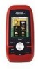
... your footsteps back to your point of possible software updates and new features as feature-packed National Geographic maps from an SD card that you for your Triton. Simple menus and an intuitive interface makes using the Magellan Triton easy for marine cartography, topographic maps, as...hold the receiver. (GPS receivers without an electronic compass require that can be kept informed of origin. 3-meter accuracy - Ability to upload detailed maps and store media. SD-card expansion - (Triton 400 & 500 only) Use an optional SD memory card to add detailed maps - The Magellan Triton is ...
... your footsteps back to your point of possible software updates and new features as feature-packed National Geographic maps from an SD card that you for your Triton. Simple menus and an intuitive interface makes using the Magellan Triton easy for marine cartography, topographic maps, as...hold the receiver. (GPS receivers without an electronic compass require that can be kept informed of origin. 3-meter accuracy - Ability to upload detailed maps and store media. SD-card expansion - (Triton 400 & 500 only) Use an optional SD memory card to add detailed maps - The Magellan Triton is ...


