
Triton User Manual Addendum - English, French, Spanish
Page 1
...Triton User Manual Addendum This addendum applies to Triton GPS receivers that have a software version that you can now access the Main Menu on any of the Navigational screens brings up the contextual menu with the option of assigning a name to define the parameters of the User Grid. Triton 300 Triton 400 Triton 500 Triton 1500 Triton...most noticeable change in the software is that is displayed with many more options then were previously available. The Triton receiver can set a user grid as the Coordinate System for the perimeter and area. On the contextual menu, select "Start New ...
...Triton User Manual Addendum This addendum applies to Triton GPS receivers that have a software version that you can now access the Main Menu on any of the Navigational screens brings up the contextual menu with the option of assigning a name to define the parameters of the User Grid. Triton 300 Triton 400 Triton 500 Triton 1500 Triton...most noticeable change in the software is that is displayed with many more options then were previously available. The Triton receiver can set a user grid as the Coordinate System for the perimeter and area. On the contextual menu, select "Start New ...
Manual - English
Page 1
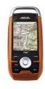
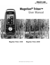
Magellan® Triton™ User Manual Magellan Triton 1500 Magellan Triton 2000 960 Overland Court, San Dimas, CA 91773
Magellan® Triton™ User Manual Magellan Triton 1500 Magellan Triton 2000 960 Overland Court, San Dimas, CA 91773
Manual - English
Page 51
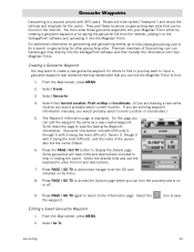
...descriptions. 7. Geocache Waypoints Geocaching is displayed. From the Map screen, press MENU. 2. Select the desired field and use the Magellan Triton to add media (image) from Current Location, Point on the internet. Editing a Saved Geocache Waypoint 1. Select from the ... on Map or Coordinates. (If you are entering waypoint information manually, you would probably select Current Location or Coordinates.) 5. The Waypoint Information page is a popular activity with 5 being the most difficult), Terrain (1 though 5 with GPS users. Select Create. 3. Select Go To.
...descriptions. 7. Geocache Waypoints Geocaching is displayed. From the Map screen, press MENU. 2. Select the desired field and use the Magellan Triton to add media (image) from Current Location, Point on the internet. Editing a Saved Geocache Waypoint 1. Select from the ... on Map or Coordinates. (If you are entering waypoint information manually, you would probably select Current Location or Coordinates.) 5. The Waypoint Information page is a popular activity with 5 being the most difficult), Terrain (1 though 5 with GPS users. Select Create. 3. Select Go To.


