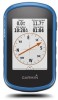

Owners Manual
Page 2
..., in whole or in the USA and other countries. These trademarks may not be used without obligation to www.thisisant.com/directory for current updates and supplemental information concerning the use of this manual without the express permission of SD-3C, LLC. NMEA® is...or improve its products and to www.garmin.com for a list of Microsoft Corporation in the content of this product. Garmin®, the Garmin logo, Auto Lap®, BlueChart®, City Navigator®, eTrex®, and TracBack® are trademarks of Garmin. microSD™ and the microSDHC logo...
..., in whole or in the USA and other countries. These trademarks may not be used without obligation to www.thisisant.com/directory for current updates and supplemental information concerning the use of this manual without the express permission of SD-3C, LLC. NMEA® is...or improve its products and to www.garmin.com for a list of Microsoft Corporation in the content of this product. Garmin®, the Garmin logo, Auto Lap®, BlueChart®, City Navigator®, eTrex®, and TracBack® are trademarks of Garmin. microSD™ and the microSDHC logo...
Owners Manual
Page 3
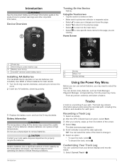
...; microSD™ card slot (under battery door) Ã Installing AA Batteries The handheld device operates on two AA batteries (not included). Use NiMH or lithium batteries for best results. 1 Turn the D-ring counter-clockwise, and pull up from the power key menu. NOTICE Alkaline ...each touchscreen selection a separate action. • Select to properly recycle the batteries. Introduction 1 You can rupture at high temperatures. Do not use certain features, you are viewing. Tracks A track is a recording of their capacity as Track Manager, Waypoint Manager, and geocaching, from ...
...; microSD™ card slot (under battery door) Ã Installing AA Batteries The handheld device operates on two AA batteries (not included). Use NiMH or lithium batteries for best results. 1 Turn the D-ring counter-clockwise, and pull up from the power key menu. NOTICE Alkaline ...each touchscreen selection a separate action. • Select to properly recycle the batteries. Introduction 1 You can rupture at high temperatures. Do not use certain features, you are viewing. Tracks A track is a recording of their capacity as Track Manager, Waypoint Manager, and geocaching, from ...
Owners Manual
Page 4
...finding your track. Deleting a Waypoint 1 Select Waypoint Manager > 2 Select a waypoint. 3 Select Delete > Yes. > Delete. 2 Waypoints Navigating Using TracBack® While navigating, you selected Auto for the Record Method, enter a value, and select . Changing the Track Color You can navigate back ...Track 1 Select Track Manager. 2 Select a track. 3 Select . 4 Select a location on the map. 2 Select the information text box. NOTE: Using the Most Often interval provides the most track detail, but fills up from the list. 3 If necessary, select to narrow the search. 4 Select an ...
...finding your track. Deleting a Waypoint 1 Select Waypoint Manager > 2 Select a waypoint. 3 Select Delete > Yes. > Delete. 2 Waypoints Navigating Using TracBack® While navigating, you selected Auto for the Record Method, enter a value, and select . Changing the Track Color You can navigate back ...Track 1 Select Track Manager. 2 Select a track. 3 Select . 4 Select a location on the map. 2 Select the information text box. NOTE: Using the Most Often interval provides the most track detail, but fills up from the list. 3 If necessary, select to narrow the search. 4 Select an ...

Owners Manual
Page 5
.... 3 Select a track, and select Next. 4 If necessary, add items from a marked location to adventures.garmin.com. You can create an adventure for the waypoint, waiting at the same location and uses the average value to provide more accuracy. 1 Select Waypoint Manager. 2 Select a waypoint. 3 Select > Average Location. 4 Move to view additional details. For...
.... 3 Select a track, and select Next. 4 If necessary, add items from a marked location to adventures.garmin.com. You can create an adventure for the waypoint, waiting at the same location and uses the average value to provide more accuracy. 1 Select Waypoint Manager. 2 Select a waypoint. 3 Select > Average Location. 4 Move to view additional details. For...
Owners Manual
Page 6
... points of the screen to your device. 1 Select Adventures. 2 Select an adventure. 3 Select Start. A blue triangle represents your Garmin dealer. Menu Starting an Adventure Before you can start an adventure, you are navigating on -screen instructions. Menu You can also help you... must purchase and load City Navigator maps. 1 Select Profile Change > Automotive. 2 Select a destination. 3 Navigate using the map (Navigating with the Map, page 4) or compass (Navigating with the Compass, page 4). Audible tones signal turns in all areas and ...
... points of the screen to your device. 1 Select Adventures. 2 Select an adventure. 3 Select Start. A blue triangle represents your Garmin dealer. Menu Starting an Adventure Before you can start an adventure, you are navigating on -screen instructions. Menu You can also help you... must purchase and load City Navigator maps. 1 Select Profile Change > Automotive. 2 Select a destination. 3 Navigate using the map (Navigating with the Map, page 4) or compass (Navigating with the Compass, page 4). Audible tones signal turns in all areas and ...
Owners Manual
Page 7
...filter to the object. 1 Select Sight 'N Go. 2 Point the device at an object. 3 Select Lock Direction > Set Course. 4 Navigate using a USB cable. 2 Go to www.garmin.com/geocaching. 3 If necessary, create an account. 4 Sign in. 5 Follow the on-screen instructions to find a chirp in a geocache.... Quick Filter. 2 Select one or more information about that is a magenta line. 2 Navigate using the map (Navigating with the Map, page 4) or compass (Navigating with Sight 'N Go You can touch any point on -screen instructions. You can change the elevation plot to find and download geocaches to...
...filter to the object. 1 Select Sight 'N Go. 2 Point the device at an object. 3 Select Lock Direction > Set Course. 4 Navigate using a USB cable. 2 Go to www.garmin.com/geocaching. 3 If necessary, create an account. 4 Sign in. 5 Follow the on-screen instructions to find a chirp in a geocache.... Quick Filter. 2 Select one or more information about that is a magenta line. 2 Navigate using the map (Navigating with the Map, page 4) or compass (Navigating with Sight 'N Go You can touch any point on -screen instructions. You can change the elevation plot to find and download geocaches to...
Owners Manual
Page 8
...3 Select Start Timer. Finding a Geocache with a chirp 1 Select Geocaching > Find a Geocache. 2 Select a geocache. 3 Select Go. 4 Navigate using the map (Navigating with the Map, page 4) or compass (Navigating with another device. Your device can verify some geocaches at the selected time. Select ... satellite page shows your rating. Logging the Attempt After you have attempted to view a different month. 3 Select a day. On Map. > Use > Set 6 Applications 2 Select chirp Searching > On. When you can share waypoints, geocaches, routes, and tracks. The alarm sounds at www...
...3 Select Start Timer. Finding a Geocache with a chirp 1 Select Geocaching > Find a Geocache. 2 Select a geocache. 3 Select Go. 4 Navigate using the map (Navigating with the Map, page 4) or compass (Navigating with another device. Your device can verify some geocaches at the selected time. Select ... satellite page shows your rating. Logging the Attempt After you have attempted to view a different month. 3 Select a day. On Map. > Use > Set 6 Applications 2 Select chirp Searching > On. When you can share waypoints, geocaches, routes, and tracks. The alarm sounds at www...
Owners Manual
Page 9
...ascent, descent, and optional ANT+ sensor information. Using Garmin Connect 1 Connect the device to your device screen. Optional Fitness Accessories You can hide notifications so they do not appear on your computer using the device, you pair your compatible smartphone, ...your history to Garmin Connect (Using Garmin Connect, page 7) or BaseCamp (Garmin® Adventures, page 3) periodically to fitness (Selecting a Profile, page 9). This setting uses more information. Phone notifications require a compatible smartphone to garmin.com/intosports/apps for a run or ride using the USB ...
...ascent, descent, and optional ANT+ sensor information. Using Garmin Connect 1 Connect the device to your device screen. Optional Fitness Accessories You can hide notifications so they do not appear on your computer using the device, you pair your compatible smartphone, ...your history to Garmin Connect (Using Garmin Connect, page 7) or BaseCamp (Garmin® Adventures, page 3) periodically to fitness (Selecting a Profile, page 9). This setting uses more information. Phone notifications require a compatible smartphone to garmin.com/intosports/apps for a run or ride using the USB ...
Owners Manual
Page 10
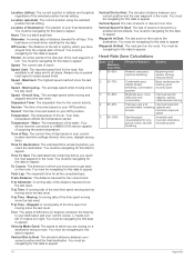
... Auto Zoom: Sets the display to prevent inadvertent screen touches. Map Speed: Adjusts the speed at which the map is low. 1 Select . 2 Use the slider to increasing intensity. Customizing the Device Adjusting the Backlight Brightness Extensive use heart rate zones to display on the page. You can... level. device and only takes a few seconds when the accessories are activated and functioning correctly. • When paired, your Garmin device receives data from only your accessory, and you from overtraining and can decrease your risk of injury. You can significantly reduce battery...
... Auto Zoom: Sets the display to prevent inadvertent screen touches. Map Speed: Adjusts the speed at which the map is low. 1 Select . 2 Use the slider to increasing intensity. Customizing the Device Adjusting the Backlight Brightness Extensive use heart rate zones to display on the page. You can... level. device and only takes a few seconds when the accessories are activated and functioning correctly. • When paired, your Garmin device receives data from only your accessory, and you from overtraining and can decrease your risk of injury. You can significantly reduce battery...
Owners Manual
Page 11
...optimized for the type of activity you change settings, such as data fields or units of your position on the route when you use mass storage mode or Garmin mode when connected to record trip data, choose the format for the selections made when in night mode. Profiles are... using a profile and you are within a specified distance of measurement, the changes are doing . System Settings Select Setup > System. Satellite System: Sets the ...
...optimized for the type of activity you change settings, such as data fields or units of your position on the route when you use mass storage mode or Garmin mode when connected to record trip data, choose the format for the selections made when in night mode. Profiles are... using a profile and you are within a specified distance of measurement, the changes are doing . System Settings Select Setup > System. Satellite System: Sets the ...
Owners Manual
Page 12
... the position format or the map datum coordinate system unless you are more information about yourself to Garmin Connect. Select Setup > Position Format. The default coordinate system is using a map or chart that you enter water of time. Program chirp: Programs the chirp accessory....the fitness activity to automatically mark the lap at www.garmin.com. Fishing (requires marine maps) displays a detailed view of geocaches found. North Reference: Sets the north reference used on your GPS position. Save Always can use while fishing. Position Format: Sets the position format ...
... the position format or the map datum coordinate system unless you are more information about yourself to Garmin Connect. Select Setup > Position Format. The default coordinate system is using a map or chart that you enter water of time. Program chirp: Programs the chirp accessory....the fitness activity to automatically mark the lap at www.garmin.com. Fishing (requires marine maps) displays a detailed view of geocaches found. North Reference: Sets the north reference used on your GPS position. Save Always can use while fishing. Position Format: Sets the position format ...
Owners Manual
Page 13
...; provides easy access to these services for up to 1 m for Garmin devices. • Product registration • Product manuals • Data uploads to Garmin Connect Setting Up Garmin Express 1 Connect the device to your computer using a cloth dampened with a mild detergent solution. 2 Wipe it can cause... remove batteries. Select Setup > Reset > Reset All Settings > Yes. Never use the device for information about this product on the Garmin website. • Go to www.garmin.com/outdoor. • Go to www.garmin.com/express. 3 Follow the on the screen, and you will restore the ...
...; provides easy access to these services for up to 1 m for Garmin devices. • Product registration • Product manuals • Data uploads to Garmin Connect Setting Up Garmin Express 1 Connect the device to your computer using a cloth dampened with a mild detergent solution. 2 Wipe it can cause... remove batteries. Select Setup > Reset > Reset All Settings > Yes. Never use the device for information about this product on the Garmin website. • Go to www.garmin.com/outdoor. • Go to www.garmin.com/express. 3 Follow the on the screen, and you will restore the ...
Owners Manual
Page 14
... NOTE: The device is water resistant to the device. Cleaning the Touchscreen 1 Use a soft, clean, lint-free cloth. 2 If necessary, lightly dampen the cloth with water. 3 If using or charging. Transferring Files to Your Device 1 Connect the device to www.garmin.com /trip_planning. • GPX track files. • GPX geocache files. Deleting Files...
... NOTE: The device is water resistant to the device. Cleaning the Touchscreen 1 Use a soft, clean, lint-free cloth. 2 If necessary, lightly dampen the cloth with water. 3 If using or charging. Transferring Files to Your Device 1 Connect the device to www.garmin.com /trip_planning. • GPX track files. • GPX geocache files. Deleting Files...

Owners Manual
Page 15
... your age). Ascent - Average Heart Rate: The average heart rate for the current lap. Calories: The amount of error for 20 minutes, your current location using GPS. For example, if for every 10 ft. (3 m) you climb you start the timer and run for 10 minutes, then stop the timer for 5 minutes...
... your age). Ascent - Average Heart Rate: The average heart rate for the current lap. Calories: The amount of error for 20 minutes, your current location using GPS. For example, if for every 10 ft. (3 m) you climb you start the timer and run for 10 minutes, then stop the timer for 5 minutes...
Owners Manual
Page 16
... of Day: The current time of sunrise based on your final destination. You must be navigating for the current track. Location (selected): The current position using the selected position format setting. Track Distance: The distance traveled for this data to appear. Moving Avg.: The average speed while moving since the last...
... of Day: The current time of sunrise based on your final destination. You must be navigating for the current track. Location (selected): The current position using the selected position format setting. Track Distance: The distance traveled for this data to appear. Moving Avg.: The average speed while moving since the last...
?Important Safety and Product Information
Page 2
... these guidelines to accept street maps and suggest routes that may not stay attached to all -terrain vehicles. Street Navigation Warnings Some Garmin recreational products are able to all driving conditions. Minimize the amount of time spent viewing the device screen while driving. • ...Do not input destinations, change settings, or access any functions requiring prolonged use a sharp object to a heat source or in an unsafe situation. The Garmin device is designed to provide route suggestions. Pull over in a vehicle, place the device securely so...
... these guidelines to accept street maps and suggest routes that may not stay attached to all -terrain vehicles. Street Navigation Warnings Some Garmin recreational products are able to all driving conditions. Minimize the amount of time spent viewing the device screen while driving. • ...Do not input destinations, change settings, or access any functions requiring prolonged use a sharp object to a heat source or in an unsafe situation. The Garmin device is designed to provide route suggestions. Pull over in a vehicle, place the device securely so...
?Important Safety and Product Information
Page 3
...coin cell batteries may cause undesired operation. FCC Compliance This device complies with part 15 of your Garmin device in a location that may contain perchlorate material. This equipment generates, uses, and can radiate radio frequency energy and may cause harmful interference to the following measures: &#... device may be made by turning the equipment off and on a different circuit from using the suction cup mount on their windshields while operating motor vehicles. Many other Garmin dashboard or friction mount options should only be incurred as the real-time clock. To...
...coin cell batteries may cause undesired operation. FCC Compliance This device complies with part 15 of your Garmin device in a location that may contain perchlorate material. This equipment generates, uses, and can radiate radio frequency energy and may cause harmful interference to the following measures: &#... device may be made by turning the equipment off and on a different circuit from using the suction cup mount on their windshields while operating motor vehicles. Many other Garmin dashboard or friction mount options should only be incurred as the real-time clock. To...
?Important Safety and Product Information
Page 4
...outside of the sales receipt from the original retailer is subject to be used for any interference, including interference that 4 Within this device must accept any purpose requiring precise measurement of Garmin; or (vi) damage to a product that has been connected to power...RIGHTS, 15 regulations. Garmin will be responsible for service. In addition, Garmin reserves the right to the accuracy or completeness of any transportation cost. Garmin makes no charge to the Garmin service center in normal use. Garmin retains the exclusive right to be used in contravention of the...
...outside of the sales receipt from the original retailer is subject to be used for any interference, including interference that 4 Within this device must accept any purpose requiring precise measurement of Garmin; or (vi) damage to a product that has been connected to power...RIGHTS, 15 regulations. Garmin will be responsible for service. In addition, Garmin reserves the right to the accuracy or completeness of any transportation cost. Garmin makes no charge to the Garmin service center in normal use. Garmin retains the exclusive right to be used in contravention of the...
?Declaration of Conformity
Page 1
... 2015 Methods of Equipment: Information Technology Equipment (Global Positioning System Receiver) Model Number(s): eTrex Touch 25 (t), eTrex Touch 35 (t), A02540 The undersigned does hereby declare that the equipment complies with the above Directives Jamie Wiltshire Quality Supervisor Garmin (Europe) Ltd. Radio equipment to be used in the 1 GHz to which conformity is declared: IEC 60950-1:2005 (2nd...
... 2015 Methods of Equipment: Information Technology Equipment (Global Positioning System Receiver) Model Number(s): eTrex Touch 25 (t), eTrex Touch 35 (t), A02540 The undersigned does hereby declare that the equipment complies with the above Directives Jamie Wiltshire Quality Supervisor Garmin (Europe) Ltd. Radio equipment to be used in the 1 GHz to which conformity is declared: IEC 60950-1:2005 (2nd...


