
Owner's Manual
Page 84
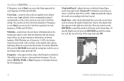
... up or down until the setting bar is all the way at the bottom of underwater objects. This allows you can set the Color Gain manually. You can also set the Color Gain separately for each frequency (50 kHz and 200 kHz). Auto automatically adjusts the scroll rate according to choose... depth of the range and reads Off. The depth of the line appears on the right side of the range and reads Off. 76 GPSMAP 392/398/492/498 Owner's Manual Whiteline-controls how the unit shows information about the bottom type (hard or soft). UltraScroll/Scroll-adjusts the rate at Normal or 1-100...
... up or down until the setting bar is all the way at the bottom of underwater objects. This allows you can set the Color Gain manually. You can also set the Color Gain separately for each frequency (50 kHz and 200 kHz). Auto automatically adjusts the scroll rate according to choose... depth of the range and reads Off. The depth of the line appears on the right side of the range and reads Off. 76 GPSMAP 392/398/492/498 Owner's Manual Whiteline-controls how the unit shows information about the bottom type (hard or soft). UltraScroll/Scroll-adjusts the rate at Normal or 1-100...
Owner's Manual
Page 88
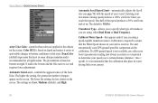
.... The default is recommended for comparison on . The unit automatically uses GPS ground speed for all applications. If a GPS ground speed is not available, use either Dual Beam or Dual Frequency.....or fish sizes. Automatic Scroll Speed Limit-automatically adjusts the Scroll rate (see page 76) with the speed of your boat's speedometer reading (not always accurate) or a stopwatch ... easier to spot subtle changes in water having little or no current. 80 GPSMAP 392/398/492/498 Owner's Manual The settings are Low, Medium (default), and High. USING SONAR > UNDERSTANDING...
.... The default is recommended for comparison on . The unit automatically uses GPS ground speed for all applications. If a GPS ground speed is not available, use either Dual Beam or Dual Frequency.....or fish sizes. Automatic Scroll Speed Limit-automatically adjusts the Scroll rate (see page 76) with the speed of your boat's speedometer reading (not always accurate) or a stopwatch ... easier to spot subtle changes in water having little or no current. 80 GPSMAP 392/398/492/498 Owner's Manual The settings are Low, Medium (default), and High. USING SONAR > UNDERSTANDING...
Owner's Manual
Page 117
... 77 communication tab 68 compass page 32 conventions i course line 62 course up 62 GPSMAP 392/398/492/498 Owner's Manual D data cards 94 data entry 6 date/time 95 daylight saving time 68 delete DSC directory ...item 23 depth line 76 dilution of precision 98 distance 58 distress calls 22, 22-... frequency 200 kHz 72 50 kHz 72 G gain 75 gain setting 74 garmin data transfer 68 go to 13 distress call 24 position report 24 GPS tab 37 options 39 H hard bottom 84 heading line 62 Highway Page,...
... 77 communication tab 68 compass page 32 conventions i course line 62 course up 62 GPSMAP 392/398/492/498 Owner's Manual D data cards 94 data entry 6 date/time 95 daylight saving time 68 delete DSC directory ...item 23 depth line 76 dilution of precision 98 distance 58 distress calls 22, 22-... frequency 200 kHz 72 50 kHz 72 G gain 75 gain setting 74 garmin data transfer 68 go to 13 distress call 24 position report 24 GPS tab 37 options 39 H hard bottom 84 heading line 62 Highway Page,...

Owner's Manual
Page 118
..., 97 MOB 10 N narrow beam 72 NAV/MOB Key 5, 12 navaids 63 navigating 12 distress call 24 Go To 13 position report 24 routes 18 TracBack 14 navigation terms 98 NMEA 70 north up 62 O off course alarm 71 orientation 62 Out... shallow/deep water alarm 71 simulator mode 3 software update card 65 soft bottom 84 sonar 72 depth line 76 understanding 72 whiteline 76 Sonar Page 74 adjustment menu 75 sonar tab 64 options 79 sound waves 72 specifications 86 speed ...tab 65 T temperature 82 temperature graph 77 temperature scale 64 temperature tab 63 thermoclines 83 GPSMAP 392/398/492/498 Owner's Manual
..., 97 MOB 10 N narrow beam 72 NAV/MOB Key 5, 12 navaids 63 navigating 12 distress call 24 Go To 13 position report 24 routes 18 TracBack 14 navigation terms 98 NMEA 70 north up 62 O off course alarm 71 orientation 62 Out... shallow/deep water alarm 71 simulator mode 3 software update card 65 soft bottom 84 sonar 72 depth line 76 understanding 72 whiteline 76 Sonar Page 74 adjustment menu 75 sonar tab 64 options 79 sound waves 72 specifications 86 speed ...tab 65 T temperature 82 temperature graph 77 temperature scale 64 temperature tab 63 thermoclines 83 GPSMAP 392/398/492/498 Owner's Manual
Owner's Manual
Page 119
... creating 8 creating graphically 9 editing 11 Enter/Mark 8 move 12 proximity 50 reviewing 11 underwater 78 waypoint lists proximity 49 user 47 weakest returns 73 whiteline 76, 83 wide beam 72 wiring installation 92 Z zoom 77 Zoom keys 5 zoom settings 29 GPSMAP 392/398/492/498 Owner's Manual INDEX 111
... creating 8 creating graphically 9 editing 11 Enter/Mark 8 move 12 proximity 50 reviewing 11 underwater 78 waypoint lists proximity 49 user 47 weakest returns 73 whiteline 76, 83 wide beam 72 wiring installation 92 Z zoom 77 Zoom keys 5 zoom settings 29 GPSMAP 392/398/492/498 Owner's Manual INDEX 111


